

Derryvree’s Threeleaf Horizon30776 BCE
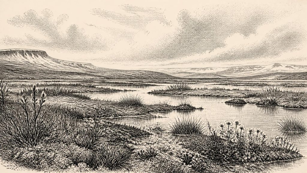
30,776 BCE is a modern label within Ireland’s Late Pleistocene, not a date with recorded events. Derryvree, County Fermanagh, preserves an ice-free wetland interval between glacier deposits, dated broadly enough to include this period. Its sediments show cold, open, frost-affected terrain with freshwater pools, mosses, sedges, dwarf willow, mountain avens and bogbean. Variable ice, climate and sea levels shaped diverse regional environments. Castlepook Cave, County Cork, contains remains of mammoth, reindeer, giant deer and predators, accumulated over millennia. A possibly cut-marked reindeer bone may indicate brief human activity, but sustained settlement remains unproven. No polities, religion or institutions are evidenced.
Dateline
A Modern Date in Deep Time
30,776 BCE is a modern chronological label, not a year for which Ireland preserves an event, a named person, a settlement or a calendar. It falls roughly 32,700 years before the radiocarbon convention of AD 1950, within the Late Pleistocene and Marine Isotope Stage 3 (MIS 3), an unstable part of the last Ice Age. Modern calendar-year precision is not available at this depth. The responsible history of Ireland must therefore be built from sediments, fossil plants, insects, animal bones, cave minerals and radiocarbon measurements, all of which illuminate ranges of time rather than one numbered year.
The closest especially informative Irish evidence is the Derryvree freshwater sequence near Maguiresbridge, County Fermanagh. Organic sediment there gave a conventional radiocarbon age of 30,500 years BP, with a large uncertainty of +1,170/−1,030 years. A radiocarbon age is not a calendar age: changes in atmospheric carbon-14 require calibration. Modern calibration places this deposit broadly around 36,900–31,700 calibrated years BP, approximately 34,950–29,750 BCE. Thus 30,776 BCE lies within the wider interval represented by Derryvree, but it cannot be claimed that a particular plant, pond or animal was present in that exact year.
This distinction is more than a technical caution. Ireland’s archaeological record has been repeatedly damaged, moved and buried by later glaciers. The evidence that remains is fragmentary and local. It can show that certain environments existed and that some animals reached the island; it cannot provide an annual chronicle comparable to later history.
Wet Ground Between Ice Advances
Derryvree was exposed during roadworks in 1969, when a drumlin section revealed fine sands, freshwater silts and organic material trapped between two deposits of till: the unsorted debris left by glacier ice. The order of layers is decisive evidence. Ice had previously occupied or affected the locality and laid down the lower till. At a later stage, the site was free of glacier ice long enough for a wetland basin to form and preserve biological remains. Afterwards, renewed ice advance covered that small landscape beneath the upper till.
The sequence does not demonstrate that all Ireland was ice-free. It does show that one part of Fermanagh experienced an ice-free interval in an otherwise severe glacial world. Its plant and insect evidence was interpreted by its original investigators as full-glacial and periglacial: cold, largely treeless country subject to intense frost, seasonal thaw and unstable drainage. The word “periglacial” does not mean permanently ice-covered. It describes ground near or affected by glacial conditions, where freezing and thawing could fracture soils, impede drainage and create shallow pools and waterlogged hollows.
Derryvree’s fossil flora makes that landscape unusually vivid. Mosses, sedges and low herbaceous vegetation occurred beside freshwater. Plant macrofossils include mountain avens (Dryas octopetala), dwarf willow (Salix herbacea) and bogbean (Menyanthes trifoliata), while water-milfoil pollen indicates aquatic conditions. These finds support a mosaic of exposed mineral ground, wet margins and shallow water rather than woodland. The three-leaved bogbean, a plant of marshy freshwater, is particularly important because it confirms that even a hard, open cold-stage landscape included sheltered wet habitats capable of preserving organic life.
That reconstruction must remain local. A pond among Fermanagh sediments cannot supply a weather forecast for all of Ireland. Upland terrain, coast-facing lowlands, valleys and areas close to ice margins would have differed in snow cover, wind exposure, moisture and seasonal productivity. Yet Derryvree is a rare survival precisely because the later glacier sealed it. It gives a glimpse of landscapes otherwise stripped away by the ice that shaped so much of modern Ireland.
Climate in Motion
At this point in MIS 3, Ireland was approaching, but had not yet reached, the more extensive glaciation associated with the Last Glacial Maximum. Reconstructions of the British–Irish Ice Sheet show that ice growth and maximum extent varied greatly by region. Ice-sheet margins did not advance in a simple, island-wide sweep. Northern and western sectors, uplands, marine basins and southern lowlands could experience different conditions, while the wider ice sheet expanded and contracted over millennia.
Other Irish evidence reinforces this picture of change rather than uniform frozen emptiness. At Crag Cave in County Kerry, broken and reworked cave formations have provided uranium-thorium dates showing episodes of speleothem growth during MIS 3. Because calcite formations require water to move through rock, their growth indicates periods when local conditions permitted liquid-water circulation. Such cave evidence cannot be converted into a precise annual temperature or assumed to describe every region. It does, however, support the broader conclusion that the Ice Age climate of Ireland was variable, with cold phases punctuated by milder or wetter intervals.
Lower global sea level also meant that Ireland’s present coastline was not the coastline of 30,776 BCE. Much of the surrounding shelf was exposed or altered by changing sea level, sediment and ice. But no simple, permanent land bridge should be imagined. Connections across the Irish Sea basin changed with ice extent, water depth and terrain, and the surviving evidence does not identify a reliable route used by people at this time.
Animals in Cork’s Limestone Caves
The strongest evidence for large animals comes not from Derryvree but from southern Irish caves, above all Castlepook Cave near Doneraile in north Cork. Excavations in the late nineteenth and early twentieth centuries recovered more than 2,000 bones from a complex limestone system. The assemblage includes woolly mammoth, reindeer, giant deer, brown bear, wolf, Arctic fox, mountain hare, lemmings and spotted hyena. It proves that Ireland’s Pleistocene fauna was once far more varied than its later historic fauna and that cold-adapted mammals could occupy or reach parts of the island during the wider pre-maximum Ice Age.
Castlepook must not be treated as a single herd or a single season preserved underground. The cave accumulated remains over a long period, through carnivore activity, water movement, collapse and excavation methods that predated modern archaeological recording. Individual dates span many millennia. Some species may have been separated in time, and not every bone necessarily reached the cave in the same way. The cave therefore supplies strong evidence for regional animal presence, but not a complete snapshot of County Cork in 30,776 BCE.
Nevertheless, its animal record accords with Derryvree’s open, cold environment. Reindeer and lemmings fit tundra-like or open habitats; mammoth, giant deer and predators imply food webs with substantial grazing animals and scavengers or hunters. This does not mean that every animal roamed together across a single Irish “mammoth steppe”. It means that over the broad period represented by the cave, southern Ireland could support a changing cold-stage fauna, while caves acted as traps, dens, shelters or repositories for bone.
The Human Question
A reindeer femur from Castlepook has given this distant period unusual archaeological significance. Zooarchaeologist Ruth Carden identified a deep mark on the bone as consistent with cutting or chopping by a sharp stone implement while the bone was fresh. The animal has been presented as dating to about 33,000 years ago. If the mark is confirmed as human-made and contemporary with the animal’s death, it would indicate that one or more Upper Palaeolithic people processed a reindeer in Ireland during the broad period close to this article’s date.
That is an important possibility, not proof of a settled population. The find is a single bone from an old cave collection, rather than a securely stratified occupation surface. No associated hearth, stone-tool assemblage, dwelling, burial, repeated butchery site or human DNA has been recovered from Ireland for this horizon. It cannot establish a permanent community, a population size, a migration route, language or ancestry. The clearest published evidence for a human presence in Ireland remains much later: cut marks on a brown-bear kneecap from Alice and Gwendoline Cave, County Clare, dating to the terminal Pleistocene, around 12,800–12,600 calibrated years BP.
For 30,776 BCE, therefore, the careful conclusion is limited. Humans may have made a brief visit to Ireland and processed an animal at Castlepook. Sustained occupation remains unproven. The absence of secure Irish sites should not be mistaken for evidence that Upper Palaeolithic people elsewhere lacked complex social lives. Communities in north-west Europe had skills, kin connections, seasonal knowledge and symbolic cultures. Ireland’s present evidence simply cannot identify those things here.
No Polities, No Recorded Religion
There is no basis for discussing Irish political affairs, diplomacy, named conflicts, leaders or institutions in this period. Nor is there evidence for monuments, formal burial grounds, art, ritual sites, trade networks or specialised learning on the island at this date. A reindeer carcass, if handled by people, might imply practical knowledge of cutting and sharing meat, but it does not demonstrate hunting strategy, exchange or social organisation. Likewise, caves containing predator-accumulated bones are not evidence of ritual or human habitation.
The principal development represented by 30,776 BCE is environmental. Ireland was a changing Late Pleistocene region, not a familiar green island awaiting recorded history: partly shaped by earlier ice, locally ice-free in places, with frost-affected ground, freshwater basins and sparse tundra vegetation. Its animal communities moved through landscapes whose coastlines, drainage and ice margins were unlike those of today. Derryvree’s buried wetland is the best witness to that world. It preserves not a dateable day in Ireland’s past, but the ecological conditions that make this notional year historically intelligible.
Primary Sources
- A Middle Midlandian Freshwater Series at Derryvree, Maguiresbridge, County Fermanagh, Northern Ireland
- Irish Pleistocene Biostratigraphy
- The Irish Quaternary Fauna Project
- Figure 6.— The Subdivision of the Quaternary Period in Ireland
- Growth and Retreat of the Last British–Irish Ice Sheet, 31,000 to 15,000 Years Ago: the BRITICE-CHRONO Reconstruction
- Exploring the Connectivity and Development of the Celtic Sea Ice Stream of the British–Irish Ice Sheet
- Timing and Pace of Ice-Sheet Withdrawal Across the Marine–Terrestrial Transition West of Ireland During the Last Glaciation
- Dimensions and Chronology of the Last Ice Sheet in Western Ireland
- The IntCal20 Northern Hemisphere Radiocarbon Age Calibration Curve (0–55 cal kBP)
- Composition and Consequences of the IntCal20 Radiocarbon Calibration Curve
- Episodic Speleothem Deposition Tracks the Terrestrial Impact of Millennial-Scale Last Glacial Climate Variability in SW Ireland
- Castlepook Cave, County Cork: County Geological Site Report
- Heritage Artefacts of County Cork
- Castlepook Cave Project, County Cork
- Mammoth Cave (Doneraile Cave, Castlepook Cave)
- Pleistocene Vertebrates in the British Isles
- Menyanthes trifoliata
- Dryas octopetala
- Salix herbacea
- Myriophyllum alterniflorum
- New Insights on the Fauna of Ireland’s Younger Dryas and Early Holocene from Alice & Gwendoline Cave
- The Mesolithic in Ireland: When Was It?
- Explore: The Wonder Cabinet
- Mammals: National Museum of Ireland – Natural History Collections