
Water-Milfoil in Ice Country30763 BCE
Around 30,763 BCE, Ireland lay within the climatically unstable Late Pleistocene MIS 3, rather than a precisely recoverable historical year. Derryvree, County Fermanagh, preserves freshwater sediments between tills, showing that local ice-free wetlands supported tundra plants, including water-milfoil, bogbean, sedges and dwarf willow. Elsewhere, ice conditions varied considerably. Castlepook Cave in County Cork records a broad MIS 3 fauna of mammoth, reindeer, giant deer, predators and smaller cold-adapted animals, although individual remains differ in age. No secure contemporary settlement exists. A possibly stone-cut reindeer bone suggests tentative human visitation, but cannot establish permanent occupation, identity or society there with certainty.
Dateline
Modern calendar-year precision is not available for Ireland in 30,763 BCE. This numbered year is a retrospective label, not a date known to people living at the time, and no written source, annual deposit or excavated settlement can tell us what happened during it. In relation to the conventional radiocarbon reference year of AD 1950, it lies about 32,712 years before present. The responsible historical frame is therefore not an invented episode but the Late Pleistocene, specifically the climatically volatile Marine Isotope Stage 3 (MIS 3), before the Last Glacial Maximum.
The evidence is fragmentary because later ice repeatedly eroded, reworked and buried older ground surfaces. Yet a few exceptional Irish deposits allow a cautious reconstruction. Around this broad period Ireland was not simply a blank white island, nor can it be pictured as a settled country with recognisable communities. It was a changing northern landscape in which ice, meltwater, open vegetation and large mammals created short-lived opportunities. The possibility of human presence is important, but remains far more limited than some popular summaries imply.
A Date Within a Range
Radiocarbon chronology must be handled especially carefully at this depth of time. A radiocarbon age is not identical to a calendar age: the amount of atmospheric carbon-14 has varied, so measurements must be calibrated against internationally maintained curves. Even calibrated results are probability ranges rather than anniversaries. The current IntCal20 Northern Hemisphere curve extends to 55,000 calibrated years before present, but it does not turn a deposit formed over time into evidence for one exact BCE year.
For orientation, 30,763 BCE falls at roughly 32.7 thousand calibrated years before present. It predates the conventional Last Glacial Maximum, generally placed in north-west Europe at about 27,000–23,000 calibrated years ago. It belongs instead to a long period in which cold conditions, glacier growth and temporary ice-free intervals varied strongly between regions. The useful question is not what occurred on one day or in one season, but what Ireland’s surviving evidence can reveal about the wider interval in which this modern date falls.
Derryvree’s Buried Water
The most informative environmental archive close to this horizon was exposed during road works in 1969 at Derryvree townland, near Maguiresbridge in County Fermanagh. The cutting passed through a drumlin and revealed freshwater silts and fine sands enclosed between two thick layers of till, the unsorted debris deposited by glacier ice. This simple order of layers is exceptionally valuable. Ice had occupied the locality before the freshwater sediments accumulated; later ice or ice-derived sediment sealed the basin beneath a second till.
Organic material from the freshwater series produced the radiocarbon determination Birm-166: 30,500 radiocarbon years before present, with a large uncertainty of +1,170/−1,030 years. It is not defensible to convert that laboratory measurement into a single calendar year. Calibration places the deposit in a broad early-to-middle 30,000s calibrated-years-before-present horizon, and the sediment itself accumulated over an interval. Nonetheless, Derryvree is directly relevant to 30,763 BCE because it demonstrates that, during this part of MIS 3, at least one Fermanagh locality lay free of overriding ice long enough for standing or slow-moving fresh water, plants and small animals to leave a record.
That conclusion has clear limits. Derryvree was a local wetland basin, not a weather station for the entire island. It cannot prove that every coast, upland and valley in Ireland was ice-free at once. Its importance is that it preserves an environmental possibility that later glaciation usually destroyed: cold, living ground between episodes of ice advance.
Open Tundra, Not Empty Ground
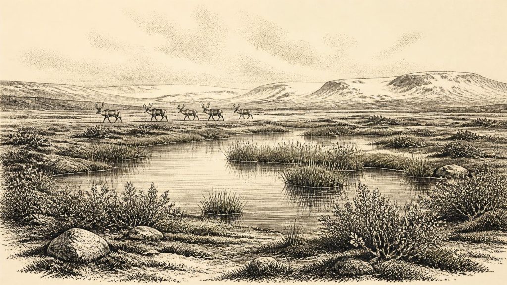
The Derryvree flora and fauna point to open tundra vegetation and a periglacial regime: a landscape shaped by severe seasonal frost, short growing seasons and ground that could freeze deeply. Plant remains include sedges, mosses and cold-adapted species. Fossil evidence for dwarf willow, mountain avens, bogbean and alternate water-milfoil is particularly revealing. Dwarf willow and mountain avens belong to low, cold-country vegetation; bogbean and water-milfoil indicate pools, wet margins or shallow freshwater. Their presence means that liquid water, summer growth and sheltered microhabitats mattered even in a harsh climate.
This was not mature temperate woodland. The most defensible picture is of low, largely treeless vegetation: sedgy wet ground around pools and channels, mossy patches, herbs and grasses, with exposed mineral soil, frost-disturbed surfaces and perhaps scattered low shrubs. Such country could be productive in summer while remaining inhospitable for much of the year. The evidence supports a mosaic, not an uninterrupted snowfield and not a modern-looking green Ireland.
Ice conditions beyond Fermanagh were also regionally complicated. Research on the Irish Ice Sheet and the wider British–Irish Ice Sheet shows that substantial ice existed in western Ireland during parts of the 40,000–19,000 calibrated-years-before-present interval, while later work reconstructs major expansion and retreat across the archipelago after about 31,000 years ago. These findings caution against drawing one fixed ice edge across Ireland for 30,763 BCE. The island’s geography was being remade unevenly: some places were glaciated, some lay near ice margins, and others could temporarily sustain open wetland and animal life.
Caves and a Mammal Landscape
Castlepook Cave, also called Mammoth Cave, near Doneraile in north County Cork, supplies the chief Irish faunal evidence for this broader period. Its old excavations recovered remains of woolly mammoth, reindeer, giant deer, brown bear, wolf, foxes, hare, lemmings and spotted hyaena. The cave therefore records an Ireland connected ecologically to the cold-steppe and tundra worlds of north-west Europe. Reindeer could exploit open country; lemmings and Arctic foxes attest cold conditions; large herbivores and carnivores show that food webs existed across at least some accessible terrain.
However, Castlepook is not a single occupation deposit. Its bones accumulated over long spans of time, in different chambers and by different processes. Animals may have fallen into cavities; hyaenas and bears could use caves; water later moved and re-sorted remains; early twentieth-century excavations removed much material with standards of recording unlike those now expected. Direct dating has shown that specimens from the cave can be thousands of years apart. A mammoth bone or hyaena remain cannot therefore be assigned automatically to the same generation, season or landscape as a dated reindeer bone.
Recent re-dating has strengthened the case that several mammals occurred in Ireland during MIS 3, while revising earlier assumptions about their ages. In particular, it suggests that giant deer and spotted hyaena may have disappeared locally before the Last Glacial Maximum, around 40,000 calibrated years ago. That is an interpretation of a changing fossil record, not proof that every species listed from Castlepook survived to 30,763 BCE. At this date, the sensible conclusion is that a varied cold-stage fauna is securely demonstrated for the wider Irish MIS 3 interval, but precise local species lists remain uncertain.
The Human Question
Ireland has no securely excavated camp, hearth, house, burial or stone-tool assemblage that can be confidently dated to 30,763 BCE. There were no known polities, leaders, diplomatic relations, religious monuments, farming settlements, trading ports or systems of writing. Accordingly, political affairs, warfare, formal religion, learning and commerce cannot be described for this year. To supply them would be invention.
One find gives the period genuine archaeological significance. A reindeer femur from Castlepook, recovered from an old collection, has been reported as approximately 33,000 years old and bears a deep linear mark interpreted by zooarchaeologist Ruth Carden as damage made by a sharp stone tool during carcass processing. If the mark is confirmed as human-made and contemporary with the animal’s death, it would push evidence for human activity in Ireland far earlier than the better-established terminal Pleistocene record.
But this is a narrow and provisional inference. The bone was not found beside securely associated tools, a hearth, a butchered-animal concentration or an intact living floor. Its date estimates when the reindeer died, not independently when or by whom the mark was made. Nor does one modified bone demonstrate a permanent population. The most that can responsibly be proposed is a possibility that hunters or other visitors reached Ireland during the broader MIS 3 interval and handled a reindeer carcass.
If such people were present, their economy would have centred on immediate survival rather than agriculture or long-distance commerce: obtaining animal food, hides, sinew, fat, marrow and perhaps antler or bone from the open landscape. That is an archaeological possibility, not a documented reconstruction of a household. Nothing yet identifies their language, social organisation, cultural affiliation or route into Ireland. Lower sea levels altered the surrounding geography, but the exact availability of land crossings or water passages at this particular point remains unresolved.
An Environmental History
The most important development around 30,763 BCE was therefore environmental. Ireland was passing through a late Ice Age world of unstable climate and expanding ice, yet one in which freshwater basins, tundra vegetation and substantial mammals could persist locally. Derryvree’s water-milfoil and bogbean, preserved beneath a drumlin, are as historically valuable as more dramatic cave bones because they show that cold Ireland was not lifeless. Castlepook adds a striking, unresolved human question. Together, these remains offer evidence for landscape and ecology, while firmly withholding the year-specific human story that the record cannot provide.
Primary Sources
- A Middle Midlandian Freshwater Series at Derryvree, Maguiresbridge, County Fermanagh, Northern Ireland
- A Reconsideration of the Radiocarbon Dating of the Marine Isotope Stage 3 Fauna from Southern Ireland
- The Irish Quaternary Fauna Project
- Irish Pleistocene Biostratigraphy
- The IntCal20 Northern Hemisphere Radiocarbon Age Calibration Curve (0–55 kcal BP)
- Composition and Consequences of the IntCal20 Radiocarbon Calibration Curve
- Growth and Retreat of the Last British–Irish Ice Sheet, 31,000 to 15,000 Years Ago: the BRITICE-CHRONO Reconstruction
- BRITICE Glacial Map, Version 2: A Map and GIS Database of Glacial Landforms of the Last British-Irish Ice Sheet
- Radiocarbon Constraints on the History of the Western Irish Ice Sheet Prior to the Last Glacial Maximum
- Trimlines, Blockfields and the Vertical Extent of the Last Ice Sheet in Southern Ireland
- The Evolution of the Terrestrial-Terminating Irish Sea Glacier During the Last Glaciation
- Advance and Retreat of the Marine-Terminating Irish Sea Ice Stream into the Celtic Sea During the Last Glacial: Timing and Maximum Extent
- Last Glacial Maximum Cirque Glaciation in Ireland and Implications for Reconstructions of the Irish Ice Sheet
- Spotted Hyena Skull
- Ireland’s Palaeolithic Archaeology – Fleeting Footprints in a Frozen Land
- BSBI: Salix herbacea
- BSBI: Dryas octopetala
- BSBI: Menyanthes trifoliata
- BSBI: Myriophyllum alterniflorum
- Proceedings: Postglacial Colonisation Conference
- References and Recommended Reading: Irish Quaternary Association Guide
- The Geological Heritage of County Leitrim
