BIRM-166 and the Reindeer Femur30678 BCE
At 30,678 BCE, Ireland had no recorded history, and evidence cannot define conditions in a single year. Derryvree, County Fermanagh, preserves organic freshwater deposits dated by the uncertain radiocarbon result BIRM-166, indicating an ice-free, cold, treeless wetland during late Marine Isotope Stage 3. Other sites confirm intermittent habitable ground before expanding ice sheets reshaped the island. Castlepook Cave, County Cork, contains diverse Pleistocene fauna, including reindeer, mammoth and predators. A possibly stone-tool-marked reindeer femur may indicate brief Upper Palaeolithic human butchery, but proves neither settlement nor continuous occupation. Ireland’s past therefore reveals glacial landscapes, ecological evidence, and possible human contact.

Dateline
30,678 BCE is a modern chronological label, not a year for which Ireland has a recorded event. No Irish community kept a calendar, named a leader or left an occupation layer that can be assigned to that single notional year. In the archaeological convention of years before present, with “present” fixed at AD 1950, it lies roughly 32,627 years ago. That arithmetic is not itself a scientific date. At this depth of time, radiocarbon results carry substantial uncertainty and must be calibrated to calendar years; environmental sequences are dated by ranges, not by a sequence of individual years.
The responsible setting is the later part of Marine Isotope Stage 3, a climatically volatile phase of the last Ice Age. Ireland was approaching the growth of the Last Glacial Maximum ice sheet, but the island was not yet uniformly the blank white expanse often imagined. Its conditions varied sharply between regions and changed over long, uneven timescales. The surviving evidence is exceptionally thin: buried wetland sediments in County Fermanagh, cave faunas in County Cork, glacial deposits and wider reconstructions of the British–Irish Ice Sheet. Together they illuminate a cold, largely treeless Irish landscape and the possibility of very brief human contact. They do not justify a story of an established Ice Age Irish people.
A Date Beyond Calendar Precision
The distinction between radiocarbon years and calendar years matters especially here. The most important Fermanagh date, laboratory number BIRM-166, was obtained from organic-rich freshwater deposits at Derryvree near Maguiresbridge. It produced an age of 30,500 radiocarbon years before present, with a large quoted uncertainty of roughly a thousand years. Such an age cannot be read straight across as 30,500 calendar years. Calibration using modern curves places comparable late radiocarbon ages broadly in the mid-30,000s cal BP, or calibrated years before AD 1950, rather than in a single precise calendar year.
Consequently, Derryvree is relevant to 30,678 BCE as evidence from the same broad late-MIS-3 world, not as proof of conditions on that exact date. Nor should its local record be made to stand for every part of Ireland. The value of BIRM-166 is that it preserves an interval between glacial tills: organic mud, plant remains and insect evidence formed after an earlier episode of ice and before later ice overran the area. It establishes that at least part of Fermanagh had been ice-free long enough for freshwater habitats to develop.
Derryvree’s Cold Wetland
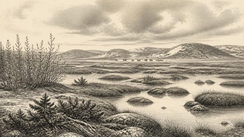
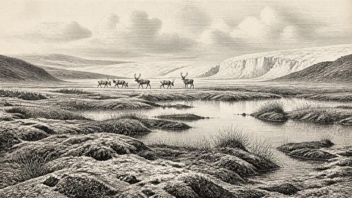
Derryvree offers a rare close view of an Irish Ice Age environment. The deposits included freshwater mosses and sedges, alongside pollen and macrofossils from plants adapted to cold, open conditions. Bogbean (Menyanthes trifoliata) and alternate water-milfoil (Myriophyllum alterniflorum) are particularly striking indicators of standing or slow-moving freshwater. The insect assemblage was likewise of a cold northern character. This was not a forested landscape. It was a tundra-like mosaic in which shallow water, sedge-rich margins, damp ground and open vegetation occurred amid severe seasonal conditions.
That picture should nonetheless be handled with care. A freshwater basin has its own sheltered microclimate and its own catchment. Plants and insects tell us directly about the habitat around the basin; they do not provide a complete map of Irish vegetation or mean that every valley supported the same community. The broader inference—that open, cold environments occupied at least some ice-free ground—is well supported. Claims about exact temperatures, annual snowfall or a uniform island-wide biome would go beyond the evidence.
Other Fermanagh sites reinforce the importance of this buried evidence. Hollymount near Maguiresbridge and Greenagho near Belcoo also yielded freshwater organic material beneath later glacial deposits. Their old radiocarbon determinations have differing limitations, and the Greenagho age has been treated cautiously by geologists. Yet the group of sites demonstrates a crucial point: cold did not always mean permanent ice cover. In parts of northern Ireland, water, vegetation and invertebrate communities persisted during an interval later sealed and partly erased by glacier action.
Ice Building Across Ireland
By the horizon represented by 30,678 BCE, conditions were becoming increasingly precarious. Reconstructions of the British–Irish Ice Sheet place its rapid expansion after roughly 35,000–32,000 years ago, while its fullest later extent belongs mainly to approximately 27,000–21,000 years ago. The precise timing, thickness and limits of ice remain debated because different methods measure different parts of a complicated process. Raised beaches, tills, offshore sediments, landforms and exposure dates do not all offer the same kind of chronological resolution.
For Ireland, this means it is misleading to say simply that the island was either “ice-free” or “glaciated” in 30,678 BCE. Fermanagh’s inter-till organic deposits show ice-free conditions there during a preceding or broadly comparable cold-stage interval. Southern and offshore evidence indicates that the last ice sheet subsequently became far more extensive. Later ice scoured bedrock, rearranged sediment and buried older surfaces, making the archaeological loss enormous. Any camp on exposed ground, especially one made of skins, wood and small hearths, would have had poor chances of survival even before later weathering and sea-level change.
Sea level was lower globally because vast quantities of water were locked in continental ice. Coastlines and shelves therefore differed markedly from those of modern Ireland. But lower sea level does not demonstrate a simple, dry and enduring land bridge from Ireland to Britain or continental Europe. The Irish Sea basin, marine channels, local ice and changing relative sea level made movement routes variable and uncertain. The arrival of land mammals proves that crossings occurred over geological time; it does not reveal the exact route, season or circumstances by which particular animals—or any people—reached the island.
Castlepook’s Animal World
Far from Derryvree, Castlepook Cave near Doneraile in north County Cork preserves the best-known Irish assemblage relevant to this earlier Late Pleistocene world. Antiquarian excavations beginning in 1904 recovered a mixed collection of animal remains from several cave galleries. Later reassessment and improved bone dating have made the cave still more important, while also demonstrating why caution is necessary: the deposits were accumulated and disturbed over long periods, rather than representing one intact moment of occupation.
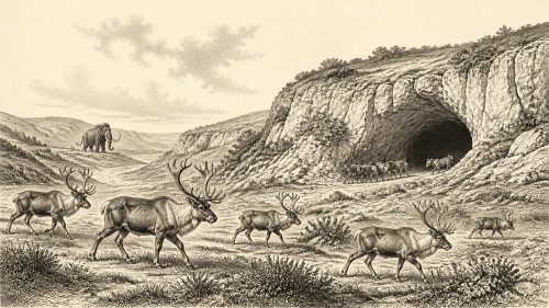
The Castlepook fauna includes animals associated with cold open habitats and complex predator–prey relationships, among them reindeer, woolly mammoth, giant deer, horse, brown bear, wolf, Arctic fox, hare and spotted hyaena. Not every species necessarily occupied the immediate area at the same moment, and a cave is not a neutral sample of the landscape. Carnivores could drag carcass parts underground; animals could die naturally in or near entrances; water could move bones; earlier digging mixed material. Still, the assemblage firmly shows that Ireland supported a much richer Pleistocene fauna than the modern island.
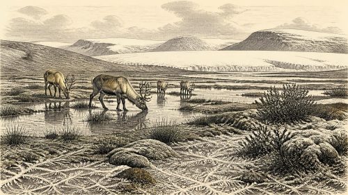
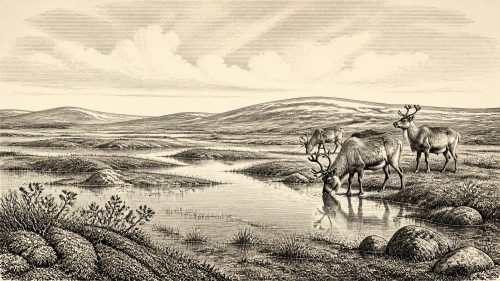
For everyday animal life, the evidence suggests seasonal movement through an open landscape rather than a stable, wooded ecosystem. Reindeer were adapted to cold conditions and could exploit sparse vegetation. Hyaenas and wolves were predators and scavengers, while caves could function as dens, traps or protected bone repositories. Mammoth remains evoke a wider mammoth-steppe world, but they do not permit a detailed reconstruction of one herd passing through Cork in this particular year. The direct evidence is fossil bone; the image of migrating herds across a tundra plain is an informed ecological interpretation.
The Reindeer Femur Question
A reindeer femur from Castlepook has changed the terms of discussion about Ireland’s earliest human past. Zooarchaeologist Ruth Carden identified a deep linear modification on the bone as consistent with a sharp stone tool used during butchery, and County Cork heritage publications have placed the specimen broadly around 31,000 BCE. If that assessment is confirmed, it is potentially evidence that people processed a reindeer carcass in Ireland during the Upper Palaeolithic, many millennia before the better-established post-glacial record.
Its importance should not turn possibility into certainty. The femur is not part of a securely sealed camp floor. No associated stone-tool assemblage, hearth, built shelter, human bone, burial or concentrated food debris of the same age has yet been recovered. The mark may preserve a real act of carcass processing, but it cannot tell us whether hunters killed the animal, found it already dead, butchered it elsewhere, or entered the cave at all. Nor can one modified bone establish continuous occupation, a population size, a language, an ethnicity or a named archaeological culture.
The most restrained interpretation is also the most valuable. Around this broad period, Ireland may have been visited by highly mobile Upper Palaeolithic hunter-gatherers moving through a wider north-west European world and exploiting a large animal carcass. That is an inference from the cut-mark interpretation and the animal’s date, not a demonstrated settlement history. It remains a research question, strengthened or weakened by future microscopic study, fresh excavation and securely stratified finds.
What Cannot Yet Be Written
There is no evidence for political institutions, rulers, diplomacy, warfare, territorial boundaries, farming, trade networks, permanent villages or formal religion in Ireland at this date. There are no Irish-made ornaments, cave paintings, musical instruments, written signs or known teaching places. Their absence from the record must not be mistaken for proof that any visitors lacked social relationships, beliefs or knowledge. Rather, the evidence available in Ireland is too slight to recover them responsibly.
Similarly, there is no basis for describing routine domestic life. If people reached the island, they would have required skill in travelling through severe conditions, managing clothing and fire, making cutting tools and reading animal behaviour. Those are reasonable deductions from the wider Upper Palaeolithic context and the proposed butchery mark, not observations of an excavated Irish household. Agriculture, herding and ceramic production lay far in the future. The economy visible here is ecological: wild animals, freshwater pockets, seasonal vegetation and movement through a changing glacial frontier.
The central historical development around 30,678 BCE is therefore not a battle, dynasty or founding. It is the unstable meeting of habitable ground and advancing ice. BIRM-166 records a cold wetland where later glacier deposits would conceal it. Castlepook preserves animal bones, and perhaps the trace of a stone tool on one of them. Between them lies the proper scale of Ireland’s deepest recoverable past: a landscape repeatedly transformed, with life present, human contact possible, and certainty earned only in fragments.
Primary Sources
- A Middle Midlandian Fresh-Water Series at Derryvree, Maguiresbridge, County Fermanagh, Northern Ireland
- Middle Midlandian Interstadial Deposits at Greenagho, Near Belcoo, County Fermanagh, Northern Ireland
- Menyanthes trifoliata L.
- Myriophyllum alterniflorum DC.
- A Reconsideration of the Radiocarbon Dating of the Marine Isotope Stage 3 Fauna from Southern Ireland
- The Irish Quaternary Fauna Project
- Occurrence of Mammalia Relicts at Site Castlepook Cave
- The Exploration of Castlepook Cave, County Cork
- The Exploration of Castlepook Cave, Co. Cork. With 3 Plates
- Heritage Artefacts of County Cork 2021
- Archaeological Heritage of County Cork
- Archaeology Research Excavation Grant 2022
- Late Pleistocene Chronostratigraphy and Ice Sheet Limits, Southern Ireland
- Extent and Timing of the Last Glacial Maximum (LGM) in Britain and Ireland: A Review
- Growth and Retreat of the Last British–Irish Ice Sheet, 31,000 to 15,000 Years Ago: The BRITICE-CHRONO Reconstruction
- Reconstructing the Last Irish Ice Sheet 2: A Geomorphologically-Driven Model of Ice Sheet Growth, Retreat and Dynamics
- Last Glacial Maximum Cirque Glaciation in Ireland and Implications for Reconstructions of the Irish Ice Sheet
- Dimensions and Chronology of the Last Ice Sheet in Western Ireland
- The Deglaciation of the Western Sector of the Irish Ice Sheet from the Inner Continental Shelf to its Terrestrial Margin
- A Stratigraphic Framework for Abrupt Climatic Changes During the Last Glacial Period Based on Three Synchronized Greenland Ice-Core Records
- The IntCal20 Northern Hemisphere Radiocarbon Age Calibration Curve (0–55 cal kBP)
- New Insights on the Fauna of Ireland’s Younger Dryas and Early Holocene from Alice & Gwendoline Cave