Derryvree’s Clubmoss Waters30679 BCE
At approximately 30,679 BCE, Ireland lay within the fluctuating cold conditions of Marine Isotope Stage 3, not a historically datable year. Derryvree, County Fermanagh, preserves freshwater sediments between glacial tills, indicating an ice-free interlude with pools, wetlands and treeless tundra vegetation, including clubmoss, mosses and cold-adapted herbs. Its radiocarbon age encompasses this date. Cave finds elsewhere indicate intermittent populations of mammoth, reindeer, giant deer, predators and other cold-stage animals, but not a single contemporaneous fauna. No secure evidence establishes human settlement, society or activity; a modified reindeer bone suggests only unproven Upper Palaeolithic presence. Later glaciation preserved this environmental record.
Dateline
“30,679 BCE” is a modern chronological label, not a year for which Ireland has a dated event, ruler, settlement or historical witness. Calendar-year precision is unavailable at this depth of time. The label corresponds only approximately to 32,600 years before AD 1950, the conventional reference point for radiocarbon chronology. It falls within the Late Pleistocene, during Marine Isotope Stage 3, when climates around the North Atlantic shifted repeatedly between severe cold and comparatively milder intervals. For Ireland, the most responsible account is therefore not a narrative of one year, but a carefully bounded reconstruction from sediments, fossils and glacial landforms.
The nearest substantial Irish evidence is the Derryvree freshwater series, exposed in 1969 in a road cutting through a drumlin near Maguiresbridge, County Fermanagh. The deposit lies between two distinct sheets of glacial till. This sequence establishes a simple but important order: glacier ice deposited the lower till; an interval followed in which freshwater silts, sands, plants and insects accumulated; later ice-related sediment sealed the archive beneath the upper till. The organic material produced the conventional radiocarbon determination BIRM-166, 30,500 radiocarbon years BP, with a large laboratory uncertainty. Modern calibration places the evidence broadly at c. 36,900–31,700 calibrated years BP, or roughly 34,950–29,750 BCE. The nominal year 30,679 BCE lies within that wide range, but cannot be assigned to a particular season, bed or generation.
A Freshwater Archive Beneath a Drumlin
Derryvree is significant because later glaciation erased or rearranged so much of Ireland’s older ground surface. Here, burial preserved a small environmental archive. Its silts and fine sands recorded open fresh water and wet ground rather than a village, cultivated field or human camp. Pollen was poorly preserved, but the plant macrofossils, mosses and insect remains were enough to demonstrate a cold, treeless landscape. The original investigators described a full-glacial flora and fauna; that phrase refers to the cold ecological character of the assemblage, not to proof that all Ireland was then uniformly buried beneath ice.
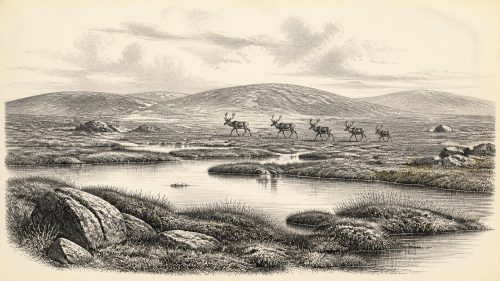
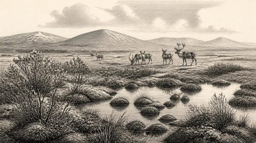
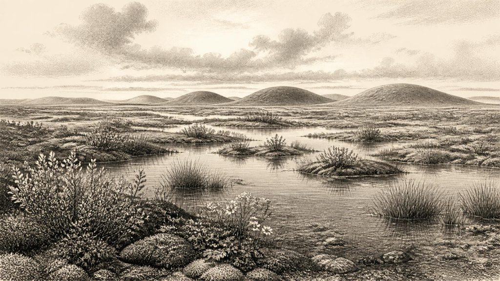
The evidence supports an image of a low, wet tundra mosaic around the Fermanagh basin: shallow pools, sedge- and moss-rich margins, patches of exposed mineral soil and sparse vegetation able to survive short growing seasons and hard winters. Fossils include aquatic and wetland plants such as alternate water-milfoil and bogbean, alongside mosses and cold-adapted terrestrial taxa. Lesser clubmoss, mountain-avens, dwarf willow, sandwort and other herbs are consistent with open ground rather than forest. Insect evidence also points towards muskeg-like wetland with open pools and abundant plant matter. These are direct records of organisms or depositional conditions at one locality; the broader reconstruction of tundra country is an interpretation built from them.
Cold Country, Not a Frozen Uniformity
At this time Ireland was entering the long deterioration that culminated in the Last Glacial Maximum. Yet the island’s ice history was neither instantaneous nor geographically uniform. The Derryvree and nearby Greenagho records show that north-central Ireland had been ice-free long enough for lakes or wetlands to develop during parts of Marine Isotope Stage 3. They do not prove that every coast, upland and lowland was open simultaneously. Conversely, the tills above and below the Derryvree deposits show that this comparatively ice-free phase sat between episodes of glacial expansion. The landscape was unstable on geological timescales: ice margins advanced and retreated, drainage routes changed, and sediment was repeatedly stripped, redeposited or sealed away.
By the later Last Glacial Maximum, broadly c. 27,000–23,000 calibrated years BP, ice covered Ireland and extended across much of its continental shelf. That later maximum must not be projected too neatly back onto 30,679 BCE. Around this earlier date, the evidence instead captures a cold but locally vegetated interlude before the island’s final extensive glaciation. Ireland’s terrain was already recognisably structured by bedrock, valleys and uplands, but the coastlines and shallow seas were very different because global sea level was lower. Precisely how land, sea ice, glaciers and water channels affected movement around Ireland at any one moment remains uncertain.
Animals in the Wider Landscape
Derryvree preserves environmental indicators rather than large-animal bones, so the island-wide fauna must be reconstructed cautiously from other sites. Castlepook Cave near Doneraile in County Cork is particularly important. Its old excavations produced remains attributed to woolly mammoth, reindeer, giant deer, brown bear, wolf, Arctic fox, mountain hare, lemmings and spotted hyaena. Revised radiocarbon work has shown that several southern Irish cave animals belong to Marine Isotope Stage 3 and are considerably older than some earlier dates suggested. The assemblage demonstrates that Ireland could support, at different times, a much richer cold-stage mammal community than its later historic fauna.
That does not mean that all those species grazed beside the Derryvree pool in the same year. Cave deposits can contain material accumulated over long periods, and Castlepook’s nineteenth- and early twentieth-century excavation history limits the precision of its contexts. Still, the combination of Fermanagh wetland evidence and Cork cave fauna supports a landscape with open forage, wetlands, predators and large herbivores. Reindeer and giant deer could exploit open country; mammoth remains imply intermittent access by animals adapted to cold, grass- and herb-rich environments; hyaenas and wolves show that carnivore guilds also reached Ireland. Such finds reveal ecological connections with north-west Europe, not a stable, complete inventory for one date.
The Human Question
No securely excavated settlement, hearth, stone-tool assemblage, burial or occupation floor is known from Ireland for this period. It would be wrong to populate Derryvree with named hunter-gatherer groups, to describe a permanent Irish population, or to infer language, kinship or political authority. The oldest unambiguous evidence for human activity on the island remains far later: a butchered brown-bear bone from Alice and Gwendoline Cave, County Clare, dated to c. 12,810–12,590 calibrated years BP.
Castlepook nevertheless raises an important, unresolved possibility. A reindeer femur from the old cave collection has been reported as bearing a deep mark interpreted as fresh-bone modification by a stone implement and associated publicly with an age of about 31,000 BCE. If that interpretation and association withstand further specialist study, it would indicate that one or more Upper Palaeolithic people processed a reindeer in Ireland within the broad period considered here. It would not demonstrate continuous settlement. The bone lacks a modern, sealed archaeological context, and no associated tool, hearth, dwelling or repeated activity surface has been recovered. The responsible conclusion is that brief human presence is possible, perhaps even plausible, but unproven as a settled way of life.
Society Without a Social Record
Accordingly, there is no evidence for political affairs, diplomacy, warfare, leaders, territories or institutions in Ireland at 30,679 BCE. Nor is there evidence for trade networks, farming, herding, craft production, monuments, formal burial or religion. These absences are not trivial gaps in a normal historical record: they are the central fact of this period. Later ice sheets destroyed many potential traces, while acidic soils, changing coastlines and the small scale of surviving exposures further restrict what can be found. Absence of proof cannot establish that no person ever entered Ireland, but it prevents a responsible account of a human society.
If people did make short incursions, their lives would have been shaped chiefly by mobility, weather and animal resources. Across north-west Europe, Upper Palaeolithic hunter-gatherers used stone, bone, hide, wood and fire, and followed seasonal opportunities. Those general comparisons may illuminate what was possible; they are not evidence that the same practices occurred in Ireland. A cut-marked reindeer bone, if genuinely anthropogenic, would show carcass processing only. It cannot tell us whether meat, marrow, hide, sinew or antler was taken, whether the animal was hunted or scavenged, how many people were involved, or whether they stayed for hours, days or a season.
What This Date Can Mean
The best history of Ireland at this date is therefore environmental and evidential. In south Fermanagh, freshwater collected within a cold periglacial landscape and supported a distinctive wetland flora. Elsewhere, open-country mammals and predators intermittently occupied parts of the island, leaving fragmentary records in caves. Glacial expansion was approaching on the larger timescale, and would later cover, scour and transform much of the terrain. The buried Derryvree sediments survive because they were sealed by that process.
Rather than a blank before “real” history, 30,679 BCE represents a deeply preserved chapter in which Ireland’s future landscape was being remade by ice, water, plants and animals. Derryvree’s clubmoss and moss-rich silts are modest remains, but they provide firmer ground than speculation. They show an Ireland capable of supporting life in a harsh, open, wet and changing Pleistocene world—while leaving no secure evidence that human society had yet taken root there.
Primary Sources
- A Middle Midlandian Freshwater Series at Derryvree, Maguiresbridge, County Fermanagh, Northern Ireland
- Palaeoecology: The Middle Midlandian Palaeoenvironment of South Fermanagh
- Figure 6.— The Subdivision of the Quaternary Period in Ireland
- Trimlines, Blockfields and the Vertical Extent of the Last Ice Sheet in Southern Ireland
- Exploring Controls of the Early and Stepped Deglaciation on the Western Margin of the British-Irish Ice Sheet
- Marine Geophysical Evidence for Late Pleistocene Ice Sheet Extent and Recession off Northwest Ireland
- Timing and Pace of Ice-Sheet Withdrawal Across the Marine–Terrestrial Transition West of Ireland During the Last Glaciation
- New Data for the Last Glacial Maximum in Great Britain and Ireland
- Subglacial Bedforms of the Irish Ice Sheet
- BRITICE Glacial Map, Version 2: A Map and GIS Database of Glacial Landforms of the Last British–Irish Ice Sheet
- Ireland: Submerged Prehistoric Sites and Landscapes
- The Colonization of Ireland: A Human Ecology Perspective
- The Irish Quaternary Fauna Project
- A Reconsideration of the Radiocarbon Dating of the Marine Isotope Stage 3 Fauna from Southern Ireland
- Occurrence of Mammalia Relicts at Site Castlepook Cave
- The Exploration of Castlepook Cave, County Cork
- First Evidence of a Late Upper Palaeolithic Human Presence in Ireland
- New Insights on the Fauna of Ireland's Younger Dryas and Early Holocene from Alice & Gwendoline Cave
- Phylogeographic, Ancient DNA, Fossil and Morphometric Analyses Reveal Ancient and Modern Introductions of a Large Mammal: The Complex Case of Red Deer in Ireland
- Middle Midlandian Interstadial Deposits at Greenagho, Near Belcoo, County Fermanagh, Northern Ireland
- Freshwater Organic Deposits and Stratified Sediments Between Early and Late Midlandian (Devensian) Till Sheets, at Aghnadarragh, County Antrim, Northern Ireland
- The IntCal20 Northern Hemisphere Radiocarbon Age Calibration Curve (0–55 cal kBP)
- IntCal Publications
- Mammals: National Museum of Ireland Natural History Collections
- Castlepook Cave, County Cork, 2022 Excavation Report