Volatile Habitats30652 BCE
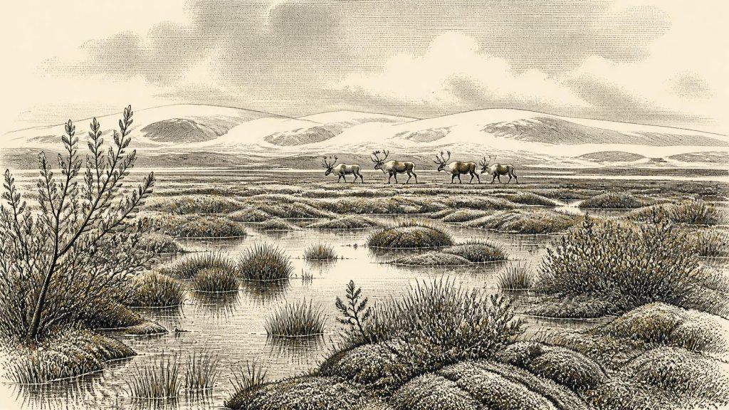
About 30,652 BCE cannot be treated as a precisely dated Irish year, but falls within a Late Pleistocene interval represented by Derryvree, County Fermanagh. Organic silts between glacial tills indicate an ice-free phase, broadly 31,700–36,900 calibrated years before present, when cold, treeless wetlands supported mosses, sedges, dwarf willow, aquatic plants and freshwater life. Cave remains demonstrate that cold-adapted fauna, including reindeer, mammoth and predators, reached Ireland, although assemblages are not local censuses. A cut-marked Castlepook reindeer bone may indicate human butchery, yet remains disputed. Evidence supports intermittently habitable, climatically volatile landscapes, not continuous occupation, settlements, states, trade or annual history.
Dateline
Modern calendar precision cannot responsibly be projected back to 30,652 BCE. No contemporary Irish written record, annual chronology, named ruler or dated event exists for this point in the Late Pleistocene. The number is best treated as a position within a very long archaeological timespan: roughly 32,600 calendar years before present, conventionally measured from 1950. Even that conversion is only an orientation. Radiocarbon determinations have statistical ranges and must be calibrated against changing atmospheric carbon levels; a single sediment layer or animal bone cannot identify conditions in one particular calendar year.
For Ireland, the most relevant evidence belongs to the Middle Midlandian, part of Marine Isotope Stage 3, when North Atlantic climates changed sharply between colder phases and relatively milder interludes. The outstanding Irish environmental archive is not a settlement but a sealed deposit at Derryvree, near Maguiresbridge in County Fermanagh. It offers a rare, local glimpse of a landscape that existed between episodes of glacier advance. Its lesson is both vivid and restrained: parts of Ireland could support freshwater and tundra life during this broad period, but the island’s evidence is too fragmentary to furnish a history of a single year.
A Date Range, Not a Dated Day
The Derryvree deposits were discovered beneath glacial sediments during road works. There, organic silts and fine sands lay between two tills: dense, unsorted material left by glacier ice. The sequence establishes the order of events securely. Ice affected the locality; an ice-free interval followed in which freshwater and wet ground developed; later glacial activity covered and preserved the organic bed. That physical relationship is more dependable than attempts to turn one radiocarbon result into a precise annual narrative.
Organic material from Derryvree returned a conventional radiocarbon age of about 30,500 years before present, with a substantial uncertainty. Subsequent calibration places the deposit broadly within approximately 31,700–36,900 calibrated years before present, depending on the calibration treatment and confidence range used. Thus 30,652 BCE falls within the broad chronological world illuminated by Derryvree, rather than being a year that the site can pinpoint. Scholars have tentatively related the interval to several Greenland interstadials, short-lived warmer episodes recognised in ice cores, but this is a regional climatic comparison rather than an exact synchronisation.
This distinction matters. A radiocarbon age dates carbon-bearing material, not the instant when every seed settled, insect died or animal crossed a valley. Calibration curves become particularly complex at this depth in time. Ireland’s Late Pleistocene deposits were also disturbed, eroded, buried and reworked by later ice. The responsible historical question is therefore not ‘what happened in Ireland in 30,652 BCE?’, but ‘what conditions and possibilities does the evidence support for Ireland around the early thirty-third millennium BCE?’
Freshwater Between the Ice
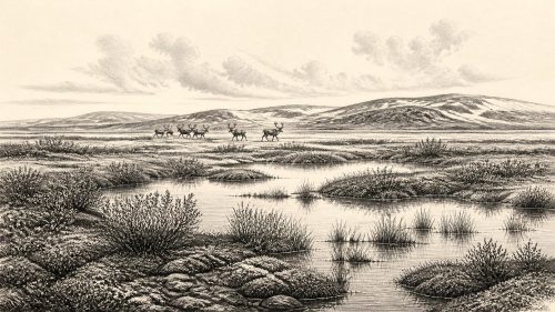
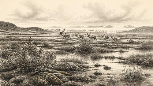
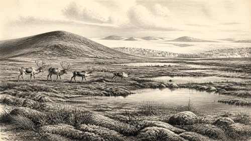
Derryvree answers that question with an unexpectedly watery landscape. The plant and animal remains from the organic silts indicate treeless, cold, waterlogged ground: a tundra or muskeg-like mosaic of shallow freshwater, mossy wetland, sedge-rich margins and open herbaceous terrain. ‘Muskeg’ is an older descriptive term, useful here if it is not mistaken for a modern Canadian wetland transplanted wholesale to Fermanagh. It conveys saturated organic ground with pools and vegetation, rather than a dense forest or a permanent ice sheet.
The fossils include plants associated with cold conditions and wet substrates, among them bogbean (Menyanthes trifoliata), dwarf willow, mountain-avens, clubmosses, mosses, sedges and aquatic plants such as water-milfoil. Their presence demonstrates that living plant communities occupied the locality during the formation of the silts. It does not mean that each species grew together in every square metre, nor that their modern ranges supply a simple thermometer for ancient Ireland. Nonetheless, the assemblage strongly favours a largely open, treeless setting in which summer thaw and standing water were important.
In this environment, seasonality must have been decisive. Long cold winters, frost action, short growing seasons and exposed ground would have restricted tree growth. During more favourable seasons, however, meltwater-fed pools, sedges and low shrubs could create productive patches for insects, birds and grazing mammals. Derryvree therefore corrects two misleading pictures at once: Ireland was not necessarily a temperate green island, but neither was every locality an unbroken, sterile ice desert. Habitats could be patchy, temporary and sharply responsive to climatic shifts.
Animals in a Mobile Landscape
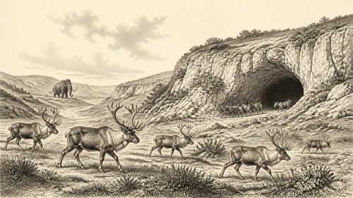
Caves, especially Castlepook Cave near Doneraile in north County Cork, add a second body of evidence. Their collections show that a diverse cold-stage fauna reached Ireland during the Late Pleistocene. Identified remains include reindeer, woolly mammoth, giant deer, brown bear, wolf, foxes, hares, lemmings and, at Castlepook, spotted hyaena. Such animals were not all necessarily contemporary, and a cave bone assemblage is not a census of one valley. Bones can be brought in by carnivores, washed through fissures, moved by sediment, or gathered by excavators working to early twentieth-century standards.
Even so, the combined evidence is significant. Reindeer and large herbivores imply open feeding grounds; wolves and hyaenas imply food webs with substantial prey; small mammals add detail to the cold-climate setting. Mammoth remains are particularly arresting, but they should not turn the Irish landscape into a cinematic herd scene. A bone establishes that an animal, or part of one, reached a site; it cannot show the size of an Irish population, its migration route, or whether mammoths were common. The actual landscape was likely a shifting regional mosaic, with suitable habitats appearing and disappearing as ice margins, drainage and climate changed.
Lower global sea levels altered coastlines profoundly, but they do not prove that Ireland had a simple, enduring land bridge to Britain or continental Europe at this moment. Ice sheets, the Irish Sea basin, changing shorelines and local relief all complicate movement. The arrival of large mammals proves that routes existed at least intermittently, whether across exposed ground, ice-adjacent corridors, narrow water crossings or combinations of these. Precisely how any particular species travelled remains unresolved.
The Castlepook Human Question
The possibility of people in Ireland is the most consequential and most uncertain issue for this period. A reindeer femur from Castlepook Cave bears a deep linear mark that has been interpreted as damage made by a sharp stone tool during butchery. If that interpretation is sustained, it would be evidence that one or more Upper Palaeolithic people processed a reindeer in Ireland during the wider Late Pleistocene. It would extend the island’s known human story far beyond the formerly accepted terminal-Pleistocene and Mesolithic evidence.
Yet the object cannot bear more historical weight than it possesses. It is a single modified bone from an old cave collection, rather than a securely excavated living floor. No associated hearth, stone-tool assemblage, built shelter, burial, artistic object or concentration of food waste has established a camp of comparable age at Castlepook. The age of the bone is not automatically the precise date of the incision; whether the mark is definitely anthropogenic requires specialist taphonomic judgement. Carnivore damage, breakage and depositional disturbance are persistent hazards in cave archaeology.
A brief visit by mobile hunters following animal resources is therefore a reasonable interpretation, not a demonstrated settlement history. There is no basis for naming a resident people, assigning a language, reconstructing kinship, or treating Ireland as continuously occupied. Future controlled excavation, direct dating, microscopic analysis of modifications and renewed study of museum collections may strengthen, revise or reject the claim. The scientific importance lies partly in that openness: Ireland’s deepest human past is still being discovered in deposits and collections long thought exhausted.
No Kingdoms, No Trade Routes
Political affairs, diplomacy and warfare cannot be reconstructed for Ireland around this date. There are no states, boundaries, rulers, treaties or defensive works evidenced in the record. If people did enter the island, their social organisation is unknown. Small, highly mobile groups are consistent with Upper Palaeolithic lifeways elsewhere in north-western Europe, but that wider comparison must not be mistaken for direct proof from Ireland.
Likewise, there is no Irish evidence for agriculture, domesticated animals, metalworking, formal trade networks, permanent villages or monuments. Any possible human economy would have depended on immediate access to wild plants, animals and workable stone, but the nature of procurement, sharing, movement and seasonal residence cannot be recovered from the present material. There is no securely dated Irish evidence for ritual structures, cave art, formal burial or systems of learning at this horizon. Such absences describe the limits of preservation and discovery, not the limits of Ice Age imagination.
The strongest historical development, then, is environmental rather than political. Around the broad period represented by 30,652 BCE, Ireland stood within a volatile North Atlantic world. At Derryvree, a freshwater wetland formed between glacial episodes; across suitable landscapes, cold-adapted animals found room to live; and at Castlepook, one disputed reindeer bone raises the possibility of a human encounter. These are small traces, but they are sufficient to replace the old image of a wholly blank Ice Age Ireland with a more compelling one: a changing island-edge landscape, intermittently habitable, whose evidence demands both imagination and caution.
Source References
Hover over a number to see the source. Select it to open the source.

- [1] Figure 6—The Subdivision of the Quaternary Period in Ireland
- [2] A Middle Midlandian Freshwater Series at Derryvree, Maguiresbridge, County Fermanagh, Northern Ireland
- [3] Late Pleistocene Chronostratigraphy and Ice Sheet Limits, Southern Ireland
- [4] Dimensions and Chronology of the Last Ice Sheet in Western Ireland
- [5] A 10Be-Dated Record of Glacial Retreat in Connemara, Ireland, Following the Last Glacial Maximum and Implications for Regional Climate
- [6] The Deglaciation of the Western Sector of the Irish Ice Sheet from the Inner Continental Shelf to its Terrestrial Margin
- [7] A Palaeo-Glaciological Reconstruction of the Last British-Irish Ice Sheet
- [8] Introduction to the Late Quaternary and Holocene of Northern Ireland
- [9] Menyanthes trifoliata — Fermanagh Botanical Site
- [10] 18) Castlepook Caves
- [11] Castlepook Cave, Castlepook South, County Cork — Excavations 2022
- [12] Archaeology Research Excavation Grant 2022: Final Report
- [13] The Archaeological Heritage of County Cork
- [14] New Insights on the Fauna of Ireland’s Younger Dryas and Early Holocene from Alice & Gwendoline Cave
- [15] A Stratigraphic Framework for Abrupt Climatic Changes During the Last Glacial Period Based on Three Synchronized Greenland Ice-Core Records
- [16] The IntCal20 Northern Hemisphere Radiocarbon Age Calibration Curve (0–55 cal kBP)
- [17] IntCal20 Issue — Radiocarbon
- [18] Prehistoric Details
- [19] Archaeological Survey — National Monuments Service
- [20] Advice to the Public: Caves
- [21] Pleistocene Glacial, Glaciomarine and Associated Deposits of Mell and Tullyallen Townlands, Near Drogheda, Eastern Ireland
Primary Sources
- Figure 6—The Subdivision of the Quaternary Period in Ireland
- A Middle Midlandian Freshwater Series at Derryvree, Maguiresbridge, County Fermanagh, Northern Ireland
- Late Pleistocene Chronostratigraphy and Ice Sheet Limits, Southern Ireland
- Dimensions and Chronology of the Last Ice Sheet in Western Ireland
- A 10Be-Dated Record of Glacial Retreat in Connemara, Ireland, Following the Last Glacial Maximum and Implications for Regional Climate
- The Deglaciation of the Western Sector of the Irish Ice Sheet from the Inner Continental Shelf to its Terrestrial Margin
- A Palaeo-Glaciological Reconstruction of the Last British-Irish Ice Sheet
- Introduction to the Late Quaternary and Holocene of Northern Ireland
- Menyanthes trifoliata — Fermanagh Botanical Site
- 18) Castlepook Caves
- Castlepook Cave, Castlepook South, County Cork — Excavations 2022
- Archaeology Research Excavation Grant 2022: Final Report
- The Archaeological Heritage of County Cork
- New Insights on the Fauna of Ireland’s Younger Dryas and Early Holocene from Alice & Gwendoline Cave
- A Stratigraphic Framework for Abrupt Climatic Changes During the Last Glacial Period Based on Three Synchronized Greenland Ice-Core Records
- The IntCal20 Northern Hemisphere Radiocarbon Age Calibration Curve (0–55 cal kBP)
- IntCal20 Issue — Radiocarbon
- Prehistoric Details
- Archaeological Survey — National Monuments Service
- Advice to the Public: Caves
- Pleistocene Glacial, Glaciomarine and Associated Deposits of Mell and Tullyallen Townlands, Near Drogheda, Eastern Ireland