
Maguirebridge’s Icebound Marsh30573 BCE
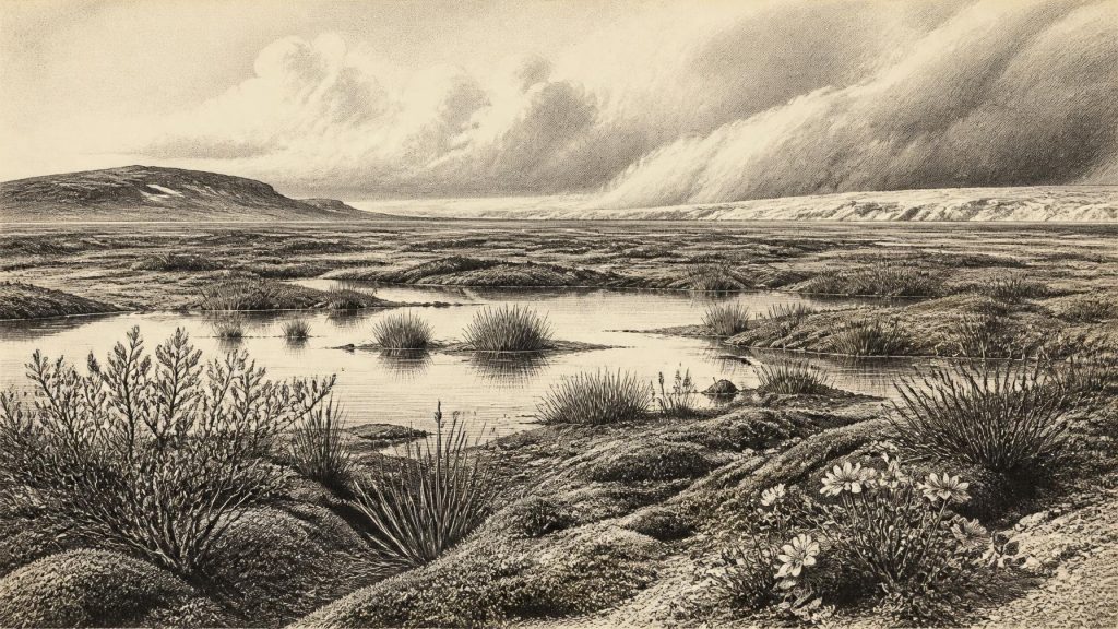
Labelled 30,573 BCE, this period cannot be reconstructed as an exact Irish year, but represents a fluctuating Late Pleistocene phase before the Last Glacial Maximum. At Derryvree near Maguiresbridge, buried wetland sediments between glacial tills preserve evidence of treeless tundra, shallow pools, mosses, herbs and cold-adapted insects, indicating temporarily ice-free ground. Castlepook Cave documents diverse fauna, including reindeer, mammoth, giant deer, hyaena and wolf, though not necessarily contemporaneously. Human presence remains uncertain: a possibly cut-marked reindeer bone may indicate brief Upper Palaeolithic activity, while later evidence is firmer. Glaciation buried, altered or destroyed many traces of this age in Ireland.
Dateline
The label 30,573 BCE is a modern chronological convenience, not a recoverable Irish calendar year. Nobody in Ireland then left a written date, a named polity, or an event that can be fixed to a particular season. In archaeological terms it corresponds approximately to 32,522 years before AD 1950, the reference point used for “before present” dating. Even that conversion must not suggest false precision. For this depth of time, Ireland is understood through broad calibrated ranges, radiocarbon determinations with substantial margins of error, sediments, fossil plants, animal remains and the changing traces of ice. The most responsible portrait is therefore of a phase in the Late Pleistocene, within Marine Isotope Stage 3, rather than of one exact year.
A Landscape Before the Maximum
At this point Ireland stood before the fullest expansion of the last British–Irish Ice Sheet. The local maximum extent of that ice sheet is generally placed around 27,000 years before present, while the global Last Glacial Maximum lasted roughly 26,500–19,000 years ago. Around the modern label 30,573 BCE, conditions were already severe and highly unstable, but Ireland was not simply a single, motionless sheet of ice. Different regions experienced different combinations of ice cover, open ground, permafrost, meltwater and cold-water wetlands. The island’s coastlines also cannot be assumed to have resembled those of today: lower global sea levels exposed wider continental shelves and altered the connections between Ireland, Britain and the European mainland.
This was a world shaped by abrupt climatic oscillations. Greenland ice-core records show that the later Ice Age was punctuated by colder stadials and relatively milder interstadials, sometimes changing over timescales shorter than the long archaeological periods by which prehistorians organise the evidence. The Irish record is too fragmentary to match every such fluctuation confidently to a particular valley or animal bone. Nevertheless, deposits beneath later glacial sediments prove that parts of the country could support freshwater habitats and tundra vegetation before advancing ice overwhelmed or sealed them.
The Derryvree Evidence
The most illuminating Irish archive for this broad interval lies at Derryvree, near Maguiresbridge in County Fermanagh. Road works in 1969 exposed a drumlin cut by a sequence of sediments. Between two tills – deposits left by glacial ice – investigators found freshwater silts and fine sands with an organic layer. This was no ordinary peat bog preserved at the surface. It was a buried remnant of a cold-age wetland, later covered and protected by ice-laid material.
A legacy radiocarbon measurement, BIRM-166, on the organic deposit gave 30,500 radiocarbon years before present, with a large uncertainty. A conventional radiocarbon age is not the same thing as a calendar age: atmospheric carbon-14 varied through time, so a result requires calibration against a curve such as IntCal20. At ages beyond about 30,000 years, the calibrated ranges can be broad and irregular. The determination is consequently valuable as evidence for a pre-Last Glacial Maximum ice-free interval, but it cannot securely describe conditions in one specific year, nor can it be converted honestly into a single anniversary in BCE.
What Derryvree does preserve is a rare local ecological assemblage. Pollen was poorly preserved, yet it was dominated by herbaceous plants. Macrofossils included mosses and plants associated with cold, open ground and shallow freshwater. Recorded indicators include dwarf willow, mountain avens, bogbean, alternate water-milfoil and other taxa capable of surviving in exposed, short-season environments. Insect remains supported the same general conclusion: a muskeg-like tundra wetland with open pools, abundant plant material and mossy margins. The evidence points to a treeless landscape, not woodland.
Wet Ground, Frost and Short Summers
The word “tundra” can mislead if it conjures an empty white plain. Derryvree instead suggests a patchwork: saturated silts, shallow water, sedge and moss communities, stony or frost-disturbed ground, and sparse herbs beyond the wettest margins. In summer, the surface may have been productive enough for insects, aquatic plants and grazing animals; in winter, it would have been a hard and exposed environment. Permafrost or seasonally frozen ground restricted drainage, helping to create pools and wet hollows even where precipitation was limited.
This is the strongest evidence for everyday environmental conditions in Ireland around the broad period represented by 30,573 BCE. It does not show houses, paths, hearths or cultivated fields. Rather, it shows the material basis on which any animal – and any visiting human group – would have had to live. Fuel would have been scarce away from driftwood or animal bone; tall timber was absent; shelter and movement would have depended on local landform, season and weather. A wetland could offer water and edible or useful plants, but it also imposed difficult crossings and changing ground conditions.
Caves and Cold-Age Animals
Far to the south, Castlepook Cave near Doneraile in County Cork provides a different kind of archive. Its deposits and historic collections have yielded one of Ireland’s most important assemblages of pre-Last Glacial Maximum fauna. Reassessment and improved radiocarbon pretreatment have shown that several older cave dates required revision, while confirming that some animals belonged to Marine Isotope Stage 3, well before the later maximum of the ice sheet. The cave record includes remains attributed to woolly mammoth, reindeer, giant deer, spotted hyaena, wolf, brown bear and smaller cold-adapted mammals.
These animals should not be assembled into a single illustrated scene. Cave deposits accumulate over long periods, and carnivores, water, collapse and excavation can mix material from different episodes. A mammoth bone and a reindeer bone from the same cave do not prove that the animals encountered one another, still less that both were present in the year 30,573 BCE. Even so, the assemblage establishes that Ireland or its immediately accessible regions supported, at different times during this cold-age phase, a far richer large-mammal community than survives on the island today.
Reindeer are particularly important because their presence fits the open, herb-rich terrain indicated at Derryvree. Their seasonal movements could have linked dispersed patches of grazing across exposed landscapes. Mammoth and giant deer point to substantial forage resources during favourable phases, while hyaena and wolf remind us that large herbivores were part of a predator-rich food web. The animal record is evidence for ecology, not for political borders, tribal territories or a settled economy.
The Human Question
No securely excavated settlement, stone-tool workshop, burial, dwelling, hearth or artistic site is known in Ireland from this period. There is, however, an intriguing and unresolved object from Castlepook: a reindeer femur bearing a deep linear mark interpreted by zooarchaeologist Ruth Carden as damage made by a sharp stone tool during carcass processing. County Cork heritage material has presented the bone as roughly 31,000 BC, while public discussion has often described it as about 33,000 years old. Such labels must be handled cautiously. The age of a bone dates the death of the animal within a range; it does not necessarily date the marking event precisely, and the specimen was recovered from an old cave collection rather than a modern, intact occupation surface.
If the mark is correctly identified as a cut mark, the narrow conclusion would be important: a person used a sharp tool on a reindeer carcass in Ireland during the Upper Palaeolithic. It would not prove permanent settlement, an annual migration route, a named culture or direct ancestry to later Irish communities. It might represent one brief visit, scavenging, butchery away from the cave followed by carnivore transport, or another limited episode. The contrast with the much later cut-marked brown-bear bone from Alice and Gwendoline Cave in County Clare is instructive. That evidence has direct calibrated dates of about 12,810–12,590 cal BP and is currently the more securely established Palaeolithic indication of human activity in Ireland.
Society Without a State
Political affairs, diplomacy, formal religion and learned institutions cannot be reconstructed for Ireland at this date. There are no texts, monuments, graves or settlement plans from which to infer chiefs, alliances, languages or ritual systems. If people did visit, they would have belonged to mobile Upper Palaeolithic hunter-gatherer communities operating across the wider north-west European world. Their social knowledge would have been practical and sophisticated – reading animal movement, weather, stone, water, hides and seasonal resources – but this is an inference from comparable archaeological contexts elsewhere, not a fact demonstrated by an Irish camp.
Nor is there evidence for trade in the later sense of regular exchange between settled communities. Any movement of people, raw materials or information would have followed changing landscapes and animal ranges. At lower sea levels, the geography of travel differed fundamentally from the modern island map, yet waterways, ice margins and exposed coasts remained serious obstacles. The available Irish evidence is better suited to describing ecological opportunity and constraint than to mapping routes.
A Buried Record
The central historical development relevant to this date was environmental transformation. Wetland and tundra habitats such as Derryvree existed in an interval before later ice advance. Subsequent glaciation remodelled the terrain, laid down till, carved and reshaped valleys, and destroyed or buried many older land surfaces. This is why the evidence is so uneven: a few caves and sealed sediment pockets survive, while most traces of any contemporary human activity may have been scoured away or remain undiscovered.
Ireland around 30,573 BCE was therefore neither a blank nor a knowable national society. It was a cold, dynamic region of the Late Pleistocene: open ground and freshwater marshes in some places; powerful ice systems expanding across others; reindeer and other Ice Age animals moving through suitable habitats; and, perhaps, rare human visitors whose presence is still debated. Derryvree’s buried marsh is the clearest witness. It preserves not an event of a year, but a fragile ecological moment before the ice closed over it.
Primary Sources
- Palaeoecology
- Figure 6.— The Subdivision of the Quaternary Period in Ireland
- A Reconsideration of the Radiocarbon Dating of the Marine Isotope Stage 3 Fauna from Southern Ireland
- First Evidence of a Late Upper Palaeolithic Human Presence in Ireland
- New Insights on the Fauna of Ireland’s Younger Dryas and Early Holocene from Alice & Gwendoline Cave
- The IntCal20 Northern Hemisphere Radiocarbon Age Calibration Curve (0–55 cal kBP)
- Pattern and Timing of Retreat of the Last British-Irish Ice Sheet
- Growth and Retreat of the Last British–Irish Ice Sheet, 31,000 to 15,000 Years Ago: the BRITICE-CHRONO Reconstruction
- Timing and Pace of Ice-Sheet Withdrawal Across the Marine–Terrestrial Transition West of Ireland During the Last Glaciation
- Late Pleistocene Chronostratigraphy and Ice Sheet Limits, Southern Ireland
- Trimlines, Blockfields and the Vertical Extent of the Last Ice Sheet in Southern Ireland
- Irish Pleistocene Biostratigraphy
- Heritage Artefacts of County Cork
- The Irish Quaternary Fauna Project
- Dating Constraints on the Last British-Irish Ice Sheet: A Map and Database
- BSBI: Salix herbacea
- BSBI: Menyanthes trifoliata
- BSBI: Dryas octopetala
- BSBI: Myriophyllum alterniflorum
- Maximum Extent and Readvance Dynamics of the Irish Sea Ice Stream and Irish Sea Glacier Since the Last Glacial Maximum