Kerry Dripstones30572 BCE
30,572 BCE is a modern label within a broad Late Pleistocene range, not a recorded Irish year. Derryvree, County Fermanagh, preserves freshwater sediments between glacial tills, indicating a cold, treeless, periglacial wetland during an ice-free interval, later buried by renewed ice. Its radiocarbon dates cannot identify conditions in any single year. Crag Cave speleothems show intermittent milder phases in south-west Ireland, while southern caves contain Marine Isotope Stage 3 animal remains, including giant deer and hyaena. Possible human modification of a Castlepook reindeer bone remains uncertain. No secure evidence demonstrates permanent settlement, polities, culture, farming, trade or sustained human occupation.
Dateline
30,572 BCE is a modern calendar label, not a date recorded by people then living in Ireland. It corresponds approximately to 32,521 years before AD 1950, the conventional ‘present’ used in radiocarbon and palaeoclimate studies. No annual Irish chronology exists for this depth of time, and it would be misleading to assign an event, ruler, migration or season to that numbered year. The responsible approach is to place it within broad calibrated ranges. Ireland was in the Late Pleistocene, during Marine Isotope Stage 3, a long and climatically unstable phase before the fullest development of the last British–Irish Ice Sheet. The most useful evidence is environmental rather than historical: buried lake and wetland sediments, cave deposits, animal bone and the changing record of ice.
A Date Within a Range
The closest securely relevant Irish chronology comes from Derryvree near Maguiresbridge, County Fermanagh. In 1969, a road cutting exposed a remarkable sequence within a drumlin: glacial till below, freshwater silts, sands and organic sediments in the middle, and a later till above. The arrangement matters more than any single laboratory number. It shows that ice had once occupied the locality, that an interval followed in which liquid fresh water and vegetation persisted, and that a subsequent ice advance buried and protected the deposit. The key radiocarbon determination, BIRM-166, was reported as 30,500 ± 1,100 radiocarbon years BP. Calibrated using modern curves, it spans broadly about 36,900–31,700 calendar years BP. The nominal year 30,572 BCE falls within that wide range, but cannot be matched to a particular sediment layer, living plant, animal visit or human action.
This distinction is essential. Radiocarbon years are not calendar years, because atmospheric carbon-14 levels have varied. Calibration converts a measurement into a probability range rather than producing a pinpoint historical date. At more than thirty millennia ago, uncertainty is substantial, and deposits usually accumulated over time. The Derryvree evidence can therefore illuminate conditions in an interval around this notional year; it cannot tell us what happened in Ireland on a particular day in 30,572 BCE. The same caution applies to wider climate correlations based on Greenland ice cores. They reveal abrupt North Atlantic shifts at a remarkable resolution, but they do not turn an Irish wetland into an annual diary.
Fresh Water Between Ice Advances
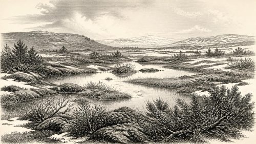
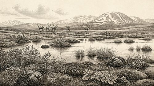
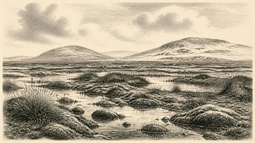
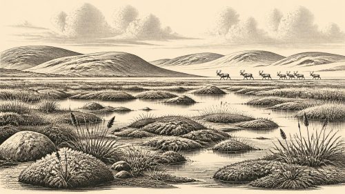
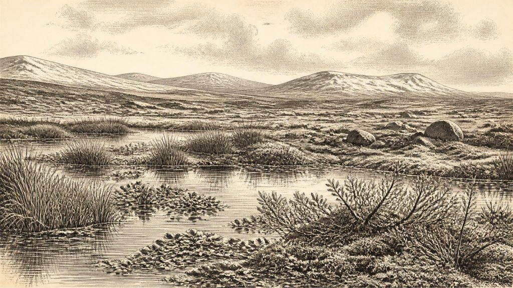
Derryvree gives Ireland an unusually vivid, though local, Late Pleistocene archive. Its middle sediments contained pollen, plant macrofossils, mosses and insect remains. Together, these indicate standing or slow-moving fresh water bordered by a cold, open and predominantly treeless landscape. The assemblage included plants associated with wet ground and cool conditions, among them sedges, mosses, dwarf willow, mountain-avens, bogbean and lesser clubmoss. They do not amount to a complete inventory of Ireland’s flora, because preservation favours organisms that entered this small basin. Yet they firmly rule out an image of unbroken ice or familiar temperate woodland at the site during the deposit’s formation.
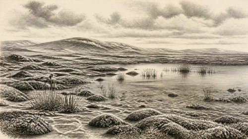
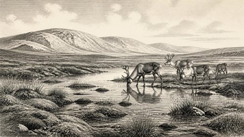
The best reconstruction is of a periglacial mosaic: wet hollows and shallow pools, sedge-rich margins, patches of low vegetation, exposed mineral ground and seasonally severe conditions. ‘Tundra’ and ‘muskeg’ are useful comparisons, not exact modern equivalents. A pool near Maguiresbridge could support aquatic plants and insects while nearby slopes remained cold, windswept and sparsely vegetated. Short growing seasons would have concentrated biological activity into the warmer months. Winters were likely harsh enough for long periods of frozen ground, snow and repeated freeze–thaw action. Such processes broke rock, shifted sediment and helped create the uneven, waterlogged terrain captured in the buried silts.
The sequence does not prove that all of Ireland was simultaneously ice-free. It demonstrates only that this part of Fermanagh was free from overriding glacier ice for long enough for freshwater sediment and organic material to accumulate. Elsewhere, uplands, coasts and basins could have had very different conditions. Ireland’s last glaciation was not a single, static blanket of ice: ice margins advanced, retreated and reorganised over long periods, while regional climate oscillated sharply. The later till above Derryvree is the physical reminder that this productive wetland world was eventually overwhelmed and sealed by renewed ice movement.
Signals From Kerry and Cork
Other Irish records help frame, rather than precisely date, the Derryvree landscape. At Crag Cave near Castleisland in County Kerry, uranium-thorium dating of broken and reworked speleothems shows episodes of calcite growth through much of the last glacial period. In a shallow cave, dripstone growth requires liquid water and conditions sufficiently mild for water to circulate through soil and limestone above the cave. The record is interpreted as responding to relatively warmer Greenland interstadials and as stopping during colder stadials. It is valuable evidence that south-west Ireland did not remain continuously frozen throughout this broad era, although individual growth phases cannot be equated exactly with 30,572 BCE.
In southern Ireland, cave collections also show that a richer Pleistocene mammal fauna once reached the island. Re-dating and review of bones from Castlepook Cave, near Doneraile in north Cork, have identified Marine Isotope Stage 3 evidence for animals including giant deer and spotted hyaena; older cave investigations also yielded mammoth and reindeer remains. These finds show that cold-stage Ireland was connected ecologically to wider north-west European animal populations at various times. They do not demonstrate that every listed species lived together, occupied every county or passed Derryvree’s pool in the same century. Cave deposits are often complex accumulations, disturbed by animals, water, excavation and later collecting.
The Human Question
The possibility of human presence must be handled even more carefully. A reindeer femur from Castlepook has been publicised as bearing a deep modification interpreted as a fresh-bone cut or chop made with a sharp stone tool, and its dating has encouraged the possibility of a very early Upper Palaeolithic visit to Ireland. If that interpretation is sustained, it would indicate the processing of a reindeer carcass, not a settled community. It would be a striking trace of action, but still only one trace from a historically excavated cave collection rather than a securely excavated campsite.
For 30,572 BCE itself, there is no published house, hearth, stone-tool assemblage, burial, decorated cave wall, food store or occupation surface that can be securely assigned to Ireland. There is no basis for naming a people, language, kin group or cultural tradition on the island. Nor can later Mesolithic evidence be projected backwards across more than twenty thousand years. The National Museum of Ireland has rightly stressed the long-standing absence of clear Palaeolithic settlement evidence, while recent discussion of the Castlepook bone makes the possibility of a brief earlier human presence worth continued investigation. The proper conclusion is uncertainty: people may have visited or used parts of Ireland during favourable intervals, but sustained occupation at this date has not been demonstrated.
No Polities, No Proven Diplomacy
Accordingly, political history cannot responsibly be written for this point. There were no documented kingdoms, chiefs, assemblies, borders, treaties or diplomatic relations. Conflict cannot be inferred from a cold landscape or from predator and prey bones. Mammoths, reindeer, giant deer, wolves, hyaenas and other animals belonged to ecological relationships of grazing, scavenging and predation; those are not evidence for warfare. Even if small groups of people reached Ireland, the surviving record cannot reveal their numbers, routes, social organisation, gender roles or relations with other groups.
Religion, culture and learning are similarly beyond recovery in an Irish-specific sense. Upper Palaeolithic communities elsewhere in Europe made sophisticated tools, ornaments, images and burial places, but no equivalent material can presently be attributed to Ireland around this date. It is reasonable to say that any humans who did reach the island would have possessed knowledge of weather, animals, stone, shelter and movement through dangerous terrain. It is not reasonable to reconstruct Irish rituals, myths, art styles or teaching traditions from that general possibility. Absence of evidence is not evidence that people lacked culture; it is evidence that Irish archaeology has not recovered material capable of describing it.
Subsistence Without a Recorded Economy
There were no farms, fields, livestock, cereal crops, metalwork, pottery or markets. The visible economy is principally environmental: plants growing during short summers, herbivores moving through suitable habitat, carnivores following prey or carrion, water carrying fine sediment, and ice periodically remaking the land. If the Castlepook reindeer modification proves anthropogenic, it would support one narrow economic inference: a person or small party obtained meat, hide, sinew, marrow or other useful material from a reindeer. It would not prove organised hunting of herds, seasonal trade, permanent settlement or maritime travel.
Nor is there evidence for trade or diplomacy across the Irish Sea. Lower global sea levels altered the surrounding shelves and changed the geography through which animals and perhaps people moved, but the exact coastlines, water crossings and land connections changed through time. A broad regional connection is demonstrated by the arrival of mammals; a specific land bridge, crossing route or exchange network cannot be drawn for this nominal year. The island’s geographical position was important, but the archaeological record does not yet show how, or whether, people exploited it at this stage.
An Island Recorded Indirectly
What can be said with confidence is both modest and consequential. Around the broad interval represented by 30,572 BCE, parts of Ireland could contain ice-free freshwater environments amid a severe, rapidly changing glacial climate. Derryvree preserves one such environment beneath later glacial deposits: a small watery refuge with its own plants, insects and sedimentary history. Crag Cave records intermittent conditions mild enough for seepage water to form calcite. Southern caves preserve traces of animals whose descendants no longer inhabit Ireland. Together they replace an old picture of a uniformly blank, ice-covered island with one of regional variation, ecological opportunity and recurring disruption.
Yet this was not Ireland in the later historical sense. There were no Irish names, territories or communities that can be traced continuously into the present. The most important ‘development’ was environmental: the shifting balance between cold, moisture, vegetation, animal movement and advancing ice. The buried water-meadow of Fermanagh, the cave dripstone of Kerry and the animal bones of Cork are fragments rather than a narrative. Their value lies precisely in that restraint. They allow us to see an inhabited landscape of plants and animals, and perhaps the faint possibility of human passage, without inventing a history that the evidence cannot bear.
Source References
Hover over a number to see the source. Select it to open the source.

- [1] A Middle Midlandian freshwater series at Derryvree, Maguiresbridge, County Fermanagh, Northern Ireland
- [2] The Glacial Deposits of the Maguiresbridge Area, County Fermanagh, Northern Ireland
- [3] Freshwater organic deposits and stratified sediments between Early and Late Midlandian (Devensian) till sheets, at Aghnadarragh, County Antrim, Northern Ireland
- [4] Episodic speleothem deposition tracks the terrestrial impact of millennial-scale last glacial climate variability in SW Ireland
- [5] Spatio-temporal dynamics of speleothem growth and glaciation in the British Isles
- [6] Growth and retreat of the last British–Irish Ice Sheet, 31 000 to 15 000 years ago: the BRITICE-CHRONO reconstruction
- [7] Character of advance and retreat of the southwest sector of the British-Irish Ice Sheet during the last glaciation
- [8] A reconsideration of the radiocarbon dating of the Marine Isotope Stage 3 fauna from southern Ireland
- [9] The Irish Quaternary Fauna Project
- [10] The IntCal20 Northern Hemisphere radiocarbon age calibration curve (0–55 cal kBP)
- [11] A stratigraphic framework for abrupt climatic changes during the Last Glacial period based on three synchronized Greenland ice-core records: refining and extending the INTIMATE event stratigraphy
- [12] High-resolution record of Northern Hemisphere climate extending into the last interglacial period
- [13] Rapid response of climatic conditions during the last glacial: evidence from U-series dated Irish speleothems
- [14] Figure 6.— The subdivision of the Quaternary Period in Ireland
- [15] References and Recommended Reading
- [16] Prehistoric Details
- [17] Heritage Artefacts of County Cork
- [18] The Geological Heritage of County Leitrim
- [19] The Glacial Deposits of the Maguires-Bridge Area, County Fermanagh, Northern Ireland
- [20] Soil and karst aquifer hydrological controls on the geochemical evolution of speleothem-forming drip waters, Crag Cave, southwest Ireland
- [21] Spatial variability in cave drip water hydrochemistry: Implications for stalagmite paleoclimate records
- [22] Phylogeographic, ancient DNA, fossil and morphometric analyses reveal ancient and modern introductions of a large mammal: the complex case of red deer (Cervus elaphus) in Ireland
Primary Sources
- A Middle Midlandian freshwater series at Derryvree, Maguiresbridge, County Fermanagh, Northern Ireland
- The Glacial Deposits of the Maguiresbridge Area, County Fermanagh, Northern Ireland
- Freshwater organic deposits and stratified sediments between Early and Late Midlandian (Devensian) till sheets, at Aghnadarragh, County Antrim, Northern Ireland
- Episodic speleothem deposition tracks the terrestrial impact of millennial-scale last glacial climate variability in SW Ireland
- Spatio-temporal dynamics of speleothem growth and glaciation in the British Isles
- Growth and retreat of the last British–Irish Ice Sheet, 31 000 to 15 000 years ago: the BRITICE-CHRONO reconstruction
- Character of advance and retreat of the southwest sector of the British-Irish Ice Sheet during the last glaciation
- A reconsideration of the radiocarbon dating of the Marine Isotope Stage 3 fauna from southern Ireland
- The Irish Quaternary Fauna Project
- The IntCal20 Northern Hemisphere radiocarbon age calibration curve (0–55 cal kBP)
- A stratigraphic framework for abrupt climatic changes during the Last Glacial period based on three synchronized Greenland ice-core records: refining and extending the INTIMATE event stratigraphy
- High-resolution record of Northern Hemisphere climate extending into the last interglacial period
- Rapid response of climatic conditions during the last glacial: evidence from U-series dated Irish speleothems
- Figure 6.— The subdivision of the Quaternary Period in Ireland
- References and Recommended Reading
- Prehistoric Details
- Heritage Artefacts of County Cork
- The Geological Heritage of County Leitrim
- The Glacial Deposits of the Maguires-Bridge Area, County Fermanagh, Northern Ireland
- Soil and karst aquifer hydrological controls on the geochemical evolution of speleothem-forming drip waters, Crag Cave, southwest Ireland
- Spatial variability in cave drip water hydrochemistry: Implications for stalagmite paleoclimate records
- Phylogeographic, ancient DNA, fossil and morphometric analyses reveal ancient and modern introductions of a large mammal: the complex case of red deer (Cervus elaphus) in Ireland