
The Maguiresbridge Silt Archive30517 BCE
The Derryvree freshwater deposit near Maguiresbridge, County Fermanagh, provides evidence for Ireland during Marine Isotope Stage 3. Radiocarbon dating places its organic silts broadly between 36,900 and 31,700 calibrated years before present, so 30,517 BCE denotes an interval, not a recoverable year. Deposited between glacial tills, the silts record a local ice-free wetland with shallow pools, tundra vegetation, mosses, insects and seasonal frost. Later ice covered the site. Cave faunas show cold-adapted animals occurred regionally, but cannot reconstruct one locality or moment. A possibly tool-marked reindeer bone suggests transient human visits, not settlement. No polities or cultural structures are evidenced.
Dateline
“30,517 BCE” is a modern calendar label, not a date that can be recovered from an Irish chronicle, settlement layer or individual human life. At this depth in time, Ireland is known through geological strata, plant and insect remains, animal bones and laboratory dating, all of which describe intervals rather than a single year. The most relevant evidence is the Derryvree freshwater deposit near Maguiresbridge in County Fermanagh. Its radiocarbon determination, Birm-166, was reported as 30,500 years before present, with an uncertainty of roughly a millennium. Calibration converts that result into a broad range of approximately 36,900–31,700 calibrated years before present. The modern year label falls within that range, but it cannot identify the precise season, generation or event represented by the deposit.
A Freshwater Interval Beneath a Drumlin
Derryvree was exposed in road works during 1969, when a cutting passed through a drumlin: one of the smooth, elongated hills formed beneath moving glacier ice. The section revealed an unusual sequence. Thick glacial tills—sediment laid down directly by ice—occurred both below and above a layer of freshwater silts and fine sands. Between those tills lay organic material containing fossil plants and insects. The basic inference is firm: when the freshwater layer accumulated, this part of south Fermanagh was not buried beneath active ice. At earlier and later stages, glaciers had crossed the locality and left their debris behind.
That sequence is more informative than it may first appear. It gives Ireland a rare terrestrial record from the middle part of the last glacial cycle, conventionally placed within Marine Isotope Stage 3. Yet its limits also matter. The deposit does not provide a map of the entire island, a continuous climatic diary or proof that all of Ireland was simultaneously ice-free. Nor can it establish exactly when the ice advanced across Derryvree afterwards. It records a local wetland landscape during an interval between glacial episodes, preserved almost accidentally beneath later ice and a drumlin’s clay-rich mantle.
Open Ground, Pools and Seasonal Frost
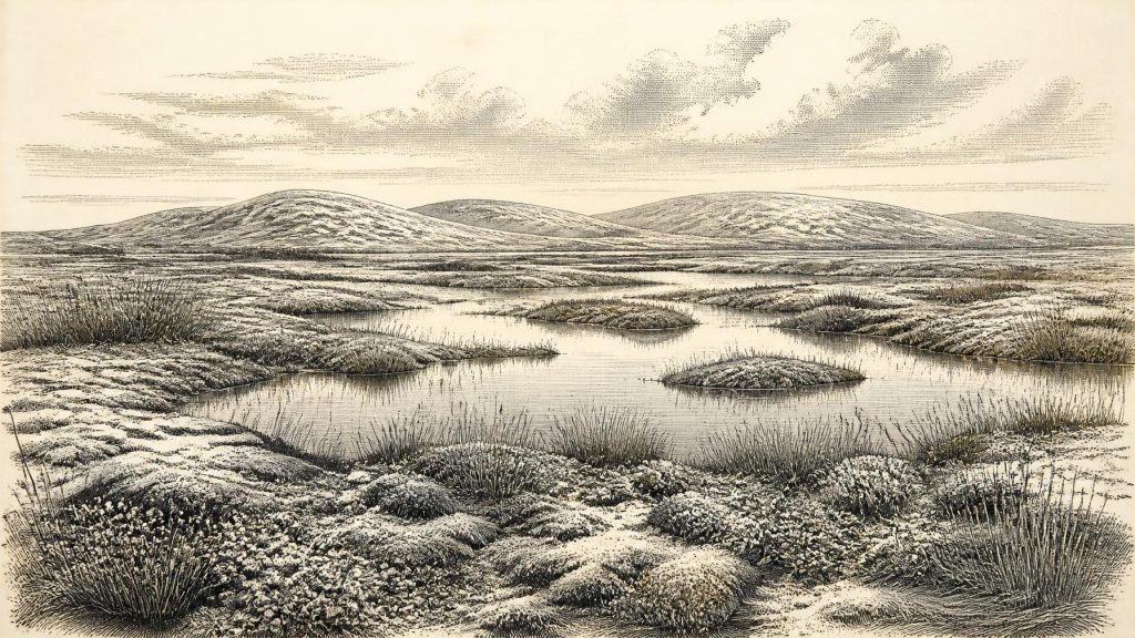
The fossils from Derryvree describe a severe but not lifeless environment. Pollen was poorly preserved, so it must be handled cautiously; macrofossils and mosses are particularly valuable because they were generally deposited close to the places where they grew. Together with the insect evidence, they indicate open, treeless vegetation: grasses, sedges, herbs, moss-rich ground and low shrubs or scattered juniper rather than woodland. The freshwater silts point to shallow pools and saturated margins. Scholars have described the setting as tundra or muskeg—a waterlogged, peaty mosaic of wet hollows, plant-rich shallows and frost-affected ground.
This was not the familiar Ireland of oak woodland, enclosed fields, bog roads and hedgerows. Winters were harsh, and seasonal freezing shaped soils and drainage. During the shorter growing season, however, wetland plants, insects and mosses could occupy sheltered ground. The important contrast is not simply between “ice age” and “ice-free”. Derryvree shows that an ice-age landscape could include open water, living vegetation and ecological niches even while the wider climate remained cold and unstable. It was a northern Atlantic margin undergoing repeated environmental change.
The date range overlaps a period before the global Last Glacial Maximum, conventionally dated to about 26,500–19,000 years ago. Later in the last glaciation, the Irish Ice Sheet became far more extensive, joining the wider British–Irish Ice Sheet system and reshaping much of the country. Derryvree therefore preserves a landscape from before the best-known maximum of the ice sheet, not a scene from its final retreat. The upper till above the freshwater beds is a material reminder that the relative respite recorded in the wetland did not last indefinitely.
Animals on a Changing Island
Irish cave collections provide a broader, though imperfect, picture of Late Pleistocene animal life. Castlepook Cave, also called Mammoth Cave, near Doneraile in north County Cork, has yielded remains attributed to reindeer, woolly mammoth, giant deer, brown bear, wolf, Arctic fox, mountain hare, lemmings and spotted hyaena. Such animals demonstrate that Ireland could support, or be visited by, cold-adapted and open-country fauna during parts of the Late Pleistocene. They do not mean that all those species grazed beside the Derryvree pools in the calendar year represented here.
Caves are especially prone to chronological mixing. Carnivores may carry bones into them; water and sediment can move remains; nineteenth- and early twentieth-century excavations often removed deposits before modern recording standards existed. Radiocarbon dates on individual bones are improving the picture, and some older Irish cave dates have been revised after better laboratory pretreatment. The responsible conclusion is therefore regional and long-term: animal communities moved through an environmentally fluctuating Ireland. A single cave assemblage is not a census of one valley, much less a snapshot of the whole island.
The Question of People
Human history at this date is even less certain. A reindeer femur from Castlepook has been reported as bearing a deep mark interpreted as having been made by a stone tool while fresh, perhaps during butchery. County Cork heritage material presents the bone as Palaeolithic and broadly around 31,000 BC. If the mark is correctly identified and genuinely contemporary with the animal’s death, it may be evidence that people handled a reindeer in Ireland tens of millennia before the long-established post-glacial settlement record.
It is not, however, evidence for a permanent Irish population, a village, named community or political territory. The bone’s date concerns the animal; the interpretation of the mark is a separate taphonomic judgement. No securely associated hearth, dwelling floor, tool assemblage, human burial, storage pit or art of comparable age has been demonstrated at Castlepook. Nor does Derryvree itself contain evidence of people. The most that can responsibly be said around this point in the chronology is that brief visits by highly mobile Upper Palaeolithic hunters remain possible, and that one disputed but important object has made that possibility a serious research question.
No Polities, But Real Landscapes
There is no evidence from Ireland for political affairs, diplomacy, warfare, formal religion, literacy or organised trade at this time. It would be misleading to populate the wetlands with chiefs, tribes or ritual systems invented from later prehistory. Even if people reached the island intermittently, archaeology cannot yet identify their language, ancestry, social structure, routes or length of stay. The absence of proof is not proof that no human ever crossed this landscape; it is a limit imposed by a sparse record repeatedly disturbed by ice, erosion and changing sea levels.
Economy, in the usual historical sense, is likewise beyond recovery. There were no demonstrated farms, herds, markets or exchange networks. If small hunting groups did enter Ireland during ice-free episodes, their subsistence would have depended on portable knowledge rather than permanent infrastructure: reading animal movements, finding fuel and shelter, working hides and bone, and navigating a cold, exposed environment. That is an informed comparison with Upper Palaeolithic lifeways elsewhere in north-west Europe, not direct evidence from Derryvree. It must remain clearly separate from what the Fermanagh deposit itself proves.
What This Date Can Mean
For Ireland, the significance of this date lies in environmental possibility rather than an anniversary. The Derryvree silts preserve freshwater life between two phases of glaciation. They show that north-central Ireland contained an open, periglacial wetland during part of Marine Isotope Stage 3, with shallow water, tundra vegetation and strong seasonal cold. The record also establishes that the island’s glacial history was not a simple uninterrupted blanket of ice followed by a single thaw.
This is a history without rulers or written memory, but not without evidence. A road cutting through a Fermanagh drumlin, a laboratory date with a wide calibrated range, plant fragments, mosses and insects together provide a disciplined glimpse of Ireland’s deep past. Their lesson is modest and powerful: around the broad interval into which 30,517 BCE falls, parts of Ireland could be cold, wet, treeless and biologically active—landscapes vulnerable to the next advance of ice, but far from empty in ecological terms.
Primary Sources
- A Middle Midlandian Freshwater Series at Derryvree, Maguiresbridge, County Fermanagh, Northern Ireland
- Middle Midlandian Freshwater Series at Derryvree, Maguiresbridge, County Fermanagh, Northern Ireland
- Exploring Controls on the Glacial Dynamics of the Last British-Irish Ice Sheet
- Trimlines, Blockfields and the Vertical Extent of the Last Ice Sheet in Southern Ireland
- The Timing and Magnitude of the British–Irish Ice Sheet Between Marine Isotope Stages 5d and 2
- Growth and Retreat of the Last British-Irish Ice Sheet, 31,000 to 15,000 Years Ago
- Maximum Extent and Readvance Dynamics of the Irish Sea Ice Stream and Irish Sea Glacier Since the Last Glacial Maximum
- Timing and Pace of Ice-Sheet Withdrawal Across the Marine–Terrestrial Transition West of Ireland During the Last Glaciation
- Early Deglaciation of the British-Irish Ice Sheet on the Atlantic Shelf Northwest of Ireland Driven by Glacioisostatic Depression and High Relative Sea Level
- New Data for the Last Glacial Maximum in Great Britain and Ireland
- The Last Glacial Maximum
- New Insights on the Fauna of Ireland's Younger Dryas and Early Holocene From Alice and Gwendoline Cave
- The Irish Quaternary Fauna Project
- Irish Pleistocene Biostratigraphy
- Landscapes and Environments of the Last Glacial-Interglacial Transition: A Time of Amazingly Rapid Change in Ireland
- Palaeoecology
- The Subdivision of the Quaternary Period in Ireland
- Heritage Artefacts of County Cork
- Ireland Through Geological Time
- Anthropogenic Changes to the Holocene Nitrogen Cycle in Ireland
