BIRM-166’s Sedge Pools30393 BCE
30,393 BCE is not a recoverable Irish historical year but falls within the climatically unstable Late Pleistocene. At Derryvree, County Fermanagh, BIRM-166 dates freshwater organic deposits between glacial tills, indicating a cold, treeless wetland of sedges, dwarf shrubs, aquatic plants and insects during an ice-free interval. Comparable northern sites show regional variation rather than uniform conditions. Castlepook Cave preserves remains of mammoth, reindeer, giant deer, predators and other cold-adapted fauna, accumulated across changing periods. A possibly tool-marked reindeer bone suggests unconfirmed early human activity. Evidence supports environmental reconstruction, not settlements, events, or island-wide conclusions from a nominal calendar date alone.

Dateline
30,393 BCE is a modern chronological label, not a recoverable year in Ireland’s past. No Irish annal, occupation layer or dated event can be assigned to that calendar year. In archaeological terms it falls about 32,342 years before AD 1950, within the Late Pleistocene and Marine Isotope Stage 3, a climatically unstable part of the last Ice Age. Evidence at this depth is necessarily broad: radiocarbon determinations have margins of error and must be calibrated, while deposits may represent years, centuries or longer. The most responsible account, therefore, is of an Irish landscape around this point in a wide timescale rather than a narrative of happenings in a particular year.
The closest major Irish environmental record is at Derryvree, near Maguiresbridge in County Fermanagh. There, a road cutting exposed freshwater silts, sands and organic layers trapped between two tills: unsorted material deposited by glacier ice. The sequence proves a local order of events. Glacier ice had laid down the lower till; a freshwater environment then occupied the site; later ice overrode or approached the area and sealed the deposits beneath the upper till. A conventional radiocarbon determination, BIRM-166, gave an age of 30,500 ± 1,100 radiocarbon years before present. Calibration places that sample broadly at about 36,900–31,700 calibrated years before present, or roughly 34,950–29,750 BCE. The nominal year lies within this very wide range, but cannot be pinpointed within it.
Fresh Water Between Ice Advances
Derryvree is important because it confounds the simple image of Ice Age Ireland as an uninterrupted sheet of lifeless ice. The organic beds preserve a period when a hollow in the Fermanagh landscape held fresh or slow-moving water, accumulated fine sediment, and supported plants and small animals. The site is sometimes grouped in older Irish Quaternary terminology as part of the Derryvree Cold Phase. That label is useful as a shorthand for a cold-stage environmental episode, but it should not be mistaken for a precisely dated, island-wide event.
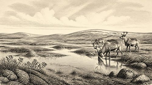
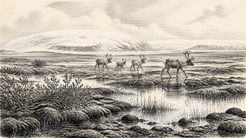
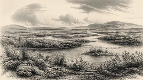
The fossil evidence indicates treeless, open ground rather than forest. Grasses, sedges, juniper, dwarf willow, herbs and mosses occur alongside aquatic or waterside plants, including bogbean and water-milfoil. Insects, especially beetles, reinforce the picture of a wet, plant-rich setting with pools and mossy margins. Such evidence supports a reconstruction of a tundra or muskeg-like mosaic: shallow water, saturated ground, sedgebanks, low vegetation and frost-affected soils. It does not establish a single unchanging landscape across all of Ireland. Derryvree was a sheltered local basin, and the interval represented in its layers was lengthy.
Cold did not mean ecological emptiness. During the growing season, water and ground vegetation could provide concentrated resources for insects, small mammals and grazing animals. Winters were likely severe, and the absence of woodland points to a climate too cold, dry, seasonal or otherwise disturbed for trees to form a closed canopy. Frost action, snow cover, meltwater and short summers would have shaped movement through the terrain. Yet the wetland evidence shows that northern Ireland retained productive patches between phases of glaciation.
An Uneven Island
Regional evidence matters greatly. Organic deposits at Greenagho near Belcoo, also in County Fermanagh, and at Aghnadarragh in County Antrim demonstrate that cold, non-glacial or locally ice-free episodes were not confined to one exposure. They do not prove that every district was simultaneously free of ice, nor that coastlines, uplands and lowlands shared one climate. Rather, they reveal the uneven character of the Midlandian glaciation. Ice advanced, retreated or changed its thermal and erosive behaviour across different sectors; habitats expanded and contracted accordingly.
Recent reconstructions of the British–Irish Ice Sheet reinforce the need for this regional approach. They place the major growth and maximum extent of the final ice sheet later than the broad Derryvree interval, with maximum ice volume around 23,000 years before present. At approximately 30,393 BCE, Ireland was approaching a more extensive phase of glaciation, but the island was not necessarily covered in the uniform ice blanket familiar from depictions of the later Last Glacial Maximum. The sequence at Derryvree supplies direct local evidence of ice-free freshwater conditions before later ice sealed the sediments; it cannot, by itself, map the entire island.
Lower sea levels altered the geography beyond Ireland’s modern shores. Exposed shelf areas and narrower water gaps could at times have made the island less isolated than today, although routes remained conditioned by sea, ice, weather and difficult terrain. The arrival of animals from wider north-west Europe demonstrates ecological connections, not an uncomplicated land bridge or a known migration corridor. Where precisely herds crossed, and whether particular routes were open at the same moment as Derryvree’s wetland, are questions the surviving evidence cannot answer.
Castlepook’s Animal Archive
For large mammals, Castlepook Cave near Doneraile in north County Cork—also known as Mammoth Cave—is the crucial Irish archive. Excavations in the early twentieth century recovered a remarkable but complicated collection of Pleistocene bones. It includes woolly mammoth, giant deer, reindeer, spotted hyaena, brown bear, wolf, foxes, hare and lemmings. The combination shows that parts of pre-Last Glacial Maximum Ireland supported, at different times, a much richer and colder-adapted animal community than the later historic island.
These species allow careful environmental inferences. Reindeer, mammoth and lemmings are consistent with open, cold landscapes rather than dense woodland. Wolves and hyaenas indicate a food web in which sizeable herbivores, carrion and predators all had a place. But the cave assemblage must not be converted into a single scene set in 30,393 BCE. Bones accumulated over extended periods and may have been brought in by carnivores, water movement or natural deaths; the early excavations predated modern recording standards. Re-dating with improved bone pretreatment has shown that some older Irish cave dates were substantially too young. Castlepook is consequently best treated as evidence for a changing succession of animals, not a guaranteed list of species living together in one season.
The underlying historical development is nonetheless striking. Ireland was not biologically sealed off. Cold-stage mammals reached it, survived for varying spans and sometimes disappeared locally as habitat and climate changed. Giant deer and spotted hyaena may have vanished from Ireland before the Last Glacial Maximum, while other species endured or later recolonised. This pattern of arrival, local survival and loss is more securely visible than any contemporary human story.
The Reindeer Femur Question
A reindeer femur from Castlepook has brought the possibility of much earlier human activity into discussion. Palaeozoologist Ruth Carden has identified a deep mark on the bone as potentially having been made by a sharp stone tool during the processing of fresh carcass material. The bone has been reported as roughly 33,000 radiocarbon years old. If the mark is confirmed as anthropogenic and related to the bone’s original depositional history, it may represent an exceptionally early indication that people handled a reindeer in Ireland during the Upper Palaeolithic.
That conditional language is essential. A radiocarbon date measures the age of the animal’s remains, not the exact moment, place or maker of a surface mark. One modified bone from an old cave collection is not a settlement. No securely associated hearth, stone-tool assemblage, dwelling floor, burial, artwork or human remains of comparable age has been published from Ireland. The find cannot identify a population, language, kin group or route of arrival; it cannot show whether people hunted the reindeer, found a carcass, stopped briefly or returned.
There is likewise no evidence from this period for political institutions, warfare, diplomacy, formal trade, agriculture, permanent villages, monuments, organised religion or writing in Ireland. It would be misleading to force those later historical categories onto a landscape from which even sustained human presence remains unproven. If people did reach Ireland intermittently, comparison with Upper Palaeolithic hunter-gatherers elsewhere suggests that survival would have depended on detailed knowledge of weather, animals, stone and seasonal movement. That is a reasoned inference from wider human ecology, not direct evidence for an Irish community.
What Can Be Said Responsibly
For this nominal year, environment is the principal subject of Irish history. Derryvree documents a cold but living freshwater landscape in Fermanagh, lying between episodes of glaciation. Greenagho and Aghnadarragh indicate broader northern variation. Castlepook preserves the remains of animal worlds that included large grazers and formidable carnivores. Together, these records show an Ireland of open vegetation, wet hollows, harsh seasonality and shifting connections to Britain and continental Europe.
They also define the limits of knowledge. The evidence is geological and palaeontological before it is historical in the usual sense. Later ice, changing sea levels, erosion and antiquarian excavation have destroyed or obscured much of what might once have survived. Future work in undisturbed cave deposits, improved radiocarbon dating, micro-wear analysis, ancient biomolecular research and better ice-sheet modelling may sharpen the picture. At present, however, 30,393 BCE should be understood through calibrated ranges and carefully separated evidence: not as a date of kings, conflicts or settlements, but as a point within the long, variable Ice Age world recorded by BIRM-166’s sedge pools.
Primary Sources
- A Middle Midlandian Freshwater Series at Derryvree, Maguiresbridge, County Fermanagh, Northern Ireland
- Figure 6.— The Subdivision of the Quaternary Period in Ireland
- Middle Midlandian Interstadial Deposits at Greenagho, Near Belcoo, County Fermanagh, Northern Ireland
- Freshwater Organic Deposits and Stratified Sediments Between Early and Late Midlandian (Devensian) Till Sheets, at Aghnadarragh, County Antrim, Northern Ireland
- Irish Pleistocene Biostratigraphy
- Pleistocene Glaciations in Ireland
- Trimlines, Blockfields and the Vertical Extent of the Last Ice Sheet in Southern Ireland
- Exploring Controls of the Early and Stepped Deglaciation on the Western Margin of the British-Irish Ice Sheet
- Growth and Retreat of the Last British–Irish Ice Sheet, 31,000 to 15,000 Years Ago: the BRITICE-CHRONO Reconstruction
- A Reconsideration of the Radiocarbon Dating of the Marine Isotope Stage 3 Fauna from Southern Ireland
- The Irish Quaternary Fauna Project
- New Insights on the Fauna of Ireland’s Younger Dryas and Early Holocene from Alice & Gwendoline Cave
- The Colonization of Ireland: A Human Ecology Perspective
- Our Ancient Landscapes: Hunter-Gatherers in Ireland
- Heritage Artefacts of County Cork
- Introduction to the Late Quaternary and Holocene of Northern Ireland
- The Geological Heritage of County Leitrim
- The Last Eurasian Ice Sheets – a Chronological Database and Time-Slice Reconstruction, DATED-1
- Dating Constraints on the Last British-Irish Ice Sheet: a Map and Database
- The Quaternary of Northern Ireland: Field Guide 16