Tundra Mire30602 BCE
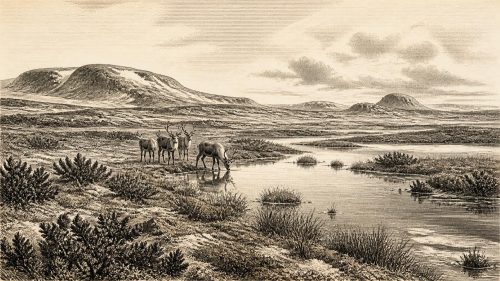
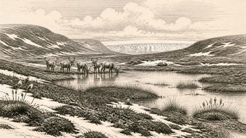
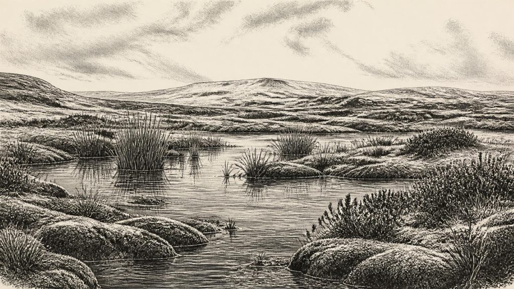
Thirty thousand six hundred and two BCE denotes an uncertain Late Pleistocene horizon, rather than a documented Irish year. At Derryvree, County Fermanagh, organic freshwater sediments, trapped between glacial tills, date broadly to this period and demonstrate a local ice-free wetland phase. Pollen, plants and insects indicate treeless, cold, waterlogged terrain with open water and sparse vegetation. Southern cave deposits record mammals including mammoth, reindeer, giant deer, hyaena and wolf, but not a simultaneous fauna. A possible butchered reindeer bone suggests early human presence, without proving settlement. Climate, shifting ice and ecology dominate the fragmentary evidence before the glacial maximum.
Dateline
“30,602 BCE” is a modern chronological label, not a year for which Ireland preserves an event, ruler or dated human action. No calendar existed on the island, and neither archaeology nor palaeoclimate research can resolve a particular Irish day, season or generation so far back. In the radiocarbon convention that fixes “present” at AD 1950, the label sits roughly 32,500 years ago, in the Late Pleistocene, within Marine Isotope Stage 3 (MIS 3) and the Irish Midlandian cold stage. It is best treated as a point within long, uncertain ranges of evidence rather than as an anniversary.
This was not yet the Last Glacial Maximum, the later interval when the British–Irish Ice Sheet attained its greatest extent. It was, however, part of the unstable climatic prelude to it. Across the North Atlantic, comparatively milder interstadial episodes alternated abruptly with colder stadials. Those shifts affected the growth and decay of ice, the availability of open water, the spread of vegetation and the routes by which animals—and perhaps people—could enter the lands now called Ireland. The evidence does not permit a single island-wide weather report for this date. It does show that Ireland was not simply and continuously entombed beneath ice throughout the wider period.
A Freshwater Record Beneath a Drumlin
The most informative Irish evidence close to this horizon comes from Derryvree, near Maguiresbridge in County Fermanagh. Roadworks in 1969 cut through a drumlin and exposed fine sands, freshwater silts and organic sediment caught between two distinct tills: unsorted material deposited directly by glacier ice. The sequence gives an unusually clear order of events. Ice had first occupied the locality and left the lower till. A later interval allowed freshwater, sediment, plants and small animals to establish. Finally, renewed glaciation sealed the wetland beneath upper till.
Organic material from the deposit, designated BIRM-166, produced a conventional radiocarbon age of 30,500 years BP, with a substantial uncertainty of +1,170 and −1,030 years. That is a laboratory radiocarbon measurement, not an exact calendar equivalent. At this depth in time, calibration produces broad probability ranges rather than a single year, while the wetland sediments themselves accumulated over an interval. Accordingly, 30,602 BCE may be discussed as falling in the broad environmental world represented by Derryvree, but it cannot be assigned to one particular sediment layer, pool, plant or animal.
The Derryvree evidence is direct proof of a local freshwater environment during an ice-free phase; it is not proof that the whole of Ireland was ice-free simultaneously. Nor should the words “tundra” or “muskeg”, often used in describing the deposit, conjure a uniform modern analogue. They are useful shorthand for cold, open, waterlogged terrain. The value of the site lies precisely in its limits: it provides a firmly stratified glimpse of one Fermanagh locality, preserved because later ice buried it.
Open Ground and Shallow Water
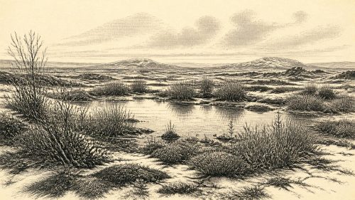
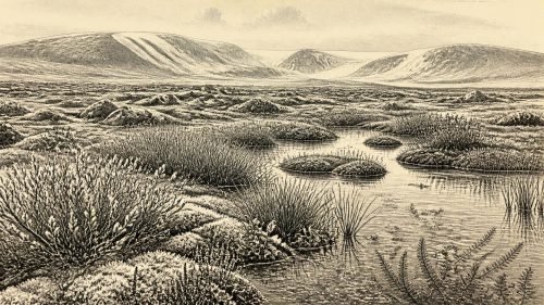
Pollen, plant macrofossils, mosses and insect remains from Derryvree indicate a treeless, periglacial landscape rather than woodland. Grasses and sedges, mosses, low herbs and dwarf woody plants belonged to a mosaic of damp ground, shallow or sluggish water, organic-rich margins and more exposed surfaces. Freshwater taxa, including water-milfoil, demonstrate open water locally; other remains point to vegetation able to survive cold winters, short growing seasons and an exposed climate. This was a living landscape, but not an easy or stable one.
The evidence supports regional variety. A sheltered wet hollow could retain water and plant matter while nearby ground was drier, frost-affected and sparsely vegetated. Snow cover, seasonal thaw, freeze–thaw action and changing drainage would have mattered greatly. Ireland’s later drumlins, tills and streamlined landforms are reminders of repeated ice movement, but they cannot be read as an uncomplicated map of conditions in one year. Some landforms were reshaped during later advances, and much archaeological evidence that might once have lain on open ground was probably eroded, transported or buried.
Environmental change was therefore the principal historical development around this date. Subsequent reconstructions of the British–Irish Ice Sheet place its major maximum much later, with different sectors advancing and retreating at different times; an ice-sheet-wide maximum volume is modelled around 23,000 years ago. The Derryvree sequence nevertheless establishes a crucial point: before that maximum, at least some Irish localities passed through non-glacial intervals capable of sustaining freshwater habitats and cold-adapted vegetation.
Animals in a Changing Country
Caves in southern Ireland provide the principal evidence for larger animals in the broader MIS 3 landscape. Castlepook Cave, near Doneraile in north County Cork and long known as Mammoth Cave, has yielded remains of woolly mammoth, reindeer, giant deer, spotted hyaena, brown bear, wolf, Arctic fox, mountain hare and lemmings, among other fauna. Modern re-dating has shown that several older cave radiocarbon results were misleadingly young, placing important elements of this fauna earlier, in MIS 3 and before the Last Glacial Maximum.
These bones demonstrate that Ireland could support, or at intervals receive, animal communities now unimaginable on the island. Reindeer and mammoth imply open, herb-rich country somewhere within their wider ranges; hyaena and wolf testify to predators and scavengers as well as prey. Yet cave assemblages are not a census. Bones may have entered caves through carnivore activity, natural death, water movement or the workings of early excavators. Individual specimens were deposited at different times. It would be wrong to place every recorded species beside the Derryvree pool in 30,602 BCE, or to assume a permanent, island-wide population of any one animal.
The same caution applies to a much-publicised reindeer femur from Castlepook. A deep mark on it has been interpreted as damage made by a sharp stone tool while fresh bone was being butchered, and heritage accounts have associated the specimen with an age of roughly 33,000 years. If that interpretation is accepted, it offers an important indication that people may have reached Ireland far earlier than the securely documented terminal-Pleistocene evidence. It does not establish a settlement at the cave, a named group, a hunting party of known size, a route of arrival or continuous occupation. The dated animal bone is not, by itself, a date for the cut, the kill or the duration of a visit.
What Cannot Be Written
There is no securely dated house, hearth, camp surface, burial, stone-tool assemblage or food store in Ireland that can responsibly be attributed to this particular date. For that reason, society and everyday life cannot be reconstructed as an Irish community narrative. If humans were present during this wider phase, they would have required formidable seasonal knowledge: of animal movement, exposed terrain, shelter, fuel, water and the dangers posed by cold and large carnivores. That is an inference from the environment and from Upper Palaeolithic lifeways elsewhere in north-west Europe, not direct evidence for an Irish settlement.
Political affairs, diplomacy, warfare and institutions are wholly beyond the record. There is no evidence for territories, chiefs, alliances, trade agreements or organised conflict in Ireland around this notional year. Equally, there is no evidence for farming, herding, metalworking, pottery, monuments, writing or permanent villages. Trade cannot be demonstrated, although the broader north-west European landmass and lower sea levels made geographical relationships different from today. Any crossing or movement between Ireland, Britain and continental Europe remains a question of changing coasts, ice margins and viable habitats, not a documented route.
Religion, art, language and formal learning are likewise unrecoverable here. The absence of evidence is not evidence that people elsewhere lacked symbolic culture; Upper Palaeolithic Europe certainly possessed rich cultural traditions. It means only that no Irish material can link such traditions to 30,602 BCE. The responsible cultural history of this date is therefore geological and ecological: sediment accumulated in freshwater, plants colonised wet ground, animals moved through changing habitats, and later ice sealed fragments of that world.
An Ireland of Evidence and Probability
The Ireland illuminated by this evidence was neither the familiar green, wooded island of later millennia nor a featureless sheet of permanent ice. It was a volatile cold-stage landscape in which local wetland and open tundra could exist between episodes of glaciation. Derryvree’s ice-sealed sediments give the clearest local image; Castlepook’s bones enlarge it with glimpses of a wider, shifting animal world. Together they show why the date matters, even though it cannot yield a conventional year-by-year story.
The most important conclusion is one of disciplined scale. Around 30,602 BCE, Ireland’s past is recoverable through calibrated ranges, radiocarbon determinations, pollen, plant fragments, insects, bones, tills and landforms—not through invented kings, battles or settlements. The record is fragmentary, but it is substantial enough to reveal a land repeatedly altered by climate, ice and ecology on the long approach to the Last Glacial Maximum.
Source References
Hover over a number to see the source. Select it to open the source.

- [1] A Middle Midlandian Freshwater Series at Derryvree, Maguiresbridge, County Fermanagh, Northern Ireland
- [2] Quaternary Deposits and Glacial Stratigraphy in Ireland
- [3] Freshwater Organic Deposits and Stratified Sediments Between Early and Late Midlandian (Devensian) Till Sheets, at Aghnadarragh, County Antrim, Northern Ireland
- [4] Irish Pleistocene Biostratigraphy
- [5] The Irish Quaternary Fauna Project
- [6] A Reconsideration of the Radiocarbon Dating of the Marine Isotope Stage 3 Fauna from Southern Ireland
- [7] Growth and Retreat of the Last British–Irish Ice Sheet, 31,000 to 15,000 Years Ago: The BRITICE-CHRONO Reconstruction
- [8] Pattern, Style and Timing of British–Irish Ice Sheet Advance and Retreat Over the Last 45,000 Years: Evidence from NW Scotland and the Adjacent Continental Shelf
- [9] Stratigraphic and Palaeo-Geomorphological Evidence for the Glacial-Deglacial History of the Last British-Irish Ice Sheet in the North-Western Irish Sea
- [10] Trimlines, Blockfields and the Vertical Extent of the Last Ice Sheet in Southern Ireland
- [11] The Colonization of Ireland: A Human Ecology Perspective
- [12] First Evidence of a Late Upper Palaeolithic Human Presence in Ireland
- [13] New Insights on the Fauna of Ireland's Younger Dryas and Early Holocene from Alice & Gwendoline Cave
- [14] Response of the Irish Ice Sheet to Abrupt Climate Change During the Last Deglaciation
- [15] Aghnadarragh
- [16] Introduction to the Late Quaternary and Holocene of Northern Ireland
- [17] Figure 6—The Subdivision of the Quaternary Period in Ireland
- [18] References and Recommended Reading
- [19] Heritage Artefacts of County Cork
- [20] Castlepook Cave, Co. Cork
- [21] Growth and Retreat of the Last British–Irish Ice Sheet, 31,000 to 15,000 Years Ago: The BRITICE-CHRONO Reconstruction
Primary Sources
- A Middle Midlandian Freshwater Series at Derryvree, Maguiresbridge, County Fermanagh, Northern Ireland
- Quaternary Deposits and Glacial Stratigraphy in Ireland
- Freshwater Organic Deposits and Stratified Sediments Between Early and Late Midlandian (Devensian) Till Sheets, at Aghnadarragh, County Antrim, Northern Ireland
- Irish Pleistocene Biostratigraphy
- The Irish Quaternary Fauna Project
- A Reconsideration of the Radiocarbon Dating of the Marine Isotope Stage 3 Fauna from Southern Ireland
- Growth and Retreat of the Last British–Irish Ice Sheet, 31,000 to 15,000 Years Ago: The BRITICE-CHRONO Reconstruction
- Pattern, Style and Timing of British–Irish Ice Sheet Advance and Retreat Over the Last 45,000 Years: Evidence from NW Scotland and the Adjacent Continental Shelf
- Stratigraphic and Palaeo-Geomorphological Evidence for the Glacial-Deglacial History of the Last British-Irish Ice Sheet in the North-Western Irish Sea
- Trimlines, Blockfields and the Vertical Extent of the Last Ice Sheet in Southern Ireland
- The Colonization of Ireland: A Human Ecology Perspective
- First Evidence of a Late Upper Palaeolithic Human Presence in Ireland
- New Insights on the Fauna of Ireland's Younger Dryas and Early Holocene from Alice & Gwendoline Cave
- Response of the Irish Ice Sheet to Abrupt Climate Change During the Last Deglaciation
- Aghnadarragh
- Introduction to the Late Quaternary and Holocene of Northern Ireland
- Figure 6—The Subdivision of the Quaternary Period in Ireland
- References and Recommended Reading
- Heritage Artefacts of County Cork
- Castlepook Cave, Co. Cork
- Growth and Retreat of the Last British–Irish Ice Sheet, 31,000 to 15,000 Years Ago: The BRITICE-CHRONO Reconstruction