Derryvree’s Milfoil Horizon30735 BCE
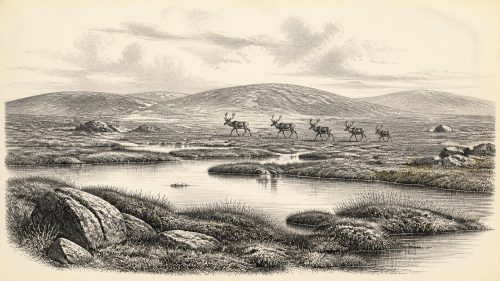
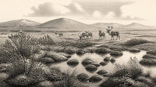
Around 30,735 BCE, Ireland cannot be described through events or communities, but through Late Pleistocene environmental evidence. Derryvree, County Fermanagh, preserves organic freshwater sediments between glacial tills, indicating a locally ice-free, cold periglacial wetland with tundra vegetation during Marine Isotope Stage 3. Its radiocarbon date calibrates broadly, so the year is only a point within an extended interval. Comparable northern deposits confirm regional variation in ice cover. Castlepook Cave, County Cork, records cold-adapted fauna, including mammoth, reindeer and hyaena. A modified reindeer bone suggests possible Upper Palaeolithic human activity, but proves neither settlement nor sustained occupation there during this period.
Dateline
30,735 BCE is not a recoverable historical year in Ireland. It is a modern calendar label for a point roughly 32,684 years before AD 1950, the reference year used in radiocarbon dating. No writing, named community, event, ruler or annual calendar survives from Ireland at this depth of time. The responsible subject is therefore not an imagined episode, but the Late Pleistocene environment that archaeology and Quaternary science can illuminate around this broad horizon.
In international terms, this was Marine Isotope Stage 3 (MIS 3), a long and climatically unstable portion of the last Ice Age. In Irish geological language it belongs to the Midlandian glacial cycle. Ireland was not simply an island locked permanently under ice, nor was it a familiar green and wooded landscape. Ice sheets, permafrost conditions, exposed ground, wetlands and animal habitats changed substantially over millennia. The evidence closest to this date comes from sediments buried beneath later glacial deposits in County Fermanagh and from cave-bone assemblages in the south.
A Date Within a Wide Range
The strongest chronological warning comes from Derryvree, near Maguiresbridge in County Fermanagh. Road works in 1969 cut through a drumlin and revealed fine sands, freshwater silts and organic layers enclosed between two thick tills: unsorted sediment laid down by glacier ice. The organic deposit produced the radiocarbon determination Birm-166, 30,500 +1,170/−1,030 radiocarbon years BP. That is not the same thing as a calendar age. Atmospheric carbon-14 levels have varied greatly, particularly in the distant past, so radiocarbon measurements must be calibrated against independently dated records.
Using modern calibration approaches, the Derryvree determination corresponds only to a very broad calendar interval, approximately 36,900–31,700 calibrated years BP at high probability. The label 30,735 BCE falls within that wide span, but cannot identify a particular season, generation, pool or animal death. It is best treated as a convenient point inside an environmental window. The deposit demonstrates that this Fermanagh locality experienced a non-glacial interval between two episodes of ice deposition; it does not prove that all parts of Ireland were simultaneously ice-free, or that conditions remained unchanged for thousands of years.
Fresh Water Beneath a Drumlin
Derryvree is valuable because later glaciers destroyed or deeply buried much of Ireland’s older landscape evidence. Its layered sequence preserves a simple relative history. First, glacier ice deposited the lower till. Then, ice no longer occupied the site and water, silt and organic matter accumulated. Finally, later ice overrode the district and laid down the upper till, sealing the freshwater record. The drumlin visible today is therefore not a direct landscape from 30,735 BCE but a much later glacial landform containing an older environmental archive.
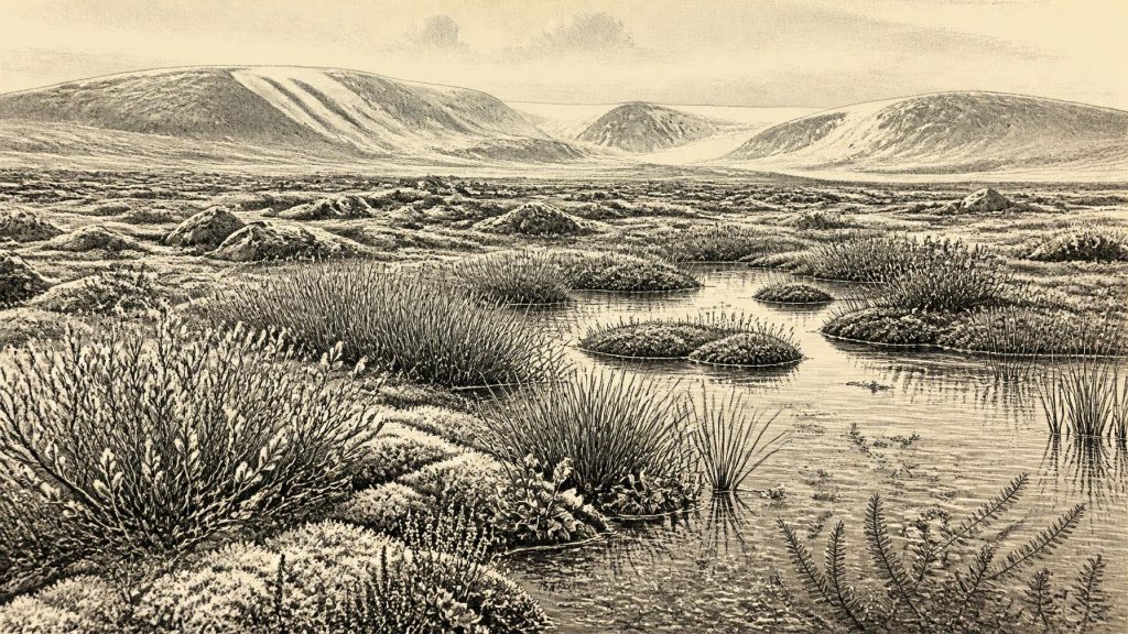
The plants and small animals preserved in the intertill deposits indicate cold, open, wet ground. Grasses, sedges, herbs, mosses and low Arctic-alpine plants were more important than trees. Plant macrofossils include mountain avens (Dryas octopetala), dwarf willow (Salix herbacea), lesser clubmoss (Selaginella selaginoides), bogbean and water-milfoil. Their presence supports the interpretation of shallow freshwater, mossy wetland and surrounding tundra-like vegetation. Fossil insects likewise point towards waterlogged, plant-rich hollows within a severe periglacial setting.
“Periglacial” is important but easily misunderstood. It does not mean that Derryvree was necessarily beneath a glacier while its organic silts formed. It means that repeated frost, seasonal thaw, sparse cover and ground processes associated with cold climates shaped the land. The local scene was probably a mosaic: pools and saturated sedge beds in hollows; exposed, frost-disturbed mineral ground beyond them; and low, discontinuous vegetation rather than broadleaf woodland. Pollen can travel far and be redeposited, so isolated tree pollen is weaker evidence than the local plant remains. The defensible conclusion is a treeless or nearly treeless cold wetland, not a precise reconstruction of every slope in Fermanagh.
Ice, Water and Regional Change
The Derryvree sequence belongs to a larger problem in Irish Quaternary history: the changing extent of the British–Irish Ice Sheet before the Last Glacial Maximum. Later glaciation was extensive enough to reshape the island profoundly, but its earlier MIS 3 limits and timing remain less certain. Recent reconstructions of the ice sheet are strongest for its growth and retreat between about 31,000 and 15,000 years ago, while evidence for the preceding millennia is patchier and often difficult to correlate. The buried wetland is consequently important precisely because it records an interruption in local ice cover.
Other northern Irish sites, notably Greenagho near Belcoo and Aghnadarragh in County Antrim, also preserve organic or stratified deposits between tills. They show that cold-stage Ireland contained environmental variation, rather than one uniform frozen surface. Correlations between these local records and abrupt Greenland climate phases remain interpretations, not direct identifications. North Atlantic climate could change sharply, and Irish ice margins, plants and wetlands need not have responded everywhere or at exactly the same time.
Caves and the Animal Landscape
At Castlepook Cave near Doneraile, County Cork, more than 2,000 bones have made the cave the richest Irish source for vertebrate life before the Last Glacial Maximum. Its remains include woolly mammoth, reindeer, giant deer, brown bear, wolf, Arctic fox, mountain hare, lemmings and spotted hyaena. This is not a list of animals demonstrably standing together in one valley in 30,735 BCE. Cave deposits accumulated across long periods, and old excavations mixed or inadequately recorded some contexts. Improved radiocarbon methods have also shown that earlier dates for individual bones could be substantially too young.
Nonetheless, the Castlepook evidence establishes that, during parts of MIS 3, Ireland was accessible to a cold-adapted continental fauna and supported at least intermittent mammoth-steppe or tundra-associated communities. Spotted hyaena is especially striking: Castlepook is Ireland’s only known site for it. Carnivore tooth marks on some bones also show that the cave’s assemblage was shaped by animal activity as well as natural death and sediment movement. A cave bone is evidence for an animal’s life or carcass, not automatically for a human hunting ground, a settlement or a stable local population.
The Limited Case for People
A reindeer femur from Castlepook has added an important but narrow human possibility. The bone has been dated to around 33,000 years ago and bears a deep linear modification interpreted by researchers as consistent with cutting or chopping by a sharp stone tool during carcass processing. If that interpretation is correct, it is evidence that people encountered and worked a reindeer in Ireland during MIS 3, far earlier than the island’s formerly accepted archaeological record.
Its limits matter as much as its significance. No associated hearth, stone-tool assemblage, dwelling floor, human bone, burial, art or securely stratified camp has been found at Castlepook for this period. Nor can the single marked bone establish whether visitors hunted the animal, scavenged it, arrived once or returned repeatedly. It cannot support claims for an established Irish population, a permanent settlement at Doneraile, or a particular cultural group. The most careful formulation is that Ireland may have been visited by Upper Palaeolithic people during an interval when suitable animal resources and traversable routes existed.
Society Beyond the Evidence
For the categories that dominate later Irish history, the evidence is silent. There were no documented political affairs, diplomacy, kingdoms, warfare, law, agriculture, trade networks, monuments or formal religious institutions that can be assigned to this date. If humans did reach Ireland, they would have belonged to small, mobile hunter-gatherer groups whose social relations and beliefs cannot be reconstructed from one modified bone. It would be misleading to turn their possible presence into a story of chiefs, tribes or ritual.
Nor is there evidence for farming, livestock, pottery, metalworking or settled village life. The economy visible in the record is ecological rather than institutional: plants growing in a cold wetland, herbivores feeding across open country, and predators or scavengers using caves and carcasses. Lower sea levels altered the geography of north-west Europe, but the exact routes by which people or animals reached Ireland at different times remain uncertain. Connectivity is demonstrated by faunal presence; the precise form, duration and seasonality of movement are not.
A Fragile Archive
The principal development relevant to Ireland around this notional year was not political but environmental: temporary ice-free terrain supported freshwater habitats and cold-adapted life within an unstable glacial world. Derryvree’s silts and Castlepook’s bones preserve that fact against the destructive effects of later ice. They also impose a discipline on interpretation. Around 30,735 BCE, Ireland can be described as a changing Late Pleistocene landscape of periglacial wetlands, open vegetation and intermittent animal occupation, with a possible human encounter at its margins. Anything more specific would exceed the evidence.
Primary Sources
- A Middle Midlandian Freshwater Series at Derryvree, Maguiresbridge, County Fermanagh, Northern Ireland
- Middle Midlandian Interstadial Deposits at Greenagho, Near Belcoo, County Fermanagh, Northern Ireland
- Freshwater Organic Deposits and Stratified Sediments Between Early and Late Midlandian (Devensian) Till Sheets, at Aghnadarragh, County Antrim, Northern Ireland
- The Irish Quaternary Fauna Project
- A Reconsideration of the Radiocarbon Dating of the Marine Isotope Stage 3 Fauna from Southern Ireland
- Castlepook Cave, County Cork: County Geological Site Report CK032
- Archaeological Heritage of County Cork
- Cenozoic: Tertiary and Quaternary
- Growth and Retreat of the Last British–Irish Ice Sheet, 31,000 to 15,000 Years Ago: the BRITICE-CHRONO Reconstruction
- BRITICE-CHRONO Maps and GIS Data of the Last British-Irish Ice Sheet 31 to 15 ka
- The Timing and Magnitude of the British–Irish Ice Sheet Between Marine Isotope Stages 5d and 2
- The IntCal20 Northern Hemisphere Radiocarbon Age Calibration Curve (0–55 cal kBP)
- OxCal
- IntCal
- A Stratigraphic Framework for Abrupt Climatic Changes During the Last Glacial Period Based on Three Synchronized Greenland Ice-Core Records
- Ice Age Ireland
- New Insights on the Fauna of Ireland’s Younger Dryas and Early Holocene from Alice & Gwendoline Cave
- The Geological Heritage of Clare
- Dryas octopetala
- Project Findings Provide Essential Insight into the Last British–Irish Ice Sheet