
BIRM-166’s Mossy Waters30542 BCE
Around 30,542 BCE, Ireland lay within the climatically unstable Late Pleistocene, approaching greater ice-sheet expansion. Evidence is sparse and cannot identify events in a single year. At Derryvree, County Fermanagh, BIRM-166 organic sediments, between glacial tills, record a temporary freshwater tundra landscape of mosses, sedges and cold-adapted plants. Later ice buried this wetland. Cave remains show that reindeer, mammoth, hyaena, wolves and other animals used parts of Ireland, though finds represent different periods. A cut-marked reindeer bone from Castlepook Cave may indicate brief human activity, but permanent occupation remains unproven. Archaeology instead reveals changing environments, surviving life and deep uncertainty.
Dateline
The label 30,542 BCE is a modern chronological convenience, not a date that anyone in Ireland could have known, named or recorded. It corresponds roughly to 32,492 calendar years before AD 1950, the conventional ‘present’ used in archaeological dating. No Irish deposit, artefact or animal bone can presently be tied to that individual year. At this depth of time, radiocarbon determinations carry substantial uncertainties and must be calibrated; deposits often accumulated over generations or centuries. The responsible history of this notional year is therefore a history of broad ranges, sequences and probabilities, not an annal of events.
It falls within the Late Pleistocene, in Marine Isotope Stage 3, a long and climatically unstable part of the last Ice Age. Ireland was not yet at the fullest extent of the Last Glacial Maximum, when ice later covered much or all of the island and spread onto surrounding shelves. Yet neither was it a stable, ice-free country. Ice masses expanded and contracted regionally; frozen ground, meltwater, wind, snow and shifting vegetation continually altered the terrain. Later glaciers also destroyed, buried and reworked much of the evidence, leaving a small and uneven archive. That scarcity is as important to this date as the discoveries themselves.
A Date Beyond Calendar Precision
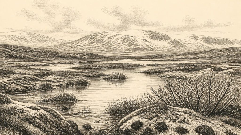
The closest Irish environmental landmark is the freshwater deposit at Derryvree, near Maguiresbridge in County Fermanagh. Roadworks in 1969 cut through a drumlin and revealed a remarkable sequence: a lower sheet of glacial till, then fine sands, freshwater silts and organic-rich mud, capped by a second substantial till. Its order is secure even where its absolute dating is broad. Glacier ice had deposited the lower till; an interval followed in which water, plants and small animals occupied the hollow; later ice returned and sealed the wetland beneath a new deposit.
Organic material from this intervening layer, laboratory sample BIRM-166, gave a conventional radiocarbon age of 30,500 years BP, with an uncertainty of +1,170 and −1,030 years. A radiocarbon age is not interchangeable with a BCE date: the quantity of atmospheric carbon-14 has varied over time. Current calibration places the sample broadly around 35,000–37,000 calibrated years before present, rather earlier than 30,542 BCE but close enough in the longer Late Pleistocene sequence to illuminate the kind of changing Irish environment from which this nominal year emerged. It cannot tell us what happened in Fermanagh in one particular season, still less across the whole island.
Wet Tundra Between Ice Advances
Derryvree’s fossils and sediments indicate an open tundra environment under periglacial conditions. The word ‘tundra’ should not conjure an unbroken white wilderness. The old basin contained freshwater, muddy margins, mosses, sedges and low-growing cold-adapted plants. Beyond it lay generally treeless ground shaped by winter freezing, seasonal thaw and poor drainage. Such a landscape would have been sharply varied at a small scale: exposed stony slopes, frost-heaved soils, waterlogged hollows, shallow pools and channels could sit within a short walk of one another.
The deposit’s plant remains offer especially valuable evidence. Mosses, sedges, dwarf shrubs and aquatic or waterside species show that cold conditions did not mean biological emptiness. Plant communities exploited brief growing seasons and protected wet places. Pollen must be interpreted more cautiously: some grains travel far on wind or water, so an isolated tree pollen grain cannot demonstrate nearby woodland. The combined evidence, however, supports open vegetation rather than forest. This was not the densely wooded Ireland familiar from later prehistory, nor the agricultural patchwork of the modern island.
At the same time, Derryvree should not be made to stand for every Irish region. It records one lowland locality in what is now northern Fermanagh. Its freshwater bed proves that this place was not continuously overridden by ice during the interval of deposition. It does not demonstrate that Cork, Connacht, the midlands and Ulster were all ice-free together, or that their climates were identical. Ireland’s position at the Atlantic edge of north-west Europe made it sensitive to rapid changes in temperature, precipitation and ice-sheet behaviour.
Ice Was Gathering, Not Static
By the broad horizon represented by 30,542 BCE, the British–Irish Ice Sheet was entering a major phase of growth. Modern reconstructions place rapid, ice-sheet-wide expansion mainly after about 31,000 calibrated years ago, with maximum extent reached at different times in different sectors rather than on one island-wide date. That chronology must not be over-read. It is based on landforms, marine sediments, modelling and dates with differing resolution, often measured in centuries or millennia. Still, its central message is clear: Ireland was moving towards a much colder and more extensively glaciated future.
This changing geography had consequences for habitats. As ice advanced, it scoured some surfaces clean, blocked drainage, altered river courses and deposited the debris that later formed drumlins and other distinctive landforms. Elsewhere, exposed ground could remain available to plants and animals for a time. Sea level was lower than today because immense quantities of water were held in continental ice. The coastlines and shallow seas around Ireland consequently differed greatly from modern ones. Yet animal finds alone cannot prove a particular land bridge, route or crossing season between Ireland and Britain or continental Europe.
Animals in a Fragmentary Record
The Irish Quaternary Fauna Project established that a range of mammals reached Ireland during the long period before the Last Glacial Maximum, broadly between at least 45,000 and 20,000 years ago. Cave collections, particularly from Castlepook Cave near Doneraile in north County Cork, preserve evidence of reindeer, mammoth, spotted hyaena, wolf, brown bear, horse, giant deer, Arctic fox, hare and lemmings. These remains do not all belong to a single community or moment. A cave is often a time-averaged archive, in which carnivores, natural deaths, water movement and nineteenth- and early twentieth-century excavation methods complicate interpretation.
Nonetheless, the fauna makes one conclusion unavoidable: parts of Ice-Age Ireland could sustain or at least be visited by substantial grazing animals, predators and scavengers. Reindeer are particularly appropriate emblems of an open, cold landscape, though their presence does not mean every year or every valley was equally harsh. Mammoth and hyaena remains testify to a wider ecological world strikingly unlike modern Ireland. Their disappearance from the island’s later fauna reflects enormous environmental change, not a simple sequence of replacement by familiar modern species.
A Possible Human Trace
Castlepook also matters because a reindeer femur from its old collections bears a deep mark interpreted by zooarchaeologist Ruth Carden as a stone-tool cut made during butchery. County Cork heritage material places the bone at about 31,000 BCE, making it potentially relevant to the broad period surrounding this article’s nominal date. If the interpretation and association are sustained by further work, it is Ireland’s earliest known indication that people handled animal remains. It is a significant possibility, but it is not evidence for a settled population.
No securely associated stone-tool assemblage, hearth, dwelling floor, burial, artwork or human bone has yet been demonstrated at Castlepook for this early horizon. The marked bone does not establish who made the cut, whether they killed the reindeer or found a carcass, how long they remained in Ireland, or whether they travelled through Cork rather than living there. Nor can it identify language, ancestry, social organisation or a continuous line of descent to later inhabitants. The most cautious conclusion is that brief human visitation or carcass processing is possible, perhaps even likely, while enduring occupation remains unproven.
What Cannot Be Recovered
For 30,542 BCE there is no evidence for political affairs, named leaders, warfare, diplomacy, law or territorial states in Ireland. Nor is there evidence for trade networks, farming, permanent villages, formal religious monuments or organised learning. This is not a failure of imagination; it is a limit set by the surviving record. If people did visit, they would have belonged to mobile Upper Palaeolithic hunter-gatherer worlds known elsewhere in north-west Europe, but importing the rich evidence of continental camps, art or technology into Ireland would be interpretation, not Irish fact.
The most historically meaningful picture is therefore environmental. A future Ireland of wide ice cover was taking shape, while local water and plant life could still persist in ice-free pockets. Animals ranged through landscapes now transformed beyond recognition. One wetland beneath a Fermanagh drumlin and one debated cut mark on a Cork reindeer bone are small survivals, but they are enough to prevent the island’s deep past from being reduced to blank ice. They show a changing, inhabited-by-life landscape—and perhaps, intermittently, one touched by people—without pretending that archaeology can recover a single lost year.
Primary Sources
- Middle Midlandian Freshwater Series at Derryvree, Maguiresbridge, County Fermanagh, Northern Ireland
- A Middle Midlandian Freshwater Series at Derryvree, Maguiresbridge, County Fermanagh, Northern Ireland
- The Irish Quaternary Fauna Project
- The Irish Quaternary Fauna Project
- Heritage Artefacts of County Cork
- New Insights on the Fauna of Ireland’s Younger Dryas and Early Holocene from Alice & Gwendoline Cave
- Growth and Retreat of the Last British–Irish Ice Sheet, 31,000 to 15,000 Years Ago: the BRITICE-CHRONO Reconstruction
- BRITICE-CHRONO Maps and GIS Data of the Last British-Irish Ice Sheet 31 to 15 ka
- The Deglaciation of the Western Sector of the Irish Ice Sheet from the Inner Continental Shelf to its Terrestrial Margin
- Reconstructing the Last Irish Ice Sheet 2: a Geomorphologically-Driven Model of Ice Sheet Growth, Retreat and Dynamics
- Early Deglaciation of the British-Irish Ice Sheet on the Atlantic Shelf Northwest of Ireland Driven by Glacioisostatic Depression and High Relative Sea Level
- Freshwater Organic Deposits and Stratified Sediments Between Early and Late Midlandian (Devensian) Till Sheets, at Aghnadarragh, County Antrim, Northern Ireland
- The Mesolithic in Ireland: When Was It?
- Figure 6: The Subdivision of the Quaternary Period in Ireland
- References and Recommended Reading
- Irish Quaternary Vertebrates
- Trimlines, Blockfields and the Vertical Extent of the Last Ice Sheet in Southern Ireland
- Late Pleistocene Chronostratigraphy and Ice Sheet Limits, Southern Ireland
- The IntCal20 Northern Hemisphere Radiocarbon Age Calibration Curve (0–55 cal kBP)
- IntCal20 Approach to Radiocarbon Calibration Curve Construction: A New Methodology Using Bayesian Splines and Errors-in-Variables
- Maximum Extent and Readvance Dynamics of the Irish Sea Ice Stream and Irish Sea Glacier During the Last Glaciation
- The Geological Heritage of County Leitrim
