BIRM-166’s Interstadial Witness30597 BCE
Around 30,597 BCE, Ireland was in Marine Isotope Stage 3, an unstable phase of the Late Pleistocene, rather than a datable year. At Derryvree, County Fermanagh, organic freshwater sediments between glacial tills, radiocarbon dated as BIRM-166, record a cold, ice-free interval. Pollen, plants, mosses and beetles indicate shallow water, wet margins and sparse, treeless tundra-like vegetation. Cave faunas demonstrate open-country ecosystems supporting herbivores, predators and scavengers, although remains span different periods. A possibly cut-marked reindeer bone suggests brief human presence, not settlement. Lower sea levels altered routes, while shifting ice and terrain restricted movement. Evidence reveals ecosystems amid changing ice.
Dateline
30,597 BCE is a modern chronological label, not a year that anyone in Ireland could have named, counted or recorded. It falls roughly 32,546 years before the radiocarbon convention of AD 1950, but that arithmetic conversion must not be mistaken for calendar-year precision in the evidence. No Irish deposit can tell us what happened in one particular year at this depth of time. The most responsible account is therefore a broad one: Ireland lay within the Late Pleistocene, during Marine Isotope Stage 3, in a climate system capable of rapid and dramatic shifts. Its history is read from sediment, pollen, seeds, mosses, insects, animal bones and ice-shaped landforms rather than from settlements, monuments or written testimony.
A Date Within a Broad Interval
The closest major Irish environmental archive is at Derryvree, near Maguiresbridge in County Fermanagh. Roadworks in 1969 exposed a drumlin cut by a remarkable sequence: an older glacial till below, freshwater silts and fine sands with organic material in the middle, and a later till above. This establishes the essential local sequence. Ice had covered the site; an interval without local ice allowed water, sediment and living things to accumulate; then ice returned and sealed the deposit.
Organic material from the freshwater beds gave the conventional radiocarbon determination BIRM-166: 30,500 radiocarbon years before present, with a substantial uncertainty of +1,170 and −1,030 years. Radiocarbon years are not calendar years, because atmospheric carbon-14 levels have varied. Modern calibration places the result within a wide span, approximately 36,900–31,700 calibrated years before present, or about 34,950–29,750 BCE. Thus 30,597 BCE lies within the broad chronological reach of the Derryvree evidence, but cannot be tied to a particular plant, animal, season or event in that deposit.
On the Greenland ice-core timescale, this point broadly approaches the onset of Greenland Interstadial 5.2, one of the abrupt warmer episodes embedded within the last glacial period. That comparison is useful for understanding North Atlantic climate, not for asserting that Fermanagh changed climate on an identical date. Ireland’s terrestrial record is fragmentary, local and subject to its own dating uncertainties. The safest conclusion is that Derryvree preserves a cold, ice-free interval in northern Ireland during the middle part of the Midlandian glaciation, rather than a precise annual snapshot.
Fresh Water Between Ice Sheets
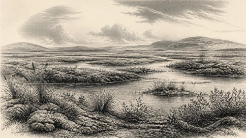
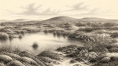
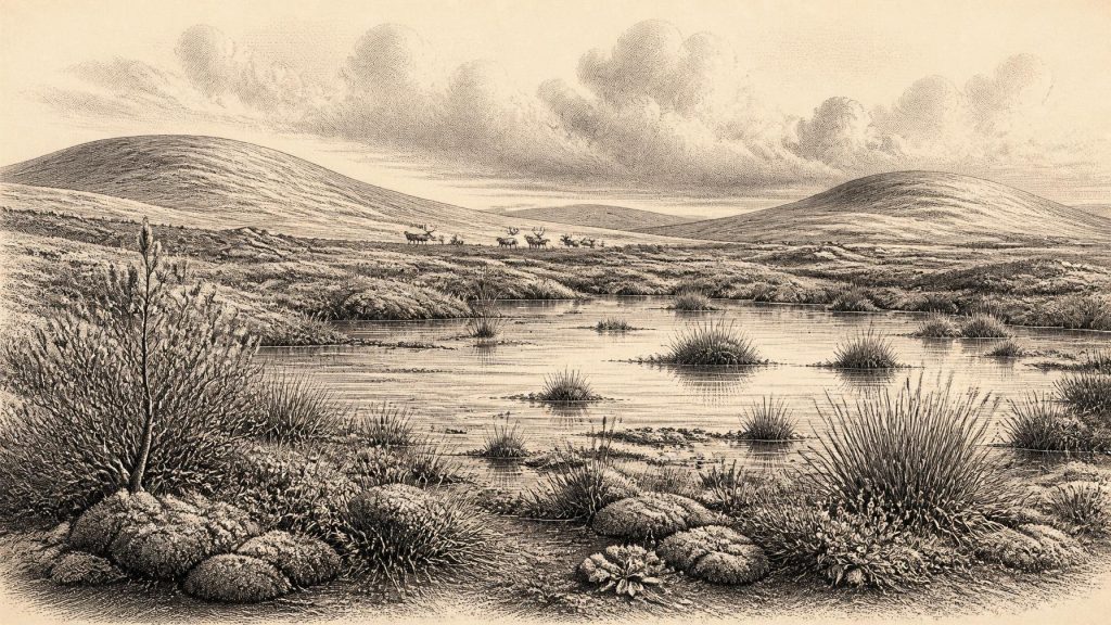
The Derryvree silts offer an unusually vivid environmental picture. Pollen, plant macrofossils, mosses and beetle remains point to an open, treeless and strongly periglacial landscape. The freshwater basin supported aquatic plants, while its margins carried sedges, grasses, mosses and low-growing herbs. Finds associated with the deposit include bogbean, water-milfoil, dwarf willow, mountain-avens and lesser clubmoss. These are direct traces of plants growing in or near the water; together they support an interpretation of shallow pools, wet ground and sparse tundra-like vegetation rather than forest.
The word tundra should be used carefully. It is an ecological comparison, not an assurance that every part of Ireland resembled a modern Arctic plain. Nor should “ice-free” be translated as mild or hospitable. Ground could have frozen seasonally or remained affected by permafrost; winds were severe; exposed soils were unstable; and the growing season was short. In such terrain, water was both opportunity and constraint. A shallow lake or sedge-fringed pool concentrated plants, invertebrates and drinking water, but saturated ground, frost heave and sudden weather changes made travel difficult.
Derryvree also warns against imagining a single island-wide landscape. It records conditions at one Fermanagh locality. Other deposits beneath tills, including those at Greenagho near Belcoo and Aghnadarragh in County Antrim, demonstrate that parts of northern Ireland preserve complex histories of ice advance, retreat and intervening sedimentation. Yet later glaciers eroded, transported and buried much of the evidence. Scientists can identify local episodes of non-glacial conditions more readily than they can draw a confident coastline or vegetation map for the whole island at one chosen moment.
Animals in an Open Country
Irish caves provide a second, differently imperfect archive. Castlepook Cave, near Doneraile in north County Cork, has yielded remains of woolly mammoth, reindeer, giant deer, brown bear, wolf, fox, hare, lemmings and spotted hyaena from various phases of the Late Pleistocene. This is evidence for a cold-stage faunal world with grazing animals, scavengers and predators, not evidence that all these species occupied one place together in 30,597 BCE. Cave deposits commonly mix bones accumulated over long periods by carnivores, water movement, natural deaths and early excavation.
Nevertheless, the fauna is important. Reindeer and mammoth imply substantial open vegetation; hyaenas and wolves indicate animal communities complex enough to sustain large carnivores and scavengers. Animal movement would have followed changing pasture, snow conditions and access to water. The familiar wooded Ireland of later millennia did not yet exist in the Derryvree evidence. Instead, the island’s usable landscapes were likely patchy: sheltered slopes, valley floors, karst caves, lake edges and seasonally productive wetland margins mattered more than permanent fields or villages.
The Human Question
There is no securely excavated house, hearth, burial, tool-making floor or settlement in Ireland dating to around 30,597 BCE. That absence is decisive when discussing society. No people, language, kin group, political authority, diplomatic relationship, ritual system or artistic tradition can responsibly be assigned to Ireland at this date. There is likewise no evidence for farming, domesticated animals, trade networks, maritime communities or territorial government. The social and political headings familiar in later history are not empty because people necessarily were absent; they are empty because the evidence cannot sustain such claims.
A reindeer femur from Castlepook makes the question more interesting, but not settled. County Cork heritage research presents the bone as dating to about 31,000 BCE and identifies a deep incision which zooarchaeologist Ruth Carden has interpreted as a cut made by a sharp stone tool during butchery. If that interpretation is upheld, it is potentially evidence that Upper Palaeolithic people processed a reindeer in Ireland during this broad period. It would indicate an act of carcass handling, perhaps by mobile hunters, rather than a settled population.
The limits are crucial. The bone comes from an old cave collection, not from a modern excavation of an intact occupation surface. Its radiocarbon age dates the animal’s death, not necessarily the instant of cutting; the cave may have been a carnivore den or a place where bones were later disturbed. No associated stone tools or hearth has yet demonstrated a camp. The femur therefore supports a cautious possibility of brief human presence, not a narrative of continuous colonisation. Ireland’s first substantial, securely documented human settlement remains much later, in the post-glacial Mesolithic.
An Island Before the Maximum Ice
At this time, sea level was lower than today because large quantities of water were held in global ice sheets. Ireland, Britain and the continental shelf consequently had different outlines, and routes for animals or occasional people may at times have been less maritime than later. But neither a lower sea nor a mapped shelf automatically proves a dry, walkable land bridge at a given place and date. Glaciers, proglacial lakes, rivers, sea inlets and unstable terrain could obstruct movement. Connections changed as ice and sea changed.
The great expansion of the last British–Irish Ice Sheet was still a major future development rather than a single completed condition across Ireland. Modern reconstructions show ice-sheet growth and maximum extent were asynchronous between sectors, while the fullest late-glacial expansion developed after this broad interval. Derryvree’s middle beds are especially valuable because their position between two tills preserves this rhythm of environmental change: an earlier glacial episode, an interval in which freshwater life returned, and a later renewed advance of ice.
What Can Be Known
The most meaningful “affairs” of Ireland around this notional date were environmental. Water gathered in a Fermanagh basin; cold-adapted plants occupied its margins; herbivores and carnivores ranged through open country elsewhere; and ice margins changed the geography available to life. Human activity is possible, particularly in light of the Castlepook reindeer femur, but remains far below the evidential threshold required for claims about communities or institutions. The silence of the record is not proof of an empty island. It is a measure of how little of a shifting Ice Age landscape survived later ice, water and time.
BIRM-166 is therefore more than a laboratory number. It is a witness to a short-lived environmental opening preserved beneath a Fermanagh drumlin: freshwater, mosses, sedges and hardy plants existing between advances of ice. Its lesson is methodological as well as historical. Around 30,597 BCE, Ireland cannot be narrated year by year. It can, however, be understood as a dynamic northern landscape whose sparse traces reveal ecological resilience amid profound climatic instability.
Primary Sources
- A Middle Midlandian Freshwater Series at Derryvree, Maguiresbridge, County Fermanagh, Northern Ireland
- Middle Midlandian Interstadial Deposits at Greenagho, Near Belcoo, County Fermanagh, Northern Ireland
- Freshwater Organic Deposits and Stratified Sediments Between Early and Late Midlandian (Devensian) Till Sheets, at Aghnadarragh, County Antrim, Northern Ireland
- Irish Pleistocene Biostratigraphy
- The Irish Quaternary Fauna Project
- The Archaeology of Caves in Ireland
- Preliminary Assessment of the Archive of Faunal Remains from Excavated Irish Cave Sites
- Heritage Artefacts of County Cork
- Prehistoric Details
- Figure 6—The Subdivision of the Quaternary Period in Ireland
- Growth and Retreat of the Last British–Irish Ice Sheet, 31,000 to 15,000 Years Ago: The BRITICE-CHRONO Reconstruction
- BRITICE Glacial Map, Version 2: A Map and GIS Database of Glacial Landforms of the Last British–Irish Ice Sheet
- Pattern and Timing of Retreat of the Last British-Irish Ice Sheet
- Bayesian Modelling the Retreat of the Irish Sea Ice Stream
- Trimlines, Blockfields and the Vertical Extent of the Last Ice Sheet in Southern Ireland
- Early Deglaciation of the British-Irish Ice Sheet on the Atlantic Shelf Northwest of Ireland Driven by Glacioisostatic Depression and High Relative Sea Level
- The Timing and Magnitude of the British–Irish Ice Sheet Between Marine Isotope Stages 5d and 2
- The IntCal20 Northern Hemisphere Radiocarbon Age Calibration Curve (0–55 cal kBP)
- A Stratigraphic Framework for Abrupt Climatic Changes During the Last Glacial Period Based on Three Synchronized Greenland Ice-Core Records: Refining and Extending the INTIMATE Event Stratigraphy
- The Timing and Pace of Ice-Sheet Withdrawal Across the Marine–Terrestrial Transition West of Ireland During the Last Glaciation
- Dimensions and Chronology of the Last Ice Sheet in Western Ireland
- First Evidence of a Late Upper Palaeolithic Human Presence in Ireland