
Derryvree’s Mid-Glacial Pool30297 BCE
30,297 BCE is an imprecise modern label for a Late Pleistocene interval, reconstructed through deposits, fauna and probabilities rather than records. At Derryvree, County Fermanagh, freshwater organic sediments between tills show a cold, treeless wetland phase between glaciations; radiocarbon dates provide only broad calibrated ranges. Castlepook Cave, County Cork, preserves diverse cold-stage fauna, including mammoth, reindeer, hyaena and lemmings, although its accumulated bones cannot represent one moment. A possibly cut-marked reindeer bone suggests Upper Palaeolithic visitors may have reached Ireland, but proves neither settlement nor culture. No evidence supports agriculture, permanent communities, trade, institutions or a simple permanent land bridge.
Dateline
30,297 BCE is a modern chronological label, not a recoverable year in Ireland’s past. There are no written records, annual layers that can be tied securely to that numbered year, or archaeological events precise enough to date it. In calendar terms it lies roughly 32,250 years before AD 1950, within the Late Pleistocene, Marine Isotope Stage 3 and the Irish Midlandian cold stage. The responsible history of this moment is therefore a history of ranges, deposits and probabilities: what the land, plants, animals, ice and a very small number of disputed human traces can reveal about an interval around it.
A Date Within a Long Cold Stage
Ireland at this depth of time cannot be treated as a modern island with familiar coastlines, counties or communities. Sea level, ice extent and the shape of lowland ground differed greatly from today; local glaciers and ice sheets repeatedly changed the practical geography of movement. The wider British–Irish Ice Sheet was growing during the later part of this period, but its margins did not advance uniformly or leave equally clear evidence everywhere. Recent reconstructions begin at about 31,000 years before present and show sustained ice-sheet growth thereafter; they do not permit a simple statement that every part of Ireland was either wholly ice-covered or wholly ice-free at 30,297 BCE.
The closest important Irish environmental archive is Derryvree, near Maguiresbridge in County Fermanagh. Roadworks in 1969 cut through a drumlin and exposed freshwater silts and fine sands between two separate sheets of till: sediment laid down directly by glacier ice. That sequence demonstrates a basic order of events. Ice had occupied the locality; a non-glacial or ice-marginal interval then allowed freshwater and organic sediment to accumulate; ice later returned and sealed the deposit beneath another till. It is unusually valuable evidence because it records environmental change in place rather than merely a fossil bone transported or disturbed in a cave.
A conventional radiocarbon determination from the Derryvree organic series, BIRM-166, was reported as about 30,500 radiocarbon years before present, with an uncertainty of roughly a millennium. That is not equivalent to a calendar date. Atmospheric carbon-14 concentrations changed through time, and radiocarbon results of this antiquity must be calibrated against independently dated records. Calibration produces broad calendar ranges rather than a single year, and refinements to calibration curves can alter their detail. Derryvree is therefore relevant to the world around 30,297 BCE, but it cannot prove that its pond or marsh existed in that exact year.
Freshwater Beneath the Tills
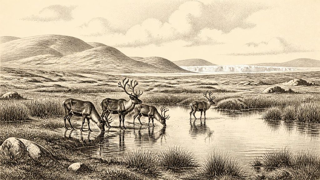
The Derryvree deposits indicate an open, cold landscape with standing or slowly moving freshwater, rather than a forested Ireland. Plant remains, pollen and small fossils point to wet ground and shallow water bordered by sedges, mosses, grasses, herbs and other cold-tolerant vegetation. The older literature called this a muskeg environment: waterlogged ground in which organic material could survive. It was a living landscape, but not a mild one. Treeless or nearly treeless country would have offered little shelter from wind, intense seasonal contrasts and a short growing season.
That conclusion is evidence-based, but its geographical reach needs care. A freshwater bed beneath one Fermanagh drumlin is powerful testimony for its own locality and broad climatic phase; it is not a map of every valley in Ireland. Differences of altitude, exposure, drainage and proximity to ice would have mattered. Some places may have been glaciated, some occupied by outwash and bare sediment, and others capable of supporting tundra-like wetland vegetation. The landscape was dynamic. Meltwater, frost action, sediment movement and advancing ice repeatedly reshaped it, leaving few stable surfaces on which an extensive archaeological record could endure.
For this reason, Ireland’s evidence does not support the familiar language of towns, territories or settled landscapes. There were no known fields, houses, roads, monuments or cemeteries. Nor can political affairs, diplomacy or warfare be reconstructed. The absence of such evidence does not establish that no people ever entered the island during this interval; it establishes that no durable evidence permits historians to describe institutions, rulers, ethnic identities, languages or formal religious practices. The historical record here is principally geological and ecological.
Castlepook’s Animal World
Far to the south, Castlepook Cave near Doneraile in County Cork provides a complementary, though very different, archive. The cave has produced Ireland’s richest known Pleistocene vertebrate assemblage, including remains attributed to woolly mammoth, reindeer, giant deer, brown bear, wolf, Arctic fox, mountain hare, lemmings and spotted hyaena. The National Museum of Ireland notes that spotted hyaenas and other mammals reached Ireland during a broad period around 45,000 to 30,000 years ago. Such animals demonstrate that Late Pleistocene Ireland was repeatedly accessible enough to sustain a substantial cold-stage fauna.
Yet Castlepook must not be read as a scene from one afternoon. Cave deposits accumulate over long spans. Carnivores can carry in bones, gnaw them, scatter them and reuse a den; water and sediment can redeposit remains; early excavations did not always preserve the detailed context expected today. A mammoth bone establishes that mammoths occurred in the wider Irish environment during the relevant broad interval. It does not establish that mammoths, hyaenas, reindeer and every other species represented in the cave were all present together in 30,297 BCE.
Even with that caution, the fauna gives the period its ecological scale. Reindeer and mountain hare suit open, cold conditions; lemmings imply tundra or steppe-tundra elements; large herbivores would have exploited grasses, herbs, shrubs and wetland margins. Wolves and hyaenas were predators and scavengers within that food web. The cave itself was likely one repeatedly used by animals, not a human home. Its bones reveal a landscape with grazing, browsing, predation, carcass scavenging and seasonal movement, rather than an empty expanse beneath permanent ice.
A Possible Human Encounter
Castlepook also contains the most provocative possible human evidence close to this part of Irish prehistory: a reindeer femur dated to approximately 33,000 years ago and reported to bear a mark consistent with cutting by a sharp stone tool. If that mark is confirmed as anthropogenic, it would show that a person or people processed a reindeer in Ireland during the Upper Palaeolithic, vastly earlier than the island’s formerly accepted evidence for human activity. It would be a major discovery.
But the limits are as important as the possibility. The bone is a single object from an old cave assemblage, not a securely sealed camp floor. No associated stone-tool collection, hearth, dwelling, burial, human skeleton or substantial mass of butchered refuse of similar age has been recovered. A cut mark, if it is a cut mark, cannot disclose whether hunters killed the animal, found an already dead carcass, stayed briefly, travelled in a small group, returned seasonally or maintained a population on the island. Nor can it identify their language, ancestry, beliefs or cultural affiliation.
The most defensible interpretation is modest: mobile Upper Palaeolithic hunters may have reached Ireland during a favourable episode and handled a reindeer there. Their movements may have followed animal ranges across changing coastal and glacial landscapes. This is an inference, not a demonstrated settlement history. Lower global sea levels exposed land now underwater, but changing relative sea level, the Irish Sea basin and local ice complicate any claim of a simple, permanent land bridge to Britain. The routes used by animals, and by any people, remain unresolved.
No Economy of the Later Kind
There is no evidence for agriculture, domestic animals, permanent trade routes, metalworking, pottery or exchange systems in Ireland at this time. If people were present, their economy would have depended on immediate knowledge of animals, weather, stone and seasonal resources: hunting, scavenging and the use of portable tools, rather than farming or commerce. That formulation is informed by the possible Castlepook butchery trace and comparison with Upper Palaeolithic lifeways elsewhere in Europe; it is not a catalogue of Irish tools or camps, because none has been securely found for this date.
Similarly, there is no responsible basis for describing Irish religion, art, education or diplomacy in 30,297 BCE. People elsewhere in Upper Palaeolithic Europe made sophisticated objects and images, but those finds cannot simply be transferred across the sea to Ireland. The evidence from Ireland permits a narrower but still compelling story: a volatile Ice Age landscape, freshwater life between phases of glaciation, large mammals and carnivores in open country, and one still-testable indication that humans may have entered that world. Derryvree’s silts and Castlepook’s bones are not a yearbook entry. They are fragments of a much longer, colder and uncertain human horizon.
Primary Sources
- A Middle Midlandian Freshwater Series at Derryvree, Maguiresbridge, County Fermanagh, Northern Ireland
- Freshwater Organic Deposits and Stratified Sediments Between Early and Late Midlandian (Devensian) Till Sheets, at Aghnadarragh, County Antrim, Northern Ireland
- Irish Pleistocene Biostratigraphy
- Pleistocene Glaciations in Ireland
- Late Pleistocene Chronostratigraphy and Ice Sheet Limits, Southern Ireland
- Dimensions and Chronology of the Last Ice Sheet in Western Ireland
- Trimlines, Blockfields and the Vertical Extent of the Last Ice Sheet in Southern Ireland
- Radiocarbon Constraints on the Age of the Maximum Advance of the British–Irish Ice Sheet in the Celtic Sea
- Growth and Retreat of the Last British–Irish Ice Sheet, 31,000 to 15,000 Years Ago: the BRITICE-CHRONO Reconstruction
- BRITICE Glacial Mapping Project
- The Timing and Magnitude of the British–Irish Ice Sheet Between Marine Isotope Stages 5d and 2
- The IntCal20 Northern Hemisphere Radiocarbon Age Calibration Curve (0–55 cal kBP)
- Figure 6: The Subdivision of the Quaternary Period in Ireland
- Palaeoecology
- Quaternary Site Descriptions
- Castlepook Cave, County Geological Site Report
- Spotted Hyena Skull
- Prehistoric Details: Stone Age
- The Irish Quaternary Fauna Project
- New Insights on the Fauna of Ireland’s Younger Dryas and Early Holocene from Alice & Gwendoline Cave
- Ireland’s Palaeolithic Archaeology – Fleeting Footprints in a Frozen Land
- Heritage Artefacts of County Cork
- Archaeological Heritage of County Cork
- Castlepook Cave Excavation, 2022
- The Island of Ireland: Drowning the Myth of an Irish Land-Bridge?
- Deglaciation, Earth Crustal Behaviour and Sea-Level Changes in the Determination of Insularity: A Perspective from Ireland
