Derryvree Shrubland30404 BCE
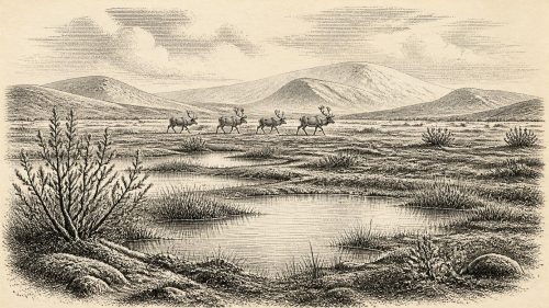
At the notional date 30,404 BCE, Ireland lay in climatically unstable Marine Isotope Stage 3, though this label cannot identify a specific event. Derryvree, in County Fermanagh, preserves freshwater silts between glacial tills, dated broadly to 36,900–31,700 calibrated years before present. Its plants and fauna indicate open, cold tundra wetlands containing mosses, sedges, grasses, dwarf willow and juniper during an ice-free interval. Other deposits and caves reveal changing regional environments and cold-adapted mammals, but cannot reconstruct one moment. A possibly cut-marked reindeer bone from Castlepook suggests fleeting human activity, not settlement. Environmental change, intermittent habitability and uncertain connections shaped Ireland.
Dateline
The label “30,404 BCE” is a modern point on a calendar that did not exist in Ice Age Ireland. It cannot identify an event, a ruler, a journey or a season. In conventional archaeological arithmetic it falls roughly 32,350 years before AD 1950, but that conversion must not be mistaken for a scientific date. For this depth of time, the responsible evidence is measured in radiocarbon ages, calibrated ranges, sediment layers and fossil assemblages, each with its own uncertainty. Ireland at this notional date belongs to the Late Pleistocene, within Marine Isotope Stage 3: a long and climatically unstable portion of the last glacial cycle, before the fullest expansion of the Last Glacial Maximum.
The best Irish evidence that can illuminate this broad interval comes not from a settlement but from a buried wetland at Derryvree, near Maguiresbridge in County Fermanagh. Road works in 1969 cut through a drumlin and exposed organic freshwater silts and fine sands lying between two substantial sheets of glacial till. The sequence records a clear local order: ice had deposited the lower till; subsequently, fresh water, plants and small animals occupied an ice-free landscape; then a renewed glacial advance sealed that record beneath the upper till. It is an unusually eloquent archive precisely because later ice preserved, while also compressing, the evidence.
A Date Within a Range
The Derryvree organic deposit produced the radiocarbon determination Birm-166: 30,500 radiocarbon years before present, with a published uncertainty of +1,170 and −1,030 years. Radiocarbon years are not calendar years. Calibration places the deposit broadly in a window of approximately 36,900–31,700 calibrated years before present, depending on the calibration approach and confidence range used in subsequent scholarship. The calendar label 30,404 BCE falls within that wide window, but it does not date the beginning or end of the deposit, still less a particular day in its formation. The safest conclusion is that Derryvree preserves conditions relevant to Ireland in the later part of MIS 3, rather than a snapshot of this nominal year.
That distinction matters. A layer of silt is accumulated history, not an annual diary. Plant fragments may have been washed into a shallow basin over years or centuries; pollen can travel farther; insects and mosses represent habitats around, rather than necessarily within, the water. The sediments nevertheless offer more secure grounds for reconstructing environment than any attempt to attach a named human community to 30,404 BCE. Their position between tills also demonstrates an important regional fact: north-central Ireland was not continuously blanketed by glacier ice throughout the entire last glacial cycle.
Fresh Water Between Glacial Advances
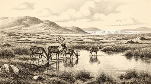
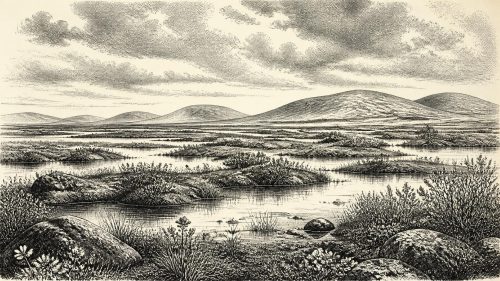
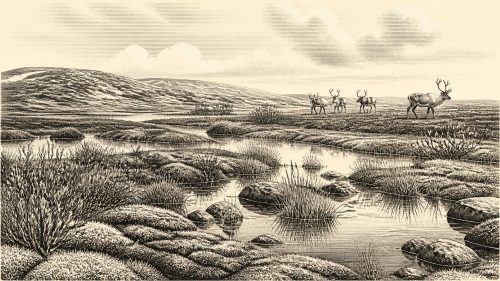
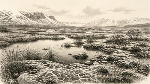
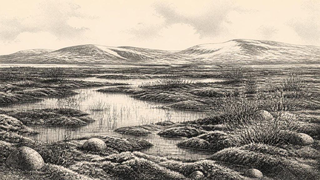
The Derryvree flora and fauna indicate a cold, open, periglacial environment. It was treeless tundra or tundra-like muskeg: wet ground with freshwater pools and margins, mosses, sedges and grasses, accompanied by hardy herbs and low shrubs. Published analyses identified such plants as dwarf willow, juniper, mountain avens, bogbean and water-milfoil, along with a rich moss flora. These species do not recreate a modern Fermanagh landscape. Their combined occurrence points instead to a mosaic in which shallow water and saturated ground lay beside exposed, frost-affected surfaces.
This was not necessarily a uniformly bleak plain. In a periglacial climate, local relief, drainage, snow cover and summer sunlight could create sharply differing microhabitats over short distances. Freshwater plants show that at least some water remained available during the growing season. Dwarf willow and juniper indicate low woody vegetation rather than forest. The absence of a woodland signature is as significant as the plants present: there is no evidence here for oak, hazel woodland, cultivated clearances or anything resembling the later familiar Irish countryside. The landscape was biologically productive in brief seasons, but it was exposed to long winters, freeze-thaw processes and marked climatic stress.
Other northern Irish deposits support this wider picture without proving that every district was identical. At Greenagho, also in County Fermanagh, organic material beneath till has been dated to an earlier part of MIS 3 and indicates an ice-free, cold environment. At Aghnadarragh near Lough Neagh, County Antrim, a complex sequence between tills has preserved freshwater sediments, pollen, beetles and large-mammal remains from other phases of the Midlandian cold stage. These sites reveal regional environmental change across long intervals. They cannot establish that Derryvree, Greenagho and Aghnadarragh shared the same weather, plants or animals at one moment.
Ice, Sea and Changing Connections
Ireland’s geography was changing as much as its vegetation. Global sea level during the glacial period was lower than today because immense quantities of water were locked in northern ice sheets. The Irish Sea basin was therefore a different physical setting, with reduced sea barriers and periodically exposed or narrowed routes between Ireland, Britain and the continental shelf. Yet this did not create a simple, permanent land bridge. Ice margins, coastlines, meltwater, sea incursions and topography shifted repeatedly. Any movement of animals or people depended on conditions at particular times and places, not on the modern map.
The British–Irish Ice Sheet was also dynamic rather than a single immutable mass. Derryvree’s enclosing tills show that its locality experienced separate glacial episodes. More recent reconstructions agree that the major Late Midlandian ice-sheet build-up and maximum came later, principally during MIS 2, but the extent and timing of earlier MIS 3 ice in Ireland remain difficult to resolve. Later ice eroded older surfaces, reworked deposits and removed evidence from many potential sites. The survival of a delicate organic horizon at Derryvree is therefore exceptional, not evidence that comparable landscapes remained intact everywhere.
Animals in the Irish Interior
Cave deposits in the south and south-east give a complementary, though complicated, view of Ice Age animal life. Castlepook Cave, or Mammoth Cave, near Doneraile in north County Cork, is Ireland’s richest known Pleistocene vertebrate assemblage. Its collections include remains attributed to woolly mammoth, reindeer, giant deer, brown bear, spotted hyaena and other mammals. Modern re-dating has shown that some earlier determinations from Irish cave bones were too young, and that parts of the Castlepook fauna belong securely to the pre-Last Glacial Maximum world. It is therefore reasonable to picture Ireland as accessible to sizeable cold-adapted mammals during broad portions of MIS 3.
It would be irresponsible, however, to turn the cave list into a single living scene for 30,404 BCE. The bones were recovered during excavations undertaken long before current recording standards; caves mix remains through scavenging, water movement, collapse and earlier disturbance. Individual animals did not necessarily overlap in time, nor did all occupy the same habitat. Castlepook demonstrates the island’s changing faunal possibilities over millennia, not a census of a particular year. Derryvree, likewise, shows an environmental setting but does not prove that mammoth or hyaena stood beside its pools.
The Human Question
The most striking possible human evidence for this broad era is a reindeer femur from Castlepook. The bone, held in the National Museum of Ireland’s Natural History collections, bears a deep mark interpreted by zooarchaeologist Ruth Carden as damage from a sharp stone implement during carcass processing. Public heritage accounts have associated it broadly with about 31,000 BC or some 33,000 years ago. If the mark is correctly identified as a tool cut made while the bone was fresh, it may represent the earliest known human handling of an animal in Ireland.
Even then, its meaning is limited and important in equal measure. The bone would suggest a brief human presence or visit, perhaps connected with the processing of a reindeer carcass. It does not demonstrate a village, a permanent population, a named Upper Palaeolithic culture, a fleet of boats, or uninterrupted descent to later inhabitants. No securely associated hearth, stone-tool assemblage, dwelling floor, burial, art or occupation layer has established a contemporary settlement at Castlepook. The National Museum of Ireland continues to describe the Palaeolithic human record as lacking clear, secure evidence; the marked femur is best treated as a consequential but still isolated claim requiring careful contextual assessment.
No Politics, but a Humanly Relevant Landscape
There is no basis for political history in Ireland at this date. No states, territories, chiefs, laws, diplomacy, warfare or organised religion can be recovered from Derryvree’s silts or Castlepook’s bones. Nor is there evidence for farming, domestic animals, market exchange, metalworking, writing or formal learning. If people did reach the island in this period, their social organisation, language, beliefs and routes remain unknown. To supply them would be invention rather than history.
What can be said is that the landscape offered resources that might have mattered to mobile hunter-gatherers: reindeer and other large mammals in some regions, seasonal fresh water, edible plants and sheltered limestone caves. Such resources do not prove their use by people. They establish only the ecological opportunities and constraints within which a short human incursion could have occurred. The most substantial development around 30,404 BCE was environmental: habitable ground appeared intermittently between episodes of ice advance, sustaining specialised cold-climate communities of plants and animals.
Derryvree’s real historical value lies in this disciplined scale of understanding. Beneath a Fermanagh drumlin, a freshwater deposit preserves evidence that life persisted in an open, cold wetland during a fluctuating Ice Age. It makes Ireland around this notional year neither an empty stage nor a documented human homeland. Instead, it reveals a changing northern landscape whose geological instability shaped every possibility of animal movement and, perhaps, the earliest fleeting human contact.
Source References
Hover over a number to see the source. Select it to open the source.

- [1] Middle Midlandian Freshwater Series at Derryvree, Maguiresbridge, County Fermanagh, Northern Ireland
- [2] A Reconsideration of the Radiocarbon Dating of the Marine Isotope Stage 3 Fauna from Southern Ireland
- [3] The Irish Quaternary Fauna Project
- [4] Pleistocene Glaciations in Ireland
- [5] Trimlines, Blockfields and the Vertical Extent of the Last Ice Sheet in Southern Ireland
- [6] The Timing and Magnitude of the British–Irish Ice Sheet Between Marine Isotope Stages 5d and 2: Implications for Glacio-Isostatic Adjustment, High Relative Sea Levels and ‘Giant Erratic’ Emplacement
- [7] Timing and Pace of Ice-Sheet Withdrawal Across the Marine–Terrestrial Transition West of Ireland During the Last Glaciation
- [8] Episodic Speleothem Deposition Tracks the Terrestrial Impact of Millennial-Scale Last Glacial Climate Variability in SW Ireland
- [9] Freshwater Organic Deposits and Stratified Sediments Between Early and Late Midlandian (Devensian) Till Sheets, at Aghnadarragh, County Antrim, Northern Ireland
- [10] Middle Midlandian Interstadial Deposits at Greenagho, Near Belcoo, County Fermanagh, Northern Ireland
- [11] The Subdivision of the Quaternary Period in Ireland
- [12] Aghnadarragh
- [13] Castlepook Cave, County Geological Site Report
- [14] Heritage Artefacts of County Cork
- [15] Castlepook Cave, Co. Cork: Excavation Report 2022
- [16] Prehistoric Details
- [17] Guide to the National Museum of Ireland
- [18] New Insights on the Fauna of Ireland’s Younger Dryas and Early Holocene from Alice & Gwendoline Cave
- [19] Exploring the Controls on the Last British–Irish Ice Sheet in the North Channel: A Review of Evidence and Priorities for Future Research
- [20] Late Pleistocene Mountain Glacier Response to North Atlantic Climate Change in South West Ireland
- [21] Dimensions and Chronology of the Last Ice Sheet in Western Ireland
Primary Sources
- Middle Midlandian Freshwater Series at Derryvree, Maguiresbridge, County Fermanagh, Northern Ireland
- A Reconsideration of the Radiocarbon Dating of the Marine Isotope Stage 3 Fauna from Southern Ireland
- The Irish Quaternary Fauna Project
- Pleistocene Glaciations in Ireland
- Trimlines, Blockfields and the Vertical Extent of the Last Ice Sheet in Southern Ireland
- The Timing and Magnitude of the British–Irish Ice Sheet Between Marine Isotope Stages 5d and 2: Implications for Glacio-Isostatic Adjustment, High Relative Sea Levels and ‘Giant Erratic’ Emplacement
- Timing and Pace of Ice-Sheet Withdrawal Across the Marine–Terrestrial Transition West of Ireland During the Last Glaciation
- Episodic Speleothem Deposition Tracks the Terrestrial Impact of Millennial-Scale Last Glacial Climate Variability in SW Ireland
- Freshwater Organic Deposits and Stratified Sediments Between Early and Late Midlandian (Devensian) Till Sheets, at Aghnadarragh, County Antrim, Northern Ireland
- Middle Midlandian Interstadial Deposits at Greenagho, Near Belcoo, County Fermanagh, Northern Ireland
- The Subdivision of the Quaternary Period in Ireland
- Aghnadarragh
- Castlepook Cave, County Geological Site Report
- Heritage Artefacts of County Cork
- Castlepook Cave, Co. Cork: Excavation Report 2022
- Prehistoric Details
- Guide to the National Museum of Ireland
- New Insights on the Fauna of Ireland’s Younger Dryas and Early Holocene from Alice & Gwendoline Cave
- Exploring the Controls on the Last British–Irish Ice Sheet in the North Channel: A Review of Evidence and Priorities for Future Research
- Late Pleistocene Mountain Glacier Response to North Atlantic Climate Change in South West Ireland
- Dimensions and Chronology of the Last Ice Sheet in Western Ireland