Derryvree’s Wind-Scoured Pools31518 BCE
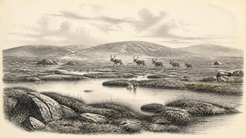
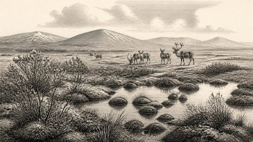
Around 31,518 BCE, Ireland cannot be described through annual historical events, but environmental evidence illuminates a broad Late Pleistocene interval. The Derryvree deposit in County Fermanagh, preserved beneath later glacial till, records cold, open periglacial wetlands with pools, sedges, mosses, grasses and sparse low vegetation. Castlepook Cave in County Cork yielded mammals including mammoth, reindeer, giant deer, hyaena, wolves and lemmings, indicating shifting cold-stage habitats. A marked reindeer bone may represent Ireland’s earliest human activity, though evidence remains inconclusive. No political or social history is recoverable. Increasing glaciation later buried and disturbed these fragile traces across the island’s varied landscapes.

Dateline
Modern calendar-year precision is not available for Ireland in 31,518 BCE. No written record, named community, political boundary or dated event can be assigned to that year. The useful scale is instead a broad Late Pleistocene horizon: roughly 33,468 calibrated years before present, within Marine Isotope Stage 3, long before the Last Glacial Maximum. The most relevant Irish evidence is environmental and palaeontological rather than historical. It comes chiefly from a buried freshwater deposit at Derryvree near Maguiresbridge in County Fermanagh, and from animal-bearing cave deposits at Castlepook near Doneraile in County Cork. Neither archive is a snapshot of one year, but together they illuminate an Ireland of open, cold ground, intermittent wetlands and mobile animal populations.
A Date Beyond Annals
The apparent exactness of 31,518 BCE is a feature of the modern calendar, not of the surviving evidence. Archaeologists use radiocarbon years, calibrated calendar ranges, sediment sequences and comparisons with wider climatic records. Each has margins of error. Radiocarbon measurements are especially difficult at this depth of time because atmospheric carbon levels varied, and calibration transforms one laboratory age into a range rather than a pinpoint date.
Derryvree offers the nearest securely relevant chronological anchor. Roadworks in 1969 cut through a drumlin and exposed fine sands, freshwater silts and organic material trapped between two distinct tills: sediments laid down directly by glacial ice. The organic deposit produced the radiocarbon determination BIRM-166, 30,500 with an uncertainty of roughly 1,100 radiocarbon years before present. Subsequent calibration places the deposit broadly within about 36,900–31,700 calendar years before present, approximately 34,950–29,750 BCE. The requested year falls within that wide interval, but it cannot be isolated within it. Derryvree therefore provides evidence for conditions around this long span, not proof of an occurrence in one particular season or generation.
In Irish Quaternary terminology the deposit has been associated with the Derryvree Cold Phase of the Middle Midlandian, part of the last glacial cycle. Such labels are useful regional shorthand, but should not imply that every part of Ireland experienced identical weather, vegetation or ice cover at the same moment. Atlantic coasts, limestone lowlands, uplands and interiors responded differently to changing temperature, snowfall, wind and ice margins.
A Freshwater World Beneath Till
At Derryvree, water lay or moved slowly across a depression before later ice buried the evidence. The silts preserved pollen, plant macrofossils, mosses and insects. These remains indicate wet, open ground rather than forest: a tundra-like or muskeg environment, with shallow pools, saturated organic margins and substantial plant material. The landscape was periglacial. That term does not mean the site lay under a glacier; it means that intense frost, seasonal freezing and thawing, sparse cover and proximity to glacial conditions shaped the terrain.
Grasses, sedges, herbs and mosses dominated the record. Fossils include bogbean, dwarf willow, mountain avens, alternate water-milfoil and lesser clubmoss. Individually, such species tell modest stories about particular wet or exposed habitats; collectively, they demonstrate a mosaic of pools, mossy ground, low vegetation and open mineral soils. They do not justify imagining a uniform treeless plain across the whole island. Equally, occasional tree pollen cannot securely demonstrate nearby woodland, since pollen may travel far on the wind or be redeposited. The responsible conclusion is a cold, largely unwooded local landscape with freshwater habitats.
Winter would have been severe, and thaw seasons short by later Irish standards. Frost action could break rock, disturb soils and limit the growth of tall plants. Yet this was not simply an empty frozen wasteland. Pools supported aquatic vegetation, while sedge and moss communities occupied wet margins. Low plants could flower and set seed during the growing season. In this sense Derryvree records an active ecological system, albeit one highly exposed to climatic change. Its later burial beneath till is a reminder that this ecological window ended when ice returned and transformed the local terrain.
Animals of the Open Country
Castlepook Cave, also known as Mammoth Cave, lies in the Awbeg Valley beneath the Ballyhoura Hills in north County Cork. Excavations in the early twentieth century recovered a remarkably rich collection of Pleistocene bones. Much of the material derived from cave sands and older excavations, and the deposits were disturbed in places; consequently, the cave must not be treated as a neatly layered record of one animal community. Even so, radiocarbon dating and later reassessment show that a striking range of mammals reached Ireland during the period before the Last Glacial Maximum.
The Castlepook assemblage includes woolly mammoth, reindeer, giant deer, brown bear, wolf, fox, mountain hare, collared lemming, Norwegian lemming and spotted hyaena. Mammoth and hyaena remains have produced radiocarbon ages of about 35,000 and 34,300 years before present respectively, placing at least parts of the fauna in a broadly comparable Middle Midlandian setting. The species need not all have occupied the cave together. Some remains were accumulated by carnivores, some by natural deaths or water movement, and some may have been displaced during excavation. Nevertheless, the assemblage establishes that southern Ireland was repeatedly accessible to cold-stage mammals during this long period.
For people accustomed to modern Ireland, spotted hyaena is perhaps the most arresting animal in the list. Its presence indicates more than an isolated visitor: hyaenas require prey, denning opportunities and an open landscape through which carcasses and hunters could move. Reindeer and mammoth suggest grass-rich or herb-rich country capable of supporting large grazers, while lemmings point to cold northern conditions. Giant deer, bear and wolf add further evidence of ecological variety. This was not the later island fauna in an earlier guise, but a changing north-west European fauna at the edge of its range.
The Human Question at Castlepook
A fragment of reindeer femur from Castlepook has made this period especially important. It has been reported as dating to about 33,000 years ago and carries a deep mark interpreted by zooarchaeologist Ruth Carden as a cut made with a stone tool while fresh tissue was being removed. If that interpretation is confirmed, it may be Ireland’s earliest evidence for human activity: an Upper Palaeolithic person, or a very small group, handling a reindeer carcass long before the well-attested post-glacial settlement of the island.
The qualification matters. A radiocarbon result dates the bone, not the identity of the agent that made a surface mark. Castlepook has not yet produced a securely associated hearth, stone-tool assemblage, dwelling floor, human bone, burial or repeatedly butchered animal group of this age. Furthermore, the reindeer femur comes from an old collection rather than a modern excavation context with complete three-dimensional recording. Natural breakage, carnivore damage, sediment movement and excavation history all complicate interpretation. It would be irresponsible to transform one possible butchery mark into a permanent settlement, a named people, a language, an ancestry or a migration route.
Still, the find gives a plausible glimpse of how people elsewhere in Upper Palaeolithic north-west Europe lived. Small, mobile hunter-gatherer groups used stone tools and depended on detailed knowledge of animal movements, seasonal resources, weather and shelter. If people reached Ireland in this period, a reindeer would have supplied meat, marrow, hide, sinew and bone. That is an informed comparison, not a direct observation of a camp at Castlepook. Ireland’s own evidence remains too slight to say whether any visit was brief, repeated or successful across generations.
No States, Borders or Diplomacy
There is no evidence for political affairs in any conventional sense. No chiefs, councils, territories, warfare, alliances or diplomatic exchanges can be identified in Ireland around this horizon. Nor can archaeologists infer religion, art, speech, kinship rules or formal learning from the Derryvree wetland and Castlepook bones. Absence of evidence is not evidence that people lacked beliefs, social bonds or knowledge; it means that no securely Irish material allows those subjects to be described responsibly.
Likewise, there is no demonstrable Irish trade network. If humans visited, movement itself would have required social connections and navigational knowledge somewhere beyond the island, but the route remains unknown. Lower global sea levels altered coastlines, yet an exposed seabed should not automatically be called a land bridge. Ice, rivers, estuaries, shallow seas and changing shores could all obstruct passage. The animal record proves that connections existed at intervals; it does not reveal whether people walked, crossed ice, used watercraft or arrived by a route no longer visible.
Approaching a Larger Freeze
The wider trajectory was towards greater glaciation. Reconstructions of the British–Irish Ice Sheet place its principal build-up after roughly 35,000–32,000 years ago, with maximum extent much later, broadly between 27,000 and 21,000 years ago. At 31,518 BCE, therefore, Ireland stood in an unstable interval before the full development of the Last Glacial Maximum. The Derryvree wetland documents ice-free ground in Fermanagh before a subsequent glacial advance; it does not prove that the entire island was simultaneously free of ice.
This environmental instability is the central development for Ireland at this depth in time. Habitats expanded and contracted, herds shifted, predators followed prey and any human visitors faced a landscape whose opportunities could disappear within comparatively few generations. Later ice sheets scoured, buried and rearranged much of the evidence. What survives is fragmentary but consequential: sediments beneath a Fermanagh drumlin, bones in a Cork cave, and a possible stone-tool incision on reindeer bone. They show that Ireland was neither timeless nor wholly lifeless. It was a cold, changing frontier of water, wind, animals and perhaps fleeting human presence.
Primary Sources
- A Middle Midlandian Freshwater Series at Derryvree, Maguiresbridge, County Fermanagh, Northern Ireland
- Irish Pleistocene Biostratigraphy
- The Irish Quaternary Fauna Project
- The Exploration of Castlepook Cave, Co. Cork
- Spotted Hyena Skull
- Castlepook Caves
- 2022:564 – Castlepook Cave, Castlepook South, Cork
- Mammoth Cave
- Pleistocene Vertebrates in the British Isles
- Pleistocene Rodents of the British Isles
- The Subdivision of the Quaternary Period in Ireland
- The Glacial Deposits of the Maguiresbridge Area, County Fermanagh, Northern Ireland
- Menyanthes trifoliata
- Salix herbacea
- Dryas octopetala
- Myriophyllum alterniflorum
- Selaginella selaginoides
- The IntCal20 Northern Hemisphere Radiocarbon Age Calibration Curve (0–55 cal kBP)
- Extent and Timing of the Last Glacial Maximum in Britain and Ireland: A Review
- Late Pleistocene Chronostratigraphy and Ice Sheet Limits, Southern Ireland
- Maximum Extent and Dynamic Behaviour of the Last British–Irish Ice Sheet West of Ireland
- Deglacial Rates and Controls for the Western Margin of the British–Irish Ice Sheet
- Exploring Controls of the Early and Stepped Deglaciation on the Western Margin of the British–Irish Ice Sheet
- The Problem of a Late Quaternary Landbridge Between Britain and Ireland