Derryvree’s Juniper Wetland31492 BCE
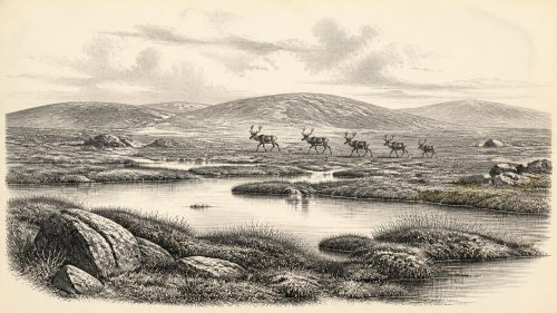
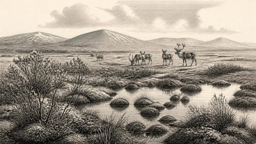
The modern label 31,492 BCE denotes no recoverable Irish event but falls near the younger end of Derryvree’s calibrated freshwater sequence in County Fermanagh. Organic silts between glacial tills, dated broadly to 36,900–31,700 calibrated years BP, record an ice-free interval of cold, open wetland containing grasses, sedges, herbs, juniper, dwarf willow, mosses, aquatic plants and insects. They demonstrate local environmental change, not uniform island conditions. Lower sea levels and fluctuating ice shaped a varied Irish Sea landscape. Cave fauna indicates wider mammoth-steppe connections. A possibly cutmarked Castlepook reindeer bone suggests, but cannot prove, early human activity; no settlement is attested.

Dateline
The label 31,492 BCE is a modern chronological convenience, not a year that can be recovered from Ireland’s prehistoric record. No community in Ice Age Ireland used a calendar that can be translated into this date; there are no written records, rulers, named places, settlements or events assignable to it. In radiocarbon terms, the notional point lies at roughly 33,440 years before AD 1950, but even this conversion must not be mistaken for precision. The most useful evidence comes from calibrated ranges spanning centuries or millennia. It places Ireland in the later part of Marine Isotope Stage 3, during the Middle Midlandian phase of the last glacial cycle.
The closest securely relevant Irish environmental archive is Derryvree townland, near Maguiresbridge in County Fermanagh. There, road works in 1969 exposed organic freshwater silts and fine sands caught between two distinct sheets of glacial till within a drumlin. The organic deposit yielded the radiocarbon determination BIRM-166, 30,500 ± 1,100 radiocarbon years BP. Later calibration has placed its broad age range at approximately 36,900–31,700 calibrated years BP. Thus 31,492 BCE falls near the younger end of an interval illuminated by Derryvree, rather than at a demonstrable moment within the deposit. Its importance is that it preserves a rare record of an ice-free landscape in northern Ireland between glacial advances.
A Date Without an Event
It would be misleading to present this as a conventional annual history. Ireland at this point was not a political territory in any human sense, and nothing supports discussion of governments, dynasties, diplomacy or organised warfare on the island. Neither can historians responsibly identify an Irish people, language, religion or artistic tradition for this time. The evidence instead consists of sediments, pollen, plant macrofossils, mosses, insect remains, animal bones, cave deposits and the landforms made or reworked by ice.
Those materials have a different temporal scale from annals. A layer of mud may have accumulated over many seasons; a pollen spectrum is an assemblage of wind-borne evidence from a surrounding area; a radiocarbon age includes laboratory uncertainty and calibration uncertainty. The Derryvree deposit therefore cannot show what happened in a particular winter, whether people were present during its formation, or even that its pool existed continuously across its full calibrated range. It can, however, establish the character of a harsh but biologically active Irish environment during a period close to the requested date.
Freshwater Between the Tills
Derryvree’s stratigraphy is the foundation of the story. The lower till records an earlier episode when glacier ice crossed the district. Above it lay the freshwater silts and sands, rich in organic material. A later till sealed the deposit, recording renewed glacial activity. This sequence demonstrates change rather than a permanently frozen Ireland: ice advanced, conditions permitted standing or slow-moving freshwater and the growth of vegetation, and ice returned. It is a small survival from a landscape whose older surfaces and possible archaeological traces were repeatedly eroded, buried or rearranged by later ice.
The deposit has been interpreted as a treeless muskeg or tundra wetland. Its pollen and plant evidence includes grasses, sedges, herbs and juniper, while mosses, aquatic plants and insect remains indicate damp ground with pools, plant-rich water and wetter mossy margins. Dwarf willow is among the plants recorded from the wider Derryvree evidence. This was not the dense green woodland commonly imagined as timeless Ireland. It was an open, cold landscape in which water, peat-like organic matter, bare sediment and low vegetation formed a varied mosaic.
That interpretation is evidence-led, but its limits matter. Pollen is particularly good at revealing broad vegetation patterns, not exact local plant cover. The presence of a water plant proves suitable water somewhere close to the accumulating sediment, not the appearance of a particular pond on a particular date. Nor should the word ‘tundra’ suggest an unchanging polar desert. Derryvree’s freshwater organisms show that parts of the ground supported life during a cold interval, even while winters were severe and growing seasons short.
Ice, Water and a Changing Island
At about 33,440 calibrated years BP, Ireland was moving through a climatically unstable world. The full Last Glacial Maximum, when the British–Irish Ice Sheet reached its greatest late-glacial extent, lay ahead, broadly around 27,000–21,000 years ago, with particular regional reconstructions placing maximum ice conditions within narrower portions of that span. Around the Derryvree interval, the size, timing and configuration of earlier Irish ice remain debated. Some evidence indicates substantial pre-Last Glacial Maximum glaciation, while the Derryvree and Greenagho organic deposits demonstrate that north-central Ireland had ice-free ground at least during parts of the relevant period.
This is not a contradiction but a warning against treating the island as a single climatic unit. Ice sheets expanded and withdrew unevenly. Mountainous, northern, western and marine sectors could experience conditions very different from a sheltered Fermanagh basin. The phrase ‘Ireland around 31,492 BCE’ therefore describes a broad region containing several environments, not one uniform scene. Derryvree offers strong evidence for local freshwater conditions; it does not prove that all of Ireland was free of ice, nor does a nearby glacial deposit prove that all ground was ice-covered.
Sea level was lower than today because water was stored in continental ice sheets. Coastlines, estuaries and shallow seas differed markedly from modern ones, yet the exact accessibility of Ireland at this particular point cannot be reconstructed from the Derryvree deposit alone. It is safer to say that the Irish Sea region was a changing glacial landscape, with routes and barriers governed by fluctuating sea level, ice margins, rivers and weather. Any traces of people using coastal or lowland routes would be especially vulnerable to later inundation, erosion and glacial disturbance.
Animals in the Open Country
Irish cave and faunal records show that large mammals entered the island during portions of the Late Pleistocene. Castlepook Cave near Doneraile, County Cork, is particularly important because it has produced a rich, though chronologically complex, assemblage including reindeer, mammoth, spotted hyaena, hare, fox and bear. Published syntheses associate elements of its fauna with the Derryvree Cold Phase, while individual radiocarbon measurements and cave deposits need not represent a single living community or season.
These animals help explain the ecological possibilities of open country. Reindeer are consistent with sparse, cold environments and could have moved through broad grass-and-herb landscapes; hyaenas were powerful scavengers and predators; mammoths, where their remains genuinely belong to a given interval, indicate connections with the wider mammoth-steppe fauna of north-west Europe. But a bone in a cave is not automatically a map of a herd range, and a carnivore accumulation is not a human hunting camp. Cave assemblages can combine deaths, scavenging, transport and deposition across long periods.
The Human Question
Human presence is the most arresting possibility, and the area in which care is most necessary. A reindeer femur from Castlepook has been reported as approximately 33,000 years old and as bearing an incision interpreted by the palaeozoologist Ruth Carden as a stone-tool cutmark. If that interpretation and association are sustained by further analysis, it would indicate that people handled a reindeer carcass in Ireland during the Upper Palaeolithic, far earlier than the once-accepted Irish record of post-glacial settlement.
It does not, however, establish a village, a seasonal camp, a population or an unbroken ancestry leading to later Irish communities. No securely associated hearth, stone-tool assemblage, dwelling floor, human burial or human skeletal remain currently defines a settlement in Ireland around 31,492 BCE. The date reported for the Castlepook bone also cannot be made identical with the requested calendar year. It should be treated as a significant but limited clue, separate from the much better-established Derryvree environmental sequence.
The most securely dated earlier human evidence in Ireland remains later: cutmarks on a brown-bear patella from Alice and Gwendoline Cave in County Clare have been dated to about 12,810–12,590 calibrated years BP. That later find demonstrates how much the picture has changed, but it must not be projected backwards as proof of a continuous Irish occupation through the colder millennia. The probable growth of ice during and after the Derryvree interval could have erased, displaced or made impossible any earlier occupation.
Life Beyond the Evidence
If people did visit Ireland in this period, comparison with Upper Palaeolithic communities elsewhere in north-west Europe makes short, mobile foraging journeys a plausible interpretation. Such groups elsewhere used stone tools, processed animal carcasses, made tailored clothing and maintained social connections across wide territories. Yet these are regional comparisons, not discoveries from Derryvree. No Irish evidence currently identifies the tools, shelters, foods, kinship systems, belief practices, artistic traditions or languages of any visitors at this date.
Accordingly, there is no responsible evidence for political affairs, diplomacy or conflict in Ireland around 31,492 BCE. There is likewise no basis for identifying trade. The movement of people, animals or materials across the Irish Sea region may have occurred, but no artefact network has been recovered to demonstrate exchange. Religion and learning leave no identifiable Irish record from this interval. The strongest cultural conclusion is negative but important: later monuments, Gaelic traditions and historical identities belong to vastly later worlds and should not be read into the Ice Age.
A Fragile Window
Derryvree’s value lies precisely in its modesty. Between deposits of glacial till, it preserves evidence that an open wetland, with cold-adapted vegetation and freshwater life, existed in Fermanagh during a broad interval embracing the notional date. Castlepook’s fauna shows that Ireland was connected to wider Late Pleistocene animal worlds; its marked reindeer bone raises, but does not settle, the prospect of much earlier human activity. Together these records replace the image of an entirely lifeless, permanently ice-bound island with a more dynamic one: local refuges of water and vegetation, roaming animals, advancing ice, and perhaps fleeting human encounters.
For 31,492 BCE, that is the responsible historical horizon. It is not an anniversary of an event. It is a calibrated, uncertain point within a cold and changing prehistoric landscape whose surviving evidence is sparse, local and scientifically invaluable.
Primary Sources
- A Middle Midlandian Freshwater Series at Derryvree, Maguiresbridge, County Fermanagh, Northern Ireland
- Irish Pleistocene Biostratigraphy
- Figure 6.— The Subdivision of the Quaternary Period in Ireland
- References and Recommended Reading
- Exploring Controls of the Early and Stepped Deglaciation on the Western Margin of the British-Irish Ice Sheet
- Trimlines, Blockfields and the Vertical Extent of the Last Ice Sheet in Southern Ireland
- The Timing and Magnitude of the British–Irish Ice Sheet Between Marine Isotope Stages 5d and 2: Implications for Glacio-Isostatic Adjustment, High Relative Sea Levels and ‘Giant Erratic’ Emplacement
- Pattern, Style and Timing of British–Irish Ice Sheet Advance and Retreat Over the Last 45,000 Years: Evidence from NW Scotland and the Adjacent Continental Shelf
- Growth and Retreat of the Last British–Irish Ice Sheet, 31,000 to 15,000 Years Ago: the BRITICE-CHRONO Reconstruction
- Maximum Extent and Dynamic Behaviour of the Last British–Irish Ice Sheet West of Ireland
- Stratigraphic and Palaeo-Geomorphological Evidence for the Glacial-Deglacial History of the Last British-Irish Ice Sheet in the North-Western Irish Sea
- Pattern and Timing of Retreat of the Last British-Irish Ice Sheet
- First Evidence of a Late Upper Palaeolithic Human Presence in Ireland
- First Evidence of a Late Upper Palaeolithic Human Presence in Ireland
- Castlepook Cave Assemblage
- Archaeological Heritage of County Cork: A Resource for Planning and Development
- Ireland’s Palaeolithic Archaeology – Fleeting Footprints in a Frozen Land
- The Mesolithic in Ireland: When Was It?
- Salix Herbacea
- The Late Quaternary History of East-Central Ireland