Derryvree’s Drumlin Testimony31342 BCE
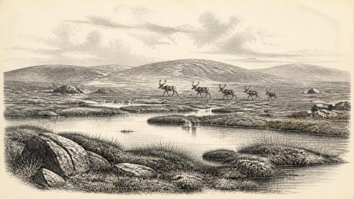
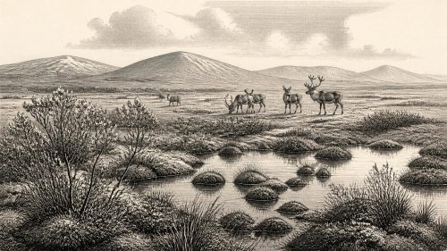
At the notional date of 31,342 BCE, Ireland lay within climatically unstable Marine Isotope Stage 3, not a year capable of precise historical dating. Derryvree, County Fermanagh, preserves wetland sediments between glacial tills, demonstrating a locally ice-free interval with treeless tundra vegetation, freshwater and severe seasonal cold. Castlepook Cave, County Cork, contains MIS 3 fauna including reindeer, mammoth and predators. An incised reindeer femur may indicate Upper Palaeolithic butchery, but cannot establish settlement or continuous occupation. Fragmentary evidence permits no conclusions about society, beliefs or politics. These sites instead reveal changing habitats, mobile animals and a possible brief human presence.
Dateline
Modern calendar-year precision is not available for Ireland in 31,342 BCE. No contemporary Irish people counted years in a system that can be converted to this date, and neither radiocarbon dating nor glacial stratigraphy can identify an event within one particular year so far back. The label is best treated as a point within the Late Pleistocene: approximately 33,291 calendar years before AD 1950, the conventional radiocarbon ‘present’. It falls in Marine Isotope Stage 3 (MIS 3), a long and climatically unstable part of the last Ice Age, not in a historical year with an annal, ruler or battle.
The responsible history of Ireland at this depth of time is therefore an account of evidence: sediments caught beneath later ice, fossil plants and animals, cave deposits, and one much-discussed possible sign of human activity. These sources reveal real environments and changing conditions, but they do not provide a political narrative. There is no basis for naming a community, reconstructing a chiefdom, assigning a language or religion, or describing an Irish society as settled and continuous at this date.
An Interval, Not an Anniversary
The strongest environmental evidence close to this notional date comes from Derryvree townland, near Maguiresbridge in County Fermanagh. Roadworks in 1969 cut through a drumlin and exposed an exceptional sequence. A lower till – unsorted debris laid down by glacier ice – was separated from an upper till by fine sands, silts and organic mud. The order of those layers is crucial. It demonstrates that ice had crossed the area, that a later ice-free interval allowed freshwater and wetland deposits to accumulate, and that another glacier eventually overran and sealed the record.
The organic deposit yielded the radiocarbon determination BIRM-166, reported as 30,500 ± 1,100 radiocarbon years BP. This is not equivalent to a calendar date. Atmospheric carbon-14 concentrations varied in the past, while the uncertainty of the original measurement is large; calibration consequently produces a broad range rather than a single answer. Published discussion places the Derryvree deposit generally in later MIS 3, with estimates spanning several millennia. The nominal date of 31,342 BCE can be placed within the wider chronological horizon illuminated by the deposit, but it cannot date the beginning or end of the wetland, still less an occurrence on its banks.
This distinction matters because Ireland’s older Pleistocene record is exceptionally fragmentary. Subsequent ice advances eroded landscapes, redistributed sediments and buried earlier ground surfaces. A deposit preserved between two tills is therefore valuable, but it is not a complete photograph of the island. Derryvree provides firm evidence for an ice-free freshwater and periglacial setting in part of south Fermanagh during an interval of MIS 3. It does not prove that every Irish region was simultaneously ice-free, equally wet, or occupied by the same plants and animals.
Cold Water and Open Ground
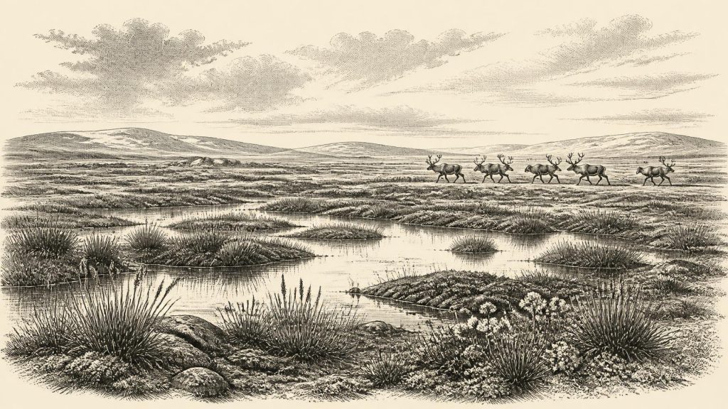
Derryvree’s pollen, plant macrofossils, mosses and invertebrate remains point to a treeless, open landscape of tundra or tundra-like wetland. Moss-rich ground, sedges, grasses and hardy herbs occurred beside pools, sluggish water and waterlogged hollows. Some recorded taxa have northern or alpine affinities, consistent with cold conditions and a short growing season. The presence of freshwater sediment and wetland vegetation is important: this was not simply an unbroken expanse of permanent snow or bare ice. Liquid water, summer growth and decomposing plant matter sustained a small but functioning ecological world.
That said, the vegetation should not be rendered as a neat modern Arctic scene. The pollen was poorly preserved, and individual grains can travel far or be redeposited. Pine or hazel pollen, for example, cannot safely be turned into local woodland. The secure inference is broader: exposed ground, low vegetation and wet places predominated around the Fermanagh locality. Winter conditions were severe, and frost action would have shaped soils and slopes. Seasonal thaw nevertheless made shallow pools and marshy surfaces possible.
At the scale of the island, change was fundamental rather than gradual. Ireland lay within the North Atlantic climatic zone, where abrupt shifts recorded in Greenland ice cores affected temperature, precipitation, sea ice and the behaviour of glaciers. The later Last Glacial Maximum, when the British–Irish Ice Sheet reached a far greater extent, lay ahead, principally about 26,000–21,000 years ago. At the date considered here, the environmental direction was not a simple march into cold: MIS 3 contained repeated warmer interstadials and colder stadials. Irish deposits must be interpreted against that unstable background, rather than as evidence for one uniform ‘Ice Age climate’.
Castlepook and the Human Question
County Cork supplies the period’s most arresting, but also most limited, possible human evidence. Castlepook Cave, near Doneraile – historically also called Mammoth Cave – produced a rich collection of Pleistocene animal bones during excavations in the early twentieth century. Later reassessment and radiocarbon work showed that parts of its fauna belong to MIS 3, much earlier than the long-established record of post-glacial human presence in Ireland. Reindeer, giant deer, brown bear, spotted hyaena and woolly mammoth are among the animals represented in its wider deposits.
A reindeer femur from the cave has been presented as dating to about 31,000 BC and as bearing a deep incision interpreted by zooarchaeologist Ruth Carden as the result of a sharp stone implement used in butchery. If that interpretation is confirmed, the bone would be potentially momentous: it would indicate that people handled a reindeer in Ireland during the Upper Palaeolithic, more than twenty millennia before the previously familiar earliest traces of human activity on the island.
Yet the qualifications are inseparable from the significance. The specimen comes from an old cave collection, not a modern excavation of an intact occupation floor. Caves can accumulate bones brought in by carnivores, water and other natural processes; Castlepook was evidently used by predators or scavengers as well as preserving animal deaths. The radiocarbon result dates the animal’s death, not necessarily the instant a surface mark was made or the place where it was killed. No securely associated hearth, stone-tool assemblage, dwelling, human burial or repeated butchered-bone concentration of comparable age has yet been identified. The femur is thus evidence for a serious hypothesis of brief human activity, not proof of a permanent settlement, continuous population or named hunting band.
Animals, Movement and Survival
Even without assuming a human presence, the fauna reveals an Ireland capable of supporting large mammals at intervals during MIS 3. Reindeer were adapted to open, cold country and could exploit seasonal vegetation; giant deer and mammoth indicate that the island was not ecologically empty. Spotted hyaena, wolf, Arctic fox and brown bear, known from the broader Castlepook record, remind us that carcasses were contested resources. The cave’s fauna must not all be treated as a single living herd seen on one day, because its deposits accumulated over time and some were disturbed. Taken together, however, they show that animal populations moved into and through Irish landscapes during the long pre-LGM period.
For any humans who may have reached the island, mobility would have been decisive. Across north-west Europe, Upper Palaeolithic groups possessed stone technologies and extensive social connections, but Irish evidence does not allow their material culture to be imported wholesale into this account. There is no Irish tool kit securely tied to 31,342 BCE, no house plan, and no evidence for a settled village. The most conservative scenario, if the Castlepook mark is human-made, is a short visit by a small mobile party, perhaps connected with the killing or processing of reindeer in an open landscape before the bone reached the cave by another route.
Nor can lowered Ice Age sea level be used to invent a guaranteed land bridge or a routine trading route. Sea levels were lower than today, and the geography of the Irish Sea was very different, but glaciers, changing shorelines and hazardous waters complicated movement. There is no evidence for exchange networks, imported ornaments, formal diplomacy or sustained traffic between Irish groups and Britain or continental Europe at this date. Geography made movement possible in some circumstances; archaeology has not yet shown precisely how, how often, or by whom it occurred.
Silences of Society and Belief
Political affairs, warfare and diplomacy are therefore beyond recovery. There are no fortifications, weapons caches, territorial monuments or written sources. Equally, religion and learning cannot be reconstructed from Derryvree’s muds or Castlepook’s bones. A possible butchery mark does not reveal ritual, language, kinship, music or art. It is better to acknowledge those silences than to fill them with attractive stories borrowed from better-known Upper Palaeolithic sites elsewhere in Europe.
What can responsibly be said is that survival, whether animal or human, depended on responding to rapid environmental change. Wetland plants colonised brief favourable surfaces; herds and predators occupied open country; ice later erased or entombed much of their world. The deposits at Derryvree and Castlepook are not merely relics of extinction. They preserve evidence that Ireland, often imagined as an empty frozen margin before the final retreat of the ice, contained varied habitats and occasionally a surprisingly rich fauna long before the Holocene island emerged.
A Landscape Awaiting Discovery
For 31,342 BCE, Ireland’s history is best understood as an archaeological threshold. Derryvree establishes that freshwater habitats and open periglacial vegetation existed during a locally ice-free MIS 3 interval. Castlepook establishes that cold-stage mammals occupied southern Ireland and raises the possibility that people briefly entered their world. Neither site supports a year-specific event, a settled society or a conventional national history. Both nevertheless make the period historically important. Future excavation, improved dating and renewed study of museum collections may clarify the human question; until then, the most accurate account is one of a cold, changing island whose evidence survives in a drumlin’s buried wetland and in bones from a Cork cave.
Primary Sources
- A Middle Midlandian Freshwater Series at Derryvree, Maguiresbridge, County Fermanagh, Northern Ireland
- A Middle Midlandian Freshwater Series at Derryvree, Maguiresbridge, County Fermanagh, Northern Ireland
- The Irish Quaternary Fauna Project
- The Irish Quaternary Fauna Project
- A reconsideration of the radiocarbon dating of the Marine Isotope Stage 3 fauna from southern Ireland
- Heritage Artefacts of County Cork
- 2022:564 – Castlepook Cave, Castlepook South, Cork
- Castlepook Caves
- Mammoth Cave
- Palaeoecology
- Figure 6.— The Subdivision of the Quaternary Period in Ireland
- Ireland Through Geological Time
- Quaternary Geomorphology 1:50,000 Ireland (ROI) ITM
- The Ice Age in Ireland
- Introduction to the Glacial Sand and Gravel Landscapes of Northern Ireland
- Site List: Fermanagh
- Late Pleistocene Chronostratigraphy and Ice Sheet Limits, Southern Ireland
- Exposure-Age Constraints on the Extent, Timing and Rate of Retreat of the Last Irish Sea Ice Stream
- Maximum Extent and Readvance Dynamics of the Irish Sea Ice Stream and Irish Sea Glacier Since the Last Glacial Maximum
- Stratigraphic and Palaeo-Geomorphological Evidence for the Glacial-Deglacial History of the Last British-Irish Ice Sheet in the North-Western Irish Sea
- A Critical Review and Re-Investigation of the Pleistocene Deposits Between Cranfield Point and Kilkeel, Northern Ireland
- A Stratigraphic Framework for Abrupt Climatic Changes During the Last Glacial Period Based on Three Synchronized Greenland Ice-Core Records
- A 60,000 Year Greenland Stratigraphic Ice Core Chronology
- The IntCal20 Northern Hemisphere Radiocarbon Age Calibration Curve (0–55 cal kBP)