BIRM-166’s Intertill Testimony31185 BCE
Labelled 31,185 BCE only as a modern approximation, this period falls in later Marine Isotope Stage 3, before the Last Glacial Maximum. Ireland experienced unstable, locally ice-free yet severe periglacial conditions. At Derryvree, Fermanagh, freshwater sediments between tills, dated by Birm-166, preserve evidence of treeless wet tundra, pools, cold-adapted plants and insects. Castlepook Cave, Cork, contains diverse pre-maximum fauna, including mammoth, reindeer, giant deer and predators. A possibly cut-marked reindeer femur may indicate mobile Upper Palaeolithic visitors, but cannot prove settlement. Later glaciation destroyed or buried evidence; Ireland’s human presence remains uncertain, whereas its environmental and faunal history is substantial.

Dateline
“31,185 BCE” is a useful modern filing label, not a date that can be recovered from the Irish archaeological record with calendar-year precision. At this depth of time, evidence is dated in radiocarbon years, calibrated ranges and broad climatic stages; those measures carry substantial uncertainty. The year corresponds roughly to 33,134 years before AD 1950, but it would be misleading to claim that an identifiable event happened in Ireland during that particular twelve-month span. The responsible subject is therefore Ireland in the later part of Marine Isotope Stage 3, close to the transition towards the much colder conditions of the Last Glacial Maximum. The evidence permits a picture of unstable Ice-Age environments, animal movements and a tantalising but unconfirmed indication of human activity; it does not permit a conventional political or biographical history.
A Landscape Before Maximum Ice
Ireland was then within the Midlandian cold stage, the last great glacial cycle in Irish geological terminology. It was not yet necessarily the fully ice-covered island familiar from reconstructions of the Last Glacial Maximum, whose maximum expansion is generally placed much later, around 27,000–23,000 calibrated years ago. The pre-maximum history remains difficult to reconstruct: ice sheets could advance, thin, fragment and re-form in response to abrupt North Atlantic climatic shifts, while conditions differed sharply between uplands, lowlands, coasts and the surrounding seas. It is consequently unsafe to draw a single ice margin across the whole island for 31,185 BCE. What can be said is that parts of Ireland preserved evidence for ice-free or seasonally exposed ground during this broader interval, before later glaciation overran and transformed much of the landscape.
Lower global sea levels altered coastlines and shallow seas, but this does not provide a simple answer to the question of access. The geography between Ireland, Britain and continental Europe changed repeatedly, and ice, water, tidal channels and exposed shelves would all have affected movement. No securely dated route, crossing point or settlement trail survives from this time. It is better to imagine Ireland as a western fringe of north-west Europe: potentially reachable during favourable circumstances, but environmentally demanding and repeatedly disrupted by glacial change.
Derryvree’s Wet Ground
The strongest direct environmental archive relevant to this period lies at Derryvree near Maguiresbridge, County Fermanagh. Roadworks in 1969 cut through a drumlin and exposed freshwater silts and fine sands trapped between two substantial till sheets. That sequence is important because it establishes a relative order: glaciation had occurred, an ice-free freshwater environment subsequently existed at the site, and renewed ice later deposited another till. The organic sediments produced the conventional radiocarbon determination Birm-166, 30,500 radiocarbon years BP, with a large published uncertainty. Subsequent discussion and calibration place the deposit broadly within the later Middle Midlandian, rather than allowing it to be treated as a precisely dated annual horizon.
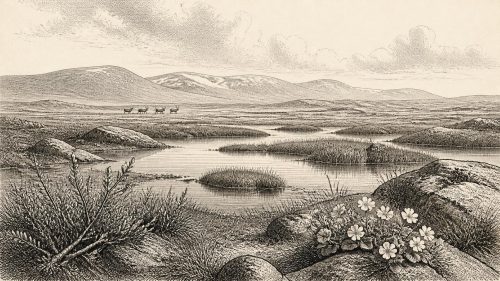
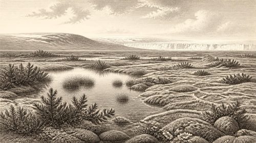
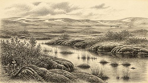
Derryvree preserves the remains of a cold freshwater and wetland environment. Plant pollen, seeds, mosses and insect evidence point towards treeless tundra or muskeg: waterlogged ground, shallow pools, sedges and herbs, with sparse vegetation beyond the wettest places. Finds include species associated with cold, open conditions, such as mountain-avens and Arctic-alpine plants, while a fossil seed of bogbean demonstrates that pools and marshy margins could support aquatic vegetation. These remains do not mean that every Irish valley looked identical. They do, however, replace an older image of an entirely sterile frozen Ireland with a more varied picture of wet ground that sustained plant and invertebrate life during a harsh periglacial phase.
The Derryvree evidence also explains why survival, for animals and any visiting people, would have depended upon season, locality and mobility. A wetland rich in plant matter could provide summer forage and attract insects, small mammals and herbivores; its value in winter would have been very different. Frost action, snow cover, wind exposure and short growing seasons constrained the landscape. There is no evidence for fields, livestock, permanent houses or woodland management. This was not an agricultural countryside awaiting farmers, but a changing cold-stage mosaic in which productive patches were limited and seasonal.
Castlepook’s Animal Archive
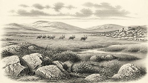
In north County Cork, Castlepook Cave in the Awbeg Valley offers a different kind of evidence. The cave system has yielded Ireland’s richest known pre-Last Glacial Maximum faunal assemblage, including woolly mammoth, reindeer, giant deer, brown bear, wolf, Arctic fox, hare, lemmings and spotted hyaena. Such a list should not be read as a single living community observed on one day. Cave deposits accumulate through many episodes: animals may die naturally, carnivores may carry prey or bones underground, water may move remains, and earlier excavations may disturb their original positions. Nevertheless, the assemblage confirms that large herbivores and cold-adapted species reached parts of Ireland during the wider pre-maximum interval, accompanied by formidable predators and scavengers.
This animal record has major implications for the island’s food web, but not for a settled human economy. Reindeer and horse-like open-country grazers could have exploited sparse vegetation; mammoths and giant deer belong to a broader northern European Ice-Age fauna; hyaenas, wolves and bears remind us that carcasses were contested resources. Cave use by carnivores is especially significant. It cautions against assuming that every bone represents human hunting, and it helps explain why Castlepook is both extraordinarily valuable and difficult to interpret. The cave is an archive of animal presence and bone accumulation, not a preserved village floor.
The Human Question
Castlepook matters to Irish human history because a reindeer femur from older collections has been reported as carrying a deep mark interpreted as having been made by a sharp stone tool while the bone was fresh. The bone has been publicised as approximately 33,000 years old, broadly near this article’s chronological horizon. If the mark is confirmed as anthropogenic, it would show that people processed a reindeer in Ireland far earlier than the better-established terminal Pleistocene evidence from County Clare. It would be a remarkable discovery, but its force must be kept proportional to the evidence: one modified bone is not a settlement, a camp, a population estimate or proof of continuous occupation.
Nor can the femur, even if the cut-mark interpretation stands, identify its makers by name, language, ancestry or political affiliation. There are no human burials, unquestioned stone-tool assemblages, hearths, dwellings or stratified occupation surfaces securely tied to this moment in Ireland. The responsible conclusion is modest: Ireland may have been visited by highly mobile Upper Palaeolithic hunter-gatherers, perhaps during a favourable window in a cold but biologically productive landscape. That is an interpretation based on the bone and on wider European comparison, not a demonstrated Irish society. Claims of tribes, chiefs, territorial boundaries or diplomatic relations would be inventions.
Political affairs and warfare are therefore beyond recovery. There is no evidence for government, collective institutions, alliances or organised conflict on the island. The same restraint applies to religion, art and formal learning. Caves later acquired many symbolic associations in human societies, but Castlepook’s known Ice-Age deposits cannot responsibly be presented as a shrine or ritual site. Any people who reached Ireland would necessarily have possessed sophisticated practical knowledge: how to travel through a severe climate, make and maintain tools, read animal behaviour and share skills within a group. Yet these are reasonable inferences about mobile foragers, not direct evidence for particular Irish customs or beliefs.
Exchange, Settlement and Absence
There is likewise no basis for describing trade. No imported ornaments, worked raw materials, exchange routes or specialised production areas are known from Ireland around this horizon. The most plausible economic activity, if people were present, was immediate acquisition and processing of animal and plant resources. Reindeer meat, marrow, hides, sinew and bone would have been useful, but Castlepook has not yielded the secure associated evidence needed to show how a carcass was divided, transported or shared. The possible incision on one femur is a clue to an action, not a record of an entire subsistence system.
Settlement evidence is absent partly because any human presence may have been fleeting, but also because later ice was destructive. Expanding ice sheets eroded bedrock and sediment, redeposited material as till, and reshaped river valleys and lowlands. Rising post-glacial seas later drowned former coastal plains. These processes reduce the likelihood that open-air camps of this age would survive or be easily recognised. The scarcity of evidence is therefore historically meaningful but not equivalent to proof that no person ever entered Ireland. Archaeology records survival as well as past behaviour.
An Iceward Horizon
At the scale of centuries and millennia, the dominant development was environmental instability leading towards greater glaciation. Research on the British–Irish Ice Sheet indicates that large-scale build-up followed the later parts of MIS 3 and culminated well after this approximate date. Ireland’s habitable patches contracted or were transformed as ice expanded, while the later Last Glacial Maximum erased or buried much of what had existed before. Derryvree’s freshwater deposits, sealed between tills, are therefore precious precisely because they preserve a short-lived environmental interval otherwise lost from the visible landscape.
The Ireland of roughly 31,185 BCE was thus neither a named nation nor an empty white void. It was a cold, open and locally wet Ice-Age landscape, inhabited by resilient plants and animals and shaped by advancing and retreating ice. Castlepook offers a compelling possible signal of people handling a reindeer; Derryvree gives firmer evidence for the wet tundra setting in which life persisted. The distinction matters. The environmental record is substantial, the faunal record is valuable, and the human story remains a carefully framed possibility rather than a complete chapter of settlement history.
Primary Sources
- A Middle Midlandian Freshwater Series at Derryvree, Maguiresbridge, County Fermanagh, Northern Ireland
- Palaeoecology: Irish Quaternary Association Field Guide
- The Subdivision of the Quaternary Period in Ireland
- Trimlines, Blockfields and the Vertical Extent of the Last Ice Sheet in Southern Ireland
- Response of the Irish Ice Sheet to Abrupt Climate Change During the Last Deglaciation
- Dimensions and Chronology of the Last Ice Sheet in Western Ireland
- Early Deglaciation of the British-Irish Ice Sheet on the Atlantic Shelf Northwest of Ireland Driven by Glacioisostatic Depression and High Relative Sea Level
- Stratigraphic and Palaeo-Geomorphological Evidence for the Glacial-Deglacial History of the Last British-Irish Ice Sheet in the North-Western Irish Sea
- Character of Advance and Retreat of the Southwest Sector of the British-Irish Ice Sheet During the Last Glaciation
- British–Irish Ice Sheet and Polar Front History of the Goban Spur, Offshore Southwest Ireland Over the Last 250,000 Years
- The Timing and Magnitude of the British–Irish Ice Sheet Between Marine Isotope Stages 5d and 2
- Last Glacial Maximum Cirque Glaciation in Ireland and Implications for Reconstructions of the Irish Ice Sheet
- Castlepook Caves
- Archaeological Heritage of County Cork
- The Irish Quaternary Fauna Project
- Ireland’s Palaeolithic Archaeology – Fleeting Footprints in a Frozen Land
- The Mesolithic in Ireland: When Was It?
- New Insights on the Fauna of Ireland’s Younger Dryas and Early Holocene from Alice & Gwendoline Cave
- The IntCal20 Northern Hemisphere Radiocarbon Age Calibration Curve (0–55 cal kBP)
- Cenozoic: Tertiary and Quaternary (Until 11,700 Years Ago)