

Derryvree’s Periglacial Marsh31177 BCE
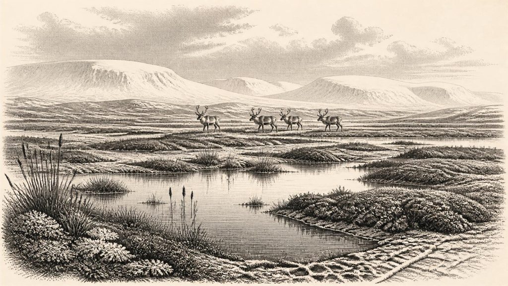
31,177 BCE is not a recoverable Irish historical year, but falls within a broad late-Pleistocene radiocarbon calibration range. At Derryvree, County Fermanagh, freshwater silts rich in organic evidence lie between glacial tills, recording a locally ice-free periglacial wetland with tundra vegetation, insects and shallow water before renewed glaciation. The site demonstrates environmental change, not island-wide conditions or annual events. Growing British-Irish ice sheets created varied local landscapes, while lowered seas did not ensure a land bridge. Castlepook Cave, County Cork, preserves cold-adapted fauna and a possibly tool-marked reindeer bone, suggesting only an unconfirmed, brief human visit, not settlement or continuity.
Dateline
31,177 BCE is a modern calendar label, not a recoverable year in Ireland’s prehistoric record. No known community on the island kept a calendar that can be aligned with this date, and neither archaeology nor Quaternary science can identify an event, person or season so precisely. The responsible history is therefore of a broad late-Pleistocene interval. In relation to the conventional scientific reference year of 1950, 31,177 BCE is approximately 33,126 years ago. It falls near the younger end of a calibrated date range associated with an exceptional deposit at Derryvree, County Fermanagh, but that association does not turn a sedimentary layer into an annual chronicle.
A Date Range, Not a Dateline
The relevant period belongs to the later part of Marine Isotope Stage 3, a cold and climatically unstable phase within the last glacial cycle. In Irish terminology it lies at the transition from the Middle Midlandian towards the Late Midlandian; in wider north-west European studies, it overlaps the early build-up of the British–Irish Ice Sheet. The familiar phrase “Last Glacial Maximum” should be used carefully here. Its principal maximum was still to come, broadly between about 27,000 and 21,000 years ago in Britain and Ireland, while maximum ice extent varied from sector to sector. Around 33,000 years ago, conditions were already severe and ice was growing, but Ireland was not necessarily a single, uniform expanse of ice.
The most important Irish evidence near this notional date is the Derryvree freshwater series, exposed during roadworks in 1969 in a drumlin about two kilometres north-east of Maguiresbridge. A drumlin is a streamlined hill made chiefly of glacial sediment. At Derryvree, investigators found a distinctive sequence: thick till below, freshwater silts and fine sands containing organic matter in the middle, and another till above. Till is the unsorted mixture deposited directly by glacier ice. The sequence therefore establishes a basic order of events: an earlier glacial episode, an interval in which water and organic sediment accumulated at this locality, and renewed glacial deposition afterwards.
Organic material from the central deposit produced radiocarbon determination BIRM-166, conventionally dated to 30,500 years BP, with a substantial uncertainty of +1,170/−1,030 years. Radiocarbon years are not calendar years: changing atmospheric carbon-14 levels require calibration. Published calibration places this determination broadly at roughly 36,900–31,700 calibrated years BP. The calendar label 31,177 BCE, approximately 33,126 years before 1950, lies within that broad interval. Yet the range spans millennia. It cannot show that a particular pool, plant, animal or human action existed in Ireland in this exact numbered year.
Water Between the Tills
Derryvree matters because later ice did not completely destroy the evidence of an earlier landscape. Its fossil assemblage has been interpreted as showing open tundra vegetation and a periglacial climate: ground shaped by intense freezing and thawing beside, rather than necessarily beneath, glacier ice. The old term “muskeg”, used in discussion of the deposit, conveys a waterlogged, peaty terrain with wet hollows and shallow pools. This was not the familiar wooded Ireland of later millennia. It was a sparse, seasonal landscape in which low plants, mosses, sedges and herbs could exploit short growing seasons around freshwater.
The evidence is particularly valuable because it is ecological rather than picturesque. Plant remains, pollen and insects offer indirect records of local habitats. They can establish that biological communities existed at or near Derryvree, and that ice did not cover that precise ground continuously throughout the relevant interval. They cannot provide a map of the entire island at one moment. Nor can a wetland sequence be assumed to represent uplands, exposed coasts or the southern limestone country. Its strength is its stratigraphic clarity; its limitation is its local scale.
The upper till gives the deposit a further historical importance. It shows that the Derryvree wetland was eventually overtaken or sealed by later glacial activity. Ireland’s late-Pleistocene story was consequently one of changing opportunities rather than steady progression towards settlement. A locality could support standing water, insects and tundra plants during one interval, then be transformed by advancing ice, frost action, meltwater and sediment movement. Much evidence for earlier landscapes was scoured away, buried, mixed or carried offshore. What survives is unusually fragmentary.
An Island on the Edge of Ice Growth
Large-scale reconstructions of the British–Irish Ice Sheet indicate that around 31,000 years before present there were growing centres of ice in northern Ireland, Scotland and other upland regions, but also major uncertainties in the exact positions of their margins. By about 30,000 years ago, ice growth was more firmly under way across parts of the region. The later ice sheet would cover much of Ireland and extend far beyond modern shorelines in several directions. At the date considered here, however, the precise size and connections of Irish ice masses remain matters of reconstruction, constrained by landforms, marine sediments, radiocarbon dates, luminescence dating and numerical modelling rather than direct observation.
This uncertainty is historically meaningful. It rules out simple statements that all Ireland was either ice-free or ice-covered in 31,177 BCE. Local conditions could differ sharply. Sheltered low ground may have held freshwater sediment and tundra vegetation; uplands and northern districts may have supported expanding ice; and the continental shelves formed part of an altered, colder physical geography. Lower global sea levels changed coastlines, but geological research does not support an uncomplicated dry land bridge across the Irish Sea. Any movement of animals or people into Ireland therefore cannot be reduced to an assured overland route.
There were no political affairs in the historical sense that can be recovered from this evidence. No territories, rulers, diplomatic relations, wars, law codes or named communities are known. Equally, the language of “conflict” is unsuitable for interpreting glacial advance as though it were a human contest. The decisive forces were climate, ice dynamics, water and frost. Their effects nevertheless shaped the future human possibilities of the island by repeatedly removing habitats, redirecting rivers and modifying the terrain beneath later soils, bogs and settlements.
Castlepook and the Human Question
County Cork offers the other major line of evidence relevant to this deep period. Castlepook Cave, near Doneraile and also known as Mammoth Cave, has produced Ireland’s richest assemblage of pre-Last Glacial Maximum vertebrate remains. Its faunal record includes woolly mammoth, reindeer, giant deer, brown bear, wolf, foxes, mountain hare, lemmings and spotted hyaena. These animals should not be treated as a perfectly contemporaneous herd. Cave deposits accumulated over long periods, while carnivores, water, sediment disturbance and early excavations mixed material. Modern redating has shown that some older radiocarbon results from Irish cave bones needed substantial revision.
Even so, Castlepook demonstrates that Ireland could support, or at least receive, a cold-adapted fauna before the fullest expansion of the last ice sheet. Reindeer and mammoth evoke open grazing country rather than forest, while lemmings and Arctic fox point towards severe cold. Spotted hyaena is especially revealing: caves could be used by carnivores as dens or places where bones accumulated, not simply as human shelters. A bone assemblage is therefore not automatically evidence of hunting, residence or a settled population.
A reindeer femur from Castlepook bearing a deep incision has been interpreted as showing fresh-bone modification by a stone tool, perhaps during butchery. If that interpretation is confirmed, it may represent an exceptionally early Upper Palaeolithic human visit to Ireland, around 33,000 years ago. It is an important possibility, not a licence to invent an Ice Age village. The bone was recovered in antiquarian excavation, lacks an associated stone-tool assemblage or hearth, and comes from a cave sequence known to be complex. It cannot establish a permanent settlement, a population size, a migration route or the identity of the people who may have handled it.
Everyday Life Beyond the Evidence
The same caution governs society and economy. Upper Palaeolithic groups elsewhere in north-west Europe were mobile hunter-gatherers whose subsistence, technology and social organisation were closely adapted to seasonal resources. That regional context makes a brief Irish hunting or scavenging visit plausible if the marked Castlepook bone is genuinely human-modified. But analogy is not evidence that such a group camped at Derryvree, exchanged goods across the Irish Sea, maintained trading partnerships or followed a known seasonal route. Ireland has no securely dated dwelling, hearth, lithic workshop, burial or personal ornament from this interval.
Nothing responsibly supports claims about religion, formal learning, ritual leadership, art or language in Ireland in 31,177 BCE. The absence is not proof that visiting people lacked symbolic lives; Upper Palaeolithic communities elsewhere certainly possessed complex cultural practices. It means only that no Irish material evidence of those practices has yet been securely tied to this period. The most honest cultural history is thus one of preservation and discovery: freshwater mud, pollen, seeds, insects, bone surfaces and stratified cave deposits are the surviving archives from which later researchers infer a vanished world.
For Ireland around this date, the central development was environmental volatility. Derryvree records a living but exposed freshwater tundra between phases of glaciation. Castlepook preserves traces of a changing Ice Age fauna and an unresolved possibility of human intervention. Together they reveal not a settled prehistoric society, but a northern Atlantic landscape at the edge of expanding ice: intermittently habitable, ecologically productive in restricted places, and repeatedly transformed before any continuous human history of the island can be demonstrated.
Primary Sources
- A Middle Midlandian Freshwater Series at Derryvree, Maguiresbridge, County Fermanagh, Northern Ireland
- Palaeoecology: Quaternary Research in Ireland
- Figure 6.— The Subdivision of the Quaternary Period in Ireland
- Growth and Retreat of the Last British–Irish Ice Sheet, 31,000 to 15,000 Years Ago: the BRITICE-CHRONO Reconstruction
- Growth and Retreat of the Last British-Irish Ice Sheet, 31,000 to 15,000 Years Ago: the BRITICE-CHRONO Reconstruction
- Extent and Timing of the Last Glacial Maximum (LGM) in Britain and Ireland: a Review
- New Data for the Last Glacial Maximum in Great Britain and Ireland
- Pattern and Timing of Retreat of the Last British-Irish Ice Sheet
- The Evolution of the Terrestrial-Terminating Irish Sea Glacier During the Last Glaciation
- Maximum Extent and Readvance Dynamics of the Irish Sea Ice Stream and Irish Sea Glacier Since the Last Glacial Maximum
- Timing and Pace of Ice-Sheet Withdrawal Across the Marine–Terrestrial Transition West of Ireland During the Last Glaciation
- Stratigraphic and Palaeo-Geomorphological Evidence for the Glacial-Deglacial History of the Last British-Irish Ice Sheet in the North-Western Irish Sea
- Radiocarbon Constraints on the Age of the Maximum Advance of the British-Irish Ice Sheet in the Celtic Sea
- Dimensions and Chronology of the Last Ice Sheet in Western Ireland
- A Reconsideration of the Radiocarbon Dating of the Marine Isotope Stage 3 Fauna from Southern Ireland
- The Irish Quaternary Fauna Project
- New Insights on the Fauna of Ireland’s Younger Dryas and Early Holocene from Alice & Gwendoline Cave
- New Insights on the Fauna of Ireland’s Younger Dryas and Early Holocene from Alice & Gwendoline Cave
- 2022:564 – Castlepook Cave, Castlepook South, Cork
- Heritage Artefacts of County Cork
- The Mesolithic in Ireland: When Was It?
- Ireland’s Palaeolithic Archaeology – Fleeting Footprints in a Frozen Land
- The Problem of a Late Quaternary Landbridge Between Britain and Ireland
- Advances in Irish Quaternary Studies





