The BIRM-166 Drumlin Cut31112 BCE
Around 31,112 BCE, Ireland experienced cold, unstable conditions during Marine Isotope Stage 3, not a precisely datable historical year. Derryvree, County Fermanagh, preserves freshwater sediments between glacial tills, demonstrating an ice-free interval with treeless periglacial wetlands, mosses, sedges and herbs. Later ice advances buried and protected this evidence. Southern cave deposits show cold-adapted fauna, including reindeer, mammoth, giant deer, predators and smaller Arctic species, though their remains represent differing periods. A possibly cut-marked reindeer bone from Castlepook Cave suggests intermittent human presence, but remains unconfirmed. No secure evidence exists for settlements, tools, farming, art, trade, political communities or permanent occupation.
Dateline
“31,112 BCE” is a modern calendrical label, not a date that people in Ice Age Ireland could have recognised or that archaeology can isolate to a single year. No written record, settlement surface or securely dated human object permits an annual narrative. The responsible approach is to place this point within the later part of Marine Isotope Stage 3, during the Last Glacial Period, and to use broad calibrated ranges rather than false precision. In radiocarbon terms, 31,112 BCE corresponds roughly to 33,000 calendar years before AD 1950, but the evidence nearest to that horizon has uncertainties measured in centuries or millennia.
The most informative Irish archive is not a village, grave or monument but a buried freshwater deposit at Derryvree, near Maguiresbridge in County Fermanagh. Roadworks in 1969 cut through a drumlin and exposed silts and fine sands trapped between two tills: sediments left by ice on separate occasions. The intervening organic layer produced the conventional radiocarbon determination BIRM-166, 30,500 radiocarbon years before present, with a substantial uncertainty. Published calibrations have placed it broadly around 36,900–31,700 calendar years before present. That range includes the modern label 31,112 BCE only approximately; it does not establish conditions on a particular day, season or year.
A Wetland Between Ice Advances
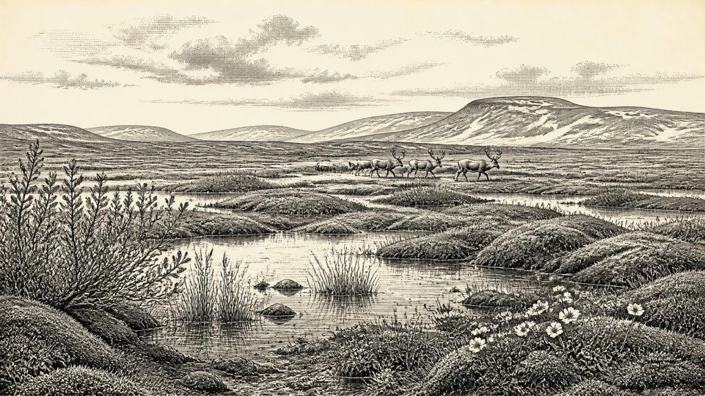
Derryvree matters because it demonstrates that this part of Ireland was ice-free for an interval between glacial episodes. Its freshwater sediments preserve pollen, plant macrofossils, mosses and insect remains. The evidence points to a cold, treeless, periglacial landscape: ground repeatedly frozen and thawed, with wet hollows and shallow water amid open vegetation. Mosses, sedges and herbs were important components. Finds including bogbean, water-milfoil, mountain-avens, dwarf willow and alpine clubmoss indicate that the ground was not a uniform desert of snow and stone. Rather, moisture, soil depth, exposure and season created a patchwork of ponds, marshy margins, sparsely vegetated ground and more sheltered niches.
This was not a precursor of the familiar green island. There is no good basis for imagining oak woods, enclosed fields, peat-cutting or a settled rural landscape. Sparse pollen of trees such as pine or hazel is not proof of local woodland: pollen can travel long distances, while preservation in the deposit was poor. The stronger conclusion is negative but valuable. South Fermanagh was largely open, cold and without forest at the time represented by the layer. Summer growth could nevertheless have been intense in sheltered wet places under long daylight, while winter brought severe cold, frost action and a radically restricted food supply.
The deposit also offers a lesson in scale. A wetland beneath one Fermanagh drumlin is an unusually rich local archive, not a map of the entire island. Conditions may have differed sharply between lowlands, mountain districts, the Atlantic-facing west and the south-east. The broad sea floor was exposed far beyond today’s coast during colder phases because global sea level was lower, changing shorelines and potential movement routes. Yet exposed land did not automatically make travel easy: ice fronts, icy rivers, boggy ground, storms and the Irish Sea basin could all form formidable barriers.
Before the Greatest Ice Extent
Around this broad period, Ireland was entering a phase of major climatic instability and ice-sheet growth. It would be misleading, however, to place the whole island beneath its maximum ice cover in 31,112 BCE. Large-scale reconstructions of the British–Irish Ice Sheet show that its fullest late-glacial extent and rapid reorganisation belonged mainly to later millennia, especially after about 26,000 calendar years ago. Evidence from Derryvree, as well as other pre-Last Glacial Maximum records, instead preserves an earlier window when at least some Irish terrain remained exposed.
The sequence at Derryvree is especially eloquent because the freshwater bed lies between tills. It records an ice-free interval, while the overlying till makes plain that ice later returned and sealed the evidence beneath the drumlin. That later advance both destroyed much of the older landscape and, paradoxically, protected this small remnant of it. Ireland’s sparse record from this era is therefore not evidence that nothing happened. It is partly the result of glaciers eroding, transporting and redepositing sediments, and of later rivers, soils and coasts further remodelling what survived.
Regional change was the dominant historical force. Ice, meltwater and frost shaped routes, habitats and the availability of food more decisively than any human institution could have done. There can be no responsible discussion of Irish political affairs, diplomacy or territorial rule at this date: there are no named communities, leaders, boundaries or social groups in the evidence. Nor is there evidence for warfare. The closest equivalent to a shifting frontier was environmental: the advance and retreat of ice, and the changing limits of land capable of sustaining plants, animals and perhaps brief human visits.
Animals in a Changing Island
Caves in southern Ireland, particularly Castlepook Cave near Doneraile in County Cork, supply a different kind of evidence. Their bone assemblages show that Ireland supported, at various times during Marine Isotope Stage 3, a cold-climate mammal community that included reindeer, woolly mammoth, giant deer, brown bear, wolf, Arctic fox, mountain hare, lemmings and spotted hyaena. These animals should not be assembled into a single imagined herd grazing together in 31,112 BCE. Cave deposits were often accumulated over long periods, disturbed by carnivores, water and early excavation, and individual bones can have very different ages. Recent re-dating has reinforced the need to assess each specimen and its context rather than treating an old collection as one moment in time.
Nonetheless, the fauna establishes an important possibility: parts of Ireland could sustain substantial animals in a cold open environment before the Last Glacial Maximum. Reindeer are particularly suited to the image of mobile grazing across open country; wolves and spotted hyaenas imply carnivore-scavenger relationships; lemmings and Arctic fox indicate cold-adapted habitats. Mammoth and giant deer remains reveal the wider ecological potential of the island, but they do not tell us how numerous those animals were locally, nor whether they occupied County Fermanagh and County Cork simultaneously.
Caves were not necessarily homes for people. At Castlepook, the evidence strongly suggests that carnivores played a major role in bringing bones underground. A cave bone assemblage can record dens, scavenging, natural deaths, water movement and excavation history as much as deliberate human activity. It is therefore more reliable for reconstructing a broad faunal world than for locating a campsite or tracing a seasonal route.
The Human Question
The possibility of people in Ireland around this horizon turns on a small but consequential item: a reindeer femur from Castlepook bearing a mark interpreted by some researchers as having been made with a sharp stone tool while fresh bone was being processed. County Cork’s heritage presentation assigns the bone broadly to about 31,000 BC and treats the mark as evidence of Palaeolithic butchery. If that interpretation, dating and association are upheld by continuing analysis, it would indicate a human presence or visit far earlier than Ireland’s better-established terminal Pleistocene evidence.
But it must remain a carefully framed possibility, not a populated national origin story. No securely associated stone-tool assemblage, hearth, dwelling, burial, repeated occupation layer or human skeletal remain has yet been demonstrated for Ireland at this age. The bone itself dates the animal, not the exact moment at which the surface was marked. Its cave context was disturbed, and the island’s Pleistocene deposits are notoriously difficult to interpret. The National Museum of Ireland has long stressed the absence of clear Palaeolithic human evidence; the Castlepook specimen is an important challenge to that older position, not a reason to claim certainty where the archaeological record remains thin.
If people did reach Ireland during this interval, the evidence supports only a modest inference: small, mobile groups familiar with northern Europe’s cold environments may have intermittently crossed into a landscape where reindeer and other large animals could be exploited. Carcass processing would have supplied meat, fat, hide, sinew, bone and antler. That is an inference from Upper Palaeolithic lifeways elsewhere and the possible cut-marked bone, not direct evidence for an Irish camp, household or hunting strategy. It cannot establish population size, language, kinship, gender roles or permanent residence.
What Cannot Yet Be Seen
Economy, exchange and culture must consequently be treated with restraint. There is no evidence of farming, metalwork, pottery, seafaring trade, mining or long-distance exchange networks within Ireland at this date. No known Irish artefact assemblage reveals toolmaking traditions, and no rock art, portable art, musical instrument or ritual site can responsibly be assigned to 31,112 BCE. Religion and learning are likewise beyond recovery. A person using a stone edge to process an animal, if that occurred, possessed practical knowledge of materials, animal bodies and a demanding climate; beyond that, the record is silent.
Yet the silence is not emptiness. Derryvree’s silt, mosses and insect remains show a living wetland under harsh conditions. Castlepook’s bones show that large mammals and predators entered Ireland during the wider period. The strata above and below them reveal an island repeatedly reorganised by ice. For Ireland at this remote point, the most meaningful history is therefore environmental and evidential: an open, cold land; local freshwater refuges; animal movement across changing terrain; and a tantalising but unconfirmed prospect that human hunters briefly shared that world before later ice obscured almost all trace of them.
Primary Sources
- A Middle Midlandian Freshwater Series at Derryvree, Maguiresbridge, County Fermanagh, Northern Ireland
- A Middle Midlandian Freshwater Series at Derryvree, Maguiresbridge, County Fermanagh, Northern Ireland
- Palaeoecology: Field Guide to Fermanagh
- A Reconsideration of the Radiocarbon Dating of the Marine Isotope Stage 3 Fauna from Southern Ireland
- The Irish Quaternary Fauna Project
- The Irish Quaternary Fauna Project
- New Insights on the Fauna of Ireland's Younger Dryas and Early Holocene from Alice & Gwendoline Cave
- First Evidence of a Late Upper Palaeolithic Human Presence in Ireland
- Heritage Artefacts of County Cork
- Prehistoric Details
- 2022:564 – Castlepook Cave, Castlepook South, Cork
- Growth and Retreat of the Last British–Irish Ice Sheet, 31,000 to 15,000 Years Ago: the BRITICE-CHRONO Reconstruction
- Trimlines, Blockfields and the Vertical Extent of the Last Ice Sheet in Southern Ireland
- Oscillating Retreat of the Last British-Irish Ice Sheet on the Continental Shelf Offshore Galway Bay, Western Ireland
- Dimensions and Chronology of the Last Ice Sheet in Western Ireland
- Character of Advance and Retreat of the Southwest Sector of the British-Irish Ice Sheet During the Last Glaciation
- A 10Be-Dated Record of Glacial Retreat in Connemara, Ireland, Following the Last Glacial Maximum and Implications for Regional Climate
- Early Deglaciation of the British-Irish Ice Sheet on the Atlantic Shelf
- The IntCal20 Northern Hemisphere Radiocarbon Age Calibration Curve (0–55 cal kBP)
- IntCal Publications
- The IntCal20 Northern Hemisphere Radiocarbon Age Calibration Curve (0–55 cal kBP)
- A North-Western Habitat: the Paleoethology and Colonisation of a European Peninsula
