Derryvree’s Interstadial Muskeg31092 BCE
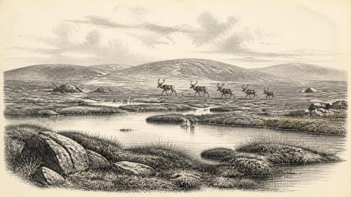
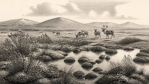
Around 31,092 BCE, Ireland’s environment can be reconstructed only broadly, not as a dated historical event. At Derryvree, County Fermanagh, freshwater organic sediments between glacial tills show that a locally ice-free wetland developed during Marine Isotope Stage 3. Pollen, plants and insects indicate cold, open periglacial terrain with sedges, mosses, pools and sparse shrubs. Climate and ice cover varied regionally. Cave fauna, especially at Castlepook, demonstrates intermittent presence of reindeer, mammoth, giant deer, hyaena and other mammals. A marked reindeer bone may indicate early humans, but settlement remains absent. Later glaciation destroyed much evidence, leaving human visits possible but unproven.
Dateline
31,092 BCE is a modern chronological label, not a year that can be recovered from an Irish calendar, settlement record or remembered event. It corresponds roughly to 33,041 years before AD 1950, the conventional reference point for “before present” dating. At such depth in time, modern calendar-year precision is unavailable. Ireland can be discussed only through broad calibrated ranges, geological sequences, animal remains and environmental traces. The nearest unusually informative Irish sequence, at Derryvree near Maguiresbridge in County Fermanagh, has a radiocarbon determination of 30,500 +1,170/−1,030 radiocarbon years BP. Calibration places it broadly at about 36,900–31,700 calendar years BP, or roughly 34,950–29,750 BCE. The assigned date falls within that wide span; it does not identify a particular day, season, community or event.
A Wetland Between Ice Advances
Derryvree was revealed in 1969 when roadworks cut through a drumlin, one of the streamlined hills formed largely from debris deposited by moving ice. Beneath an upper sheet of till, and above an older sheet, investigators found fine sands, silts and organic freshwater deposits. The sequence establishes an important order of events. Glacier ice had earlier occupied or affected the locality; subsequently, the place was ice-free long enough for standing or slow-moving water, plants and small animals to leave a sedimentary record; later ice advanced again and sealed that record beneath fresh till.
This does not mean that all Ireland was free of ice in 31,092 BCE. Derryvree is a local archive, not a map of the entire island. The extent, thickness and timing of ice in Ireland during the later part of Marine Isotope Stage 3 remain difficult to reconstruct because later glaciers eroded, buried and rearranged older evidence. Recent British–Irish Ice Sheet modelling portrays a developing and highly variable ice complex around this wider period, while Derryvree demonstrates that at least one part of Fermanagh had experienced a non-glacial freshwater interval. Both observations can be true: the island’s conditions were regionally diverse and changed over long timescales.
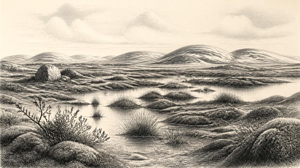
The organic bed is valuable precisely because it preserves life that usually vanishes from glaciated landscapes. Its pollen, seeds, mosses and insect remains indicate open, treeless vegetation and a periglacial regime. The older investigators used the term “muskeg” for its waterlogged ground; in practical terms, this suggests a patchwork of saturated sedge beds, shallow pools, muddy margins and mossy surfaces rather than either dense forest or a modern raised bog. Bogbean, Menyanthes trifoliata, is among the plants represented, alongside sedges, grasses, herbs and cold-tolerant mosses. Dwarf willow and juniper were part of the wider vegetation picture inferred from such evidence, but no single species should be imagined as covering every slope or surviving unchanged throughout the whole dated interval.
Climate Without a Single Weather Report
The period belongs to the Late Pleistocene, within the fluctuating climatic world conventionally called Marine Isotope Stage 3. It preceded the fullest expansion of the last British–Irish Ice Sheet, but it was no uncomplicated respite from cold. North Atlantic climate repeatedly shifted on millennial scales, affecting temperature, precipitation, snow persistence, vegetation and glacier growth. Speleothems in Crag Cave, County Kerry, provide independent evidence that liquid water could occasionally circulate through caves during milder phases, while interruptions in growth signal more severe conditions. Such cave deposits do not supply an annual weather forecast for Derryvree, but they support the broader conclusion that south-western Ireland, like the rest of the North Atlantic fringe, experienced instability rather than a fixed Ice Age climate.
At the notional point represented by 31,092 BCE, an exposed Fermanagh wetland would have had a short growing season, frozen or waterlogged soils and little shelter from wind. Yet “tundra” should not be mistaken for lifeless desert. Wet ground can support productive, localised plant communities; pools sustain aquatic life; and patches of herbs, sedges and mosses can feed invertebrates and grazing animals. The evidence demonstrates a cold ecological mosaic. It cannot securely tell us the month in which any seed fell, how deep snow lay in a particular winter, or whether a similar wetland existed simultaneously in Cork, Clare or Kerry.
Animals on an Island Margin
Fossil assemblages, particularly those from limestone caves in southern Ireland, show that sizeable mammals reached the island during parts of the pre-Last Glacial Maximum period. Castlepook Cave, near Doneraile in County Cork, is the most important Irish site for this deeper fauna. Its collections include remains attributed to reindeer, woolly mammoth, giant deer, brown bear, fox, hare, lemmings and spotted hyaena. These animals make clear that Ireland was not permanently isolated from European ecological processes. Faunal movement must have occurred when geography, climate and available routes allowed it.
However, Castlepook’s animal list is not a census from one year, season or even one undisturbed occupation layer. Much of the cave was excavated in the early twentieth century, and its bone deposits accumulated through varied processes: carnivores carrying prey or scavenged remains into shelter, animals dying naturally, water moving material, and later human excavation disturbing sediments. Modern re-dating has also shown that some older radiocarbon determinations understated the antiquity of the fauna. The responsible conclusion is that different cold-stage animal communities used or were represented at Castlepook across a long span, not that mammoths, hyaenas and every other recorded species necessarily stood together in the same Irish valley in 31,092 BCE.
Reindeer are especially relevant to the Derryvree-type landscape. They are well suited to open, cold country and could exploit sparse vegetation across extensive ranges. Their presence, like that of lemmings and Arctic-adapted predators, reinforces the interpretation of a substantially colder Ireland than today. Spotted hyaena is an equally arresting reminder that caves were not naturally human places: they could be carnivore dens and bone traps. A cave deposit therefore records animal behaviour and geological chance before it can be used as evidence of human activity.
The Human Question
A reindeer femur from Castlepook has been reported to bear a deep mark interpreted as a possible chop or cut made while fresh bone was being processed with a sharp stone tool. Its age, broadly close to thirty-three thousand radiocarbon years ago, has made it central to discussion of a possible very early human presence in Ireland. If that interpretation is eventually confirmed through renewed study and securely stratified finds, it would substantially extend the island’s known human story.
For the date represented here, though, the evidence is insufficient to claim a settlement, hunting camp, family group or continuous occupation. The bone was recovered from an old cave collection rather than a modern, sealed archaeological context, and a mark on bone requires separate taphonomic assessment from the dating of the animal itself. No unequivocal stone-tool assemblage, hearth, dwelling floor, human burial, engraving, ritual site or repeated occupation horizon is known in Ireland from this period. The most defensible wording is that transient human visits remain possible, not proven.
That distinction sets firm limits on social history. There is no evidence for political institutions, named leaders, diplomacy, territorial rule or organised warfare in Ireland around 31,092 BCE. Nor is there Irish evidence for trade networks, farming, animal husbandry, pottery, textiles, writing, formal religion or teaching institutions. If people did reach the island, they would have belonged to highly mobile Upper Palaeolithic populations operating in a wider north-west European world; but applying that general European comparison cannot substitute for Irish finds. It does not prove who crossed, how often they travelled, or how they understood this landscape.
Routes, Resources and Absence
Lower global sea levels altered the geography of north-west Europe, but they do not justify a simple claim that Ireland was automatically joined to Britain by a permanent dry-land corridor. Coastlines, ice margins, river systems and marine passages shifted repeatedly, while the exact accessibility of routes depended on the phase under discussion. Animal fossils establish intermittent ecological connection, yet they do not reveal a specific route or the duration of any connection. Equally, the apparent scarcity of human evidence should not be treated as proof that nobody ever came. Later ice was an efficient destroyer and recycler of soils, campsites and exposed land surfaces.
Derryvree offers the clearest lesson for this notional year: prehistoric Ireland is not a blank stage before history, but neither is it a place where a conventional annual narrative can honestly be imposed. A buried freshwater bed, sealed between glacier deposits, records resilient plant and insect life in a cold landscape. Castlepook’s cave fauna reveals that large mammals intermittently inhabited the island, and a marked reindeer bone raises a major but unresolved question about people. What can be stated with confidence is environmental: parts of Ireland contained living, locally ice-free periglacial habitats during this broad interval. What remains interpretation is the scale of animal movements, the exact pattern of ice cover, and any human role within that world.
Primary Sources
- A Middle Midlandian Freshwater Series at Derryvree, Maguiresbridge, County Fermanagh, Northern Ireland
- Quaternary Deposits and Glacial Stratigraphy in Ireland
- The Irish Quaternary Fauna Project
- A Reconsideration of the Radiocarbon Dating of the Marine Isotope Stage 3 Fauna from Southern Ireland
- Growth and Retreat of the Last British–Irish Ice Sheet, 31,000 to 15,000 Years Ago: the BRITICE-CHRONO Reconstruction
- Trimlines, Blockfields and the Vertical Extent of the Last Ice Sheet in Southern Ireland
- Episodic Speleothem Deposition Tracks the Terrestrial Impact of Millennial-Scale Last Glacial Climate Variability in SW Ireland
- Spatio-Temporal Dynamics of Speleothem Growth and Glaciation in the British Isles
- The IntCal20 Northern Hemisphere Radiocarbon Age Calibration Curve (0–55 cal kBP)
- Marine20—The Marine Radiocarbon Age Calibration Curve (0–55,000 cal BP)
- New Insights on the Fauna of Ireland's Younger Dryas and Early Holocene from Alice & Gwendoline Cave
- The Subdivision of the Quaternary Period in Ireland
- References and Recommended Reading
- Exploring Controls of the Early and Stepped Deglaciation on the Western Margin of the British–Irish Ice Sheet
- The Deglaciation of the Western Sector of the Irish Ice Sheet from the Inner Continental Shelf to its Terrestrial Margin
- Pattern, Style and Timing of British–Irish Ice Sheet Retreat: Shetland and Northern North Sea Sector
- Ireland's Palaeolithic Archaeology – Fleeting Footprints in a Frozen Land
- Heritage Artefacts of County Cork
- The Mesolithic in Ireland: When Was It?
- IntCal | RadioCarbon Dating Research | 14Chrono