Derryvree’s Buried Tundra31088 BCE
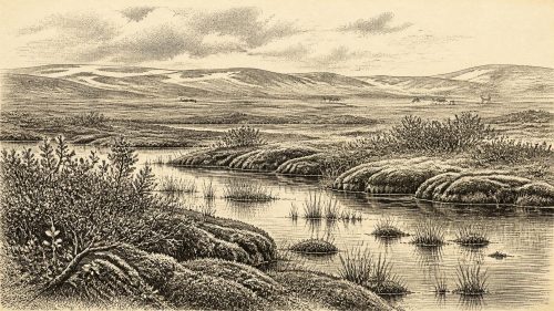
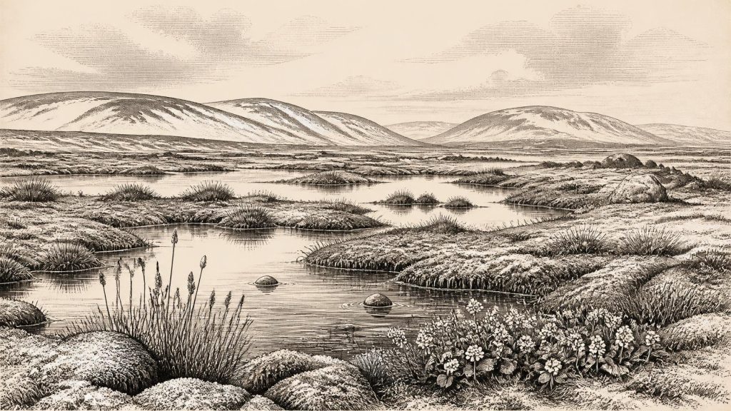
Around 31,088 BCE, Ireland cannot be described through annual events or historical communities, but through Late Pleistocene environmental evidence. At Derryvree, County Fermanagh, freshwater sediments between glacial tills record an ice-free MIS 3 interval, dated broadly between 34,950 and 29,750 BCE. Mosses, sedges, bogbean and cold-adapted insects indicate open, wet tundra-like terrain. Castlepook Cave, County Cork, preserves a mixed, cautiously interpreted fauna including mammoth, reindeer and hyaena. Possible human activity rests on an uncertain cut-marked bone, not settlement evidence. Later ice expansion erased much evidence, leaving a dynamic, harsh landscape rather than identifiable societies or events at any precise date.
Dateline
The label 31,088 BCE cannot identify an event, a ruler, a community or even a season in Ireland. It is a modern calendar conversion, roughly 33,037 years before the archaeological reference year of AD 1950. No written record exists, and the available evidence cannot be resolved to an individual calendar year. The responsible subject is therefore a broad Late Pleistocene interval: Marine Isotope Stage 3 (MIS 3), a climatically unstable part of the last Ice Age. Ireland at this depth of time is known through buried sediments, fossil plants and insects, animal bones, cave deposits and the traces left by advancing ice.
The strongest Irish environmental evidence relevant to this notional date comes from Derryvree, near Maguiresbridge in County Fermanagh. There, road works in 1969 cut through a drumlin, exposing a remarkable sequence: organic-rich freshwater silts and fine sands lay between two thick beds of till, the unsorted material deposited by glacier ice. The sequence provides a secure order of events. Ice had formerly occupied the locality; an interval followed in which open water and wet ground supported life and accumulated sediment; then a later ice advance buried the deposit. It is not an annual record, but it is a rare surviving chapter from an Irish landscape repeatedly remodelled by glaciers.
A Date Within a Range
Organic material from the Derryvree deposit produced the radiocarbon determination BIRM-166, conventionally dated to 30,500 years BP, with a large uncertainty of approximately +1,170 and −1,030 years. Radiocarbon years are not the same as calendar years. Because atmospheric carbon-14 levels have varied over time, such measurements require calibration against independently dated records. Published calibrations place the Derryvree deposit broadly at about 36,900–31,700 calibrated years BP, or approximately 34,950–29,750 BCE.
Thus 31,088 BCE falls within the wide period that Derryvree may illuminate, but it cannot be assigned to a particular sediment layer, plant, insect or episode at the site. The range is not an inconvenience to be hidden: it is the essential limit on what can be claimed. Derryvree demonstrates that its part of Fermanagh was ice-free during a cold interval in later MIS 3. It does not prove that every part of Ireland was ice-free at once, nor that the exact conditions observed in the deposit prevailed across the island in the modern calendar year selected here.
This distinction also matters for the name “Ireland”. The island’s present coastlines, political divisions and familiar regional identities belong to a vastly later world. Sea level was lower globally during glacial conditions, but local coastlines and routes were shaped by a complicated interaction of sea level, ice loading and the changing form of the British–Irish Ice Sheet. It is reasonable to infer that animal dispersal into and out of the area required changing terrestrial or marine connections with Britain and continental Europe. It is not responsible to draw a fixed land bridge, a known route or a political frontier for 31,088 BCE.
Fresh Water Under an Open Sky
Derryvree’s value lies in the life preserved in its freshwater sediments. The plant evidence includes mosses, sedges and herbs characteristic of open tundra-like ground, rather than closed forest. A fossil seed of bogbean (Menyanthes trifoliata) is especially memorable. Today bogbean is associated with wet ground and the margins of freshwater pools; its presence in the ancient deposit confirms a watery habitat amid a generally severe setting. Other remains indicate low, sparse vegetation, with wet hollows and shallow pools set within an exposed, periglacial landscape.
Insect remains add an important independent line of evidence. They include species of cold northern aspect, supporting the conclusion that the climate was harsh. Periglacial does not necessarily mean a featureless expanse of permanent snow or ice. It describes ground affected by frost in the vicinity of glaciers: freezing and thawing, short growing seasons, open plant cover, and local waters sustained by seasonal melt, rainfall or groundwater. Derryvree therefore offers a more varied picture than the shorthand “Ice Age” suggests. There were habitats in which mosses, aquatic plants and invertebrates could survive, even as wider climatic deterioration set the conditions for renewed glaciation.
The evidence speaks most securely about environment, not human settlement. There are no Derryvree hearths, stone tools, huts, graves, ornaments or human remains. Nothing there can establish a language, a kinship system, leadership structure, religion or named people. Nor is there any evidence for farming, herding, cultivated fields, pottery, metalworking or monuments. The ordinary categories of later Irish history—politics, diplomacy, warfare, learning and trade—cannot be populated at this date without invention.
Animals at Castlepook
Far to the south, Castlepook Cave near Doneraile in north County Cork provides the principal Irish archive for Late Pleistocene mammals. The cave, also known as Mammoth Cave, has yielded remains attributed to woolly mammoth, reindeer, giant deer, brown bear, wolf, foxes, Arctic fox, mountain hare, Norwegian and collared lemmings, and spotted hyaena. This is an extraordinary fauna for Ireland, showing that the island or its changing landmass could at times support, or receive, animals now absent from the country.
Yet Castlepook must be read with care. Much of its material was excavated in the early twentieth century, before modern standards of stratigraphic recording, and the cave contains deposits of more than one age. Water movement, carnivore activity and earlier excavation may all have mixed or displaced bones. A cave is also not a census of a landscape. Hyaenas can carry carcass parts into dens; scavengers, natural deaths and sediment movement can each create bone accumulations. The listed animals need not all have lived together, nor does the presence of a species prove its abundance across Ireland.
Direct dating and later reassessment nevertheless place elements of the Castlepook fauna in MIS 3, before the Last Glacial Maximum. A woolly mammoth bone had an older radiocarbon result of about 33,400 ± 1,200 BP, while subsequent work has reconsidered the reliability and implications of dates from the southern Irish fauna. The important conclusion is modest but significant: Ireland’s pre-maximum animal history was richer and more dynamic than the much later historic fauna implies. Reindeer and mammoth belong to the broader environmental world relevant to this article, but cannot responsibly be placed at Derryvree, or in a precise Irish valley, in 31,088 BCE.
The Human Question
The possibility of people in Ireland during this period remains one of the most intriguing and most constrained questions in Irish archaeology. A reindeer femur from Castlepook has been reported as bearing a possible cut mark made with a sharp stone tool and has been associated with a very early date. If confirmed, it could indicate that a human visitor handled or butchered an animal in Ireland during the Upper Palaeolithic. It would be a discovery of major importance.
But a single modified bone from an old cave collection is not evidence for a settled population. No securely excavated Upper Palaeolithic camp, tool assemblage, dwelling floor, hearth, human burial or human bone is currently known from Ireland for this interval. Natural scratches, carnivore damage, breakage and post-depositional movement can sometimes resemble intentional marks; the original find context is also incomplete. The proper conclusion is that short human incursions remain possible, not that 31,088 BCE had an established Irish hunter-gatherer society.
Modern humans certainly occupied parts of western Europe in the wider Upper Palaeolithic world. That fact provides a context for the Castlepook question, but it cannot fill Ireland’s evidential silence. Cave art, formal burial customs, named tool traditions and long-distance exchange networks known in France, Iberia or central Europe should not automatically be imported across the sea. Ireland may have been visited intermittently; it may also have been bypassed during many cold phases. The existing Irish record cannot yet decide between those possibilities for this particular point in time.
Iceward Change
Derryvree captures an interval before the major build-up that eventually produced the Last Glacial Maximum. Later ice sheets eroded, transported and buried much of the older landscape, which helps explain why evidence is so scarce. Recent modelling of the western margin of the British–Irish Ice Sheet uses Derryvree as one of the few pre-maximum Irish constraints and places an ice-free phase around 33,500 ± 1,200 calibrated years BP, with a subsequent build-up beginning considerably later. The island-wide maximum lay thousands of years after the Derryvree interval, broadly in the period around 26,000–20,000 years ago, with considerable regional variation.
This approaching transformation was the decisive ‘regional change’ of the age. A cold wetland in Fermanagh, a cave fauna in Cork and shifting ice margins around the Irish Sea belong to a landscape whose resources, habitability and connections could alter dramatically across generations. If people did reach Ireland, mobility and subsistence would have depended on seasonal animal movements, exposed ground, water, weather and access routes rather than on territorial states or permanent settlements. That is an interpretation based on Palaeolithic lifeways elsewhere, not direct proof of an Irish community.
The most accurate portrait of Ireland around 31,088 BCE is consequently not a story of kings, conflicts or institutions. It is a buried tundra wetland beneath a Fermanagh drumlin; bogbean and mosses beside cold water; animals moving through changing open country; and a cave in Cork preserving fragments of a lost fauna. These remains establish a living, environmentally diverse Ireland during a fluctuating cold stage. They do not yet reveal who, if anyone, watched that landscape.
Primary Sources
- A Middle Midlandian Freshwater Series at Derryvree, Maguiresbridge, County Fermanagh, Northern Ireland
- Early Midlandian–Middle Midlandian, Pleistocene, Northern Ireland
- Palaeoecology: Field Guide to County Fermanagh
- Exploring Controls of the Early and Stepped Deglaciation on the Western Margin of the British Irish Ice Sheet
- A Reconsideration of the Radiocarbon Dating of the Marine Isotope Stage 3 Fauna from Southern Ireland
- First Evidence of a Late Upper Palaeolithic Human Presence in Ireland
- New Insights on the Fauna of Ireland's Younger Dryas and Early Holocene from Alice & Gwendoline Cave
- Castlepook Cave, County Cork
- The Exploration of Castlepook Cave, County Cork
- The Irish Quaternary Fauna Project
- Occurrence of Mammalia Relicts at Site Castlepook Cave
- The Geology of Ireland: Cenozoic, Tertiary and Quaternary
- Pattern, Style and Timing of British–Irish Ice Sheet Advance and Retreat Over the Last 45,000 Years
- The Last Irish Ice Sheet: Extent and Chronology
- Menyanthes trifoliata
- Prehistoric Details
- The Colonization of Ireland: A Human Ecology Perspective
- Ireland: Submerged Prehistoric Sites and Landscapes
- Revisiting Alice and Gwendoline Cave, Co. Clare: New Light on the 1902 Excavations
- Quaternary Deposits and Glacial Stratigraphy in Ireland
- Field Guides
- Heritage Artefacts of County Cork