
Maguirebridge and Doneraile30907 BCE
About 30,907 BCE, Ireland formed part of a changing Late Pleistocene landscape rather than a historical society. Derryvree, County Fermanagh, preserves freshwater sediments beneath glacial tills, indicating open, treeless, wet periglacial ground with sedges, herbs and cold-adapted plants. Castlepook Cave, County Cork, yielded diverse fauna, including mammoth, reindeer, giant deer, bears, wolves, foxes, lemmings and Ireland’s only known spotted hyena remains. These sites show intermittent ecosystems before the Last Glacial Maximum, amid expanding ice and altered coastlines. A possibly butchered reindeer bone hints at transient human activity, but provides no secure evidence for settlement, institutions, trade, religion or political communities.
Dateline
Modern calendar-year precision is not available for Ireland in 30,907 BCE. The label is a useful point on a modern timeline, but it does not identify a recorded year, season, ruler, migration or battle. Counted back from the archaeological convention of AD 1950, it lies about 32,856 calendar years before present, during the Late Pleistocene and Marine Isotope Stage 3 (MIS 3). At this depth of time, evidence comes from dated deposits, animal bones, cave sediments and glacial landforms, all of which describe intervals rather than a single year.
The responsible history of Ireland at this point is therefore one of changing environments and limited traces of animal and possibly human movement. Ireland was not yet a political or cultural community in any historical sense. It was a north-western extension of a larger Ice Age world, repeatedly reshaped by ice, frost, rivers, changing coastlines and shifts in sea level. The best Irish evidence relevant to this broad horizon comes from a freshwater deposit beneath a drumlin at Derryvree near Maguiresbridge, County Fermanagh, and from the remarkable bone assemblage of Castlepook Cave, near Doneraile in north County Cork.
A Date, Not a Dateline
Radiocarbon dates must not be read as direct calendar dates. They measure the decay of carbon-14 and require calibration against independently dated records of past atmospheric change. The current IntCal20 calibration curve extends to 55,000 calibrated years before present, but its output at this antiquity is a probability range, not a date that can be narrowed to a named year. A modern BCE label is even less exact: it is imposed retrospectively on a landscape whose inhabitants, if people were present, left neither writing nor a calendar.
Derryvree provides the closest securely dated environmental archive. Organic silts and fine sands were exposed during roadworks in 1969 within a Fermanagh drumlin. They lay between two layers of glacial till: unsorted material left by ice. The arrangement matters. An earlier ice advance deposited the lower till; afterwards, a hollow held freshwater sediments and organic remains; a subsequent advance covered the deposit with the upper till. One conventional radiocarbon determination from the organic sequence was 30,500 radiocarbon years BP, with a large published error margin of +1,170 and −1,030 years. Calibration places such a result broadly in the mid-to-late 30,000s calendar years BP, not at a precise point equivalent to 30,907 BCE.
The numbered year should thus be treated as falling within a broad late-MIS-3 setting, not as the moment when the Derryvree pool formed or vanished. Equally, the target date cannot be made to coincide mechanically with a radiocarbon result from Cork. These archives are separated by hundreds of kilometres and accumulated over long, differently dated spans. Their value lies in what they establish together: parts of Ireland supported functioning cold-climate ecosystems before the later maximum expansion of the British–Irish Ice Sheet.
Wet Ground Beneath a Drumlin
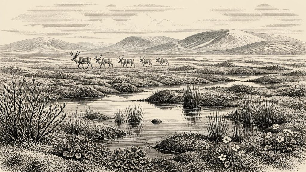
Derryvree overturns the simplest image of Ice Age Ireland as a featureless white expanse. Its fossils indicate a largely open, treeless and periglacial landscape: one shaped by severe cold, repeated freezing and thawing, sparse cover and poorly developed soils, but not necessarily buried beneath glacier ice at the time the sediments formed. The site has been described as a muskeg-like environment, with saturated ground, pools, mosses and sedges.
Plant remains include grasses, sedges, herbs and cold-tolerant species. Mountain-avens, dwarf willow, lesser clubmoss and bogbean are especially revealing, while water-milfoil indicates shallow or slow-moving freshwater. Mosses and insect remains support the interpretation of wet, exposed ground under harsh climatic conditions. These are local signals, not a complete map of Ireland. They show what grew around one basin and its catchment; they do not prove that every Irish valley or upland had the same vegetation, nor that trees were absent everywhere. Pollen can travel far and can be redeposited, whereas the macrofossils from the wetland provide firmer evidence for its immediate surroundings.
For living creatures, this was not an empty world. During the short growing season, water and marsh-edge plants could support insects and other small animals, while herbs, grasses and low shrubs created patches of forage across more freely drained ground. Winter would have sharply altered the balance: deep frost, snow, frozen soil, exposure to wind and a restricted food supply. The essential environmental rhythm was seasonal uncertainty rather than settled agricultural plenty. There were no fields, livestock, cleared woodland or permanent farmsteads known from Ireland at this time.
Ice Building Across the Islands
30,907 BCE predates the Last Glacial Maximum, the phase when the last British–Irish Ice Sheet reached its greatest overall volume and extent. Recent ice-sheet reconstruction places substantial growth between about 31,000 and 26,000 years ago, with maximum volume around 23,000 years ago; different sectors advanced, peaked and retreated at different times. Ireland was therefore entering a major glacial reorganisation, not experiencing one simultaneous island-wide event.
That distinction prevents two errors. First, the later maximum ice map cannot simply be projected backwards onto every earlier millennium. Second, an ice-free wetland at Derryvree does not mean that all Ireland was hospitable, connected or uniform. Glaciers and local ice caps occupied some regions, while exposed lowlands, valleys and coastal plains could differ greatly over relatively short distances. Much of the evidence has also been destroyed, buried or reworked by later ice. The archaeological silence of many areas is consequently not proof that nothing ever lived or travelled there.
Lower sea levels changed the physical setting too. Ireland’s modern shorelines did not exist in their present form, and the surrounding shelves exposed or submerged at different stages. Yet a simple claim of a permanent land bridge to Britain or continental Europe would be unsafe. Access routes depended on the geometry of ice, water, sea level and terrain at particular times. The animal record shows that movements occurred during the Pleistocene; it does not reveal a single route, season or uninterrupted corridor.
Castlepook’s Mixed Fauna
At Castlepook Cave, a Carboniferous limestone cave system near Doneraile, excavators recovered more than 2,000 bones from deposits investigated mainly in the early twentieth century. The cave is Ireland’s richest known site for vertebrate fauna in the period leading towards the Last Glacial Maximum. Its assemblage includes woolly mammoth, reindeer, giant deer, brown bear, wolf, fox, Arctic fox, stoat, mountain hare, collared lemming, Norwegian lemming and spotted hyena. The hyena is particularly significant: Castlepook is the only Irish locality known to have yielded it.
This list should not be mistaken for a census of animals seen together in 30,907 BCE. Cave deposits may accumulate over many generations or millennia. Carnivores may drag prey or scavenged material inside; animals can die in traps; water, burrowing and later excavation disturb layers. Some Castlepook material was collected before modern excavation standards, and later research has warned that older radiocarbon determinations need reassessment because methods of collagen preparation have improved. Individual dates from the cave span a wide range, approximately 45,700 to 19,950 radiocarbon years BP.
Even so, the fauna makes a robust larger point. Southern Ireland was intermittently part of a north-west European cold-stage ecological zone able to sustain large herbivores, small Arctic-adapted mammals and major predators. Reindeer and mammoth suggest open forage-rich habitats rather than closed forest. Hyenas and wolves indicate carnivore activity within that broader food web. Giant deer belonged to the same long Pleistocene story, though their precise local timing and habitat relationships cannot be reduced to one scene or one date.
A Possible Human Trace
The most consequential but most limited evidence for people is a reindeer femur from Castlepook reported to bear a deep mark consistent with fresh-bone butchery by a sharp stone tool. The animal has been publicised as roughly 33,000 years old, making the find relevant to the general time horizon of this article. If the interpretation of the modification is sustained, it suggests that one or more Upper Palaeolithic people processed a reindeer in Ireland long before the well-established post-glacial settlement record.
But the evidence does not establish a resident population, a camp, a journey from any particular homeland or a date in 30,907 BCE. The bone comes from an old and complex cave collection rather than a sealed occupation floor. No securely associated hearth, stone-tool assemblage, dwelling surface, burial, repeated food-processing area or settlement has been published for this horizon. The cautious conclusion is that the femur may preserve a fleeting human action; it cannot support a narrative of an Irish tribe, household or colony.
What Cannot Be Recovered
Political affairs, diplomacy and organised warfare cannot responsibly be described for Ireland at this date. There are no named communities, leaders, territories, monuments, languages or institutions. Nor is there evidence for religion in the archaeological sense: no demonstrable shrine, burial rite, figurative art or ceremonial object belongs securely to this Irish horizon. People, if present, certainly had social lives, knowledge and beliefs, but archaeology cannot specify them from one possibly worked bone and environmental deposits.
There is likewise no evidence for trade in the later historical meaning of regular exchange between settled communities. The faunal record demonstrates movement across a wider region, not commerce. The most defensible account of everyday life is ecological: mobile animals seeking forage and shelter; predators using caves and landscapes of pursuit; perhaps transient human visitors taking meat, marrow, hide or sinew from a carcass. Those possibilities remain interpretation, not recovered fact.
The principal development around this notional year was environmental rather than political. Ireland stood within a cold, dynamic Late Pleistocene world as ice grew, wetlands persisted in sheltered places and animal communities shifted through a fragmented landscape. Derryvree and Castlepook preserve rare windows onto that world. Their very incompleteness is part of the history: later ice repeatedly erased the ground on which any camps, tracks, shorelines and seasonal encounters might once have stood.
Primary Sources
- A Middle Midlandian Freshwater Series at Derryvree, Maguiresbridge, County Fermanagh, Northern Ireland
- The Exploration of Castlepook Cave, County Cork
- A Reconsideration of the Radiocarbon Dating of the Marine Isotope Stage 3 Fauna from Southern Ireland
- The Irish Quaternary Fauna Project
- Growth and Retreat of the Last British–Irish Ice Sheet, 31,000 to 15,000 Years Ago: the BRITICE-CHRONO Reconstruction
- Growth and Retreat of the Last British–Irish Ice Sheet, 31,000 to 15,000 Years Ago: the BRITICE-CHRONO Reconstruction
- The IntCal20 Northern Hemisphere Radiocarbon Age Calibration Curve (0–55 cal kBP)
- IntCal Publications
- Castlepook Cave: County Geological Site Report
- Spotted Hyena Skull: Mammoth Cave, Castlepook, County Cork
- Prehistoric Details: National Museum of Ireland
- Quaternary Site Descriptions
- Quaternary Geology of Ireland
- Mammoth Cave, Castlepook
- Occurrence of Mammalia Relicts at Site Castlepook Cave
- New Insights on the Fauna of Ireland's Younger Dryas and Early Holocene from Alice and Gwendoline Cave
- Excavation at Castlepook Cave, County Cork, 2022
- Deposits of the Last Glaciation
- Menyanthes trifoliata: Fossil Record in Fermanagh
- Dryas octopetala: Fossil Record in Fermanagh
- Archaeological Heritage of County Cork
