
BIRM-166’s Wetland30846 BCE
Around 30,846 BCE, Ireland lay within the climatically unstable Late Pleistocene, rather than a precisely recoverable historical year. At Derryvree, County Fermanagh, freshwater organic silts between glacial tills document an interval of wetland, tundra-like vegetation, mosses, sedges and aquatic plants between ice advances. BIRM-166 radiocarbon dating broadly encompasses this date but cannot define annual conditions or island-wide ice cover. Castlepook Cave, County Cork, preserves varied cold-stage fauna, including reindeer, mammoth and predators, accumulated across different periods. Possible cut marks on a reindeer bone suggest transient human activity, not settlement. Later glaciation and coastal change destroyed or obscured much surviving evidence.
Dateline
30,846 BCE is not a year that can be recovered from Ireland’s archaeological record in the manner of a later historical date. It is a modern calendar label for a point roughly 32,796 calibrated years before AD 1950, the conventional reference point for “before present” dating. At this depth in time, radiocarbon measurements, sediment layers, fossil remains and ice-sheet reconstructions provide ranges and sequences rather than an identifiable season, generation or event. The most responsible account is therefore of Late Pleistocene Ireland in the broad vicinity of this date, not of things that happened in a precisely knowable year.
A Cold-Stage Landscape
This was Marine Isotope Stage 3, a long and climatically volatile part of the last glacial cycle. It preceded the fullest expansion of the Last Glacial Maximum, conventionally dated in this region to later than this horizon. Ireland was not yet the familiar island of modern maps in environmental terms: sea level was lower, coastlines and drainage patterns differed, and ice, permafrost and open ground could all change markedly across relatively short geological intervals. Nor should Ireland be imagined as uniformly covered by permanent ice. The evidence instead points to a landscape in which local ice advances, cold open environments and occasionally ice-free terrain succeeded one another.
The best Irish environmental evidence relevant to this period comes from Derryvree near Maguiresbridge, County Fermanagh. During road works in 1969, a cutting through a drumlin exposed fine sands and organic freshwater silts between two thick deposits of glacial till. Till is the unsorted mixture of clay, stones and other debris deposited by moving glacier ice. The order of the layers is decisive: ice formed the lower till; a freshwater or wetland environment then existed long enough to accumulate sediments and organic remains; and later ice deposited the upper till above it. Derryvree is consequently a record of environmental succession, not a snapshot of an entire island.
The Wide Date of BIRM-166
Organic material from the Derryvree deposit, known by the laboratory number BIRM-166, returned a conventional radiocarbon age of 30,500 years before present, with a substantial uncertainty of +1,170 and −1,030 years. Radiocarbon years are not identical to calendar years. Atmospheric carbon-14 has varied over time, so such measurements must be calibrated against independently dated archives. Published calibration places this determination broadly in the range of about 36,900 to 31,700 calibrated years before present. The modern label 30,846 BCE falls within that broad span, but this does not establish that every grain of silt, plant fragment or insect remain at Derryvree belongs to that nominal year.
That qualification matters. A date range can demonstrate that an environment existed within a large interval; it cannot turn a layer of mud into an annual chronicle. Equally, Derryvree cannot by itself show that all of Ireland was ice-free at once. It gives unusually detailed local evidence from Fermanagh, and it establishes that the conventional picture of a continuously ice-bound Ireland is too simple. It does not license a map of precise ice margins for 30,846 BCE, nor claims that particular people or animal herds were present throughout the island on that date.
Water, Moss and Open Ground
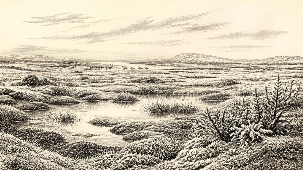
The Derryvree fossils indicate open tundra-like vegetation and a periglacial regime: ground affected by intense cold, seasonal freezing and thaw, but not necessarily buried beneath an active glacier. Mosses, sedges and aquatic plants were among the material recovered from the freshwater series. Finds reported from the deposit include bogbean and water-milfoil, plants which require wet ground or standing freshwater. Together with pollen, plant macrofossils and insect remains, they indicate pools, wet hollows and saturated ground within an otherwise treeless landscape.
Such a setting should not be reduced to a barren white wilderness. In summer, shallow water, mossy ground and sedge-rich margins could have been biologically productive. Yet it was a hard and unstable habitat. Trees did not form the closed woodland that later generations would know; exposed soils were vulnerable to frost action; and the length of the growing season was limited. The landscape was probably a mosaic, varying with relief, drainage and proximity to ice. A wetland beneath the future drumlins of Fermanagh could sustain plants and invertebrates even while colder, drier or more glaciated conditions prevailed elsewhere.
The wider British–Irish Ice Sheet reconstruction reinforces this sense of transition. Its detailed, well-dated reconstruction begins around 31,000 years before present, slightly later than the calendar point considered here, and shows substantial ice growth in Ireland and Britain between about 31,000 and 26,000 years ago. It is therefore reasonable to regard 30,846 BCE as close to the threshold of major glacial expansion, but not to project the reconstruction backwards as though it were a photograph of the island almost two millennia earlier. Ice-sheet modelling is a powerful guide to broad tendencies, not a substitute for direct local deposits.
Animals in the Cave Record
Southern Ireland supplies a different sort of evidence. Castlepook Cave, near Doneraile in County Cork, produced a large assemblage of Late Pleistocene animal remains during excavations in the late nineteenth and early twentieth centuries. Reassessment and improved radiocarbon dating have shown that the cave preserves evidence from more than one period, including Marine Isotope Stage 3. Species represented in its wider faunal record include reindeer, woolly mammoth, giant deer, brown bear, wolf, Arctic fox and spotted hyaena. These finds show that Ireland could support, or at least be visited by, a striking range of cold-climate mammals and predators during parts of the late Ice Age.
They must not, however, be made into a single painted scene. Cave deposits often accumulate over long periods, and bones may have been dragged in by carnivores, disturbed by water, moved in earlier excavations or drawn from layers of different ages. Recent work on the southern Irish fauna has particularly cautioned against relying uncritically on older radiocarbon determinations. At Castlepook, a mammoth bone and a hyaena tooth need not prove that mammoths and hyaenas shared the cave mouth on one day; nor does their presence prove that all the listed animals lived at Derryvree. The evidence is strongest when used to demonstrate a changing regional fauna, rather than a perfectly synchronous “mammoth-steppe” community.
The Human Question
There is no secure settlement, hearth, stone-tool assemblage, dwelling, burial or human skeleton from Ireland that can be assigned to 30,846 BCE. That absence is important. It means there is no basis for describing resident communities, family structures, language, territory, leadership or population size. There is likewise no evidence for agriculture, domesticated animals, monuments, formal trade routes, religious shrines, art or systems of learning in Ireland at this date. Political affairs, diplomacy and warfare belong to societies for which organised human groups can be identified; the available Irish record at this horizon does not permit such a history.
One find nonetheless makes the question of human presence unusually significant. A reindeer femur from Castlepook Cave has been reported as approximately 33,000 years old and bears deep linear modifications interpreted as possible marks made while fresh bone was being processed with a sharp stone tool. If the dating and interpretation are sustained, this would be evidence that one or more Upper Palaeolithic people handled a reindeer carcass in Ireland during this broad period. It would not demonstrate a permanent settlement. A modified bone, especially from a complex cave archive, is a trace of an episode: perhaps a short visit, perhaps carcass processing, but not proof of a village, a migration route or a continuing population.
The distinction between direct evidence and reasonable inference is crucial. People elsewhere in north-west Europe used animal meat, hide, sinew, antler, bone and stone tools, and a visitor to Ireland might have done the same. But no Irish assemblage of tools or butchered carcasses from 30,846 BCE allows those possibilities to be turned into a detailed account of everyday life. Even travel between Ireland, Britain and continental Europe remains uncertain at the scale of a particular journey. Lower sea level altered the surrounding geography, but neither a documented crossing nor a dependable route can be identified from the surviving Irish evidence.
What Later Ice Removed
The scarcity of evidence is not necessarily evidence of an empty island. Subsequent glaciation was capable of eroding, redepositing and burying older land surfaces. Coastal change also removed or submerged parts of the landscapes where people and animals may once have travelled. Caves and sealed deposits are disproportionately valuable because they sometimes preserve material that open-air sites do not. Derryvree survived because its freshwater sediments were enclosed between tills; Castlepook survives because a cave could collect and protect bones, although its long and disturbed history creates other interpretative problems.
Ireland around 30,846 BCE is therefore best understood as a cold, dynamic and only partly visible world. In Fermanagh, a freshwater wetland supported specialised plant and insect life during an interval between ice advances. In the south, cave faunas indicate that large herbivores and predators reached Ireland at various times during the wider cold stage. A possible reindeer butchery mark offers an intriguing, but isolated, hint of human activity. Beyond that, silence is more truthful than invention: no named people, communities, conflicts or beliefs can responsibly be attached to this numbered year.
Primary Sources
- A Middle Midlandian Freshwater Series at Derryvree, Maguiresbridge, County Fermanagh, Northern Ireland
- Quaternary Deposits and Glacial Stratigraphy in Ireland
- A Reconsideration of the Radiocarbon Dating of the Marine Isotope Stage 3 Fauna from Southern Ireland
- The Irish Quaternary Fauna Project
- First Evidence of a Late Upper Palaeolithic Human Presence in Ireland
- New Insights on the Fauna of Ireland's Younger Dryas and Early Holocene from Alice & Gwendoline Cave
- Growth and Retreat of the Last British–Irish Ice Sheet, 31,000 to 15,000 Years Ago: the BRITICE-CHRONO Reconstruction
- BRITICE Glacial Map, Version 2: a Map and GIS Database of Glacial Landforms of the Last British–Irish Ice Sheet
- Timing, Pace and Controls on Ice Sheet Retreat: an Introduction to the BRITICE-CHRONO Transect Reconstructions of the British-Irish Ice Sheet
- The Timing and Magnitude of the British–Irish Ice Sheet between Marine Isotope Stages 5d and 2: Implications for Glacio-Isostatic Adjustment, High Relative Sea Levels and ‘Giant Erratic’ Emplacement
- The IntCal20 Northern Hemisphere Radiocarbon Age Calibration Curve (0–55 cal kBP)
- A Stratigraphic Framework for Abrupt Climatic Changes during the Last Glacial Period Based on Three Synchronized Greenland Ice-Core Records
- A 60,000 Year Greenland Stratigraphic Ice Core Chronology
- Figure 6.— The Subdivision of the Quaternary Period in Ireland
- References and Recommended Reading
- Ireland through Geological Time
- Quaternary Geomorphology
- The Mesolithic in Ireland: When Was It?
- 2022:564 – Castlepook Cave, Castlepook South, Cork
- The Geological Heritage of County Leitrim
