

Derryvree’s Interstadial Ledger30725 BCE
30,725 BCE is a modern label rather than a dateable Irish event. During MIS 3, Ireland experienced fluctuating cold conditions before the last ice sheet’s greatest expansion. At Derryvree, County Fermanagh, freshwater organic sediments between glacial tills demonstrate a temporary wetland with tundra-like vegetation and cold-adapted insects, although they cannot describe the whole island. Castlepook Cave, County Cork, preserves diverse Late Pleistocene fauna, including mammoth, reindeer and hyaena, indicating connections with wider Eurasian ecosystems. A possibly cut-marked reindeer bone may signal human carcass processing, but cannot prove permanent settlement. Evidence permits cautious environmental reconstruction, not political, social or calendar-year history.
Dateline
30,725 BCE is a modern calendar label, not a date at which an Irish event can be placed. There were no written records, calendars, named communities or year-by-year chronicles on the island. At this depth in time, archaeological and geological dating works in ranges, probabilities and sequences of deposits. The most responsible account is therefore of Ireland around this point: a Late Pleistocene landscape within Marine Isotope Stage 3 (MIS 3), during the long, climatically erratic cold phase before the fullest known expansion of the last British–Irish Ice Sheet.
In the archaeological convention of years before present, where “present” is AD 1950, this nominal year lies roughly 32,700 years ago. That is close to, but not identical with, radiocarbon ages quoted in older research. A radiocarbon result must be calibrated against past changes in atmospheric carbon, and the uncertainties at this age are substantial. The best relevant Irish environmental sequence, at Derryvree near Maguiresbridge in County Fermanagh, has a conventional radiocarbon age of about 30,500 ± 1,170 radiocarbon years BP. Its calibrated position has been placed broadly at about 36,900–31,700 cal BP, approximately 34,950–29,750 BCE. Thus 30,725 BCE falls within a broad scholarly range, not within a securely identifiable season, generation or individual layer of sediment.
A Wetland Between Ice Advances
Derryvree is important precisely because it interrupts the old, simple picture of an Ireland continuously smothered by ice throughout the later Ice Age. In a road cutting through a drumlin, researchers found freshwater silts, sands and organic deposits lying between two tills: the unsorted sediments left directly by glacier ice. The lower till records an earlier glacial occupation. Above it, a period of open or slowly moving freshwater and wet ground allowed sediment, plant material and insect remains to collect. A later ice advance then covered and protected this small archive beneath another till.
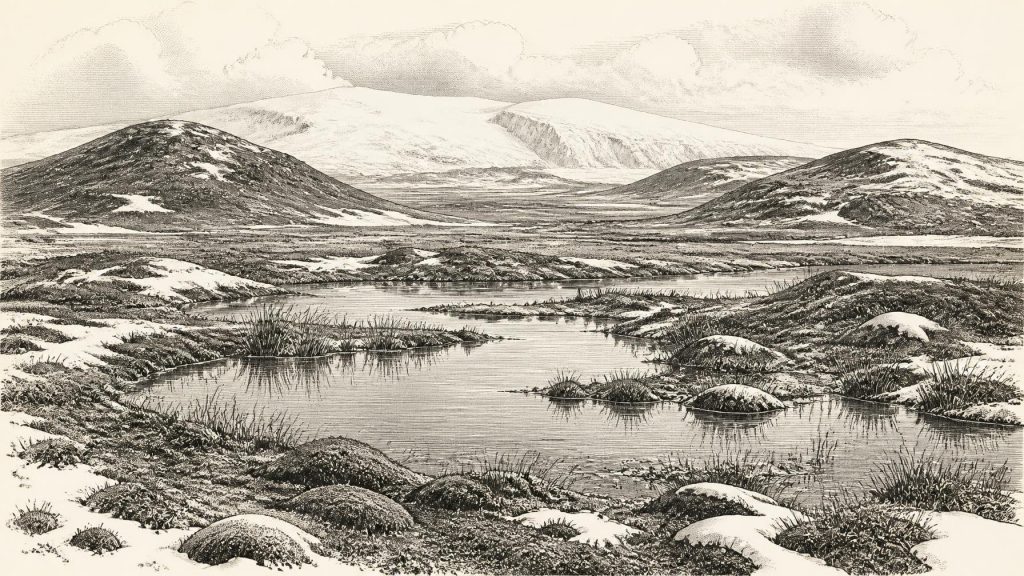
That order is firm evidence for environmental change at the locality. It demonstrates that, for a time during the Middle Midlandian, the Derryvree area was not under active glacier ice and supported a freshwater wetland. Mosses and sedges occur in the deposits, while the insect evidence is of cold northern character. The wider plant assemblage has been interpreted as largely treeless and tundra-like, with Arctic-alpine and wetland species able to survive beside shallow water, saturated ground and patches of exposed mineral soil. This was not modern Fermanagh, with its farmland, hedges, woods and settled lake shores. Nor was it necessarily a featureless snow desert.
The limitation is as important as the discovery. Derryvree records a particular low-lying setting near Maguiresbridge, rather than the entire island. It cannot prove that all of Ireland was ice-free at once, establish the exact position of every ice margin, or show that each animal known from southern caves lived in Fermanagh at the same moment. Later glaciation repeatedly eroded, buried and rearranged earlier deposits. The rarity of such surviving organic beds is why this modest-looking buried wetland has such large importance for Irish prehistory.
An Unstable Cold-Stage Island
MIS 3 was not a single unchanging “Ice Age” climate. Across north-west Europe it contained abrupt warmer and colder oscillations, and Ireland’s glacial history was correspondingly complex. At the time represented by Derryvree, conditions were severe by modern standards, but the major and better-established last glacial maximum lay later. Reconstructions of the British–Irish Ice Sheet show that its growth, maximum limits and retreat varied from one sector to another; no single date applies neatly to every Irish coast, upland and lowland.
The practical result for an observer in this broad period would have been a shifting mosaic. Some areas could have carried ice or lain close to an ice margin; elsewhere, seasonally thawed ground, rivers, pools and sedge-rich hollows existed within open vegetation. Frost action, sparse plant cover, wind and meltwater shaped exposed ground. A short growing season constrained plant life, while snow cover, frozen soils and seasonal flooding would have altered where grazing animals and predators could move. The sediment at Derryvree preserves wetland life because water and fine mud trapped and protected biological traces; it does not offer a panoramic map of the island.
Sea level was far lower than it is today because much of the world’s water was held in ice sheets. Continental shelves around Ireland and Britain were therefore more exposed, changing coastlines and the geography through which animals could disperse. Yet lower sea level does not by itself demonstrate a continuous, easy land route to every part of Ireland in this particular millennium. Ice margins, channels, rivers, marshes and changing shorelines mattered. The cautious conclusion is that Ireland was more closely connected ecologically to the surrounding north-west European world than its modern insular outline might suggest, but the exact routes and timing remain unresolved.
Castlepook’s Faunal Archive
Far to the south, Castlepook Cave near Doneraile in north County Cork supplies a different, complementary record. Known historically as Mammoth Cave, it yielded a large collection during antiquarian excavations, especially in the early twentieth century. Subsequent study and re-dating have shown that the cave preserves animal remains from a long span of the Late Pleistocene, including material from before the Last Glacial Maximum. Its fauna includes woolly mammoth, reindeer, giant deer, brown bear, wolf, Arctic fox, mountain hare, lemmings and spotted hyaena.
This is compelling evidence that Ireland formed part of a cold-stage mammal world much richer than the modern island. Reindeer, lemmings and Arctic fox point towards open, cold environments; mammoth, giant deer and hyaena evoke wider grass- and herb-rich landscapes capable of supporting large herbivores and their predators. Recent sedimentary ancient-DNA work at Castlepook has added further evidence for faunal connections between Ireland and Eurasia before the Last Glacial Maximum. Such evidence supports the broad interpretation of repeated animal movement into Ireland during favourable intervals.
It must not, however, be converted into a single imagined scene. Cave assemblages are time-averaged. Animals may have died naturally, been dragged in by carnivores, entered the cave themselves, or had bones moved by water, collapse, excavation and later handling. The animal list is not a census from one day in 30,725 BCE. Nor can Castlepook tell us that mammoths, hyaenas and reindeer all stood together on a particular Cork hillside. Its value is cumulative: the cave establishes the ecological possibilities of MIS 3 Ireland over long periods.
The Reindeer Femur Question
Castlepook also provides the most intriguing, but still limited, possible evidence for people in Ireland at this remote date. A fragment of reindeer femur has been identified as bearing a deep linear mark interpreted by zooarchaeologist Ruth Carden as damage made by a sharp stone tool while a fresh carcass was being processed. County Cork heritage material places the object broadly at about 31,000 BC, making it particularly relevant to the horizon considered here. If the mark is correctly identified as a human cut mark, it would indicate that people reached Ireland and handled a reindeer carcass during the Upper Palaeolithic.
The claim deserves careful emphasis rather than dismissal or exaggeration. A cut-marked bone may preserve an action: perhaps meat removal, hide-working, disarticulation or access to sinew and marrow. It cannot identify the people involved, their language, their route, their group size or how long they remained. The bone does not show that they killed the reindeer; it may have been scavenged or partly processed elsewhere. Nor does it establish a permanent Irish population. No securely associated lithic assemblage, hearth, dwelling floor, burial, human remains, art or enduring settlement of this age has been published from Ireland.
The cave’s complicated depositional history deepens the need for restraint. Its older collections were recovered before the recording standards of modern excavation, and cave deposits are particularly vulnerable to mixing by animals and natural processes. The bone’s scientific date concerns the animal, while the identification of the incision as a tool mark is a separate taphonomic judgement. Together they make Castlepook a vital lead, not a complete account of Palaeolithic settlement. Continued excavation of undisturbed deposits and full specialist publication are needed to test how secure the human interpretation is.
What Cannot Yet Be Written
There is no evidence for political affairs, diplomacy, warfare, chiefs, territorial states or collective institutions in Ireland around this time. There is likewise no basis for describing religion, language, law, kinship systems, artistic traditions or formal learning. No grave, shrine, monument, house or camp permits historians to reconstruct everyday social organisation. The absence of evidence is partly a result of preservation: later ice movement removed or concealed much of the older landscape. But it remains an absence, and should not be filled with a borrowed story from better-known Upper Palaeolithic societies elsewhere in Europe.
Economic life can be discussed only conditionally. If the Castlepook incision is human-made, it indicates knowledge of sharp stone-edged cutting and the practical use of a large animal carcass. It would be reasonable to infer a highly mobile subsistence strategy comparable in broad outline to hunter-gatherer adaptations elsewhere in Ice Age Europe, but not to assert a regular reindeer-hunting economy in Ireland. There is no direct Irish evidence at this date for trade, farming, herding, fishing settlements, pottery, metalworking or managed woodland. Even a brief human visit would have been shaped by animal movements, weather and the hazards of a changing cold landscape.
A Prehistory of Fragments
The year 30,725 BCE is therefore best understood as a point within a long environmental interval rather than a chapter in recorded national history. Derryvree offers the clearest local testimony: freshwater, wet ground, cold-adapted plants and insects existed between phases of glaciation in what is now County Fermanagh. Castlepook reveals a more expansive animal world in County Cork and a tantalising possible trace of carcass processing by people. Together they show an Ireland that was ecologically active, regionally varied and connected to wider Ice Age processes, yet still almost silent on human society.
That silence is not emptiness. It is a warning about scale. The surviving evidence can illuminate glaciers, wetlands, animal dispersal and perhaps one human act; it cannot credibly supply a named event for a numbered calendar year. In this period, Ireland’s history is written not in annals but in buried silt, fossil bone, cave sediment and the calibrated ranges through which archaeologists cautiously bring them into time.
Primary Sources
- A Middle Midlandian freshwater series at Derryvree, Maguiresbridge, County Fermanagh, Northern Ireland
- Early Midlandian–Middle Midlandian, Pleistocene, Northern Ireland
- The Irish Quaternary Fauna Project
- A Reconsideration of the Radiocarbon Dating of the Marine Isotope Stage 3 Fauna from Southern Ireland
- Growth and Retreat of the Last British–Irish Ice Sheet, 31,000 to 15,000 Years Ago: the BRITICE-CHRONO Reconstruction
- Growth and Retreat of the Last British–Irish Ice Sheet, 31,000 to 15,000 Years Ago: the BRITICE-CHRONO Reconstruction
- BRITICE-CHRONO Maps and GIS Data of the Last British-Irish Ice Sheet 31 to 15 ka
- Pattern and Timing of Retreat of the Last British-Irish Ice Sheet
- Oscillating Retreat of the Last British-Irish Ice Sheet on the Continental Shelf Offshore Galway Bay, Western Ireland
- Trimlines, Blockfields and the Vertical Extent of the Last Ice Sheet in Southern Ireland
- Freshwater Organic Deposits and Stratified Sediments Between Early and Late Midlandian (Devensian) Till Sheets, at Aghnadarragh, County Antrim, Northern Ireland
- The Geological Heritage of County Leitrim
- Heritage Artefacts of County Cork
- Archaeology Research Excavation Grant 2022: Final Report
- New Insights on the Fauna of Ireland's Younger Dryas and Early Holocene from Alice & Gwendoline Cave
- Sedimentary Ancient DNA Reveals Late Pleistocene Faunal Connectivity Between Ireland and Eurasia
- Reindeer Bone Found in Cork Cave Shows Human Activity in Ireland 33,000 Years Ago
- Ireland's Palaeolithic Archaeology – Fleeting Footprints in a Frozen Land
- What Was on the Menu in Prehistoric Ireland?
- The Late Quaternary History of East-Central Ireland


