
Derryvree’s Arctic Pool30726 BCE
Labelled 30,726 BCE, this period cannot be dated precisely and is best understood through environmental evidence from MIS 3. At Derryvree, County Fermanagh, freshwater organic deposits between glacial tills record an interval of cold, treeless tundra-like terrain, with shallow water, marsh plants, mosses and Arctic-adapted insects. The site shows that Ireland was not continuously ice-covered, although advancing glaciers and unstable climates transformed landscapes. Castlepook Cave fauna indicates that mammoths, reindeer, predators and other cold-climate mammals reached Ireland. A possibly tool-marked reindeer bone raises, but does not prove, early human visits. No evidence supports settlement, political or cultural events in Ireland.
Dateline
“30,726 BCE” is a modern filing label, not a recoverable year in Irish prehistory. No written record, seasonal calendar, settlement layer or dated historical event allows Ireland’s past to be resolved to a particular twelve-month period at this depth in time. Expressed on the conventional archaeological scale, the label falls roughly 32,700 calendar years before AD 1950, within the Late Pleistocene and Marine Isotope Stage 3 (MIS 3). That conversion must not be mistaken for precision: radiocarbon measurements require calibration, and at this age their results are ranges with substantial uncertainty.
The most responsible way to illuminate Ireland around this broad horizon is through a small number of environmental archives: glacial sediments, plant and insect remains, animal bones and the difficult record of caves. They show a country shaped above all by climatic instability and advancing ice, not one with recoverable rulers, peoples or events. Among the most revealing sites is Derryvree near Maguiresbridge in County Fermanagh, where an ancient freshwater deposit survived beneath later glacial material.
A Wetland Between Ice Sheets
In 1969 roadworks cut through a drumlin at Derryvree and exposed a remarkable sequence. Freshwater silts, fine sands and organic sediments lay between two distinct sheets of till: debris deposited by glacier ice. The lower till records an earlier glacial episode; the upper till shows that ice later returned across, or at least overwhelmed, the landscape. Between them lies evidence for an interval in which open water, wet ground, plants and insects could persist.
The organic deposit produced the radiocarbon determination BIRM-166, conventionally reported as 30,500 radiocarbon years BP, with an uncertainty of +1,170 and −1,030 years. A radiocarbon age is not the same thing as a calendar age. Calibration against internationally maintained curves converts the result into a broad probability distribution; published discussions place Derryvree generally within about 36,900–31,700 calibrated years BP. The modern label 30,726 BCE lies within the kind of timespan to which this deposit is relevant, but cannot be attached to a particular bed, pool, plant or episode at the site.
That limitation is crucial. Derryvree is not a complete portrait of Ireland, still less a diary of one community. It is a local archive, unusually valuable because later ice repeatedly eroded, rearranged or buried older ground surfaces across the island. Its significance is nevertheless considerable: it demonstrates that this part of Fermanagh was not continuously sealed beneath ice throughout the later Ice Age.
Open Country, Shallow Water
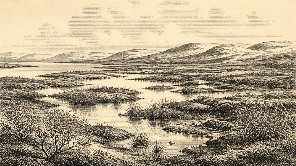
The Derryvree fossils point to a cold, largely treeless and periglacial environment. Pollen was poorly preserved, but it was predominantly from herbaceous plants. More informative plant macrofossils and mosses included sedges and cold-tolerant species associated with wet ground and tundra-like vegetation. Finds reported from the deposit include dwarf willow, mountain-avens, lesser clubmoss, bogbean and alternate water-milfoil. Together, these do not recreate an exact view, but they support a mosaic of shallow freshwater, marshy margins, mossy ground and sparsely vegetated open country rather than woodland.
Bogbean and water-milfoil are particularly telling. Both require freshwater habitats, while sedges and mosses imply saturated or damp soils around pools and sluggish water. Dwarf willow and mountain-avens are familiar from cold and exposed settings. The evidence therefore supports a landscape with local ecological variety: water and sheltered pockets could sustain more plant life than adjacent frost-affected ground. It does not support the image of a uniformly barren, wind-scoured wilderness.
Insect remains reinforce the cold-climate interpretation. Their northern and Arctic affinities indicate severe conditions, while the combination of aquatic and wetland organisms confirms that standing or slow-moving water was part of the local setting. The landscape was probably seasonal and exacting: frozen ground, short growing seasons and changing drainage would have governed where vegetation could establish. Yet the preserved organic matter is itself proof that productive microhabitats existed between episodes of glaciation.
Ireland Before the Maximum Ice
This was still an Ice Age, but not the Last Glacial Maximum. MIS 3 was marked across the North Atlantic by abrupt shifts between relatively milder interstadials and colder stadials. The British–Irish Ice Sheet did not grow everywhere at the same time or in the same manner. Modern reconstructions indicate that ice was building across Ireland and Britain from around 31,000 years ago, with maximum extent in different sectors reached later and asynchronously. At Derryvree, the sequence itself records that an ice-free or ice-retreated interval separated two phases of glacial deposition.
Consequently, it would be unsafe to say simply that Ireland was either “ice-covered” or “ice-free” in 30,726 BCE. Upland ice, regional glaciers, exposed lowlands, lakes, wetlands and marginal zones could coexist. What happened in southern Cork or the Irish Sea basin need not have matched Fermanagh. The island’s familiar modern coast was also absent. Global sea levels were lower, exposing parts of the surrounding shelf, but routes between Ireland, Britain and continental Europe were controlled by a shifting combination of sea, ice, rivers, relief and coastlines. A permanent, easy land bridge should not be assumed.
These changing connections mattered greatly to animals. They also matter to the human question, but they do not answer it. Environmental opportunity did not automatically create a viable route, and a viable route did not automatically create a permanent population.
Mammals and the Cave Record
Southern Irish caves, above all Castlepook Cave near Doneraile in County Cork, provide the complementary animal record. Their deposits have yielded remains attributed to woolly mammoth, reindeer, giant deer, brown bear, wolf, Arctic fox, mountain hare, lemmings and spotted hyaena. Revised radiocarbon programmes have shown that several older Irish cave dates were misleadingly young, placing important parts of the Castlepook fauna much earlier, within MIS 3.
This assemblage demonstrates that Ireland could at times support, or be reached by, mammals characteristic of cold open environments in north-west Europe. It should not be compressed into a single dramatic scene. Cave accumulations may combine animals from different centuries or millennia; bones can be dragged in by carnivores, moved by water, disturbed after deposition or recovered without modern standards of stratigraphic recording. The presence of hyaena, for example, makes carnivore activity a practical explanation for some bone concentrations, not merely an evocative detail.
The fauna and the Fermanagh wetland need not have been precisely contemporary. Rather, they belong to the same broad pre-maximum world of fluctuating climates, open habitats and changing access to Ireland. Derryvree offers the plants and water; Castlepook supplies a wider sense of the large mammals and predators that could move through suitable Irish landscapes.
The Unsettled Human Question
A reindeer femur from Castlepook has been reported as approximately 33,000 years old and as carrying a deep mark interpreted as damage made by a stone tool during butchery. If that interpretation is sustained, it would be momentous: evidence that people reached Ireland during the Upper Palaeolithic, far earlier than the previously accepted terminal-Pleistocene traces. Its relevance to this article lies in its broad age and environmental setting, not in a claim that people visited the cave in this exact calendar year.
The proper conclusion remains narrow. A radiocarbon date establishes the approximate age of the animal’s death, not the date of a mark by itself. Nor does one modified bone establish a camp, hearth, dwelling, tool-making site, burial, repeated occupation or resident population. Castlepook’s early excavations also leave problems of context that current fieldwork is attempting to address. Ireland around this horizon may have received brief visits by hunters moving through a wider European landscape; it cannot yet be said to have had a demonstrated settled human community.
What Cannot Be Recovered
There is no evidence from around 30,726 BCE for political authority, diplomacy, organised warfare, named groups, law or territorial boundaries in Ireland. There is likewise no direct evidence for religious observance, language, art, formal learning, exchange networks or trade. If people were present, a short-lived hunting visit is a possibility, but their social organisation, beliefs and origin cannot responsibly be reconstructed from the present record. Animal movement, carnivore behaviour and environmental change are much better evidenced than human lives.
The economy of the landscape was ecological rather than documentable in human terms. Sedges, mosses and aquatic plants grew where water and soils permitted; herbivores could exploit open vegetation; predators and scavengers followed them. Recurrent ice advance transformed this system, stripping surfaces, diverting drainage and entombing short-lived wetlands beneath till. The main development was not a political turning point but a profound regional transition towards fuller glaciation.
Derryvree’s buried freshwater series therefore gives this remote date its clearest Irish meaning. Around the modern label 30,726 BCE, the evidence supports a cold, open and locally watery Fermanagh landscape within an unstable Ice Age. It also imposes discipline: a small pool, a layer of silt, a moss fragment and an animal bone can reveal much about environment, but they cannot be made to tell a year-by-year human story that the surviving record does not contain.
Primary Sources
- A Middle Midlandian Freshwater Series at Derryvree, Maguiresbridge, County Fermanagh, Northern Ireland
- Early Midlandian–Middle Midlandian, Pleistocene, Northern Ireland
- Palaeoecology: Irish Quaternary Association Field Guide
- Figure 6: The Subdivision of the Quaternary Period in Ireland
- Irish Pleistocene Biostratigraphy
- Middle Midlandian Interstadial Deposits at Greenagho, Near Belcoo, County Fermanagh, Northern Ireland
- A Reconsideration of the Radiocarbon Dating of the Marine Isotope Stage 3 Fauna from Southern Ireland
- The Irish Quaternary Fauna Project
- Growth and Retreat of the Last British–Irish Ice Sheet, 31,000 to 15,000 Years Ago: the BRITICE-CHRONO Reconstruction
- The Late Quaternary History of East-Central Ireland
- The IntCal20 Northern Hemisphere Radiocarbon Age Calibration Curve (0–55 cal kBP)
- IntCal: Radiocarbon Calibration Curves
- 2022:564 – Castlepook Cave, Castlepook South, Cork
- Archaeological Heritage of County Cork
- Heritage Artefacts of County Cork
- New Insights on the Fauna of Ireland’s Younger Dryas and Early Holocene from Alice & Gwendoline Cave
- The Colonization of Ireland: A Human Ecology Perspective
- Salix herbacea
- Menyanthes trifoliata
- The Geological Heritage of County Leitrim
