

Derryvree’s Intertill Lake30698 BCE
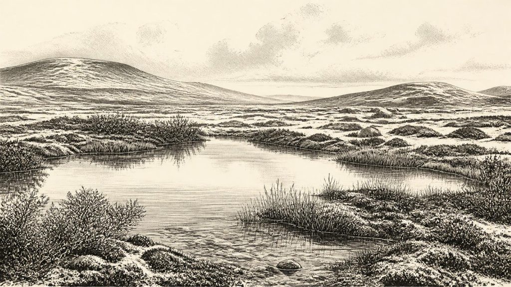
Approximately 32,650 years before present, Ireland lay within the unstable Late Pleistocene climate of Marine Isotope Stage 3, not a recoverable historical year. At Derryvree, County Fermanagh, freshwater sediments between glacial tills, dated broadly to 36,900–31,700 calibrated years BP, record an ice-free interval. Plant and insect remains indicate treeless, periglacial tundra with wetlands, pools and sparse Arctic-alpine vegetation. Other Fermanagh deposits confirm varied local conditions amid shifting ice. Castlepook Cave preserves evidence of diverse cold-climate fauna, though species did not necessarily coexist. No evidence establishes permanent human occupation; a possibly butchered reindeer bone only suggests brief human presence. Uncertainty remains.
Dateline
The label 30,698 BCE is useful for arranging a modern timeline, but it cannot denote a recoverable Irish ‘year’. It equates very approximately to 32,650 calendar years before present, where ‘present’ is conventionally AD 1950. No written record, calendar, settlement sequence or archaeological layer allows events in Ireland to be assigned to that precise point. The responsible account is therefore one of dated ranges and environmental evidence. This was the Late Pleistocene, broadly within Marine Isotope Stage 3 (MIS 3), a long, unstable phase of the last Ice Age in which cold conditions, changing sea levels and advancing ice repeatedly transformed the north-west European world.
Evidence Between the Tills
The most valuable Irish evidence relevant to this period comes from Derryvree near Maguiresbridge, County Fermanagh. Roadworks in 1969 cut through a drumlin and exposed a remarkable sequence: freshwater silts, fine sands and organic layers lay between two thick sheets of till, the unsorted sediment deposited directly by glacier ice. The order of the deposits is important. It proves that ice had affected this place, that an interval followed in which water, plants and organic mud accumulated, and that later glacial activity buried and preserved the basin.
Organic material from the Derryvree freshwater bed produced the radiocarbon determination BIRM-166, conventionally reported as 30,500 radiocarbon years BP with a substantial uncertainty. Published calibration has placed the deposit broadly between about 36,900 and 31,700 calibrated years BP. The modern label 30,698 BCE falls within that broad span, but that does not mean that the bed records conditions in that exact year. A sedimentary layer represents time passing, and calibration at this age yields ranges rather than annual dates. Derryvree is best understood as a closely relevant window onto an interval, not as an Ice-Age diary.
Other Fermanagh sites reinforce the warning against treating Ireland as either wholly ice-covered or wholly open at all times. Organic deposits at Greenagho near Belcoo, and at Hollymount near Maguiresbridge, point to non-glacial conditions in parts of north-central Ireland during earlier stretches of the Midlandian glaciation. Their dates and correlations have limitations, especially where old measurements approach the difficult end of radiocarbon dating, but together they demonstrate regional complexity. Ice margins moved; lakes and wetlands formed in suitable hollows; then renewed ice could erode, redeposit and conceal the evidence.
A Cold Freshwater Landscape
Derryvree’s plant and insect remains give the clearest picture of local everyday ecology. They indicate treeless, open tundra under periglacial conditions: a landscape shaped by severe cold, repeated freezing and thawing, saturated ground and short growing seasons near glacial environments. Periglacial does not mean permanently ice-covered. Rather, it describes ground beyond or between glaciers where frost action, seasonal meltwater and sparse vegetation were dominant.
The deposit contained freshwater mosses and sedges, alongside remains of plants associated with cold or Arctic-alpine settings, including mountain avens, dwarf willow and lesser clubmoss. Bogbean and water-milfoil indicate standing or slowly moving fresh water. Insect evidence supports a wet, plant-rich basin with open pools and mossy margins. Taken together, these are direct traces of organisms present in or close to the Derryvree waterbody. The wider reconstruction—a shallow wetland enclosed by exposed, low vegetation and frost-disturbed ground—is an interpretation, but a well-supported one.
This was not the wooded Ireland familiar from later prehistory, nor a featureless expanse of snow. The Fermanagh basin may have offered sheltered patches of water and vegetation within a severe regional climate. Such places were ecologically important: they concentrated plant growth, insects and fresh water. Yet the evidence does not justify a precise map of rivers, shorelines or weather for 30,698 BCE, much less a claim that every Irish region looked alike. The landscape of the south-west, uplands, Atlantic shelf and Irish Sea basin was subject to different local controls.
Ice, Sea and Regional Change
Ireland belonged to the developing British–Irish Ice Sheet system, but its growth was neither simple nor simultaneous. Recent large-scale reconstructions begin at about 31,000 years BP because earlier evidence is sparse and uncertain; they show an ice sheet growing in different sectors, rather than a single uniform advance across every part of the island. At roughly 32,650 years BP, therefore, it is unsafe to state that all Ireland lay beneath thick ice—or that all was open ground. Derryvree’s intertill sequence is compelling evidence for an ice-free freshwater interval in Fermanagh, while other evidence indicates that ice and ice-related processes were significant elsewhere or at other times.
Sea level was much lower globally than today because enormous volumes of water were stored in continental ice sheets. Nonetheless, the shape of coasts and the availability of routes across the Irish Sea cannot responsibly be reconstructed for one notional year. Glacial loading also altered local relative sea level, while advancing or retreating ice changed drainage patterns and redistributed vast quantities of sediment. Drumlin country, moraine ridges, sands and gravels visible in Ireland today are products of these much longer processes, not monuments created in a single season.
Fauna and Cave Archives
Southern Ireland offers another, different archive. Castlepook Cave near Doneraile in County Cork is Ireland’s richest known site for vertebrate fauna in the period leading towards the Last Glacial Maximum. More than 2,000 bones have been recovered from its chambers. The cave has yielded remains of woolly mammoth, giant deer, reindeer, brown bear and spotted hyaena, as well as, in later Ice-Age deposits, Arctic fox, wolf and lemmings.
These animals should not be assembled into a single illustrated scene for 30,698 BCE. Cave deposits accumulated over long spans, were disturbed by water and carnivore activity, and contain remains of different ages. Improved radiocarbon pretreatment has shown that some older Irish cave dates underestimated the true ages of specimens, strengthening the case for a substantial MIS 3 fauna while also demonstrating why each bone needs individual scrutiny. Castlepook establishes that Ireland was, at intervals, part of a wider cold-climate ecological zone capable of supporting or receiving large herbivores and predators. It does not supply a census, a season-by-season food chain, or proof that every listed species lived together.
The Human Question
No securely excavated camp, hearth, house floor, stone-tool workshop, burial or repeated occupation surface in Ireland can be dated to this period. Consequently, there is no responsible basis for describing a resident community’s political organisation, warfare, diplomacy, religion, learning, trade or artistic tradition. There are no chiefs, tribes or cult places to name. Nor can the absence of excavated settlements prove that no person ever reached Ireland: later ice movement, rising seas, erosion and the uneven history of investigation have all reduced what might survive.
A reindeer femur from Castlepook has attracted particular attention because an incision on it has been interpreted as a cut made by a sharp stone tool during butchery, and the bone has been publicly associated with an age of roughly 33,000 years ago. If that interpretation is sustained, it would suggest a brief Upper Palaeolithic human encounter with a reindeer carcass in Ireland during the broad period under discussion. It would still not demonstrate a permanent population, a settlement at Castlepook, or a route by which people arrived. The bone derives from an old cave collection rather than a modern, stratified occupation excavation, so its historical implications must remain deliberately limited.
At most, the evidence permits a cautious picture of opportunity rather than a settled society. Any short-term visitors capable of reaching Ireland might have sought meat, marrow, hide, sinew, antler or bone from large animals, as hunter-gatherers elsewhere in Upper Palaeolithic Europe did. But that comparison is external context, not proof of an Irish economy. There is no evidence here for cultivation, herding, pottery, exchange networks or durable built settlement.
An Island of Intervals
Ireland around 30,698 BCE is illuminated not by an event but by the survival of fragile traces beneath later ice: a freshwater basin at Derryvree, plant remains and insects in its silts, cave fauna at Castlepook, and the changing geometry of a growing ice sheet. The central historical fact is uncertainty with boundaries. Parts of the island could sustain wetland and tundra life during intervals of local ice-free ground; large mammals ranged through the wider landscape at different times; human presence remains possible but unproven as a continuous occupation. This is an Ireland repeatedly remade by frost, water, animals and ice, long before the evidence can support an Irish history of named people or annual events.
Primary Sources
- A Middle Midlandian Freshwater Series at Derryvree, Maguiresbridge, County Fermanagh, Northern Ireland
- Early Midlandian–Middle Midlandian, Pleistocene, Northern Ireland
- Middle Midlandian Interstadial Deposits at Greenagho, Near Belcoo, County Fermanagh, Northern Ireland
- The Irish Quaternary Fauna Project
- A Reconsideration of the Radiocarbon Dating of the Marine Isotope Stage 3 Fauna from Southern Ireland
- Castlepook Cave: County Geological Site Report
- Growth and Retreat of the Last British–Irish Ice Sheet, 31,000 to 15,000 Years Ago: The BRITICE-CHRONO Reconstruction
- Growth and Retreat of the Last British–Irish Ice Sheet, 31,000 to 15,000 Years Ago: The BRITICE-CHRONO Reconstruction
- The Timing and Magnitude of the British–Irish Ice Sheet Between Marine Isotope Stages 5d and 2
- Exploring Controls of the Early and Stepped Deglaciation on the Western Margin of the British–Irish Ice Sheet
- Trimlines, Blockfields and the Vertical Extent of the Last Ice Sheet in Southern Ireland
- Episodic Speleothem Deposition Tracks the Terrestrial Impact of Millennial-Scale Last Glacial Climate Variability in SW Ireland
- A Stratigraphic Framework for Abrupt Climatic Changes During the Last Glacial Period Based on Three Synchronized Greenland Ice-Core Records
- The IntCal20 Northern Hemisphere Radiocarbon Age Calibration Curve (0–55 cal kBP)
- IntCal Publications
- Prehistoric Details: Mell Flint Flake
- Guide to the National Museum of Ireland – Natural History
- Ice Age Ireland: Cool Fossils!
- Selaginella selaginoides
- Saxifraga rosacea
- Palaeoecology: Irish Quaternary Association Field Guide No. 16
- Castlepook, Co. Cork, 2022
- New Insights on the Fauna of Ireland’s Younger Dryas





