Derryvree’s Alpine Pond30624 BCE
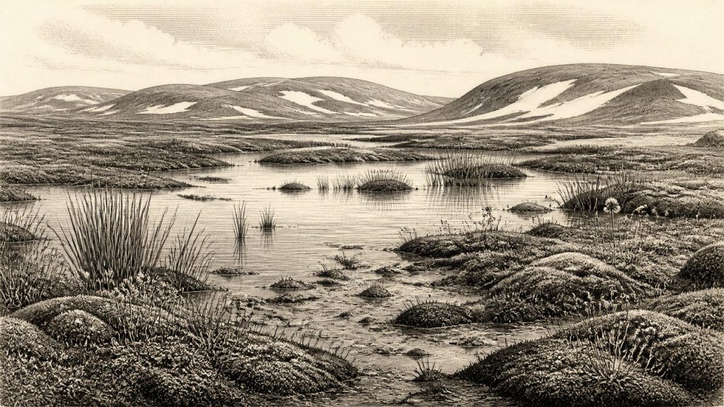
30,624 BCE is not a datable Irish event but falls broadly within Marine Isotope Stage 3. At Derryvree, County Fermanagh, organic freshwater sediments between glacial tills indicate an ice-free interval around 31,700–36,900 calibrated years ago. Fossils reveal cold, treeless tundra-muskeg wetlands with Arctic-alpine plants, insects and seasonal productivity, before later ice advanced. Southern Irish caves preserve time-averaged remains of reindeer, mammoth, giant deer, predators and other cold-adapted fauna, showing intermittent ecological connectivity with north-west Europe. A possible early human cut mark remains uncertain; no secure habitation evidence exists. The record documents changing Pleistocene environments, not precise events, societies or politics.
Dateline
30,624 BCE is a modern calendar label, not a date at which the archaeological record can identify an Irish event. No written sources, settlements, named people or annually resolved deposits survive from this depth of time. Calendar-year precision is therefore unavailable. The responsible approach is to place the label within broad, calibrated chronological ranges and ask what physical evidence can illuminate Ireland during that interval. In doing so, the year belongs to the later part of the Pleistocene, within Marine Isotope Stage 3: a long, unstable cold phase before the greatest expansion of the last Irish Ice Sheet.
A Date Within a Wide Window
The key Irish evidence is the Derryvree freshwater deposit near Maguiresbridge in County Fermanagh. In 1969, a road cutting through a drumlin revealed organic silts and fine sands lying between two thick sheets of glacial till. The deposit was thus sealed between episodes of ice advance. Its conventional radiocarbon determination, BIRM-166, was 30,500 radiocarbon years before present, with a large error range. Later scholarship has treated its calibrated age as broadly about 31.7–36.9 thousand calibrated years before present. The modern label 30,624 BCE falls within that wide interval, but cannot be matched to a particular layer, season or moment in the Derryvree sequence.
That distinction matters. Radiocarbon dating does not turn the silt into a historical chronicle, and the calibration curve at this age has substantial uncertainty. The deposit demonstrates conditions that existed during a span of centuries or millennia; it does not prove what occurred on one numbered year. Nor should the Derryvree evidence be stretched into a reconstruction of the whole island at once. It is a local window, exceptionally valuable because few Irish deposits of this antiquity preserve organic material, but still one window among landscapes repeatedly reshaped by ice.
Fresh Water Beneath Future Ice
The Derryvree sediments record a time when this part of Fermanagh was ice-free enough for fresh water, fine sediment and plant remains to accumulate. Later glacier ice overrode the site and helped form the drumlin through which the modern road was cut. The simple stratigraphic fact is powerful: a wetland or shallow-water environment existed between two glacial episodes. Ireland was not locked continuously beneath a single, unchanging ice cover throughout the last cold stage. Ice margins advanced, retreated or thinned; periglacial ground and wetlands developed in intervals between them.
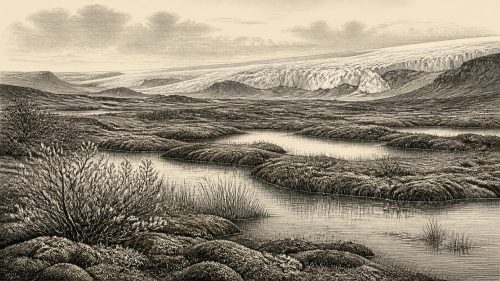
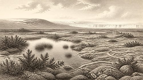
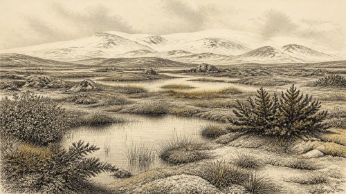
Researchers describe the Derryvree setting as open tundra and muskeg: waterlogged ground with pools, moss-rich vegetation and abundant organic matter, set within a cold, treeless terrain. Fossil plants and insects point towards conditions unlike modern lowland Ireland. They indicate a landscape of short growing seasons, hard winters and ground affected by freezing and thawing. Open water did not imply warmth. In a severe climate, shallow pools, saturated margins and slow-flowing channels could nonetheless sustain specialised plants and invertebrates during the brief productive season.
This was not the later blanket bog landscape familiar from Ireland’s uplands and Atlantic fringes. Peatlands of the modern type developed much later, under very different post-glacial climates and vegetation. “Muskeg” is a useful comparison for the wet, mossy, cold-ground mosaic suggested by the fossils, but it should not be mistaken for an exact modern analogue. The evidence supports a diverse local wetland within an open polar or sub-polar environment, not a detailed map of every hill, coast and valley.
Plants at the Edge of Survival
Derryvree’s importance rests partly on its palaeobotany. The plant assemblage includes Arctic-alpine elements, among them fringed sandwort (Arenaria ciliata), whose modern Irish distribution is restricted and strikingly disjunct. Mosses, sedges and other small herbaceous plants, rather than woodland trees, dominated the record. Such finds show that Ireland could support a low, open vegetation cover during an ice-free interval. They do not demonstrate continuous survival of every modern Irish Arctic-alpine population from this precise time; that is a separate biogeographical question requiring genetic as well as fossil evidence.
The vegetation had practical consequences for the food web. Mosses and sedges retained water at pond margins; herbaceous tundra plants could feed grazing mammals when snow cover withdrew; insects occupied the pools and damp ground. Yet productivity was seasonal and vulnerable. A shift in temperature, summer moisture or snow persistence could alter the landscape swiftly. Greenland ice-core records and Irish cave mineral deposits independently show that the North Atlantic climate of Marine Isotope Stage 3 was highly variable, with relatively milder interstadials punctuating colder stadials. Derryvree belongs to this restless environmental history, rather than to a stable ‘Ice Age’ backdrop.
An Island Before the Maximum Ice
The evidence does not mean that all Ireland was mild or uniformly habitable. At this time the island’s glacial geography was changing, and the extent of ice remains reconstructed from scattered terrestrial deposits, offshore landforms and dating programmes. Derryvree provides evidence for an ice-free Fermanagh locality before the Last Glacial Maximum. Modelling and wider geological synthesis indicate that the British-Irish Ice Sheet expanded strongly afterwards, reaching major offshore limits between roughly 28,000 and 26,500 years ago in the north-western sector. Much of the record from before that advance was later eroded, buried or redeposited.
The Ireland of this broad period was also not necessarily an island in the modern geographical sense. Lower global sea levels exposed extensive continental shelves and altered the outlines of the Irish Sea and Atlantic coasts. Nevertheless, exposed ground, ice barriers, rivers, marine channels and changing shorelines made movement across north-west Europe contingent rather than automatic. For animals, and potentially for people, Ireland was a western edge of a larger glacial-world ecology. Its accessibility and attractiveness changed with climate, sea level and ice-sheet configuration.
Animals and the Cave Record
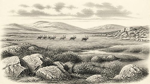
Caves in southern Ireland supply another, different kind of evidence. Castlepook Cave, near Doneraile in County Cork, has yielded remains of reindeer, giant deer, woolly mammoth, spotted hyaena, brown bear, Arctic fox, wolf and small cold-adapted mammals. Improved radiocarbon pretreatment has shown that several Irish cave bones once thought to be younger are in fact substantially older, placing important parts of this fauna in Marine Isotope Stage 3. The revised record establishes that large mammals and formidable carnivores used at least parts of Ireland during pre-maximum glacial intervals.
It would be wrong, however, to assemble those bones into a single herd seen on one day, or to suppose that every listed species occupied every Irish region simultaneously. Cave assemblages commonly result from carnivore activity, water movement, deaths at different times and antiquarian excavation. They are time-averaged deposits. Even so, reindeer and other cold-environment species make ecological sense alongside Derryvree’s open tundra wetland. The combined records suggest a varied, largely treeless country in which grazing, scavenging and predation could occur across exposed ground, wetland margins and limestone cave landscapes.
The Human Question
The possibility of people in Ireland at such an early date must be expressed more cautiously still. A reindeer femur from Castlepook has been publicised as bearing a mark interpreted as a stone-tool cut made during carcass processing, and it has been associated broadly with an age of about 33,000 years. If that interpretation is confirmed, it would be extraordinary evidence that Upper Palaeolithic people reached Ireland far earlier than the island’s securely documented terminal-Pleistocene human trace. It would suggest a brief encounter with an animal carcass, not a town, tribe, migration route or enduring population.
There is presently no securely excavated Irish habitation surface of this age with hearths, stone-tool assemblages, structures, human remains and tightly associated food refuse. Castlepook’s old cave collections have complicated formation histories, while direct dating establishes the age of a bone rather than automatically the date or agent of every surface modification. The better-established later evidence is a cut-marked brown-bear kneecap from Alice and Gwendoline Cave, County Clare, dated to about 12,810–12,590 calibrated years before present. That later discovery should not be used to fill the far earlier Derryvree interval with imagined communities.
No Polities, No Proven Trade
Consequently, political affairs, diplomacy, warfare, formal religion, artistic traditions, learning and trade cannot responsibly be narrated for Ireland in 30,624 BCE. There are no Irish monuments, graves, artworks, houses, exchange goods or inscriptions from this precise horizon. Nor can social organisation or everyday human life be recovered from the Derryvree plants and silts. These are absences in the evidence, not proof that people were absent everywhere, but they set firm limits on historical storytelling.
What can be said is more modest and, in its way, more revealing. Around this broad chronological horizon, an ice-free patch of Fermanagh supported cold-climate freshwater life and open tundra vegetation before later ice sealed the evidence beneath till. Elsewhere, Pleistocene fauna demonstrates that Ireland could sustain or receive mammals associated with the wider north-west European cold-steppe world. This landscape was the deep environmental precondition for all later Irish history: a changing terrain in which ice, water, plants and animals repeatedly determined where life could persist.
Primary Sources
- A Middle Midlandian Freshwater Series at Derryvree, Maguiresbridge, County Fermanagh, Northern Ireland
- A reconsideration of the radiocarbon dating of the Marine Isotope Stage 3 fauna from southern Ireland
- Exploring controls of the early and stepped deglaciation on the western margin of the British-Irish Ice Sheet
- The IntCal20 Northern Hemisphere Radiocarbon Age Calibration Curve (0–55 cal kBP)
- IntCal Publications
- A stratigraphic framework for abrupt climatic changes during the Last Glacial period based on three synchronized Greenland ice-core records
- Episodic speleothem deposition tracks the terrestrial impact of millennial-scale last glacial climate variability in SW Ireland
- Growth and retreat of the last British–Irish Ice Sheet, 31,000 to 15,000 years ago: the BRITICE-CHRONO reconstruction
- Pattern and timing of retreat of the last British-Irish Ice Sheet
- Trimlines, blockfields and the vertical extent of the last ice sheet in southern Ireland
- The deglaciation of the western sector of the Irish Ice Sheet from the inner continental shelf to its terrestrial margin
- The Quaternary of the Irish Midlands
- The Subdivision of the Quaternary Period in Ireland
- Quaternary
- Conserving Quaternary geoheritage in Northern Ireland
- Landscapes and Environments of the Last Glacial-Interglacial Transition: A Time of Amazingly Rapid Change in Ireland
- First evidence of a Late Upper Palaeolithic human presence in Ireland
- New insights on the fauna of Ireland’s Younger Dryas and Early Holocene from Alice & Gwendoline Cave
- Heritage Artefacts of County Cork
- On the Cave of Castlepook, Near Doneraile, Co. Cork
- The Irish Quaternary Fauna Project
- Irish Quaternary Association: Outreach and Education Resources