BIRM-166’s Calibrated Window30502 BCE
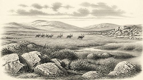
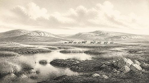
Around 30,502 BCE, Ireland was in the Late Pleistocene, not a period of recorded history. Derryvree, County Fermanagh, provides key evidence: freshwater sediments, dated broadly to this interval, formed between glacier advances. Their plants and insects indicate cold, treeless tundra with shallow water, mosses, sedges and dwarf shrubs. Castlepook Cave, County Cork, preserves Ice-Age animal remains, including mammoth, reindeer, giant deer, predators and cold-adapted species, though not as a single community. No secure evidence proves human occupation at this date; possible earlier visits remain uncertain. Environmental change, shifting ice, low sea levels and intermittent habitats define this sparse prehistoric landscape.

Dateline
The label 30,502 BCE cannot identify an eventful Irish “year” in the historical sense. No written record, annual chronology, named community or securely dateable settlement survives from so remote a time. It is a modern calendar conversion applied to a much longer and less exact archaeological interval. The most responsible account is therefore one of changing ice, water, plants and animals, grounded chiefly in rare deposits that happen to have endured later glaciation. Around this notional date, Ireland lay in the Late Pleistocene, within the traditionally named Middle Midlandian and the broader Marine Isotope Stage 3.
Dating an Ice-Age Interval
Modern calendar-year precision is unavailable. The closest particularly informative Irish deposit is at Derryvree, near Maguiresbridge in County Fermanagh. Organic material from its freshwater sediments produced the radiocarbon determination BIRM-166: 30,500 radiocarbon years before present, with a substantial published uncertainty of +1,170 and −1,030 years. In radiocarbon terminology, “present” means AD 1950, not the present day. Atmospheric radiocarbon has fluctuated through time, so such measurements cannot simply be subtracted from 1950 to yield a calendar year.
Using modern calibration curves, the Derryvree determination corresponds broadly to a range of roughly 36,900–31,700 calibrated years before present, or approximately 34,950–29,750 BCE. The date 30,502 BCE falls within that wide window. It does not date an individual season, a particular human generation, or every fossil in the deposit. Rather, it makes Derryvree the best local environmental witness for an interval that overlaps this nominal year. Its value lies in stratigraphy: the order of layers is clearer than the exact duration represented by each layer.
A Freshwater Bed Beneath the Drumlin
Roadworks in 1969 cut through a drumlin in Derryvree townland, about two kilometres north-east of Maguiresbridge. Drumlins are streamlined hills shaped beneath moving ice. The exposed section contained a lower till, then freshwater silts and fine sands rich in organic remains, followed by another thick till. Till is the unsorted debris deposited directly by glacier ice. The sequence records three broad stages: ice crossed the locality; conditions then allowed a freshwater basin and wet ground to develop; and ice later advanced or re-advanced over the site, burying its record.
This is powerful but local evidence. It proves that the Derryvree area was not continuously sealed beneath active ice while the freshwater sediment accumulated. It does not prove that all Ireland was ice-free at once, nor does it offer a complete map of coasts, uplands and routes across the island. Later glacier movement both preserved the organic bed beneath till and destroyed or rearranged much comparable evidence elsewhere. The surviving glimpse is therefore unusually valuable precisely because it is incomplete.
Cold Water and Open Ground
Derryvree was not a wooded precursor of the later Irish countryside. Its plant and insect evidence indicates open tundra vegetation and a periglacial climate: a landscape strongly governed by frost, prolonged winter and short growing seasons, but with summer thaw sufficient for standing or slowly moving water. Pollen was dominated by herbaceous plants, though preservation was poor. Macrofossils—identifiable seeds, leaves and moss remains—supply firmer local evidence for hardy vegetation around the water.
The recorded flora includes mosses and sedges, together with bogbean, dwarf willow, mountain avens and alternate water-milfoil. Bogbean and water-milfoil testify especially clearly to freshwater habitats; mountain avens and dwarf willow evoke low, cold-adapted plant cover on better-drained ground. These species should not be assembled into a picturesque modern-style bog. The evidence instead suggests a patchwork of shallow water, saturated margins, exposed mineral soil, low herbs and dwarf shrubs. Such a mosaic could be biologically active in summer while remaining treeless, windswept and severe for much of the year.
This environmental evidence is also a corrective to the idea of an entirely lifeless glacial Ireland. Liquid water, aquatic plants, mosses and insects required functioning habitats. Yet productivity was constrained. There is no basis for estimating local population densities of animals, the length of the thaw season, or the precise temperature of 30,502 BCE. The responsible conclusion is modest: part of south Fermanagh contained a cold, open freshwater landscape during an interval between ice incursions.
The Castlepook Animal World
Caves in the south add a different, less tightly localised kind of evidence. Castlepook Cave, also called Mammoth Cave, near Doneraile in County Cork, is Ireland’s richest known repository of late Ice-Age vertebrate remains. Its collections include woolly mammoth, reindeer, giant deer, brown bear, wolf, Arctic fox, lemmings and spotted hyaena. Direct radiocarbon dating of selected bones shows that the cave received animal remains across a long span, from roughly 45,700 to 19,950 radiocarbon years ago. Several specimens consequently fall within the broad Middle Midlandian world relevant to this date.
The fauna demonstrates that, at differing times, suitable Irish landscapes could be reached by large grazing mammals and their predators or scavengers. Reindeer and mammoth imply open feeding country; lemmings and Arctic fox are consistent with cold conditions; wolves and spotted hyaenas reveal a food web unlike anything in later Ireland. The National Museum of Ireland’s Castlepook hyaena material preserves a tangible reminder that this was not merely a land of ice and plants, but an intermittently inhabited animal landscape.
There are strict limits on the picture, however. Castlepook is a cave repository, not a sealed campsite or a single undisturbed animal community. Bones could have been brought in by carnivores, water or other processes, and much was recovered in early twentieth-century excavations. Improved laboratory treatment has shown that some older radiocarbon results required revision, in places by thousands of years. It would be wrong to place every recorded species together at Derryvree, or to claim that a particular herd crossed Cork in this exact calendar year.
People: Possibility and Proof
No securely dated house, hearth, burial, tool-making floor, artwork or settlement establishes a human community in Ireland at 30,502 BCE. Farming, domestic livestock, pottery, metalworking, monuments and permanent villages belong to vastly later periods. Nor is there evidence for a named people, language, political authority, alliance, territorial boundary, religious rite or organised trade network. For this point in the Ice Age, silence in these categories is itself historically important: Ireland has not yet yielded the material record from which such claims can responsibly be made.
A reported cut-marked reindeer bone from Castlepook has been publicised as possible evidence that people visited Ireland around 33,000 years ago. If its interpretation and dating continue to stand, it would indicate a brief Upper Palaeolithic human episode earlier than the long-recognised terminal Pleistocene evidence from County Clare. It would not demonstrate continuous occupation, a settlement at Castlepook, or a population present at 30,502 BCE. At most, the cave fauna and the wider north-west European Upper Palaeolithic make occasional human access conceivable during favourable intervals. That remains an interpretation awaiting the fuller, securely contextualised archaeological record that would turn possibility into a detailed social history.
Society Without a Social Archive
For that reason, everyday life can only be discussed negatively. There is no Irish evidence from this date for households, kin groups, cooking practices, clothing, exchange goods or teaching traditions. If people entered Ireland, comparison with contemporary hunter-gatherers elsewhere in north-west Europe suggests that they would have travelled in small, mobile groups and relied on close knowledge of weather, animal movement, stone and shelter. But that is an analogy, not a discovery at Derryvree or Castlepook. It cannot justify invented camps, hunting parties or ceremonies.
Likewise, there were no political affairs or diplomacy that archaeology can identify. The meaningful regional change was environmental: ice margins shifted, drainage changed, sea level stood far below that of today and habitats expanded or contracted. Lower sea levels altered the geography of the Irish Sea basin and may at times have made movement between Ireland, Britain and continental Europe less difficult than in later millennia. The exact available route at any particular moment, however, cannot be recovered from the Derryvree bed alone.
Approaching the Last Glacial Maximum
This date preceded the fullest expansion of the Last Glacial Maximum, conventionally placed later, broadly between about 26,500 and 19,000 years ago. Recent reconstructions of the British–Irish Ice Sheet show that ice build-up and retreat were complex, regionally variable processes rather than a single island-wide advance. Derryvree belongs to an unstable threshold: it preserves a local interval of water and tundra life before later ice transformed the district again.
The central development in Ireland around 30,502 BCE was therefore not a datable human deed but the persistence of a fragile ice-age environment. Beneath the future drumlin of south Fermanagh, freshwater supported cold-adapted plants and small animals. Elsewhere, at intervals across the island, large mammals moved through open landscapes whose contours and connections have since been altered by glacier erosion and rising seas. That is a sparse history, but not an empty one: it is the deep environmental foundation from which Ireland’s much later human past eventually emerged.
Primary Sources
- A Middle Midlandian Freshwater Series at Derryvree, Maguiresbridge, County Fermanagh, Northern Ireland
- Palaeoecology
- Exploring Controls of the Early and Stepped Deglaciation on the Western Margin of the British-Irish Ice Sheet
- Growth and Retreat of the Last British-Irish Ice Sheet, 31,000 to 15,000 Years Ago: the BRITICE-CHRONO Reconstruction
- The Timing and Magnitude of the British-Irish Ice Sheet Between Marine Isotope Stages 5d and 2
- The Irish Quaternary Fauna Project
- A Reconsideration of the Radiocarbon Dating of the Marine Isotope Stage 3 Fauna from Southern Ireland
- Castlepook Cave
- Spotted Hyena Skull
- First Evidence of a Late Upper Palaeolithic Human Presence in Ireland
- New Insights on the Fauna of Ireland’s Younger Dryas and Early Holocene from Alice & Gwendoline Cave
- Phylogeographic, Ancient DNA, Fossil and Morphometric Analyses Reveal Ancient and Modern Introductions of a Large Mammal: the Complex Case of Red Deer (Cervus elaphus) in Ireland
- Radiocarbon Dates from the Oxford AMS System: Archaeometry Datelist 31
- The IntCal20 Northern Hemisphere Radiocarbon Age Calibration Curve (0–55 cal kBP)
- IntCal Publications
- Menyanthes trifoliata
- Salix herbacea
- Dryas octopetala
- Myriophyllum alterniflorum
- Heritage Artefacts of County Cork