

Derryvree Macrofossil Mosaic30481 BCE
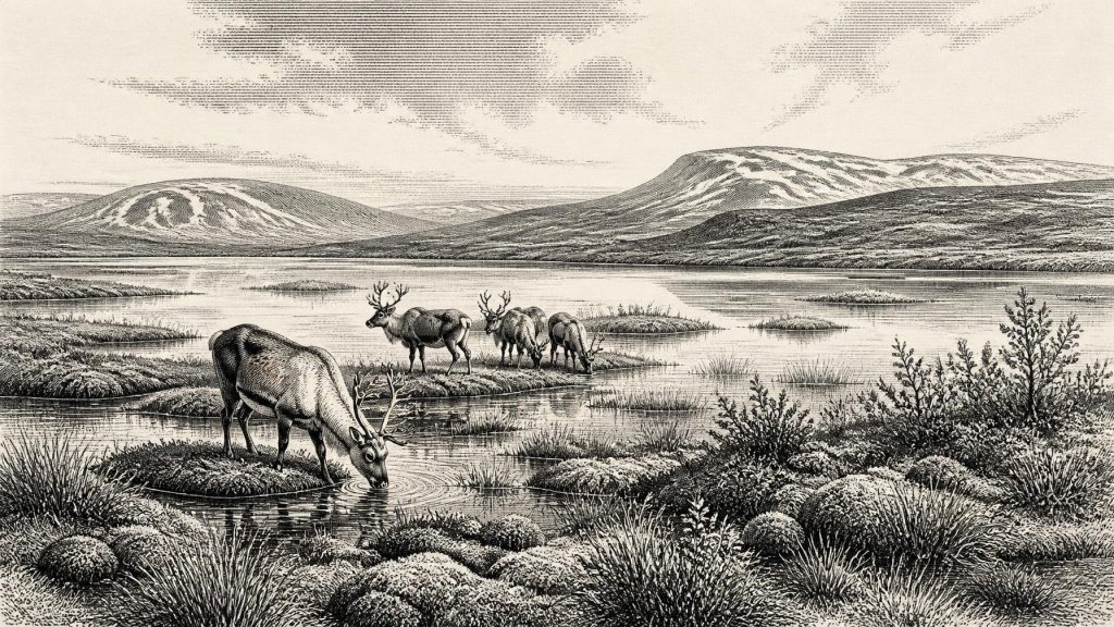
30,481 BCE is a modern label within a broad Late Pleistocene window, not a recoverable Irish calendar year. At Derryvree, County Fermanagh, freshwater silts between glacial tills preserve plants, mosses and insects dated broadly to 36,900–31,700 calibrated BP. They reveal cold, treeless, open periglacial terrain, with pools, wet margins and tundra-like vegetation, before renewed ice advance. Fauna from Castlepook Cave indicates mammals such as reindeer, mammoth and predators, though remains derive from different periods. A cut-marked reindeer bone may indicate fleeting human activity, but sustained settlement is unproven. No political, social or cultural history survives; environmental uncertainty defines this era.
Dateline
30,481 BCE is a modern chronological label, not a year that can be recovered from the Irish archaeological record. No Irish person recorded an event, season, ruler or journey at this point in the Late Pleistocene, and neither radiocarbon dating nor glacial deposits can provide calendar-year precision so far back. The most responsible approach is therefore to place the date within a broad scientific window. In the conventional system in which “before present” is counted from 1950, it falls roughly 32,430 calendar years ago: within Marine Isotope Stage 3, a long and climatically unstable part of the last Ice Age, and before the Last Glacial Maximum.
A Date Within a Wide Window
The best Irish environmental evidence relevant to this horizon comes not from a settlement but from Derryvree townland, near Maguiresbridge in County Fermanagh. Roadworks in 1969 cut through a drumlin and exposed an extraordinary sequence: a lower glacial till, freshwater silts and fine sands containing organic material, and then an upper till. Till is the unsorted sediment deposited by glacier ice. The sequence demonstrates a local order of events: ice had crossed the site; an interval followed in which fresh water, plants and animals occupied the basin; then a later advance of ice buried and preserved the deposit.
Organic material from Derryvree produced a conventional radiocarbon age of 30,500 years BP, with a large uncertainty of +1,170 and −1,030 years. A radiocarbon age is not identical to a calendar age, because atmospheric carbon-14 levels have changed through time. Modern calibration curves accordingly convert this result only into a broad calendar range, commonly expressed for the Derryvree horizon as about 36,900–31,700 calibrated years BP, or approximately 34,950–29,750 BCE. The requested year sits towards the later part of that wide span, but it cannot be attached to a particular layer, animal, pool or human action. Derryvree illuminates an interval, not a dated day.
Fresh Water Between Glacial Advances
The Derryvree deposits are especially valuable because later ice sheets erased, mixed or buried much of Ireland’s older landscape record. Here, however, a shallow freshwater environment survived beneath the drumlin. Pollen was poorly preserved, but plant macrofossils, mosses and insect remains were sufficiently informative to show that south Fermanagh was neither a familiar wooded Ireland nor a featureless white wilderness. It was a cold, open and periglacial landscape: one shaped by severe frost and short growing seasons, but with wet ground, pools and vegetation around water.
The fossil assemblage includes sedges and grasses, aquatic or wet-margin plants such as bogbean and water-milfoil, and species associated with cold northern or arctic-alpine conditions, including mountain-avens, dwarf willow and lesser clubmoss. Mosses were an important component of the local ground cover. Together they indicate a mosaic rather than one uniform habitat: shallow water and saturated margins in the basin, with sparse herb-rich tundra or steppe-tundra vegetation on better-drained ground. The evidence is local. It does not prove that every valley, coast or upland in Ireland looked the same, but it firmly rules out a simple picture of the entire island being permanently entombed beneath ice throughout the cold stage.
Summer melting must have supplied open water and allowed plants to flower, set seed and sustain invertebrate life. Yet the vegetation also indicates exposure, low temperatures and a limited growing season. Trees did not form woodland at Derryvree. A few grains of tree pollen are not sufficient evidence for nearby forest; such pollen may have travelled long distances or derived from reworked sediments. Ireland at this point should therefore be envisaged as largely treeless in the areas represented by the record, with low vegetation close to the ground and a landscape highly sensitive to shifts in temperature, snowfall and glacier margins.
Animals in an Open Country
Other Irish sites supply a wider, though chronologically mixed, view of the animals capable of reaching the island during the Middle Midlandian cold stage. Castlepook Cave near Doneraile in north County Cork is central. Old excavations there produced remains attributed to woolly mammoth, reindeer, giant deer, brown bear, wolf, Arctic fox, mountain hare, lemmings and spotted hyaena. Direct radiocarbon dating undertaken through the Irish Quaternary Fauna Project showed that the cave collection contains material from markedly different times. It is not a single living community frozen in one moment.
That qualification matters. A mammoth bone, a hyaena bone and a reindeer bone from Castlepook do not demonstrate that all these species stood together outside the cave in 30,481 BCE. Caves often accumulated bones over long periods; carnivores dragged in carcass parts, water moved sediment, and early excavations did not document contexts to modern standards. Even so, the Irish fauna shows that large herbivores, predators and scavengers could occupy or pass through cold-stage landscapes. Reindeer, in particular, suit the image of open ground and seasonal movement. Carnivores also remind us that caves were animal refuges and dens, not automatically human shelters.
The Question of Human Presence
Castlepook also raises the most tantalising question about Ireland at this depth of time. A reindeer femur in the National Museum of Ireland’s Natural History collections bears a deep incision interpreted by zooarchaeologist Ruth Carden as a mark made with a sharp stone tool during carcass processing. County Cork heritage material associates the bone broadly with c. 31,000 BC. If that interpretation is sustained, it is potentially evidence that people handled a reindeer in Ireland during the Upper Palaeolithic, far earlier than the securely dated terminal-Pleistocene butchered bear bone from Alice and Gwendoline Cave in County Clare.
It would nevertheless be unsafe to turn one marked bone into a settled Ice Age population. The Castlepook femur comes from an old cave assemblage rather than a newly excavated, sealed occupation floor. No securely associated stone-tool assemblage, hearth, dwelling, burial, human skeleton, artwork or repeatedly used camp surface has been identified for this period in Ireland. The date of the animal’s death cannot establish the precise time at which the mark was made, nor whether the animal was killed, butchered or merely encountered near the cave. The strongest conclusion is deliberately narrow: the bone may preserve a brief human interaction with a reindeer, while the wider evidence for sustained occupation remains absent.
A short visit by mobile hunter-gatherers is a reasonable interpretation, not a demonstrated event. Groups elsewhere in north-west Europe had sophisticated knowledge of game, stone-working techniques and social networks, but Irish evidence cannot simply borrow their camps, identities or customs. There is no basis for naming a people, language, ethnicity or archaeological culture in Ireland at 30,481 BCE. Nor can an isolated possible butchery mark prove ancestry between any visitors of this era and later inhabitants of the island.
Society Beyond the Evidence
For this reason, political history is silent. There are no rulers, territories, alliances, diplomatic contacts or wars that can responsibly be assigned to Ireland at this date. Likewise, no evidence documents religion, formal learning, artistic traditions, exchange goods, farming, domestic animals or trade. The absence of such evidence does not mean that any possible visitors lacked beliefs, social relationships or ecological knowledge; it means that Ireland has not preserved material capable of reconstructing them.
Everyday life can be described only conditionally. If people reached the island, they would have faced cold, exposed country with highly seasonal resources, potentially following animal movements and using portable equipment rather than permanent buildings. But this is an inference from the environment and from Upper Palaeolithic behaviour elsewhere, not an excavated Irish household. There is no evidence for a village, a cemetery, a ritual place or a settled economy. The word “Ireland” itself is a geographical convenience: there was no Irish polity, nation or cultural community in any later sense.
An Island in a Changing North-West
Lower global sea levels altered coastlines across north-west Europe, exposing land now submerged beneath the Atlantic and Irish Sea. Yet lowered seas did not necessarily create an easy, permanent land bridge between Ireland and Britain. Ice, changing relative sea level, deep marine basins and shifting coastlines complicate every route. The presence of Pleistocene mammals proves that animals reached Ireland at various times; it does not reveal precisely how a particular herd, predator or possible human party crossed on this date.
The larger regional development was the growth and reorganisation of the British–Irish Ice Sheet. Reconstructions agree that the major Last Glacial Maximum came later, with its maximum extent broadly after this horizon, but the extent of earlier ice cover around 32,000 years ago remains debated and regionally varied. Derryvree is important precisely because it records an ice-free freshwater episode at one place before renewed glaciation sealed it. Its buried plants, mosses and insects are therefore not a footnote to human history: they are the principal witnesses to what Ireland could be like in this otherwise almost unrecorded age.
30,481 BCE was not a known Irish year of politics or memorable events. It belongs instead to a precarious environmental interval, revealed by a Fermanagh wetland beneath later ice and complemented by the difficult evidence of Cork cave fauna. The record supports a vivid but bounded conclusion: parts of Ireland contained cold open habitats, fresh water and mobile animals; people may have made fleeting visits; and virtually everything else remains beyond recovery. That uncertainty is not a failure of history. It is the most important fact this deep past has left behind.
Primary Sources
- A Middle Midlandian Freshwater Series at Derryvree, Maguiresbridge, County Fermanagh, Northern Ireland
- Palaeoecology: Irish Quaternary Association Field Guide
- The Irish Quaternary Fauna Project
- Pleistocene Glaciations in Ireland
- Radiocarbon Constraints on the Age of the Maximum Advance of the British–Irish Ice Sheet in the Celtic Sea
- Dimensions and Chronology of the Last Ice Sheet in Western Ireland
- Growth and Retreat of the Last British–Irish Ice Sheet, 31,000 to 15,000 Years Ago: the BRITICE-CHRONO Reconstruction
- The Timing and Magnitude of the British–Irish Ice Sheet Between Marine Isotope Stages 5d and 2
- The Deglaciation of the Western Sector of the Irish Ice Sheet From the Inner Continental Shelf to its Terrestrial Margin
- Timing and Pace of Ice-Sheet Withdrawal Across the Marine–Terrestrial Transition West of Ireland During the Last Glaciation
- Timing, Pace and Controls on Ice Sheet Retreat: An Introduction to the BRITICE-CHRONO Transect Reconstructions of the British–Irish Ice Sheet
- The IntCal20 Northern Hemisphere Radiocarbon Age Calibration Curve (0–55 cal kBP)
- First Evidence of a Late Upper Palaeolithic Human Presence in Ireland
- New Insights on the Fauna of Ireland's Younger Dryas and Early Holocene From Alice & Gwendoline Cave
- Heritage Artefacts of County Cork
- Archaeology Research Excavation Grant 2022: Final Report
- Quaternary
- Geology of Ireland
- Outreach and Education Resources
- BRITICE-CHRONO Maps and GIS Data of the Last British-Irish Ice Sheet 31 to 15 ka








