BIRM-166’s Frozen Wetland30482 BCE
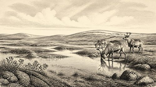
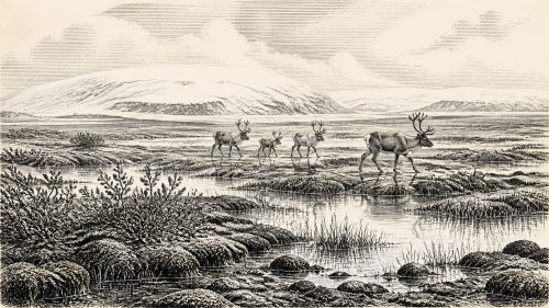
30,482 BCE cannot be assigned a precise Irish event, but falls within the calibrated age range of the BIRM-166 organic deposit at Derryvree, County Fermanagh. Sealed between glacial layers, this freshwater sediment records an interval between ice advances during Marine Isotope Stage 3. Mosses, aquatic plants, sedges and cold-adapted tundra flora indicate treeless, periglacial wetland rather than continuous ice cover. Southern Irish caves preserve remains of mammoth, reindeer and other Pleistocene animals, although their chronology and contexts are uncertain. Possible human butchery evidence remains unconfirmed. The record supports only a local, environmentally unstable Ice Age landscape, later reshaped by glaciers.
Dateline
Modern calendar-year precision is not available for Ireland in 30,482 BCE. No written record, settlement sequence or annually dated event can identify what happened in that particular year. The responsible approach is to place the notional date within wider calibrated chronologies and to ask what surviving deposits can reveal. In this case, the most informative evidence is a buried freshwater deposit at Derryvree, near Maguiresbridge in County Fermanagh: its broad calibrated range of roughly 36,900–31,700 years before present spans 30,482 BCE. It offers a rare, local glimpse of Irish conditions during Marine Isotope Stage 3, long before the later maximum of the Last Glacial Maximum.
A Date Within a Range
The number 30,482 BCE should therefore not be read as a date on which a named event occurred. It is a modern conversion of a point deep in prehistory, and the scientific evidence comes with margins of error, differing dating methods and complex depositional histories. The key Derryvree measurement, BIRM-166, was obtained from organic material in moss-rich mud and gave a conventional radiocarbon age of 30,500 years before present, with a substantial uncertainty. Calibration against changing atmospheric radiocarbon levels places the deposit in a much broader calendar-age interval. The target year falls within that interval, but neither begins nor ends it.
This distinction matters because radiocarbon dating dates the death of organic material, not a national historical episode. Sediment can also accumulate over time, while later water, frost and glacial activity may disturb it. Derryvree is valuable not because it supplies an exact anniversary, but because its position between two layers of glacial till preserves a clear environmental sequence: ice had occupied the locality; freshwater and organic sediment then accumulated; subsequently, ice or glacial meltwater again deposited sands and till over the site. It is evidence for changing local conditions, not a complete map of Ireland on one day.
Water Beneath a Drumlin
Road works in 1969 cut through a drumlin in the townland of Derryvree, about two kilometres north-east of Maguiresbridge. Within the section lay fine sands, silts and organic layers sealed between glacial deposits. The find was remarkable because much of Ireland’s older Pleistocene surface has been eroded, overridden or buried by later ice. Here, a small basin had kept a record of water, plants and invertebrates through an interval otherwise scarcely represented in the Irish landscape.
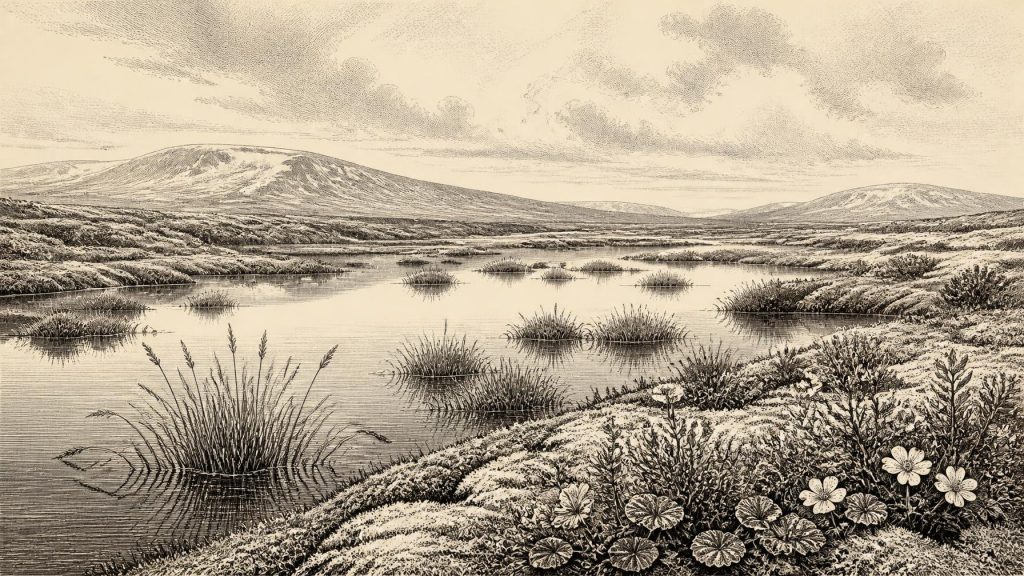
The fossils indicate that this was not a forested country. Poorly preserved pollen was dominated by herbaceous plants, while macrofossils, mosses and associated remains pointed to open tundra and wet ground under periglacial conditions. Periglacial does not mean that the site was beneath glacier ice. Rather, it describes a cold environment strongly affected by frost, long winters, seasonal thaw and proximity to glacial systems. Sparse plants could grow on exposed ground, but trees did not form dense woodland around the basin.
The most evocative evidence comes from the plants themselves. Mountain avens, dwarf willow, lesser clubmoss and alpine sandwort belong to a cold-adapted, low-growing flora. Bogbean and water-milfoil, alongside sedges and freshwater mosses, show that shallow freshwater and waterlogged margins persisted locally. This was not simply a white, lifeless wasteland. It was a mosaic: open mineral ground, mossy wetland, sedgy edges, small pools and low vegetation capable of exploiting the brief growing season. The individual fossils establish the presence of particular plants or suitable habitats near Derryvree; the wider image of a tundra wetland is an archaeological and palaeoecological interpretation built from their combination.
Cold Ireland Before the Maximum
Around the broad interval represented by Derryvree, Ireland was in the later part of the last glacial cycle, but not yet at the global Last Glacial Maximum. That maximum is conventionally placed about 26,500–19,000 years ago, when the Irish Ice Sheet formed part of the much larger British–Irish Ice Sheet. Later ice sculpted many of the landforms now familiar across the island and extended far onto the surrounding continental shelf. The Derryvree sequence demonstrates that this story was not one of uninterrupted ice cover everywhere at every moment. At least in south Fermanagh, freshwater conditions developed between glacial episodes.
That does not justify imagining all of Ireland as equally ice-free, equally wet or equally habitable. Uplands, coasts, valleys and lowlands responded differently to changing snowfall, temperature, sea level, wind and ice movement. The dated organic bed records one northern locality. Its significance lies in showing that a biologically active environment existed during a severe cold phase, and that glacial advances and retreats were episodic. Irish landscapes were being repeatedly remade, with ice, meltwater and frost changing drainage and burying earlier surfaces.
The surrounding seas were also unlike those of the present. Global sea levels were lower during glacial conditions, exposing more continental shelf in some areas. Yet it would be rash to turn that fact into a simple land-bridge narrative for Ireland at this date. The routes by which animals, and potentially people, reached the island remain debated and varied through time. Faunal evidence proves that large mammals occurred in Ireland during parts of the Middle and Late Pleistocene; it does not by itself reveal whether every crossing was made over continuous dry land, seasonal ice, short water gaps or combinations of changing routes.
Animals and an Uncertain Human Presence
Cave deposits in southern Ireland provide a second, very different body of evidence. Castlepook Cave, also called Mammoth Cave, near Doneraile in County Cork has yielded remains attributed to mammoth, reindeer, giant deer, spotted hyaena, wolf, fox, Arctic fox, bear and lemmings. Modern redating has shown that some older Irish cave chronologies require caution: improved pretreatment of bone collagen can produce dates thousands of years older than results obtained in the 1990s. Even so, the revised work confirms the importance of southern Irish caves for understanding animal communities during Marine Isotope Stage 3.
These cave bones should not be treated as a neatly excavated herd list for 30,482 BCE. Many were recovered during early twentieth-century excavations, often from disturbed deposits and without the fine stratigraphic controls expected today. Carnivores may have carried carcass parts into caves; bones of different ages can occur in the same collection; and a species found in County Cork need not have occupied Fermanagh at the same time. The secure conclusion is more modest: during this wider cold-stage interval, Ireland supported, or was intermittently visited by, substantial Pleistocene fauna adapted to open and often severe environments.
Human activity is still more uncertain. A reindeer femur from Castlepook has been interpreted as bearing a cut mark made by a stone tool and has been presented as possible evidence for Upper Palaeolithic butchery around 31,000 BCE. If that interpretation and its chronological association are sustained, it would indicate that people reached Ireland far earlier than the long-accepted Late Glacial evidence. But no securely associated stone-tool assemblage, hearth, dwelling floor or burial has yet been recovered from this period in Ireland. A single modified bone, from an old cave collection, cannot demonstrate a permanent population or describe a community’s seasonal movements.
No Politics in the Evidence
For this reason, there is no responsible basis for describing Irish political affairs, diplomacy, rulers, warfare, tribes or territorial boundaries in 30,482 BCE. Nor is there evidence for formal religious institutions, monuments, writing, schools, trade networks or named cultural traditions on the island at this point. These are not missing chapters waiting to be filled with plausible stories; they are subjects beyond the resolution of the surviving Irish record.
Everyday life can be addressed only conditionally. If small groups of Upper Palaeolithic hunter-gatherers visited Ireland during favourable intervals, they would have depended on mobile knowledge of terrain, animals, weather and seasonal resources, and would probably have left little visible trace in a landscape repeatedly altered by ice. That is an inference from the wider archaeology of north-west Europe, not direct proof of an Irish camp at Derryvree or Castlepook in this year. The firm evidence concerns wetland plants, cold-climate habitats, glacial change and animal remains.
A Fragile Environmental Archive
Derryvree’s importance is thus disproportionate to its size. Beneath a later drumlin, a thin buried deposit records an interval when freshwater, mosses and tundra plants existed between phases of ice occupation. It corrects any assumption that Ice Age Ireland was always wholly frozen or ecologically empty. At the same time, it disciplines the imagination: the deposit is local, its chronology broad, and its evidence environmental rather than historical.
For 30,482 BCE, the most accurate picture is not of a kingdom, a battle or a known settlement, but of a cold and unstable island margin. In south Fermanagh, somewhere within the broad span into which this date falls, shallow water and wet ground supported hardy vegetation under a treeless sky. Elsewhere, large mammals moved through landscapes whose connections to Britain and continental Europe changed with climate and sea level. Later glaciers would cover, scour and reshape much of that world. The chance survival of BIRM-166 is what allows it to be seen at all.
Primary Sources
- Palaeoecology
- The Subdivision of the Quaternary Period in Ireland
- Trimlines, Blockfields and the Vertical Extent of the Last Ice Sheet in Southern Ireland
- Growth and Retreat of the Last British–Irish Ice Sheet, 31,000 to 15,000 Years Ago: The BRITICE-CHRONO Reconstruction
- Maximum Extent and Readvance Dynamics of the Irish Sea Ice Stream and Irish Sea Glacier Since the Last Glacial Maximum
- Deglaciation Chronology of the Donegal Ice Centre, North-West Ireland
- Last Glacial Maximum Cirque Glaciation in Ireland and Implications for Reconstructions of the Irish Ice Sheet
- Episodic Speleothem Deposition Tracks the Terrestrial Impact of Millennial-Scale Climate Change During the Last Glacial Period
- The Tolsta Interstadial, Scotland: Correlation with D–O Cycles GI-8 to GI-5?
- A Reconsideration of the Radiocarbon Dating of the Marine Isotope Stage 3 Fauna from Southern Ireland
- The Irish Quaternary Fauna Project
- Pleistocene Vertebrates in the British Isles
- First Evidence of a Late Upper Palaeolithic Human Presence in Ireland
- New Insights on the Fauna of Ireland's Younger Dryas and Early Holocene from Alice & Gwendoline Cave
- New Insights on the Fauna of Ireland's Younger Dryas and Early Holocene from Alice & Gwendoline Cave
- Heritage Artefacts of County Cork
- Archaeology Research Excavation Grant 2022
- Archaeology Research Excavation Grant Report 2023
- Menyanthes trifoliata L. in Fermanagh
- Myriophyllum alterniflorum DC. in Fermanagh
- Dryas octopetala L. in Fermanagh
- Mammoth Cave