

Elephant Hall’s Moving Fauna30463 BCE
30,463 BCE is a modern label rather than a recoverable Irish date, within the climatically unstable later Marine Isotope Stage 3. Growing ice sheets, lower seas and changing coastlines shaped a variable landscape before the Last Glacial Maximum. Derryvree, County Fermanagh, preserves freshwater sediments between tills, indicating locally sheltered, treeless tundra wetland with cold-adapted plants and insects. Castlepook Cave, County Cork, records mammoths, reindeer, hyaenas and fauna connected to wider Eurasia, though not as a single contemporary community. A possibly cut-marked reindeer bone suggests unconfirmed human activity. No evidence establishes settlement, society or events; traces reveal environmental change and uncertainty.
Dateline
“30,463 BCE” is a modern chronological label, not a recoverable Irish year. No community in Ireland left a calendar, written record or dated sequence of events that can be assigned to it. By simple conversion, the label falls about 32,412 calendar years before AD 1950, but that arithmetic should not be mistaken for archaeological precision. Evidence for this stretch of the Late Pleistocene is dated in broad calibrated ranges, often with uncertainties of centuries or millennia, and deposits from different sites need not be exactly contemporary.
The appropriate setting is the later part of Marine Isotope Stage 3 (MIS 3), an unstable interval of the last glacial cycle before the Last Glacial Maximum. Ireland’s landscape, coastlines, ice cover and animal populations changed repeatedly over long timescales. A responsible account of this point in time is therefore not a story of a ruler, battle or settlement, but an account of what traces in caves, sediments and ice-shaped landforms can—and cannot—say about an island at the north-western edge of Ice Age Europe.
A Date Within a Moving Climate
MIS 3 was neither a single uniform “Ice Age” landscape nor a simple prelude to the maximum cold. Greenland ice cores record abrupt swings between colder stadials and comparatively milder interstadials. Those shifts affected temperature, precipitation, vegetation and glaciers around the North Atlantic, but the exact local response in Ireland remains difficult to reconstruct. Later glaciers eroded, rearranged and buried much of the older evidence. Consequently, there is no secure map showing precisely which parts of Ireland were ice-covered in 30,463 BCE, nor a dependable estimate of seasonal weather for every region.
What can be said is that this date preceded the full Last Glacial Maximum, conventionally placed roughly between 26,000 and 19,000 years ago. Reconstructions of the British–Irish Ice Sheet increasingly show major growth during the later MIS 3 interval, with ice expansion becoming significant around 31,000 years ago and reaching much wider limits thereafter. That does not establish that all of Ireland was simultaneously engulfed in ice at the notional date. It does establish an era in which habitable ground, water, animal movement and access routes could be sharply constrained by an expanding and highly dynamic ice-sheet system.
Sea level was substantially lower than today, exposing parts of the continental shelf and changing the outline of the Irish Sea world. Lower seas could reduce distances between Ireland, Britain and the European mainland, while glaciers, rivers, permafrost and shifting shorelines created new barriers of their own. The evidence supports intermittent ecological connections between Irish fauna and wider Eurasian populations; it does not permit a confident reconstruction of one particular route used in one particular year.
Derryvree’s Earlier Wetland
The most revealing environmental record relevant to this broad period comes from Derryvree near Maguiresbridge in County Fermanagh. Roadworks in 1969 exposed an unusual sequence inside a drumlin: a freshwater deposit of fine sands, silts and organic material lay between two thick tills, sediments deposited by glacier ice. Its order is important. Ice had occupied the locality; an ice-free or at least non-glacial interval then allowed freshwater and vegetation to develop; later ice sealed the deposit beneath another till.
The organic horizon, known by its laboratory number BIRM-166, produced a conventional radiocarbon determination of 30,500 years BP, with a large uncertainty. Radiocarbon years are not calendar years: because atmospheric carbon-14 has varied, they require calibration. The resulting calendar range is broad and lies chiefly earlier than the notional 30,463 BCE label. Derryvree is therefore not proof that a particular pond, plant or animal existed in Fermanagh in that exact numbered year. Rather, it is a rare Irish window onto the kind of cold-stage environment that had existed in the preceding millennia and into the rapid environmental reversals that frame this date.
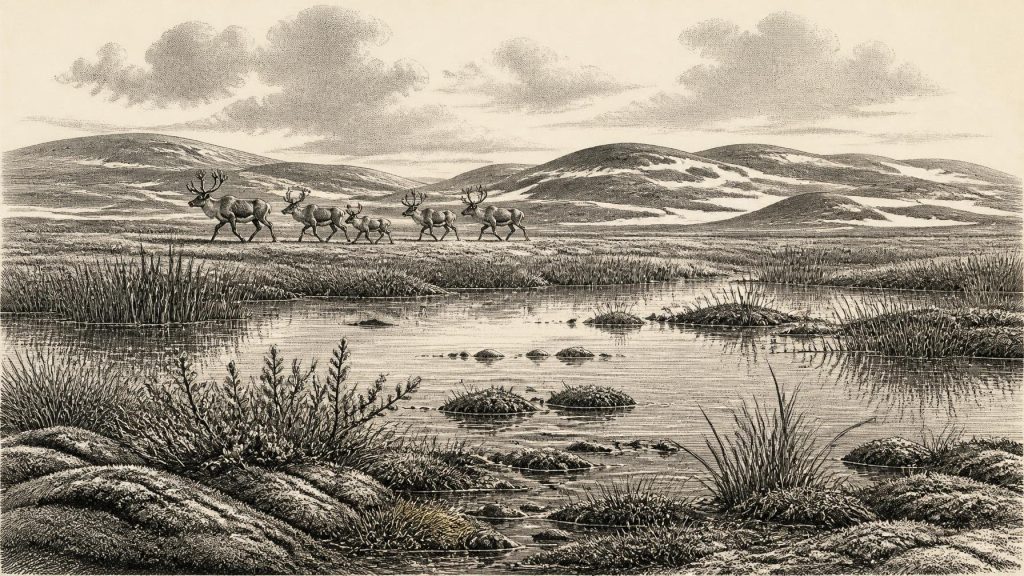
Its fossils indicate open, treeless tundra or muskeg-like wetland under periglacial conditions. Mosses, sedges and herbaceous pollen point to damp ground rather than forest. Plant macrofossils, including bogbean, water-milfoil, dwarf willow, mountain-avens and lesser clubmoss, show that shallow or slow-moving freshwater and vegetated margins could persist locally. Insect remains add to the picture of cold, wet ground with open pools. This was not a productive woodland landscape and should not be romanticised as a summer pasture; it was a severe environment in which shelter, thawed water and short growing seasons would have mattered profoundly.
Derryvree also guards against a misleading image of a uniformly frozen, lifeless Ireland. Freshwater sediments and their biological remains demonstrate ecological patchiness. A basin protected from direct ice could contain water, moss and plants even while frost processes dominated the wider terrain. Yet one buried Fermanagh wetland cannot stand for the whole island. Southern limestone caves, northern drumlin country, upland areas and the then-exposed shelf each had different local histories.
The Cave Record in Cork
For large animals, Castlepook Cave near Doneraile in north County Cork is the key Irish site. Its chambers include Elephant Hall, Hyaena Hall and the Gallery of the Aged Carnivores. Antiquarian excavations recovered an enormous and complicated bone assemblage, and later research has revisited museum collections, surviving deposits and their dates. The cave preserves evidence for a striking Late Pleistocene fauna: woolly mammoth, reindeer, giant deer, brown bear, wolf, hare, Arctic fox, lemmings and spotted hyaena.
These finds demonstrate that Ireland was at times part of a wider north-west European faunal world, not a permanently isolated biological backwater. Recent sedimentary ancient-DNA work at Castlepook has reinforced that conclusion by detecting multiple animal taxa and identifying genetic links between Irish mammoths, hyaenas and broader Eurasian populations. But a species list is not a census of one season. Bones entered cave passages through different processes and at different dates; carnivores, natural deaths, water movement, excavation disturbance and collecting practices all complicate the record. Mammoth, reindeer and hyaena should not automatically be pictured together beside one Irish pool in 30,463 BCE.
Improved radiocarbon pretreatment has been especially important. Re-dating has shown that several older measurements from southern Irish caves were too young, pushing parts of the Castlepook fauna further back into MIS 3. That revision illustrates both the value and the limits of the archive. The cave confirms repeated animal presence across a long pre-Last Glacial Maximum span, but it cannot yield a continuous chronology of a stable local ecosystem. At the specified date, the sound conclusion is that cold-adapted and open-country mammals had reached Ireland during this wider period, while the exact composition of the island’s fauna at that moment remains unknown.
The Human Question
Castlepook also raises the most consequential question of all: were people in Ireland? A reindeer femur from the cave’s historic collections has been reported to carry a deep mark interpreted as damage from a stone tool during butchery. Public discussion has linked the bone to an age of about 33,000 radiocarbon years. If the surface modification is confirmed as a fresh-bone tool cut and is securely associated with the bone’s age, it would be exceptionally early evidence that humans handled an animal in Ireland.
That possibility deserves attention, but not inflation. A radiocarbon determination dates the animal’s death, not necessarily the instant a mark was made. The specimen was recovered from an old, complex cave archive rather than a modernly excavated occupation floor. There is no securely associated hearth, stone-tool assemblage, house, burial, art panel or human skeleton of this age in Ireland. The mark is evidence under assessment, not a basis for declaring a settled population, a named culture or a permanent hunting territory.
For 30,463 BCE, therefore, neither politics nor diplomacy can responsibly be reconstructed. There is no evidence for chiefs, territories, alliances, warfare or institutions. There is likewise no basis for identifying religion, ceremonial practice, language, teaching, trade networks or an Irish material culture. If occasional hunter-gatherers did cross into Ireland during MIS 3, their economy may have involved the opportunistic pursuit or processing of large game, as in other parts of Upper Palaeolithic Europe; in Ireland itself, that remains an inference rather than demonstrated everyday life.
Settlement Without a Settlement Record
The absence of identified camps does not prove that no person ever entered the island. Sparse traces are expected in a landscape repeatedly overridden by ice, altered by sea-level change and investigated unevenly. Caves preserve bones better than exposed ground, while the areas most likely to have been used as open-air stopping places may have been scoured, drowned or buried. Nevertheless, an argument from loss cannot become evidence of occupation. The archaeological position remains one of possibility, not population.
Nor was Ireland a country in any later historical sense. There were no farms, fields, ports or trading settlements. Any human presence, if it existed, would have been small-scale, mobile and contingent upon weather, prey, fuel, water and passages through a changing landscape. Animals, rather than people, provide the firmer evidence of movement. Reindeer and other grazing mammals imply open habitats; predators and scavengers imply food webs sufficiently varied to sustain them; freshwater plants show that some sheltered places supported life despite severe cold.
A Landscape of Evidence and Uncertainty
The significance of 30,463 BCE lies in that tension. Ireland was not blank: sediments at Derryvree preserve the remains of a cold wetland, while Castlepook holds evidence of an unexpectedly diverse Ice Age fauna and perhaps a fleeting human intervention. Yet these archives are fragments separated by distance, depositional history and time. They illuminate environmental conditions and animal connectivity more securely than they illuminate human society.
The most historically honest image is thus not of an event, but of a threshold. Ireland stood within a fluctuating North Atlantic world as ice grew, coastlines changed and ecological opportunities narrowed or opened. The record can show water between tills, animals in cave deposits and an unresolved cut on a reindeer bone. It cannot supply a dateable Irish story for this individual year. Its value lies precisely in revealing how deep prehistory must be written: with calibrated ranges, careful distinctions and respect for what the evidence has not preserved.
Primary Sources
- Middle Midlandian Freshwater Series at Derryvree, Maguiresbridge, County Fermanagh, Northern Ireland
- MIDDLE MIDLANDIAN FRESHWATER SERIES AT DERRYVREE, MAGUIRESBRIDGE, COUNTY FERMANAGH, NORTHERN IRELAND
- Palaeoecology: The Middle Midlandian Palaeoenvironment of South Fermanagh
- The Irish Quaternary Fauna Project
- A reconsideration of the radiocarbon dating of the Marine Isotope Stage 3 fauna from southern Ireland
- A reconsideration of the radiocarbon dating of the Marine Isotope Stage 3 fauna from southern Ireland
- Sedimentary ancient DNA reveals Late Pleistocene faunal connectivity between Ireland and Eurasia
- New insights on the fauna of Ireland's Younger Dryas and Early Holocene from Alice & Gwendoline Cave
- New insights on the fauna of Ireland’s Younger Dryas and Early Holocene from Alice & Gwendoline Cave
- Heritage Artefacts of County Cork
- Ireland's Palaeolithic Archaeology – Fleeting Footprints in a Frozen Land
- Pleistocene glaciations in Ireland
- Growth and retreat of the last British–Irish Ice Sheet, 31,000 to 15,000 years ago: the BRITICE-CHRONO reconstruction
- Pattern, style and timing of British–Irish Ice Sheet advance and retreat over the last 45,000 years: evidence from NW Scotland and the adjacent continental shelf
- Pattern, style and timing of British–Irish Ice Sheet advance and retreat over the last 45,000 years: evidence from NW Scotland and the adjacent continental shelf
- Maximum extent and readvance dynamics of the Irish Sea Ice Stream and Irish Sea Glacier since the Last Glacial Maximum
- Character of advance and retreat of the southwest sector of the British-Irish Ice Sheet during the last glaciation
- Timing and pace of ice-sheet withdrawal across the marine–terrestrial transition west of Ireland during the last glaciation
- A stratigraphic framework for abrupt climatic changes during the Last Glacial period based on three synchronized Greenland ice-core records
- The IntCal20 Northern Hemisphere Radiocarbon Age Calibration Curve (0–55 cal kBP)
- Quaternary Science Reviews 339 (2024) 108827
- The Irish Quaternary Fauna Project





