BIRM-166’s Plant Record30441 BCE
About 30,441 BCE, Ireland lay within fluctuating cold conditions of Marine Isotope Stage 3, not a documented historical year. At Derryvree, County Fermanagh, freshwater silts between glacial tills, dated by Birm-166, preserve evidence of an ice-free interval before renewed glaciation. Plants, pollen and insects indicate treeless tundra wetland, with sedges, mosses, pools and cold-adapted species. Castlepook Cave, County Cork, contains MIS 3 fauna including mammoth, reindeer, giant deer, predators and smaller mammals, though deposits represent different times. Possible human modification of reindeer bone remains uncertain. Evidence shows dynamic environments and occasional connections, but neither permanent human occupation nor cultural history.
Dateline
A Date Within a Range
The year 30,441 BCE cannot be treated as a date on which a recorded Irish event occurred. No writing, calendar, named community or securely dated human occupation survives from this remote part of the Late Pleistocene. Indeed, converting the modern label into archaeological time only produces an approximation: 30,441 BCE is about 32,390 years before 1950, the conventional reference point for “cal BP” dating. It falls within a long and uncertain span of climatic fluctuation during Marine Isotope Stage 3, before the Last Glacial Maximum. The responsible history of Ireland at this point is therefore not a narrative of rulers, battles or settlements, but a reconstruction assembled from sediments, fossil plants, animal bones, cave deposits and radiocarbon measurements.
The closest Irish environmental archive is Derryvree, near Maguiresbridge in County Fermanagh. It does not date an individual year. Instead, it preserves organic freshwater silts and fine sands sealed between two distinct layers of glacial till in a drumlin exposed during road works in 1969. The sequence records a simple but powerful order of events: ice deposited the lower till; a period followed in which the locality was ice-free enough for freshwater sediments, plants and small animals to accumulate; then glacier ice returned and laid down the upper till. The organic horizon produced the conventional radiocarbon determination Birm-166, 30,500 radiocarbon years BP, with a substantial published uncertainty. Modern calibration converts such results into broad calendar ranges rather than an exact historical year. Published assessments place the Derryvree deposit broadly within the later part of MIS 3, spanning a range that includes the notional year in question.
That distinction matters. BIRM-166 is evidence for an interval of local conditions, not for a single season in 30,441 BCE. It demonstrates that north-central Ireland was not continuously buried beneath ice before the maximum expansion of the last British–Irish Ice Sheet. It does not demonstrate that the entire island was ice-free, that every region shared the same climate, or that people lived beside the Fermanagh waterbody.
Fresh Water Under Cold Skies
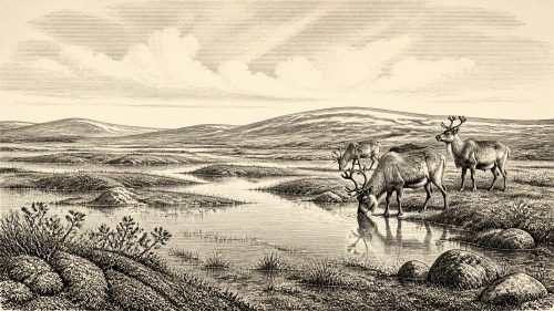
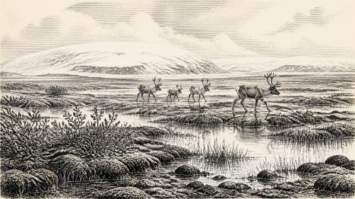
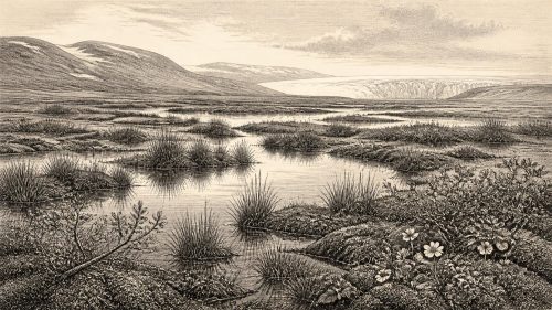
The Derryvree fossils give this otherwise abstract interval a striking texture. Plant remains and pollen point to an open, treeless vegetation cover of tundra or tundra-like wetland. Sedges and grasses were prominent; mosses were abundant. The assemblage included plants associated with cold, wet ground and shallow fresh water, among them bogbean (Menyanthes trifoliata), water-milfoil, mountain avens, dwarf willow, juniper and lesser clubmoss. Such species should not be imagined as forming a neat modern community. Fossil assemblages combine evidence accumulated over time, and individual species occupied different microsites. Yet together they strongly indicate a periglacial landscape: cold winters, short growing seasons, exposed mineral ground, mossy wet places and pools rich enough to sustain aquatic vegetation.
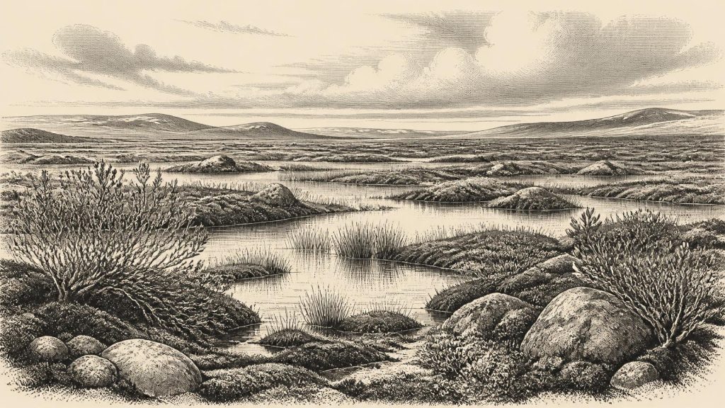
The landscape around Derryvree was therefore neither a featureless sheet of snow nor an Irish countryside recognisable from later millennia. The surviving evidence suggests low vegetation rather than forest, with local freshwater margins offering comparatively sheltered, productive patches. During warmer months, sedges, herbs and dwarf shrubs could exploit the long northern daylight; during winter, frost, snow cover and frozen ground would have dominated. The word “muskeg”, used in older descriptions, captures the mixture of wet ground, moss, shallow water and organic matter, but should not conceal variation: the fossil record indicates a mosaic of pools, margins and open terrestrial vegetation.
Insect remains reinforce that interpretation. They point to wet, plant-rich settings with open water and surrounding mosses rather than closed woodland. This is valuable evidence because beetles and other invertebrates can be highly sensitive to habitat and temperature. Still, the record is local. It permits a careful reconstruction of the Derryvree basin and its immediate catchment, not a detailed weather report for every Irish coast and upland.
Ice, Land and Changing Coasts
At this time Ireland formed part of the unstable western margin of the British–Irish Ice Sheet system. The great Last Glacial Maximum lay in the future: major reconstructions place its most extensive phase between roughly 26,500 and 19,000 calendar years BP, with important regional differences in timing and ice behaviour. Around the Derryvree interval, ice sheets and smaller glaciers advanced and retreated repeatedly in response to abrupt North Atlantic climate shifts. The tills above and below the organic bed show that Fermanagh had experienced glaciation before the wetland developed and would experience renewed ice cover afterwards.
Ice did not merely alter temperature. It rerouted drainage, eroded older ground, deposited clay-rich till and repeatedly destroyed or buried surfaces on which camps, tracks or hearths might once have existed. This helps explain why the archaeological record is so thin. The absence of a known settlement from 30,441 BCE is not proof that no person ever entered Ireland during the wider period; it is, however, a decisive reason not to invent a resident population. Pleistocene Ireland is recorded disproportionately in caves and in rare protected sedimentary sequences because they survived later glacial reshaping.
Sea level was far lower than today because enormous quantities of water were held in global ice sheets. Ireland’s coastline was consequently different, with wider coastal plains in some areas. But lower sea level should not automatically be turned into a simple land bridge to Britain. Geological reconstructions have challenged the old assumption of a broad, dry post-glacial bridge across the Irish Sea. For this earlier, ice-affected interval, routes could have involved changing shorelines, ice, narrow water crossings or temporary connections whose local character remains difficult to resolve. Animal presence establishes movement into Ireland at some stage; it does not reveal a single route, nor does it prove regular human travel.
Castlepook and the Animal World
County Cork’s Castlepook Cave, also known as Mammoth Cave, provides the principal Irish faunal counterpoint to Derryvree. Its deposits and old excavation collections include woolly mammoth, reindeer, giant deer, brown bear, wolf, foxes, mountain hare, lemmings and spotted hyaena. This is not a single living community frozen at one moment. Bones accumulated through carnivore activity, natural death, water movement and early twentieth-century excavation, while later material could intrude into the cave system. Direct dating and renewed analysis are therefore essential.
Even with those cautions, modern redating has established that some Castlepook mammals belong to MIS 3, well before the Last Glacial Maximum. The fauna shows that Ireland was, at intervals, ecologically connected to the wider north-west European world of large herbivores and formidable carnivores. Reindeer and lemmings fit cold open-country conditions; mammoth and giant deer imply enough plant productivity to support large-bodied herbivores; hyaenas and wolves indicate a food web more diverse than any in historic Ireland. It would be wrong, though, to put every listed species into a single herd outside the cave in 30,441 BCE. Their dates and depositional histories differ.
A reindeer femur from Castlepook has attracted particular attention because a deep mark has been interpreted as possible stone-tool damage made while fresh bone was being processed. The bone has been reported as approximately 33,000 radiocarbon years old. If that interpretation is confirmed, it may mark an extraordinarily early episode of human contact with an animal in Ireland. It is not, on present evidence, a settlement, a house, a hearth, a tool assemblage, a burial or proof of continuous occupation. The animal bone’s age and the interpretation of its surface modification are separate questions, both requiring secure context and specialist taphonomic assessment.
No Kingdoms, No Known Communities
Political affairs, diplomacy and organised conflict cannot responsibly be described for Ireland in this year. There are no named peoples, territories, leaders, languages, religious monuments, graves, artworks or exchange networks securely attributable to 30,441 BCE. Nor is there evidence for farming, herding, pottery, metalworking or permanent villages. Terms such as tribe, nation and kingdom belong to much later historical worlds and would mislead here.
There is also no direct evidence for religion or formal learning. If people did make brief visits during the broader period represented by Castlepook, they would have been mobile Palaeolithic hunter-gatherers comparable in broad lifeway, not identity, to groups elsewhere in Upper Palaeolithic Europe. They would have required formidable knowledge of weather, animal behaviour, stone and organic materials, fire, clothing and route-finding. But this is a general inference from human survival in Ice Age Europe, not an excavated Irish camp. Ireland itself has not yielded the associated lithic assemblage, hearth or dwelling that would let historians describe everyday social life with confidence.
What This Year Can Mean
30,441 BCE is best understood as a point placed inside a wide scientific window. Derryvree shows cold freshwater habitats and treeless vegetation in Fermanagh during an ice-free interval between glacial advances. Castlepook shows that a remarkable cold-stage fauna reached or persisted in southern Ireland during the broader MIS 3 world. Together, these archives replace the old image of an eternally ice-covered, lifeless island with a more dynamic one: changing ice margins, wetland refuges, open ground, large mammals and occasional ecological connections beyond the Irish Sea.
Yet the evidence also sets strict limits. It cannot identify an event in this calendar year; it cannot prove that people were resident in Ireland; and it cannot support imagined diplomacy, warfare, trade or ritual. The most important development was environmental rather than political: Ireland was passing through a volatile pre-maximum phase of the last glacial cycle, in which a Fermanagh wetland could form between episodes of ice cover. BIRM-166 survives as a small but exceptional record of that lost landscape—plants, water, insects and silt preserved beneath a drumlin for more than thirty millennia.
Primary Sources
- A Middle Midlandian Freshwater Series at Derryvree, Maguiresbridge, County Fermanagh, Northern Ireland
- A Reconsideration of the Radiocarbon Dating of the Marine Isotope Stage 3 Fauna from Southern Ireland
- The Irish Quaternary Fauna Project
- The Exploration of Castlepook Cave, County Cork
- Occurrence of Mammalia Relicts at Site Castlepook Cave
- Pleistocene Vertebrates in the British Isles
- Trimlines, Blockfields and the Vertical Extent of the Last Ice Sheet in Southern Ireland
- Growth and Retreat of the Last British–Irish Ice Sheet, 31,000 to 15,000 Years Ago: the BRITICE-CHRONO Reconstruction
- Pattern and Timing of Retreat of the Last British-Irish Ice Sheet
- The Deglaciation of the Western Sector of the Irish Ice Sheet from the Inner Continental Shelf to its Terrestrial Margin
- Radiocarbon Constraints on the Age of the Maximum Advance of the British–Irish Ice Sheet in the Celtic Sea
- Stratigraphic and Palaeo-Geomorphological Evidence for the Glacial-Deglacial History of the Last British-Irish Ice Sheet in the North-Western Irish Sea
- The Island of Ireland: Drowning the Myth of an Irish Land-Bridge?
- IntCal20 Northern Hemisphere Radiocarbon Age Calibration Curve (0–55 cal kBP)
- New Insights on the Fauna of Ireland's Younger Dryas and Early Holocene from Alice & Gwendoline Cave
- 32564: Castlepook Cave, Castlepook, Doneraile, Cork
- Ireland's Palaeolithic Archaeology – Fleeting Footprints in a Frozen Land
- IQUA Field Guide 16: Fermanagh
- Figure 6—The Subdivision of the Quaternary Period in Ireland
- BSBI: Menyanthes trifoliata
- BSBI: Dryas octopetala
- BSBI: Selaginella selaginoides
- Exploring Controls of the Early and Stepped Deglaciation on the Western Margin of the British Irish Ice Sheet
- New Data for the Last Glacial Maximum in Great Britain and Ireland