
BIRM-166 Freshwater Refuge30307 BCE
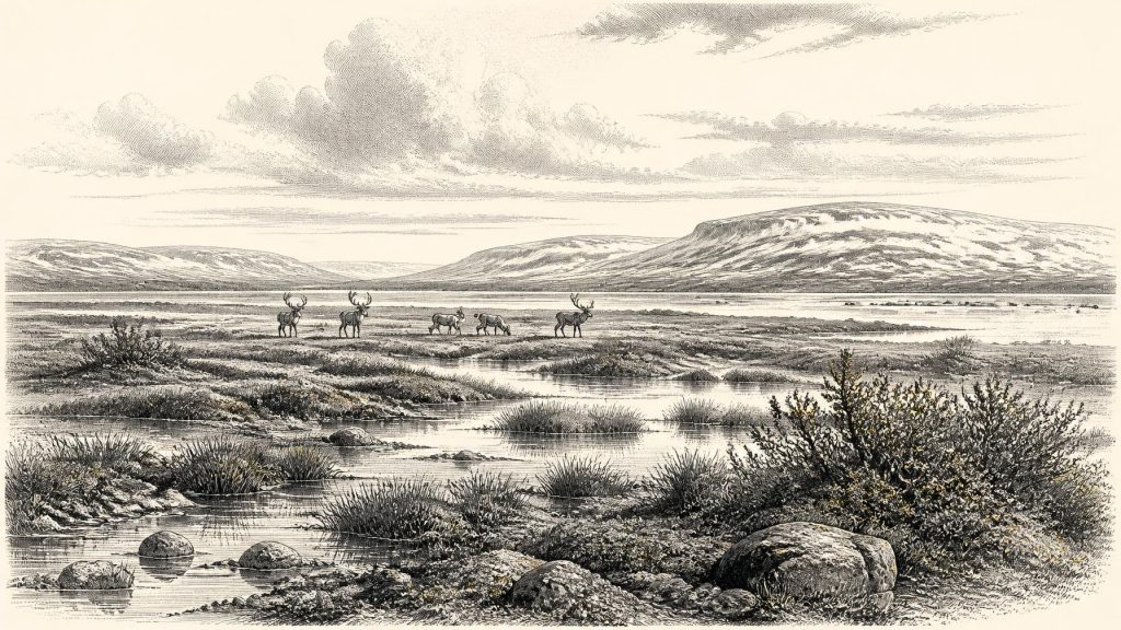
Around 30,307 BCE, Ireland’s history is reconstructed from deposits, fauna and ice rather than recorded events. Derryvree, County Fermanagh, preserves freshwater organic sediments between glacial tills, dated broadly to this interval. Its plants, insects and aquatic remains indicate a cold, treeless mosaic of sedges, mosses, pools and exposed ground during a local ice-free phase. Growing British–Irish ice sheets created unstable, regionally varied conditions. Castlepook Cave, County Cork, contains remains of mammoth, reindeer, giant deer and predators, showing intermittent animal occupation. A marked reindeer bone may indicate human processing, but does not prove settlement. Later glaciation destroyed or buried much evidence.
Dateline
30,307 BCE is a modern calendar label, not a recoverable Irish year. No calendar used in Ireland at this depth of time is known, and neither archaeology nor Quaternary science can identify an event in one particular year. In calendar terms the date falls about 32,250 years before the 1950 reference point used for “BP” dating. It belongs to the later part of the Pleistocene, within Marine Isotope Stage 3: a long, unstable cold phase before the fullest development of the Last Glacial Maximum.
The responsible history of Ireland at this point is therefore a history of dated deposits, animal remains and changing ice, rather than of rulers, battles or named communities. The most informative Irish evidence is an organic freshwater layer exposed at Derryvree, near Maguiresbridge in County Fermanagh. Its radiocarbon determination, BIRM-166, is conventionally reported as 30,500 ± 1,100 radiocarbon years BP and has been published as a broad calibrated span of roughly 36,900–31,700 calendar years BP. The notional year 30,307 BCE falls within that wide window. It does not, however, date the formation of every grain of silt, seed or moss to that year.
A Date Range, Not an Anniversary
That distinction matters. Radiocarbon years are not identical to calendar years because atmospheric carbon-14 has varied over time. Calibration converts a laboratory measurement into a probability range, not an annual timestamp. The relevant range is measured in millennia, and revision of calibration curves can alter its exact form. BIRM-166 therefore illuminates conditions during a broad interval around this date; it is not a diary entry from 30,307 BCE.
Nor should a single date be made to describe all Ireland. The island’s terrain was divided by altitude, exposure, ice flow, waterways and local climate. What survived at Derryvree is an exceptional local record, preserved only because later glacial sediments sealed it. Across much of Ireland, advancing ice and meltwater eroded or buried soils, plants, animal bones and any traces left by people. The thinness of the record is itself part of the historical reality.
Freshwater Between Two Tills
Derryvree was revealed in a road cutting through a drumlin, one of the streamlined hills formed beneath moving ice. The exposed sequence had a lower glacial till, then freshwater silts and fine sands rich in organic matter, followed by an upper till. Till is unsorted material deposited directly by glacier ice. The order of deposits supplies firm evidence for a sequence of environmental change: ice affected the site; a period followed in which water, sediment and organic material accumulated; then later ice or ice-related deposition covered the wetland.
The middle layer is consequently far more than a patch of old mud. Its plant macrofossils, pollen, mosses, aquatic remains and insect evidence point to a treeless, cold landscape with freshwater at or near the site. Grasses and sedges formed important parts of the vegetation. Mossy, waterlogged ground and shallow pools were present, while arctic-alpine or cold-tolerant plants indicate severe conditions and a short growing season. Juniper appears in the assemblage, but there is no basis for imagining a wooded Fermanagh resembling the modern county.
“Tundra” is a useful short description if used carefully. It conveys open ground, persistent cold and a vegetation cover unlike woodland, but it should not imply a featureless white plain. Derryvree probably contained a mosaic: wet sedge margins, mossy hollows, open freshwater, exposed mineral soils and patches of low vegetation. Freeze-thaw processes would have disturbed soil and sediment. The deposit represents one basin and its immediate catchment, not a complete map of the island, yet it proves that this locality could sustain a freshwater ecosystem during an interval between glacial incursions.
Ice Was Building, Not Static
The broader setting was the growth of the British–Irish Ice Sheet. Modern reconstructions show that ice-sheet expansion and retreat were asynchronous: different sectors advanced, thickened, merged and withdrew at different times. The global Last Glacial Maximum is commonly placed at about 26,500–19,000 years BP, while the most recent large-scale reconstruction identifies steady British–Irish ice-sheet growth from about 31,000 to 26,000 years BP. At roughly 32,250 calendar years BP, the deepest island-wide glacial conditions still lay ahead, but Ireland was already within a world of intensifying cold and growing glacial pressure.
This does not licence a simple map in which all Ireland was either open or ice-covered in 30,307 BCE. Derryvree demonstrates local ice-free freshwater conditions during its dated interval; the tills above and below show that ice had not permanently vanished from the regional story. Other Fermanagh deposits, including those at Greenagho and Hollymount, also preserve evidence relevant to non-glacial episodes, though their dates and correlations have limitations. Offshore landforms and cores add another scale of evidence, recording later and often extensive ice movement across the continental shelves. Together they reveal a changing frontier, not a stable climate zone.
Animals of the Open Country
County Cork’s Castlepook Cave, near Doneraile, supplies a complementary but more complicated perspective. It is Ireland’s richest cave site for vertebrate remains from the period leading towards the Last Glacial Maximum. Its old excavations produced bones of woolly mammoth, giant deer, reindeer, wolf, fox, Arctic fox, bear and spotted hyaena, alongside smaller animals. Such a list establishes that cold-stage mammals reached parts of Ireland during the wider late-Pleistocene interval. It supports the picture of open, seasonally harsh habitats capable of sustaining grazing animals, scavengers and predators.
But the cave is not a single, sealed moment. Its deposits were excavated in the early twentieth century, fauna derived from more than one context, and later reassessment has shown why individual bone dates and associations require caution. A mammoth bone once provided a middle-Devensian radiocarbon age; newer work has reconsidered the reliability of some older dates and pretreatment methods. It is unsafe to arrange all Castlepook species into one herd, one year or even one generation. The cave records repeated biological histories, not a snapshot of Cork in 30,307 BCE.
Even so, the animal evidence changes the scale on which Ireland’s Ice Age must be understood. The island was not simply sterile beneath permanent ice throughout the whole period. At suitable times and in suitable places, mammals colonised or re-entered it. How they travelled is less certain. Lower sea levels changed coasts and shelves, but an automatic dry-land bridge between Ireland and Britain should not be assumed. The palaeogeography of the Irish Sea was complex, and neither animal bones nor the Derryvree wetland identifies a particular migration route.
The Human Question
A reindeer femur from Castlepook has become central to the question of very early people in Ireland. The bone has been publicised as bearing a deep mark interpreted by zooarchaeologist Ruth Carden as damage made by a sharp stone tool during carcass processing, and it has been associated with an age around 31,000 BCE. If that interpretation and association are upheld, it would show that a person or small group handled a reindeer in Ireland during the broader Marine Isotope Stage 3 interval.
The implication is important, but its limits are equally important. One marked bone is not a settlement. No securely associated hearth, stone-tool assemblage, dwelling floor, burial, human skeletal remain, rock art or durable occupation surface currently establishes a resident Upper Palaeolithic community in Ireland at this date. The bone cannot tell us whether people killed the animal, scavenged it, processed it at the cave, or transported part of a carcass there. It cannot identify their language, ancestry, name, numbers or route to the island.
Comparison with Upper Palaeolithic groups elsewhere in north-west Europe allows a restrained inference only. If people occasionally reached Ireland, they would probably have required intense practical knowledge of weather, animal movement, shelter, fuel and stone. Reindeer could provide meat, marrow, fat, hide, sinew and bone. That is a reasonable model of survival in a cold landscape, but it is not direct evidence for an Irish hunting tradition, a permanent camp or a named archaeological culture.
No Polities to Recover
There is no evidence from Ireland around this broad date for kingship, borders, diplomacy, formal warfare, law, farming, herding, pottery, metalworking, monuments or organised trade. There is likewise no securely identifiable shrine, grave or ritual deposit from which to infer religion. These absences should not be papered over with invented “tribes” or imagined chiefs. The surviving evidence is ecological and geological: freshwater organisms at Derryvree; large mammals and carnivores at Castlepook; and the deposits left by ice.
Society and everyday life can therefore be discussed only conditionally. Any human visitors may have travelled in very small, mobile groups, but that remains an interpretation based on comparable hunter-gatherer lifeways beyond Ireland. Economy, in the directly visible sense, was the economy of the landscape: plants growing during a short season, herbivores finding forage in open country, predators competing for carcasses, and water and frost moving sediment. No Irish object of this date securely documents exchange with another region.
An Exceptional Survival
The central development around 30,307 BCE was environmental instability. Derryvree’s freshwater bed records a locally living wetland during a cold interval between phases of glaciation. Castlepook’s fauna shows that sizeable mammals occupied or reached Ireland in the wider period, while its marked reindeer femur offers a provocative but still limited clue to human activity. Later ice obliterated much evidence and sealed the rare deposits that remain.
That is why this is not a year of recorded Irish politics or biography. It is a calibrated archaeological horizon: one in which Fermanagh’s cold freshwater, Cork’s Ice Age animals and the advancing dynamics of the British–Irish Ice Sheet offer the most responsible account of Ireland’s distant past.
Primary Sources
- Early Midlandian–Middle Midlandian, Pleistocene, Northern Ireland
- A Middle Midlandian Freshwater Series at Derryvree, Maguiresbridge, County Fermanagh, Northern Ireland
- Trimlines, Blockfields and the Vertical Extent of the Last Ice Sheet in Southern Ireland
- The Timing and Magnitude of the British–Irish Ice Sheet Between Marine Isotope Stages 5d and 2
- Growth and Retreat of the Last British–Irish Ice Sheet, 31,000 to 15,000 Years Ago: the BRITICE-CHRONO Reconstruction
- Pattern and Timing of Retreat of the Last British-Irish Ice Sheet
- Timing, Pace and Controls on Ice Sheet Retreat: an Introduction to the BRITICE-CHRONO Transect Reconstructions of the British-Irish Ice Sheet
- BRITICE Glacial Map, Version 2: a Map and GIS Database of Glacial Landforms of the Last British–Irish Ice Sheet
- Radiocarbon Constraints on the Age of the Maximum Advance of the British–Irish Ice Sheet in the Celtic Sea
- Timing and Pace of Ice-Sheet Withdrawal Across the Marine–Terrestrial Transition West of Ireland During the Last Glaciation
- Exploring Controls of the Early and Stepped Deglaciation on the Western Margin of the British Irish Ice Sheet
- The Irish Quaternary Fauna Project
- A Reconsideration of the Radiocarbon Dating of the Marine Isotope Stage 3 Fauna from Southern Ireland
- Castlepook Cave
- Occurrence of Mammalia Relicts at Site Castlepook Cave
- Excavations at Castlepook Cave, County Cork, 2022
- Heritage Artefacts of County Cork
- The IntCal20 Northern Hemisphere Radiocarbon Age Calibration Curve (0–55 cal kBP)
- IntCal: The International Radiocarbon Calibration Curves
- Origin of British and Irish Mammals: Disparate Post-Glacial Colonisation and Species Introductions
- The Problem of a Late Quaternary Landbridge Between Britain and Ireland
- Ireland: Submerged Prehistoric Sites and Landscapes
- The Mesolithic in Ireland: When Was It?
