

Derryvree’s Freshwater Seam30283 BCE
Around 30,283 BCE, Ireland lay within unstable Marine Isotope Stage 3, as the British–Irish Ice Sheet expanded. Derryvree, County Fermanagh, preserves freshwater silts and organic deposits between glacial tills, demonstrating a cold, open, tundra-like wetland with hardy plants during an ice-free or ice-marginal interval. Radiocarbon calibration permits only a broad date range, not annual precision. Castlepook Cave, County Cork, records mammoth, reindeer, giant deer and predators, indicating varied cold-stage fauna. A possibly cut-marked reindeer bone may suggest an early human visit, but remains unconfirmed. No evidence supports permanent settlement, society or events; environmental change dominates this period across the island.
Dateline
The label 30,283 BCE is a modern way of marking a point deep in the Late Pleistocene, not a year for which Ireland possesses an annal, a dated settlement layer or a recoverable human biography. In conventional “before present” terms, it lies about 32,232 calendar years before AD 1950. That apparent precision is misleading. At this depth in time, radiocarbon results require calibration and commonly yield ranges of centuries or millennia; ice-sheet reconstructions are usually resolved in thousand-year steps. The responsible task is therefore to describe Ireland’s archaeological and environmental setting around this horizon, distinguishing what deposits demonstrate from what scholars reasonably infer.
That setting belongs to Marine Isotope Stage 3, an unstable part of the last Ice Age. Ireland was not yet simply the uniformly frozen island often imagined from later glacial maps. Yet neither was it a familiar green landscape awaiting farmers or even a securely documented hunter-gatherer population. Local conditions varied sharply as climate fluctuated and the British–Irish Ice Sheet accumulated, advanced and altered drainage across the region. The evidence is strongest for cold, open ground, freshwater habitats and large mammals; it is weakest precisely where popular imagination most wants certainty: people, households and events.
A Date Within Wide Ranges
The crucial chronological distinction is between a radiocarbon age and a calendar age. Organic material from the important Derryvree exposure near Maguiresbridge, County Fermanagh, produced the determination BIRM-166: 30,500 radiocarbon years before present, with a large uncertainty of plus 1,170 and minus 1,030 years. Modern calibration places the relevant interval broadly at c. 36,900–31,700 calibrated years before present, approximately 34,950–29,750 BCE. The nominal year 30,283 BCE falls within that broad window, but it cannot be assigned to a particular season, water level, animal herd or human visit represented by the deposit.
Such caution is not pedantry. A sample date tells us when the carbon in the sampled organic material ceased exchanging with the atmosphere, within statistical limits; it does not date every grain of sediment or every event at a site. At more than 30,000 years ago, calibration matters especially because atmospheric radiocarbon varied considerably. Thus BIRM-166 is a powerful chronological anchor for a phase of local environmental history, not a timestamp for an annual Irish narrative.
The Fermanagh Record
Derryvree was revealed during road excavations in 1969, when a cut through a drumlin exposed freshwater silts and fine sands between two thick and distinct till sheets. This simple sequence is its enduring importance. A glacier had deposited the lower till. Later, at least at this locality, an ice-free or ice-marginal basin existed long enough for water, sediment, plants and small animals to leave a record. Afterwards, renewed glaciation laid down the upper till. The wetland was therefore both a refuge for evidence and an interval bracketed by episodes of ice movement.
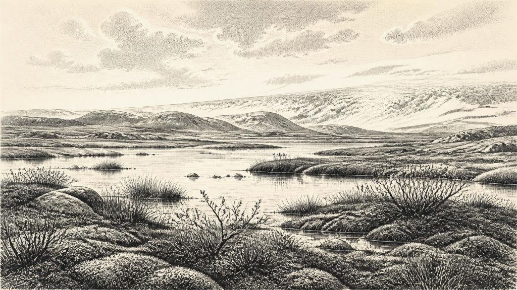
The organic layers indicate a full-glacial, periglacial environment rather than forest. Fossil plant remains and pollen point to open tundra-like vegetation: grasses, sedges, mosses and hardy herbs, with aquatic and waterside plants in the basin itself. Finds reported from the sequence include bogbean, water-milfoil, dwarf willow, mountain avens and lesser clubmoss. Their combination should not be turned into a postcard-perfect reconstruction, but it securely demonstrates that cold-tolerant vegetation occupied and fringed freshwater in this part of Fermanagh during an interval of severe climate.
In everyday visual terms, the locality was likely a patchwork of shallow water, muddy or peaty margins, sparse ground cover and exposed mineral soil, not dense woodland. Short summers could generate a productive burst of growth around water, while long winters, frost action and powerful winds constrained trees. Insects and other small fauna recovered or inferred from comparable deposits help confirm the cold character of the setting. The key point is regional variation: Derryvree proves that this particular basin supported life during part of its dated range. It does not prove that all Ireland was ice-free, nor that every coast, upland and lowland had the same ecology.
Ice in Ascent
Around this broad horizon, the last British–Irish Ice Sheet was growing. Recent ice-sheet synthesis begins its detailed reconstructions at 31,000 years before present because earlier constraints are sparse, but indicates rapidly expanding and merging ice masses by about 30,000 years ago. Northern Ireland contained a substantial ice centre in those reconstructions, while ice also developed in Irish uplands and interacted with marine sectors. By about 29,000 years ago the reconstruction depicts further expansion in Ireland; by 28,000 years ago it depicts nearly complete ice cover. The greatest overall ice volume came later, around 23,000 years ago.
This makes 30,283 BCE a threshold rather than a climatic plateau. It is reasonable to infer that landscapes, rivers, local coastlines and animal routes were being transformed as ice accumulated. It is not responsible to claim that an ice front stood at a precisely known distance from Derryvree on this numbered year. The maps are evidence-based reconstructions, but their early growth phases include modelling assumptions and wide margins of error. Derryvree’s inter-till wetland and the ice-sheet model should consequently be read together: one records local open conditions within a broad interval, the other shows the wider system moving towards more extensive glaciation.
Sea level was substantially lower than today because water was stored in global ice sheets, exposing broader shelves around Ireland and Britain. But lower sea level did not automatically create a simple, dry land bridge from Ireland to continental Europe. The geography of the Irish Sea and western approaches was complicated by deep basins, changing ice margins and marine water. Any claim that people or animals could straightforwardly have walked to Ireland at this time goes beyond the evidence. Movement may have been possible under some circumstances, and sea crossings were technologically conceivable for Upper Palaeolithic groups elsewhere, but the route and frequency remain unproven for Ireland.
Castlepook’s Animal World
The clearest southern counterpart to Derryvree is Castlepook Cave, also known as Mammoth Cave or Doneraile Cave, in north County Cork. Its long history of excavation, much of it before modern archaeological recording, limits exact associations. Even so, it is Ireland’s richest cave archive for vertebrate life before the Last Glacial Maximum. The assemblage includes woolly mammoth, reindeer, giant deer, brown bear, wolf and spotted hyaena; later or differently dated elements include Arctic fox, lemmings and mountain hare. A mammoth date of 33,500 ± 1,200 radiocarbon years before present and a hyaena date of 34,300 ± 1,800 radiocarbon years before present are broadly relevant to this wider period.
These animals establish that Ireland could support, at intervals, a varied cold-stage fauna. Reindeer imply grazing country and seasonal mobility; mammoths and giant deer point to substantial herbivore resources; wolves and hyaenas indicate predators and scavengers. Cave assemblages, however, are not direct census records. Carnivores may have carried bones in, water may have redistributed them, and older excavations did not always preserve the stratigraphic detail expected today. Castlepook is best understood as evidence of an ecological community and a repeated cave history, not proof that every listed species grazed together beside the entrance in 30,283 BCE.
The Human Question
A reindeer femur from Castlepook has been reported as bearing a mark interpreted as a fresh-bone cut made by a sharp stone tool, and public accounts have associated it broadly with about 33,000 years ago. If a full specialist analysis confirms both the anthropogenic mark and its chronological context, it would be exceptionally important: evidence of carcass processing by people in Ireland far earlier than the securely dated late-glacial human trace at Alice and Gwendoline Cave, County Clare.
For this date, though, the finding must remain a carefully bounded possibility rather than the foundation for a populated prehistoric Ireland. The bone came from an old cave collection, not a sealed excavation floor accompanied by a stone-tool assemblage, hearth, shelter, human remains, refitting debris or repeated activity surfaces. One worked bone could show a brief visit and butchery episode. It could not establish permanent settlement, population size, continuity of occupation, language, kinship or a named cultural group. The later Clare evidence, a cut-marked brown-bear patella dated to c. 12,810–12,590 calibrated years before present, is independently dated and published, but it belongs many millennia after the present horizon.
No Polities, but a Living Landscape
There is no evidence for political communities, diplomacy, warfare, leaders, ritual monuments, formal religion, trade networks, writing or learned institutions in Ireland around 30,283 BCE. Nor can domestic life be reconstructed directly: no Irish dwelling, hearth, clothing assemblage or food-preparation site has been securely tied to this moment. If people did reach the island, comparisons with Upper Palaeolithic groups elsewhere suggest highly mobile foragers who could have used animal resources, hides and stone tools. That is a contextual inference, not a demonstrated account of Irish society.
The best history of Ireland at this point is therefore environmental and archaeological. Derryvree records a cold freshwater world between glacial advances; Castlepook preserves the remains of a formidable mammal community; expanding ice-sheet reconstructions warn that this ecological opportunity was increasingly precarious. The period deserves attention not for imaginary chiefs or battles, but because it shows Ireland as a changing north-west European landscape in which ice, water, plants and animals left fragile traces—and where the possibility of an extraordinarily early human presence remains open, significant and not yet settled.
Primary Sources
- A Middle Midlandian Freshwater Series at Derryvree, Maguiresbridge, County Fermanagh, Northern Ireland
- Middle Midlandian Freshwater Series at Derryvree, Maguiresbridge, County Fermanagh, Northern Ireland
- Early Midlandian–Middle Midlandian, Pleistocene, Northern Ireland
- Exploring the last British-Irish Ice Sheet: a review of the BRITICE-CHRONO programme and its contributions to the understanding of marine-influenced ice sheet behaviour
- Growth and Retreat of the Last British–Irish Ice Sheet, 31,000 to 15,000 Years Ago: the BRITICE-CHRONO Reconstruction
- Growth and Retreat of the Last British–Irish Ice Sheet, 31,000 to 15,000 Years Ago: the BRITICE-CHRONO Reconstruction
- Stratigraphic and Palaeo-Geomorphological Evidence for the Glacial-Deglacial History of the Last British-Irish Ice Sheet in the North-Western Irish Sea
- Radiocarbon Constraints on the Age of the Maximum Advance of the British–Irish Ice Sheet in the Celtic Sea
- New Data for the Last Glacial Maximum in Great Britain and Ireland
- Freshwater Organic Deposits and Stratified Sediments Between Early and Late Midlandian (Devensian) Till Sheets, at Aghnadarragh, County Antrim, Northern Ireland
- The Irish Quaternary Fauna Project
- Castlepook Cave: County Geological Site Report
- The Exploration of Castlepook Cave, County Cork, Being the Third Report from the Committee Appointed to Explore Irish Caves
- Occurrence of Mammalia Relicts at Site Castlepook Cave
- Spotted Hyena Skull
- Advice to the Public: Caves and Archaeology
- Irish Cave Exploration
- Mammoth Cave (Castlepook Cave)
- First Evidence of a Late Upper Palaeolithic Human Presence in Ireland
- New Insights on the Fauna of Ireland's Younger Dryas and Early Holocene from Alice & Gwendoline Cave
- The IntCal20 Northern Hemisphere Radiocarbon Age Calibration Curve (0–55 cal kBP)
- Composition and Consequences of the IntCal20 Radiocarbon Calibration Curve
- The IntCal20 Approach to Radiocarbon Calibration Curve Construction: a New Methodology Using Bayesian Splines and Errors-in-Variables
- The Quaternary History of Ireland








