
Menyanthes Between Tills30284 BCE
Around 30,284 BCE, Ireland cannot be described through a precise annual chronology, but environmental evidence illuminates a Late Pleistocene landscape. At Derryvree, County Fermanagh, freshwater organic deposits between glacial tills demonstrate a locally ice-free tundra wetland, with sedges, mosses, herbs and bogbean, during an unstable climatic interval. Cave evidence from Kerry indicates episodic unfrozen conditions, while Castlepook Cave, County Cork, records cold-adapted fauna including reindeer, mammoth and predators. A possibly cut-marked reindeer bone suggests, but does not confirm, human presence. Before the Last Glacial Maximum, Ireland was a shifting mosaic of water, open vegetation, animals and advancing ice across regions.
Dateline
The label 30,284 BCE cannot describe a recoverable Irish ‘year’ in the modern sense. No written calendar existed, no event can be assigned to a particular season, and the archaeological evidence is dated in broad scientific ranges rather than to twelve-month precision. This point falls roughly 32,234 years before AD 1950, within the Late Pleistocene and Marine Isotope Stage 3, a period of abrupt climatic fluctuation before the fullest expansion of the last British–Irish Ice Sheet. The responsible history of Ireland at this depth of time is therefore environmental and archaeological: a story of sediment, plants, insects, animal bone and advancing ice, not of named rulers, battles or settlements.
A Date Within a Range
The strongest Irish evidence relevant to this nominal date comes from Derryvree, near Maguiresbridge in County Fermanagh. Roadworks in 1969 cut through a drumlin and revealed an exceptional sequence. Beneath an upper layer of glacial till lay freshwater silts and fine sands rich in organic remains; below them was another, distinct till. The order matters. Glacier ice had deposited the lower till, then an interval of water, vegetation and animal life followed, and later ice or glacial sediment sealed the deposit beneath the upper till.
Organic material from the freshwater layer produced radiocarbon determination BIRM-166: 30,500 radiocarbon years before present, with an uncertainty of +1,170 and −1,030 years. Radiocarbon years are not calendar years. After calibration, and allowing for the large uncertainties inherent at this age, the Derryvree deposit is broadly relevant to a span of several millennia, commonly modelled around the later part of Marine Isotope Stage 3. The nominal year 30,284 BCE falls within the wide calendar range in which this evidence can illuminate Ireland; it cannot be attached to one particular mud layer, plant, pool or living animal.
That distinction is more than technical caution. The evidence demonstrates that Derryvree had an ice-free freshwater environment during the formation of the organic beds. It does not demonstrate that all Ireland was simultaneously ice-free, or that the island possessed a single uniform climate. A numbered year on a modern timeline is useful for ordering articles, but the historical scale here is centuries and millennia.
Water Between Two Glaciers
Derryvree preserves an unusually vivid ecological interval because fine, wet sediments can trap small remains that would otherwise vanish. The original investigation recorded fossil plants and animals of a full-glacial aspect, indicating open tundra vegetation and a periglacial regime. Periglacial does not mean that the site itself lay beneath glacier ice. It describes a cold landscape shaped by nearby ice, severe frost, seasonal thaw and unstable drainage. In such country, frozen or compacted ground could impede drainage, while summer meltwater collected in hollows.
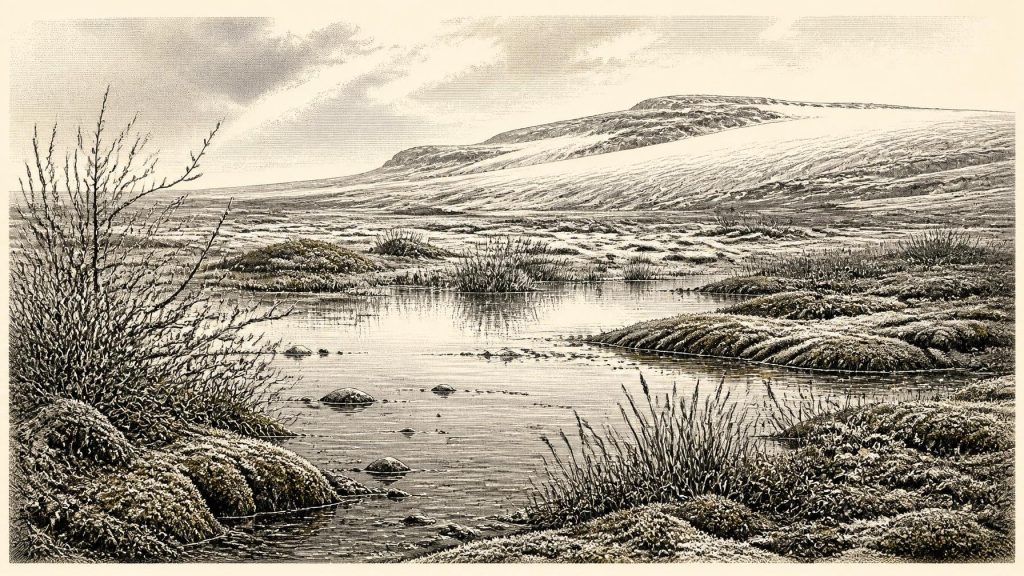
The Fermanagh landscape was not the green, wooded island familiar from later millennia. The deposits indicate treeless ground supporting grasses, sedges, mosses and cold-tolerant herbs and shrubs. Plant remains associated with the sequence include bogbean or buckbean (Menyanthes trifoliata), a species of wet ground and shallow freshwater. The wider flora was consistent with low, open vegetation rather than forest. A mosaic of pools, sedge margins, mossy mud and patches of frost-disturbed earth is a more defensible reconstruction than either a featureless snowfield or a settled, fertile plain.
This was a demanding environment, but not a lifeless one. Brief growing seasons could produce plant cover around water; insects and other small organisms occupied niches in the wetland; and sediment accumulated quietly enough to preserve their traces. The later advance of ice did not merely destroy the earlier landscape. At Derryvree it also buried and protected part of it, leaving a rare archive beneath a drumlin tens of thousands of years later.
A Changing Ice World
At this date, Ireland stood within an unstable phase of the last cold stage. Greenland ice-core records and wider North Atlantic research show that Marine Isotope Stage 3 was marked by sharp switches between colder stadials and comparatively milder interstadials. Irish evidence cannot resolve every one of those changes at the scale of a modern year, but it confirms that the island’s conditions were neither fixed nor simple. Derryvree records an interval in which freshwater and tundra vegetation persisted locally; the tills above and below it record glacial episodes before and after.
Crag Cave in County Kerry provides a complementary, though geographically distant, indication of change. Uranium-series dates on cave formations show episodic speleothem growth during the last glacial period. Stalagmites need water moving through unfrozen ground, so their growth points to intervals when local subsurface conditions permitted infiltration. This is not proof that Kerry and Fermanagh shared precisely the same weather, nor evidence for woodland. It does show that Ireland responded to climatic oscillations in varied ways across different regions.
The most extensive phase of the British–Irish Ice Sheet lay still ahead. Research on the Irish Sea and its margins places major maximum ice expansion broadly around 26,000–23,000 years ago, several thousand years after 30,284 BCE. It would be misleading, therefore, to picture the whole island already entombed beneath its final maximum ice cover. Yet it would be equally misleading to treat the Derryvree wetland as a secure refuge. Its place between two tills makes clear that open ground and freshwater existed within a longer history of glacier growth and return.
Animals and Cave Archives
County Cork’s Castlepook Cave, near Doneraile, supplies a different kind of evidence. Historic cave excavations recovered a rich but complicated collection of Late Pleistocene animal remains. Mammoth, reindeer, giant deer, brown bear, wolf, fox, Arctic fox, spotted hyaena, lemmings and mountain hare are among the animals documented from the wider Castlepook assemblage. Together, they establish that parts of Ireland were reached by a cold-stage fauna very unlike that of the historic island.
The cave evidence must be handled with care. These are not the contents of a single living herd, nor a neatly sealed scene from one season. Bones accumulated over long periods; many were excavated before modern field recording standards; and later work has shown that dates from Irish cave collections must be reassessed specimen by specimen. Castlepook cannot prove that every listed animal was present at Derryvree in 30,284 BCE. What it does support is a broader conclusion: during the Late Pleistocene, suitable Irish landscapes could sustain or be visited by large grazers, predators and scavengers adapted to open, cold conditions.
Reindeer are especially important because one Castlepook femur has been dated to about 33,000 years ago and bears a deep surface incision interpreted by zooarchaeologist Ruth Carden as a possible mark from a sharp stone tool used during butchery. If that interpretation is confirmed and the mark is contemporary with the bone, it may be Ireland’s earliest indication of human activity. It should not, however, be inflated into evidence for permanent occupation, a village or an Irish Upper Palaeolithic population. No securely associated hearth, house floor, human burial or diagnostic stone-tool assemblage has yet established a settlement of this age at Castlepook.
Human Possibility, Not a Known Society
The possible cut-marked bone permits a narrow inference: people may have entered Ireland during a favourable interval of the Late Pleistocene and processed animal carcasses here. That is all. It does not identify who those people were, how long they stayed, which route they used, or whether they left descendants. At times of lower sea level, the geography of the Irish Sea region differed substantially from that of today, but moving through a cold, shifting world of water, exposed shelves, ice margins and scarce resources would still have been difficult.
Comparison with Upper Palaeolithic communities elsewhere in north-west Europe can suggest practical capacities rather than Irish facts. Hunters who followed or encountered reindeer would have valued meat, fat, marrow, hides, sinew and bone. They would have needed detailed knowledge of animal movement, weather and the cutting properties of stone. Such knowledge may be envisaged as a survival economy only if the Castlepook mark truly records human agency; it is not evidence for trade networks, political organisation or a settled regional culture in Ireland.
There is no basis at all for reconstructing Irish diplomacy, warfare, territorial rule, formal religion, monuments, art, schools or long-distance commerce at 30,284 BCE. There are no named groups, leaders, boundaries, ritual deposits or weapon assemblages. Sophisticated art and social traditions existed among some contemporary Upper Palaeolithic peoples elsewhere in Europe, but they cannot be imported into the Irish record merely because they are chronologically comparable.
The History the Evidence Allows
Everyday life, where it can responsibly be discussed, is chiefly non-human. Sedges and bogbean rooted in shallow water; mosses and herbs occupied wet ground; frost and thaw reworked exposed soils; insects lived within tightly constrained habitats; and larger mammals moved through suitable patches of open country at different times. The economy visible in Ireland was the economy of ecosystems: short seasons of growth, grazing, predation, scavenging, water flow and sedimentation. Human activity remains, at most, a tantalising and unconfirmed edge of that picture.
The central development relevant to 30,284 BCE was not a political event but environmental instability. Derryvree shows that Ireland contained a local, functioning tundra wetland during a broad calibrated interval before the Last Glacial Maximum. Castlepook demonstrates a substantial Ice-Age faunal record and preserves a cautiously interpreted clue to human action. Later glacier ice transformed much of the island and erased innumerable traces. What survived is enough to rule out a simple empty wasteland, but far too little to support an invented annual chronicle. Ireland at this point was a changing frontier of freshwater, low vegetation, mobile animals and encroaching ice.
Primary Sources
- Middle Midlandian Freshwater Series at Derryvree, Maguiresbridge, County Fermanagh, Northern Ireland
- Middle Midlandian Freshwater Series at Derryvree, Maguiresbridge, County Fermanagh, Northern Ireland
- Figure 6.— The Subdivision of the Quaternary Period in Ireland
- Introduction to the Late Quaternary and Holocene of Northern Ireland
- Exploring Controls of the Early and Stepped Deglaciation on the Western Margin of the British-Irish Ice Sheet
- Deglaciation Chronology of the Donegal Ice Centre, North-West Ireland
- Timing and Pace of Ice-Sheet Withdrawal Across the Marine–Terrestrial Transition West of Ireland During the Last Glaciation
- Maximum Extent and Readvance Dynamics of the Irish Sea Ice Stream and Irish Sea Glacier Since the Last Glacial Maximum
- Exposure-Age Constraints on the Extent, Timing and Rate of Retreat of the Last Irish Sea Ice Stream
- Radiocarbon Constraints on the Age of the Maximum Advance of the British–Irish Ice Sheet in the Celtic Sea
- Stratigraphic and Palaeo-Geomorphological Evidence for the Glacial-Deglacial History of the Last British-Irish Ice Sheet in the North-Western Irish Sea
- Stratigraphic and Palaeo-Geomorphological Evidence for the Glacial-Deglacial History of the Last British-Irish Ice Sheet in the North-Western Irish Sea
- The Irish Quaternary Fauna Project
- Episodic Speleothem Deposition Tracks the Terrestrial Impact of Millennial-Scale Last Glacial Climate Variability in SW Ireland
- Spatio-Temporal Dynamics of Speleothem Growth and Glaciation in the British Isles
- 32564 — Castlepook Cave, County Cork
- Archaeological Heritage of County Cork
- Heritage Artefacts of County Cork
- Prehistoric Details: Mell Flint Flake
- Publications
- The Irish Quaternary Association
- The IntCal20 Northern Hemisphere Radiocarbon Age Calibration Curve (0–55 cal kBP)
