

Derryvree’s Intertill Sands30235 BCE
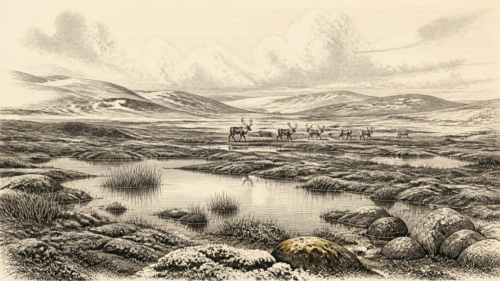
Around 30,235 BCE, Ireland was a climatically unstable, partly ice-free landscape rather than a place with datable events or known communities. At Derryvree, County Fermanagh, organic sediments between glacial tills record a freshwater tundra wetland during Marine Isotope Stage 3, with cold-adapted plants, insects and open ground. Its radiocarbon date has a broad calibrated range, not year-level precision. Castlepook Cave, County Cork, preserves Ice Age fauna and a reindeer bone possibly cut by a stone tool about 33,000 years ago. This contested evidence may indicate brief human activity, but neither settlement nor enduring population is established. Later ice erased evidence.
Dateline
30,235 BCE cannot be treated as a date in the annalistic sense. No Irish inscription, settlement layer or event can be fixed to this individual calendar year. In fact, modern calendar-year precision is unavailable at this depth of time. The responsible question is what evidence illuminates Ireland around this point: a world in the later part of the last glacial period, where ice, tundra wetlands and mobile animal populations mattered far more than states, borders or named communities.
The most useful Irish evidence comes from two very different places. At Derryvree near Maguiresbridge in County Fermanagh, organic freshwater deposits trapped between glacial tills preserve a rare environmental record. At Castlepook Cave, near Doneraile in north County Cork, bones of Ice Age animals raise the possibility—still debated—that people may have processed a reindeer in Ireland far earlier than once thought. Together they offer a narrow but vivid view of a changing island.
Dating a Vanished Landscape
The label 30,235 BCE is a modern conversion, equivalent to roughly 32,184 years before AD 1950, the conventional reference point for radiocarbon ages. It should not be mistaken for a date that archaeology can identify on the ground. The closest important Irish chronological marker is the Derryvree deposit, which produced the radiocarbon determination BIRM-166: 30,500 years BP, with a large uncertainty of +1,170/−1,030 years. Radiocarbon years are not calendar years because atmospheric carbon-14 levels have varied substantially through time.
Later calibration places the Derryvree evidence broadly between about 31.7 and 36.9 thousand calibrated years BP, approximately 29,750–34,950 BCE. That wide interval includes 30,235 BCE, but it does not mean the Derryvree wetland can be assigned to that precise year. Rather, it makes the site a particularly valuable witness to the environmental conditions that could have existed in northern Ireland during this long span. The deposit belongs to late Marine Isotope Stage 3, a climatically unstable part of the last glacial period, before the fullest expansion of the last British–Irish Ice Sheet.
Derryvree Between the Tills
Derryvree was exposed in a road cutting through a drumlin in 1969. The section revealed organic silts and fine sands enclosed between two thick till sheets: sediment laid down directly by glaciers. This arrangement is the key to the site’s importance. It shows that, after an earlier phase of glaciation and before a later overriding of ice, there was enough ice-free ground locally for freshwater sediment, plants and small animals to accumulate.
The evidence is direct but local. It supports ice-free conditions in the Derryvree area when the organic material formed; it does not supply a map of the whole island in a single moment. Ireland’s ice cover expanded and contracted unevenly, and the growth of ice in one region need not exactly match conditions in another. Nevertheless, the Derryvree sequence is among the strongest reminders that the island’s glacial history was not a simple story of uninterrupted white cover. There were intervals and districts in which water moved, plants flowered and animals occupied exposed ground.
The fossil assemblage points to an open, treeless tundra or muskeg landscape: wet, mossy ground with shallow pools and sedge-rich margins rather than forest. Plant remains include species associated with cold freshwater and arctic-alpine conditions, among them bogbean and mountain avens. Insect evidence reinforces the picture of open pools with abundant plant matter, mosses and a severe seasonal regime. This was not barren land. Yet its productivity would have been intensely seasonal, and its vegetation low-growing, patchy and exposed to frost, wind and frozen ground.
A Cold Season of Change
At the scale of north-west Europe, the centuries around this date fell within a climate system prone to abrupt shifts. Greenland and North Atlantic records show that Marine Isotope Stage 3 contained repeated swings between colder stadials and comparatively milder interstadials. Ireland stood at the Atlantic edge of that volatile system. A few warmer summers could sustain freshwater plants and insects; increasingly harsh winters and the growth of nearby ice could rapidly alter drainage, vegetation and the movement of animals.
The later Last Glacial Maximum had not yet reached its fullest Irish extent. Major reconstructions place the maximum expansion of the British–Irish Ice Sheet from roughly 27,000 years BP onwards, although its sectors advanced at different times and rates. Thus Ireland around 30,235 BCE was not the later familiar image of an island uniformly buried beneath maximum ice. It was a regional mosaic under pressure: some landscapes were already glacial or periglacial, while others retained open ground and wetlands that would eventually be overridden, scoured or buried by later ice.
That later ice is also why the record is so fragmentary. Glaciers eroded older surfaces, reworked sediment and destroyed many possible campsites. The absence of a preserved hearth or stone-tool scatter therefore cannot prove that no person ever entered Ireland. Equally, destruction cannot be used as a licence to imagine settlements for which there is no material evidence. Derryvree tells us securely about environment, not about a human community.
Castlepook and the Reindeer
Castlepook Cave offers the most provocative archaeological possibility relevant to this era. Excavated principally in the early twentieth century and also known as Mammoth Cave, it yielded a rich but disturbed collection of Pleistocene animal remains. Mammoth, reindeer, brown bear, wolf, fox, hare, lemming and spotted hyaena form part of its wider faunal record. These species demonstrate that Ireland could support a cold-adapted animal community during favourable phases of the late Pleistocene, though individual bones need not all be contemporary.
A reindeer femur from the Castlepook collection has been reported as dating to about 33,000 years ago and bears a deep linear modification interpreted by zooarchaeologist Ruth Carden as a mark made on fresh bone with a sharp stone tool. If that interpretation is confirmed, it would be evidence that people processed a reindeer in Ireland during the Upper Palaeolithic, tens of millennia before the long-established Mesolithic settlement record. It is an important possibility, but it is not proof of an enduring population in 30,235 BCE.
Several cautions matter. The date measures the animal’s death, not automatically the moment when the mark was made. Cave deposits can be disturbed by carnivores, water, sediment movement, excavation and later collection practices. Nor has Castlepook yielded a securely associated tool-kit, hearth, dwelling, burial, human bone or occupation floor from this period. The cave may have been a place where carnivores dragged carcass parts, where natural processes concentrated bones, or where people briefly handled an animal elsewhere before a bone reached the cave. Renewed excavations have located surviving faunal deposits, making careful stratigraphic work more important than dramatic conclusions.
Society Beyond the Evidence
There is no basis for describing political affairs, diplomacy, warfare, religious belief, language, named peoples or social rank in Ireland at this date. There were no known Irish polities, monuments, farms, trade routes or settlements. Nor is there evidence for a local economy in the later prehistoric sense of herding, cultivation, mining or exchange. If people did reach the island, the Castlepook bone suggests a far more limited possibility: highly mobile foragers exploiting animal resources in a severe, seasonal landscape.
Reindeer would have offered meat, fat, hide, sinew, antler and bone; other large mammals could likewise have been valuable. But those are general possibilities drawn from Palaeolithic lifeways elsewhere in Europe, not observations of a documented Irish camp. No artefact assemblage permits us to identify technology, hunting strategy, group size, travel route or whether any visitors returned. It is safer to speak of potential short incursions than of colonisation.
What This Year Can Mean
The enduring significance of around 30,235 BCE lies in the contrast between a living landscape and the thinness of its surviving archive. Derryvree preserves a cold wetland, open tundra vegetation and evidence of local ice-free conditions within a wide calibrated range. Castlepook preserves animals from an Ice Age ecosystem and a single, consequential question about human activity. Neither site yields a year-specific story. Together, however, they show that Ireland was not outside prehistory before its later settlement: it was a changing Atlantic landscape in which water, ice, plants and animals left scattered traces—and in which people may, briefly and precariously, have done so too.
Primary Sources
- A Middle Midlandian Freshwater Series at Derryvree, Maguiresbridge, County Fermanagh, Northern Ireland
- Exploring controls of the early and stepped deglaciation on the western margin of the British-Irish Ice Sheet
- The Last Irish Ice Sheet: Extent and Chronology
- Pattern and Timing of Retreat of the Last British-Irish Ice Sheet
- Timing and Pace of Ice-Sheet Withdrawal Across the Marine–Terrestrial Transition West of Ireland During the Last Glaciation
- Trimlines, Blockfields and the Vertical Extent of the Last Ice Sheet in Southern Ireland
- Radiocarbon Constraints on the Age of the Maximum Advance of the British-Irish Ice Sheet in the Celtic Sea
- Dimensions and Chronology of the Last Ice Sheet in Western Ireland
- Deglaciation Chronology of the Donegal Ice Centre, North-West Ireland
- The IntCal20 Northern Hemisphere Radiocarbon Age Calibration Curve (0–55 cal kBP)
- The Irish Quaternary Fauna Project
- Heritage Artefacts of County Cork
- 2022:564 – Castlepook Cave, Castlepook South, Cork
- Archaeology Research Excavation Grant 2022: Castlepook Cave Final Report
- Ireland’s Palaeolithic Archaeology – Fleeting Footprints in a Frozen Land
- New Insights on the Fauna of Ireland’s Younger Dryas
- First Evidence of a Late Upper Palaeolithic Human Presence in Ireland
- The Subdivision of the Quaternary Period in Ireland
- Derryvree and Maguiresbridge: Interstadial Deposits and Drumlins
- Prehistoric Details
- Menyanthes trifoliata
- Dryas octopetala
- The Nature of MIS 3 Stadial–Interstadial Transitions in Europe: New Insights from Model–Data Comparisons
- Equilibrium Simulations of Marine Isotope Stage 3 Climate





