Crag Cave’s Thawwater Flowstone30172 BCE
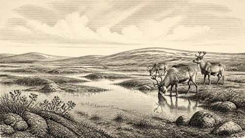
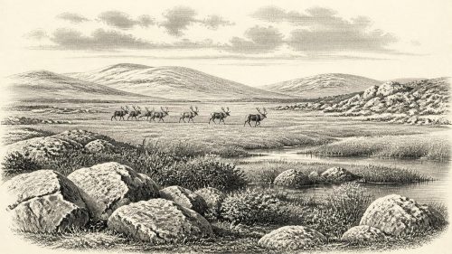
Thirty-thousand years BCE is best understood as a broad Late Pleistocene horizon, not a date for a recorded Irish event. During Marine Isotope Stage 3, Ireland experienced unstable climates, fluctuating ice and altered coastlines. Derryvree, County Fermanagh, preserves treeless wetland sediments between glacial tills, indicating cold, open habitats during an ice-free interval. Crag Cave flowstones in Kerry show liquid-water infiltration around 32,100 years ago, suggesting locally above-freezing annual conditions. Southern caves contain cold-stage fauna, including mammoth and reindeer. A possibly butchered reindeer bone at Castlepook hints at human activity, but permanent settlement remains unproven before later extensive glaciation across Ireland.
Dateline
30,172 BCE is a modern chronological label, not a year in which an Irish event can be dated. Counted in the archaeological convention of years before present, with “present” fixed at 1950, it falls around 32,122 years ago: approximately 32.1 thousand calibrated years BP. No Irish calendar, written testimony or annually resolved archaeological sequence reaches this far back. Radiocarbon measurements at such depth carry substantial statistical uncertainty and require calibration; even the best environmental records normally describe intervals of centuries or millennia. The responsible subject, therefore, is Ireland during the later part of the Late Pleistocene, rather than an invented episode on a particular day or in a particular year.
This was Marine Isotope Stage 3, an unstable stretch of the last Ice Age preceding the fullest expansion of the British–Irish Ice Sheet. Ireland was not the settled, wooded island familiar today. Its shorelines, climate, vegetation and access routes were repeatedly reshaped by falling sea level, severe cold, shifts in precipitation and the growth of glacier ice. Yet the available evidence also rules out a simple image of an island permanently entombed beneath ice. Cave calcite, buried wetland sediments, animal bones and ice-sheet reconstructions instead reveal a changing mosaic, with local ice-free conditions at some times and later glacial overrun.
A Date Within Broad Ranges
The closest Irish evidence to this nominal date comes from several different kinds of archive, each recording something different. At Derryvree near Maguiresbridge in County Fermanagh, organic silts and fine freshwater deposits lay between two bodies of glacial till. A conventional radiocarbon determination, BIRM-166, produced 30,500 radiocarbon years BP, with a large error range of +1,170 and −1,030 years. When calibrated, published discussion places the deposit broadly around 36,900–31,700 cal BP. That broad range overlaps the chronological horizon represented by 30,172 BCE, but it cannot establish that a particular pond, plant or animal existed in that specific calendar year.
Crag Cave, near Castleisland in County Kerry, provides a complementary record. Uranium-thorium dating has shown episodes of speleothem growth through much of the last glacial period, including a growth phase around 32.1 ± 0.1 thousand years ago. Stalagmite and flowstone growth require infiltrating liquid water; in this relatively shallow cave system, researchers interpret growth as evidence that mean annual temperatures were generally above freezing. This is not proof of a mild Irish climate, nor evidence for forest across Kerry. It is, however, persuasive local evidence that south-west Ireland experienced intervals in which water circulated through soil and limestone rather than remaining locked in permanent frost.
Together, Derryvree and Crag Cave illuminate an important historical reality: conditions could vary sharply across the island and through time. The Greenland ice-core record shows that North Atlantic climate oscillated abruptly during this wider period. Irish proxies register the terrestrial consequences imperfectly, but clearly enough to caution against describing every part of Ireland as either wholly habitable or wholly glaciated at once.
Wet Ground Before the Great Advance
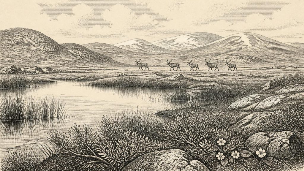
Derryvree is especially valuable because its order of deposits is unambiguous even if its absolute age is broad. Glacier ice first left till at the site. Later, in an ice-free interval, water deposited sands, silts and organic mud. A subsequent ice advance covered the wetland with another till, sealing part of its record beneath the drumlin landscape of Fermanagh. The intervening sediments yielded remains of mosses, sedges, dwarf willow, mountain avens, clubmosses and aquatic plants including bogbean and alternate water-milfoil. Insects associated with cold, open conditions add further detail.
This evidence supports a treeless, wet and exposed setting, often described as tundra or muskeg: shallow pools, saturated ground, sedge-rich margins and low vegetation rather than mature woodland. Such a landscape would have been seasonal and difficult, shaped by frost, snow cover and short growing periods. It nevertheless contained fresh water, plant communities and invertebrate life. The record says much about ecology and nothing direct about villages, field boundaries or named peoples. The wetland was an environmental refuge between glacial episodes, not evidence for a settled Fermanagh society.
At the scale of the whole island, the position and extent of ice remain matters of reconstruction rather than simple observation. The BRITICE-CHRONO synthesis begins its detailed mapping at 31,000 years BP and stresses uncertainty in ice margins and timings. Recent scholarship also debates how substantial the British–Irish Ice Sheet had become before its later maximum. By roughly 27,000–23,000 cal BP, Ireland and much of its continental shelf were fully ice-covered, but that maximum lay in the future of the date considered here. Around 32.1 cal ka BP, local records show both climatic amelioration and the approach of a glacial regime that would profoundly rework the landscape.
Animals of the Open Country
Southern Irish caves supply the most vivid evidence for animal life. Castlepook Cave near Doneraile in north County Cork has produced remains attributed to woolly mammoth, reindeer, horse, giant deer, brown bear, wolf, Arctic fox, mountain hare, stoat, collared and Norwegian lemmings, and spotted hyaena. These were not necessarily all living together in one season. Cave deposits accumulated over long periods, were excavated largely in the early twentieth century, and have complex histories. Direct dates on selected bones nevertheless show that a broad cold-stage fauna used Ireland between at least about 45,000 and 20,000 years ago.
For the horizon around 30,172 BCE, reindeer, mammoth and carnivores are historically supportable possibilities within this wider Irish faunal world, but the evidence does not permit a precise census or a confidently reconstructed food chain for a single locality. The animals indicate open landscapes connected, at least intermittently, to wider north-west European ranges. Lower sea levels altered the geography of the Irish Sea region; Ireland was not necessarily separated by the present coastline, although routes could be interrupted by water, ice, rough terrain and changing climate. Animal movement may have occurred through land corridors or across seasonally and geographically variable glacial landscapes, rather than along one fixed “land bridge”.
Predators and scavengers matter as much as large herbivores. Hyaena remains at Castlepook suggest caves could be carnivore dens or bone-accumulation sites, not simply shelters waiting for people. Bones may have been carried in by predators, dragged from carcasses, redeposited or disturbed after burial. Archaeological interpretation must therefore distinguish a dated animal, a trace made on its bone, and a securely excavated human occupation surface. Those are very different grades of evidence.
The Castlepook Human Question
A reindeer femur from Castlepook has been reported by zooarchaeologist Ruth Carden as bearing a deep linear mark made by a sharp stone tool during butchery. County Cork heritage material has associated the bone with an age of about 30,000 BCE. If that interpretation and association are sustained by further research, it is potentially the nearest evidence for human action in Ireland to the date represented here: a person or small group processing a reindeer carcass during the Upper Palaeolithic.
Its importance should not be exaggerated. The object is one bone from an old cave collection, not a sealed camp floor. No securely associated lithic assemblage, hearth, dwelling, burial, human bone, artwork or repeated occupation sequence of this age has been published from Ireland. A radiocarbon date establishes when the animal lived, not automatically the moment an incision was made. Nor can a cut mark alone reveal whether people hunted the reindeer, found it dead, removed meat, hide or sinew, broke the limb for marrow, or stayed nearby for more than a short visit.
The most cautious conclusion is also the most significant: permanent settlement in Ireland around 30,172 BCE is unproven, but a possible human encounter with the island’s cold-stage fauna deserves serious investigation. Future work at Castlepook, including modern stratigraphic excavation, direct dating, microscopic surface analysis and study of newly recovered material, may clarify the question. Until then, it is wrong either to dismiss the specimen casually or to turn it into an Ice Age Irish community.
What Cannot Yet Be Written
There is no evidence for political affairs, rulers, diplomacy, territorial states or organised warfare in Ireland at this date. There are likewise no Irish data for religion, ritual, language, art, formal learning, exchange networks or social identities. If people did enter the island, their lives may have resembled those of highly mobile Upper Palaeolithic foragers elsewhere in north-west Europe, dependent on close environmental knowledge and portable stone technologies. That is a comparative possibility, not an Irish fact demonstrated by excavated tools or camps.
Economy, in the narrow sense, can only be discussed through ecology. Large herbivores offered potential food and raw materials; caves, rock shelters, watercourses and seasonal grazing may have structured movement for animals and any human visitors. No evidence supports farming, herding, pottery, metalworking, trade or permanent built settlement. The principal regional change was environmental: a cold but intermittently varied Ireland was moving towards the far more extensive ice cover of the Last Glacial Maximum.
An Environmental History
Ireland around this notional year is therefore known chiefly through sediments, bones and mineral deposits rather than through human stories. Derryvree preserves wet, treeless ground between advances of ice. Crag Cave records episodes when liquid water again formed dripstone in Kerry. Castlepook preserves the fragmentary remains of a remarkable cold-stage fauna and a disputed but compelling clue to human butchery. These records do not yield a year-by-year narrative. They do show that late Pleistocene Ireland was environmentally alive, climatically unstable and increasingly vulnerable to glacial transformation.
Primary Sources
- The IntCal20 Northern Hemisphere Radiocarbon Age Calibration Curve (0–55 cal kBP)
- Growth and Retreat of the Last British–Irish Ice Sheet, 31,000 to 15,000 Years Ago: The BRITICE-CHRONO Reconstruction
- BRITICE-CHRONO Maps and GIS Data of the Last British-Irish Ice Sheet 31 to 15 ka
- The Timing and Magnitude of the British–Irish Ice Sheet Between Marine Isotope Stages 5d and 2
- Timing and Pace of Ice-Sheet Withdrawal Across the Marine–Terrestrial Transition West of Ireland During the Last Glaciation
- Early Deglaciation of Western Ireland and the Adjacent Continental Shelf
- Pleistocene Glaciations in Ireland
- Episodic Speleothem Deposition Tracks the Terrestrial Impact of Millennial-Scale Last Glacial Climate Variability in SW Ireland
- Spatio-Temporal Dynamics of Speleothem Growth and Glaciation in the British Isles
- A Reconsideration of the Radiocarbon Dating of the Marine Isotope Stage 3 Fauna from Southern Ireland
- The Irish Quaternary Fauna Project
- Phylogeographic, Ancient DNA, Fossil and Morphometric Analyses Reveal Ancient and Modern Introductions of a Large Mammal: The Complex Case of Red Deer in Ireland
- New Insights on the Fauna of Ireland's Younger Dryas and Early Holocene from Alice & Gwendoline Cave
- The Colonization of Ireland: A Human Ecology Perspective
- Ireland: Submerged Prehistoric Sites and Landscapes
- Deglaciation Chronology of the Donegal Ice Centre, North-West Ireland
- Anthropogenic Changes to the Holocene Nitrogen Cycle in Ireland
- Outreach and Education Resources
- Heritage Artefacts of County Cork
- Castlepook Cave, Co. Cork: Excavation Report 2022
- The Greenland Ice Core Chronology 2005, 15–42 ka. Part 1: Constructing the Time Scale