
Archived: 26 September 2026
Abstract
In 1008, Irish annals recorded no battle but revealed pressures shaping Brian Boru's overkingship. Chronological discrepancies require caution, yet Inisfallen and Ulster agree on a severe winter, ecclesiastical deaths and political violence. Muiredach son of Matudán, heir designate of Ulaid, was killed by his own people, exposing dynastic division amid northern rivalries. The deaths of abbots and coarbs, including Ferdomnach of Colum Cille's familia, prompted transitions in institutions controlling land, relics, learning and legitimacy. Frost and snow from January to Easter threatened livestock, farming and communications. Together, events illuminate a weather-vulnerable society governed through churches, dynasties, tribute, negotiation and force.
Read Article

Archived: 10 September 2026
Abstract
About 31,814 BCE, Ireland lay within the climatically unstable later Marine Isotope Stage 3, although no evidence permits dating events to a single year. Derryvree, County Fermanagh, preserves freshwater silts beneath later tills, indicating a cold, open, treeless tundra with ponds, mosses and sparse vegetation. Southern caves, particularly Castlepook, contain remains of cold-stage mammals, but mixed deposits and revised dates prevent reconstructing one contemporary fauna. A cut-marked reindeer femur may indicate Upper Palaeolithic human processing, yet lacks secure archaeological context and proves neither settlement nor population. Ireland was a shifting, intermittently habitable glacial frontier documented by sediments, bones and ice.
Read Article

Archived: 10 September 2026
Abstract
Modern dating places 31,817 BCE within a broad, uncertain Marine Isotope Stage 3 range, rather than a recoverable historical year. Deposits at Derryvree in Fermanagh show that parts of Ireland supported cold, treeless tundra, freshwater hollows and grazing fauna between glacial advances. Castlepook Cave, County Cork, preserves reindeer, mammoth, hyaena and other Ice Age remains, reflecting a wider north-west European ecology. A deep mark on a reindeer femur may be a stone-tool butchery cut, offering evidence of Upper Palaeolithic visitors. However, disturbance, dating limits and absent associated finds preclude claims for settlement, society or continuity. Later ice expansion erased evidence.
Read Article

Archived: 10 September 2026
Abstract
Labelled 31,833 BCE, this period cannot be dated precisely in Ireland and is best understood as a Late Pleistocene interval within Marine Isotope Stage 3. Sediments at Derryvree and Greenagho show that parts of Ireland remained ice-free, supporting open tundra, sedge marshes and seasonal freshwater habitats before later glaciation. Castlepook Cave preserves remains of reindeer, mammoth and other cold-adapted fauna, although they do not represent a single community. A possible stone-tool cut on a reindeer bone suggests brief human activity, but no secure settlement evidence exists. Subsequent ice-sheet expansion reshaped Ireland, preserving Derryvree as a rare pre-glacial environmental record survival.
Read Article

Archived: 10 September 2026
Abstract
Labelled 31,840 BCE, this period in Ireland belongs broadly to the climatically variable later Marine Isotope Stage 3, not to a recoverable historical year. Derryvree, County Fermanagh, preserves freshwater silts between glacial tills, indicating an ice-free interval of cold, treeless, waterlogged tundra with bogbean, mosses, sedges and other plants. Cave finds in southern Ireland show Ice-Age fauna including mammoth, reindeer, giant deer, bears, Arctic foxes and hyaenas, though their dates and contexts vary. Possible human evidence remains inconclusive. Later glaciation transformed and erased much evidence, leaving environmental records rather than evidence of settlement, politics, economy or culture by people locally.
Read Article

Archived: 9 September 2026
Abstract
31,877 BCE is a modern approximation for a broad later Pleistocene interval, not a recoverable Irish year. Before the Last Glacial Maximum, Ireland contained regionally varied, cold, open tundra and wetlands, evidenced by Derryvree deposits in Fermanagh. Castlepook Cave Cork’s Awbeg valley preserves fauna, including reindeer, mammoth, giant deer, predators and, accumulated across different times rather than one moment. A dated reindeer femur may bear human cut marks, suggesting brief Upper Palaeolithic visitation, but disturbed contexts prevent certainty. No settlements, tools, identities or social institutions are securely known. The evidence portrays active Ice Age ecosystems and possible early human presence.
Read Article

Archived: 9 September 2026
Abstract
Around 31,882 BCE, Ireland was a climatically unstable Late Pleistocene landscape, not a settled or historically documented society. Calibrated radiocarbon evidence from Shandon Cave, County Waterford, indicates red deer were present during a broad period overlapping this date. Derryvree sediments in Fermanagh suggest cold, open, seasonally wet tundra habitats, while cave assemblages reveal changing communities of large herbivores, predators and small mammals. Later glaciation destroyed much evidence. Claims for early human visits, including a possibly cut-marked Castlepook bone, remain unproven. No secure Palaeolithic dwellings, tools or burials exist. Ireland’s record instead documents intermittent Ice Age ecological opportunity and fragmented survival.
Read Article
Archived: 9 September 2026
Abstract
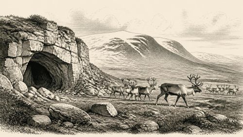
31,919 BCE is a modern label for a Late Pleistocene period, not a recoverable Irish historical year. Before the Last Glacial Maximum, deposits in Fermanagh indicate that some Irish landscapes were intermittently ice-free, although conditions varied regionally. Castlepook Cave in County Cork preserves a chronologically mixed fauna including reindeer, mammoth, giant deer, hyaena and other cold-stage animals, demonstrating habitable environments. A cut-marked reindeer femur may indicate human butchery around 33,000 BCE, but disturbed deposits, alternative explanations and absent artefacts prevent confirmation. Later glaciation created a vast gap; securely dated human activity appears only over twenty millennia later in County Clare.
Read Article

Archived: 9 September 2026
Abstract
Around 31,927 BCE, Ireland lay in Marine Isotope Stage 3, before major Last Glacial Maximum ice expansion. Derryvree sediments in County Fermanagh, dated broadly to 36,900–31,700 years before present, preserve evidence of ice-free but intensely cold tundra terrain. Similar deposits indicate exposed north-central ground until about 34,000 years ago, before advancing ice transformed habitats. Cave remains demonstrate diverse Pleistocene fauna, although dates and associations require caution. No securely dated human settlement or community is known. A possibly butchered reindeer bone from Castlepook may indicate an early visit, but remains unconfirmed. The record principally documents environmental change, not conventional human history.
Read Article

Archived: 9 September 2026
Abstract
31,938 BCE is a modern label for an imprecisely dated phase of late Marine Isotope Stage 3, not an identifiable Irish event. Ireland experienced unstable, cold conditions before maximum glaciation, with open grassland, sedges, dwarf shrubs and marked seasonality indicated by Ulster pollen and beetles. Castlepook Cave preserves a diverse fauna, including reindeer, mammoth, bear, giant deer and hyaena, showing changing animal access despite uncertain routes. A cut-marked reindeer bone may indicate Upper Palaeolithic butchery and brief human visits. However, no associated camp or tools prove settlement. The period chiefly reveals a changing Ice Age landscape and rare, precarious evidence.
Read Article

Archived: 8 September 2026
Abstract
31,961 BCE is an imprecise label for a Late Pleistocene MIS 3 interval, when Ireland experienced cold conditions and advancing ice preceding the Last Glacial Maximum. Geological and cave-faunal evidence, especially from Castlepook Cave, records mammals including cold-adapted and open-country species, though deposits span long periods and were imperfectly excavated. A reportedly cut-marked reindeer bone may indicate human activity around 33,000 years ago, but lacks secure context and remains under investigation. No contemporary settlement, tools, hearths or cultural assemblage is known. Later bear-bone evidence confirms human presence only about 10,800–10,500 BCE. Ireland’s period remains an environmentally documented, uncertain human prehistory.
Read Article

Archived: 8 September 2026
Abstract
Around 31,966 BCE, Ireland lay in the unstable later Marine Isotope Stage 3, before the fullest advance of the Last Glacial Maximum. Sea levels were lower, coastlines and possible routes changed, and expanding ice later destroyed much evidence. Southern caves, especially Castlepook, preserve remains of reindeer, mammoth, giant deer, bears and hyaenas, indicating cold, open mosaic habitats. A cut-marked reindeer femur, dated about 33,000 years ago, may record an early hunter visit, but lacks archaeological context or settlement evidence. No peoples, polities, beliefs or permanent communities can be identified. Knowledge relies on radiocarbon dating, faunal analysis, stratigraphy and ice-sheet reconstruction.
Read Article

Archived: 8 September 2026
Abstract
Around 31,978 BCE, Ireland lay in a cold, changing Pleistocene environment before the Last Glacial Maximum, when expanding ice later reshaped much of the island. Evidence is chiefly geological and faunal, with Castlepook Cave near Doneraile providing a significant but uncertain clue to human presence. A reindeer femur, dated roughly 33,000 years ago, bears a possible butchery mark, suggesting intermittent Upper Palaeolithic visitors rather than settlement. Cave remains reveal open tundra-steppe supporting reindeer, giant deer, predators and Arctic mammals. Poor excavation records and disturbed deposits prevent certainty. No camps, tools, hearths, political institutions or specifically Irish cultural practices are known.
Read Article

Archived: 8 September 2026
Abstract
At about 31,991 BCE, Ireland lay within the climatically unstable later Marine Isotope Stage 3, before the Last Glacial Maximum. Growing ice, lower sea levels and changing coastlines transformed habitats and possible access routes, though any land connection with Britain remains uncertain. Castlepook Cave in County Cork preserves key evidence: reindeer, mammoth, giant deer, lemmings, predators and other fauna indicate varied cold open environments. A cut-marked reindeer bone suggests possible Upper Palaeolithic human activity, but cannot prove settlement or continuous occupation. Later glaciation destroyed evidence. Consequently, this period is understood through imprecise dating, cave deposits and reconstruction, not year-specific history.
Read Article

