

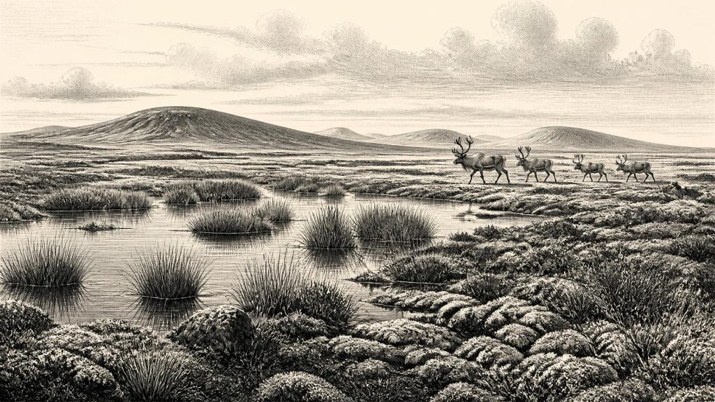
Derryvree’s Sedge Marsh31833 BCE
Labelled 31,833 BCE, this period cannot be dated precisely in Ireland and is best understood as a Late Pleistocene interval within Marine Isotope Stage 3. Sediments at Derryvree and Greenagho show that parts of Ireland remained ice-free, supporting open tundra, sedge marshes and seasonal freshwater habitats before later glaciation. Castlepook Cave preserves remains of reindeer, mammoth and other cold-adapted fauna, although they do not represent a single community. A possible stone-tool cut on a reindeer bone suggests brief human activity, but no secure settlement evidence exists. Subsequent ice-sheet expansion reshaped Ireland, preserving Derryvree as a rare pre-glacial environmental record survival.
Dateline
31,833 BCE is a modern calendar label, not a date that can be recovered from the Irish archaeological record with year-by-year precision. There were no written calendars, named communities or documentary events in Ireland at this depth of time. In the conventional system of years before AD 1950, the label falls about 33,783 calendar years BP. The responsible historical scale is therefore a broad Late Pleistocene interval, not a single year. It belongs to Marine Isotope Stage 3, a volatile phase of the last Ice Age, before the fullest expansion of the British–Irish Ice Sheet.
The evidence for Ireland at this point is primarily geological, palaeoenvironmental and faunal. It comes from buried freshwater sediments, cave-bone collections, pollen, plant remains, insects and the landforms left by later ice. These sources can illuminate climates, habitats and animal movements. They cannot identify a government, a tribe, a diplomatic agreement, a battle, a religious rite or a settled village. The most important development around this notional year was environmental: parts of Ireland still supported cold-stage landscapes and animal communities, but conditions were changing towards the much more extensive glaciation that would later remodel the island.
An Interval Rather Than an Event
The best Irish chronological anchor is the Derryvree sequence near Maguiresbridge in County Fermanagh. Roadworks in 1969 cut through a drumlin and exposed organic freshwater silts and fine sands trapped between two substantial layers of till, sediment laid down by ice. This order is crucial. It records glaciation, then an ice-free freshwater environment, followed by another glacial advance. Derryvree is not a record of all Ireland, but it decisively complicates any simple image of an island continuously buried beneath ice.
The original radiocarbon determination from Derryvree was 30,500 radiocarbon years BP, with a large uncertainty. Radiocarbon years are not calendar years: atmospheric carbon-14 levels have changed through time, so dates require calibration against internationally maintained curves. Later calibration places the deposit broadly at about 36,900–31,700 calibrated years BP. The modern label 31,833 BCE falls within that wide span. That does not mean a particular layer, plant or animal can be assigned to this exact year; it means that the Derryvree environment is relevant to the larger period in which that year falls.
Greenagho, near Belcoo in the same county, provides a related indication of ice-free north-central Ireland. Organic material from lacustrine deposits beneath till has been calibrated to roughly 37,200–35,700 years BP. Taken together, these sites support the interpretation that substantial inland areas remained free of the final great Irish ice expansion until at least around 34,000 years ago. The precise pattern of earlier ice cover, however, remains debated. Ancient deposits are rare, frequently disturbed and difficult to date; later glaciers destroyed much of the evidence that might have settled the question.
A Cold, Open Country
Derryvree’s biological remains describe a severe but living landscape. Its flora and fauna have been interpreted as evidence for open tundra and a periglacial climate: ground affected by intense frost, seasonal thaw and short growing seasons, rather than by permanent local ice. Mosses, sedges, grasses, herbs and low shrubs could survive where dense woodland could not. Wet hollows and shallow water lay among exposed ground. The useful modern comparison is not a uniform snowfield but a patchwork of sedge-rich marsh, frost-shattered soil, sparse vegetation and freshwater margins, changing sharply with season and shelter.
This should not be turned into a precise weather report. The Derryvree deposit represents a local basin, and pollen may travel or be redeposited. Yet plant macrofossils, pollen and insect evidence from comparable Irish cold-phase deposits consistently indicate open, treeless or very sparsely wooded settings. The landscape was likely highly seasonal. Summers could briefly support vegetation attractive to grazing animals; winters brought prolonged cold, frozen ground and restricted food. Rivers, pools and wet ground were important ecological refuges, even as they accumulated the silts that now permit this reconstruction.
Marine Isotope Stage 3 was climatically unstable across the North Atlantic world. Its warmer and colder oscillations affected sea level, vegetation, snow accumulation, glacier margins and the routes available to animals. Ireland’s local record cannot match every Greenland climatic shift to a named valley or decade. What it does show is variation rather than permanence. At about 31,833 BCE, the island was not yet the fully ice-covered terrain of the later Last Glacial Maximum, but neither was it approaching a temperate landscape. It was part of a northern cold-world frontier in transition.
Animals at Castlepook
The principal evidence from southern Ireland comes from Castlepook Cave, also called Mammoth Cave, near Doneraile in north County Cork. Its old collections, supplemented by modern reassessment, contain one of Ireland’s most important Pleistocene faunal assemblages. Remains attributed to reindeer, giant deer, woolly mammoth, brown bear, wolf, Arctic fox, mountain hare, lemmings and spotted hyaena show that, at different times during the later Ice Age, Ireland was ecologically connected to the wider north-west European world.
That list must be handled carefully. A cave is not necessarily a settlement, nor even a single contemporaneous animal community. Carnivores may drag carcass parts inside; animals can die in caves; water and sediment can move bones; nineteenth- and early twentieth-century excavations often lacked the recording standards now expected. The Castlepook collections are therefore evidence for the presence of species over lengthy intervals, not a census for 31,833 BCE. Reindeer and mammoth should not be imagined automatically sharing the same valley, season or herd.
Nevertheless, the fauna matters. Reindeer point to open, cold habitats and mobile grazing resources. Hyaenas and wolves indicate predators and scavengers able to exploit carcasses in this landscape. Mammoth and giant deer remains suggest that parts of Ireland could, at favourable moments, support large herbivores. The animal world was richer and more continental in character than Ireland’s later historic fauna. Its existence also indicates that barriers of water, ice and terrain were not absolute over the long term, though the precise routes and timing of colonisation remain matters for palaeogeographical reconstruction.
The Human Question
A reindeer femur from Castlepook has made this period unusually important for Irish archaeology. Zooarchaeologist Ruth Carden identified a deep mark on the bone as consistent with a cut made by a sharp stone tool during carcass processing. County Cork heritage material dates the bone broadly to about 31,000 BCE and presents it as potential evidence that Palaeolithic hunters handled reindeer in Ireland. If sustained, this interpretation would push possible human activity on the island dramatically earlier than the better-established Late Palaeolithic evidence from County Clare and the substantial Mesolithic settlement record beginning millennia later.
The claim is promising, but its limits are fundamental. The specimen derives from an old cave collection rather than a modern excavation of an intact occupation surface. A radiocarbon date establishes the age of the animal’s death, not automatically the moment when the mark was made, the number of people involved, or the place where the animal was killed. Identifying a line on bone as a stone-tool cut, rather than carnivore damage, sediment abrasion, weathering or later damage, is a specialist taphonomic judgement. No securely associated hearth, stone-tool assemblage, dwelling floor, grave or repeated processing area of comparable age has been demonstrated in Ireland.
The evidence can therefore support only a restrained possibility: people may have made a brief visit to Ireland during this broad cold-stage period and may have butchered a reindeer. It cannot support a permanent population, a named archaeological culture, a continuous line of descent to later inhabitants or a settled hunting camp at Castlepook. Further excavation of undisturbed deposits, direct dating and microscopic analysis of bone surfaces are needed before the tentative trace can bear more historical weight.
Society Beyond the Evidence
There is no responsible basis for describing political affairs in Ireland in 31,833 BCE. No state, kingship, chiefdom, territorial boundary or diplomatic system is evidenced. Equally, there is no material proof of organised warfare, formal religion, monuments, farming, domestic architecture, metalworking, exchange institutions or long-distance trade. These are not absences that archaeology can always prove absolutely; rather, the surviving record is far too slight to make such claims.
If the Castlepook cut mark proves anthropogenic, it would imply a highly mobile and small-scale form of activity: people with a sharp stone edge, knowledge of animal anatomy and the ability to reach a difficult cold-stage landscape. Such an inference concerns a practical act of carcass processing, not a complete way of life. It is reasonable to say that any visitors would have depended on flexible movement, clothing, fire, shelter and social cooperation, as other Upper Palaeolithic groups did in northern Europe. It is not reasonable to claim those things as directly observed in Ireland, where none has yet been recovered for this period.
Approaching the Great Advance
The longer trajectory is clearer than the notional year. Reconstructions of the British–Irish Ice Sheet indicate major growth after the interval represented by Derryvree. By the local Last Glacial Maximum, roughly 27,000–23,000 years BP in many reconstructions, ice had expanded across almost all of Ireland and far onto the surrounding continental shelf. Its movement eroded older landscapes, rearranged sediments and left the drumlins, tills, meltwater channels and rock-scoured surfaces that dominate much of the island’s physical geography.
In that sense, Derryvree’s buried sedge marsh is a precious survival from before the great remaking. Around 31,833 BCE, Ireland’s history is not one of rulers and recorded deeds but of freshwater basins, wandering animals, frost-driven ground and gathering ice. The archaeological record offers a landscape in which human presence is, at most, a disputed flicker. Its strongest testimony is to ecological possibility and approaching environmental change—an Ice Age Ireland that was harsh, inhabited by animals, locally ice-free, and soon to be transformed again.
Primary Sources
- Middle Midlandian Freshwater Series at Derryvree, Maguiresbridge, County Fermanagh, Northern Ireland
- Middle Midlandian Interstadial Deposits at Greenagho, Near Belcoo, County Fermanagh, Northern Ireland
- A Reconsideration of the Radiocarbon Dating of the Marine Isotope Stage 3 Fauna from Southern Ireland
- Heritage Artefacts of County Cork
- The Irish Quaternary Fauna Project
- Trimlines, Blockfields and the Vertical Extent of the Last Ice Sheet in Southern Ireland
- Growth and Retreat of the Last British–Irish Ice Sheet, 31,000 to 15,000 Years Ago: The BRITICE-CHRONO Reconstruction
- The Evolution of the Terrestrial-Terminating Irish Sea Glacier During the Last Glaciation
- Exploring Controls of the Early and Stepped Deglaciation on the Western Margin of the British–Irish Ice Sheet
- Character of Advance and Retreat of the Southwest Sector of the British-Irish Ice Sheet During the Last Glaciation
- Maximum Extent and Readvance Dynamics of the Irish Sea Ice Stream and Irish Sea Glacier Since the Last Glacial Maximum
- Timing and Pace of Ice-Sheet Withdrawal Across the Marine–Terrestrial Transition West of Ireland During the Last Glaciation
- A Critical Review and Re-Investigation of the Pleistocene Deposits Between Cranfield Point and Kilkeel, Northern Ireland
- The IntCal20 Northern Hemisphere Radiocarbon Age Calibration Curve (0–55 cal kBP)
- Figure 6—The Subdivision of the Quaternary Period in Ireland
- Ireland’s Palaeolithic Archaeology – Fleeting Footprints in a Frozen Land
- The Mesolithic in Ireland: When Was It?
- Britain and Ireland: Glacial Landforms from the Last Glacial Maximum
- Pattern and Timing of Retreat of the Last British-Irish Ice Sheet
- Glacial Geomorphology in the Wicklow Mountains, Ireland







