Maguirebridge’s Tundra Mosses31823 BCE
Around 33,800 cal BP, corresponding broadly to 31,823 BCE, Ireland experienced a climatically unstable late Pleistocene environment before the Last Glacial Maximum. Derryvree, near Maguiresbridge, preserves freshwater silts between tills, dated approximately 35,900 cal BP, indicating locally ice-free, open tundra with mosses, sedges, grasses, herbs and juniper. Cave deposits show that reindeer, giant deer and carnivores reached Ireland at various times, but do not form single snapshots. No securely dated human settlements, tools or institutions exist for this period; early human presence remains unproven. Fragmentary geological and biological evidence instead records seasonal habitats later profoundly reshaped by expanding ice sheets.
Dateline
The label 31,823 BCE gives a modern calendar address to a period that had no calendars, writing, named rulers or datable events in Ireland. It cannot identify a particular winter, journey or birth. In archaeological terms, it falls approximately 33,800 calendar years before present (cal BP, where “present” is AD 1950), within the later part of the Pleistocene and broadly within Marine Isotope Stage 3. The responsible history of Ireland at this depth of time is therefore not a chronicle of people or politics. It is an account of changing land, climate, plants and animals, reconstructed from sediments, fossils, cave deposits and the dating methods applied to them.
A Landscape Before the Ice Maximum
This was an age of pronounced climatic instability, not a single, unchanging “Ice Age”. Ireland lay on the Atlantic fringe of north-west Europe, exposed to shifts in temperature, precipitation, sea level and the growth or retreat of ice. The great expansion of the last British–Irish Ice Sheet, conventionally associated with the Last Glacial Maximum, lay ahead. Current reconstructions place its most extensive later phase mainly between about 27,000 and 23,000 cal BP, though individual sectors developed differently and the history of ice growth remains actively refined. Around 33,800 cal BP, Ireland was therefore approaching a much harsher glacial world rather than already standing at its fullest ice-sheet extent.
That distinction matters. Later ice covered and eroded huge areas, disturbing or removing older deposits. The evidence for an earlier, ice-free or locally ice-free Irish landscape is consequently rare and uneven. A surviving layer may represent a pond, seep, cave chamber or sheltered hollow rather than the whole island. Equally, the absence of a deposit in another county cannot prove that no comparable habitat existed there. Archaeologists and Quaternary scientists build a regional picture from such fragments, testing whether their dates, sediments and fossil assemblages agree.
The coastline did not resemble that of modern Ireland. Global sea levels were lower than today because more water was held in continental ice sheets, exposing portions of the continental shelf. Yet it would be misleading to draw a simple land bridge across every stretch of the Irish Sea. The form, timing and accessibility of routes between Ireland, Britain and continental Europe changed as sea level, ice margins and local topography changed. At this date, any movement of animals or people would have depended on a shifting northern landscape, not on the political or maritime boundaries familiar today.
The Derryvree Evidence
The most illuminating Irish evidence for this broad interval comes from Derryvree near Maguiresbridge in County Fermanagh. Road works exposed freshwater silts and fine sands caught between two thick layers of till within a drumlin. Till is sediment laid down by glacier ice; its position above and below the organic layer shows that the locality experienced glacial conditions before and after the interval recorded by the silts. The deposit is an unusually valuable survival because it preserves a moment when freshwater and vegetation occupied ground later overridden or sealed by ice.
An original radiocarbon determination on the Derryvree organic material was 30,500 radiocarbon years BP, with a substantial uncertainty. Radiocarbon years are not calendar years: atmospheric carbon levels varied through time, especially during the Pleistocene, so dates must be calibrated against independently constructed curves. In broad calibrated terms, the Derryvree horizon belongs around 35,900 cal BP, with uncertainty of roughly a millennium. It is not a measurement for the calendar year 31,823 BCE, but it is close enough to illuminate the kind of environment that could have existed in Ireland during the wider period.
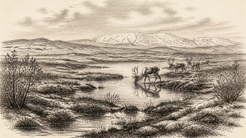
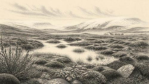
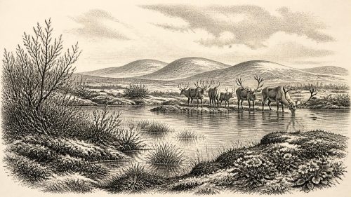
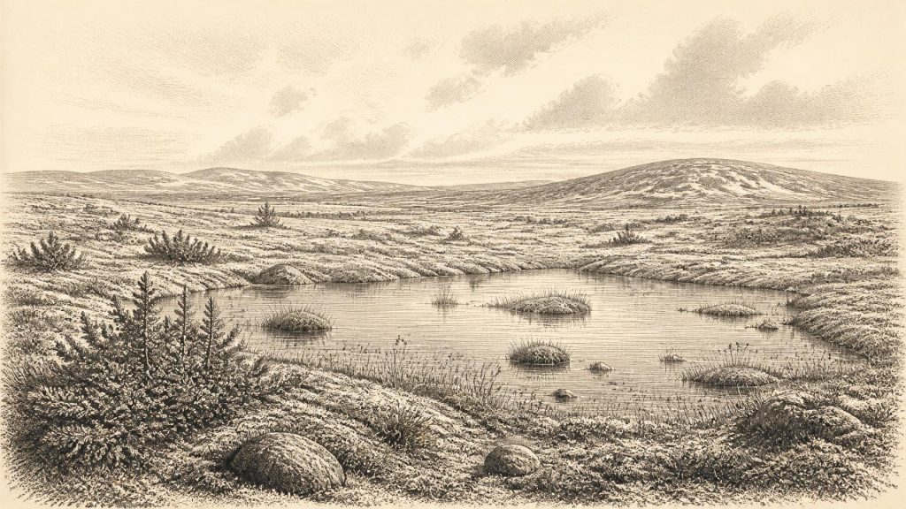
The plant evidence points to open, treeless tundra and a periglacial regime: a landscape affected by severe seasonal frost near, but not necessarily beneath, glacier ice. Pollen was poorly preserved, yet it included herbaceous taxa associated with tundra. Better-preserved plant macrofossils included mosses, while sedges, grasses, herbs and juniper form part of the reconstructed vegetation. Such evidence does not justify imagining an unbroken carpet of identical tundra from Cork to Donegal. Rather, it suggests damp, mossy and sedge-rich ground, patches of sparse dry-land vegetation, shallow freshwater and exposed mineral surfaces in the Fermanagh locality.
“Muskeg” has sometimes been used as an analogy for this wet, moss-dominated setting. The comparison is useful only if treated cautiously. It conveys waterlogged, organic ground broken by pools and frost-affected hollows; it should not be mistaken for an exact modern ecosystem transplanted into the past. The important conclusion is firmer: Derryvree preserves evidence for a cold, open habitat rather than woodland, farmland or a settled human landscape.
Animals on a Changing Margin
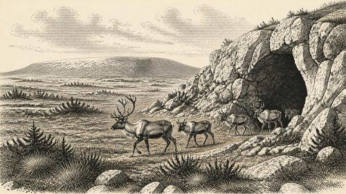
Irish cave deposits add another line of evidence, although they also demand caution. Caves such as Castlepook in north Cork, Foley Cave and Shandon Cave have yielded mammal remains attributed to parts of Marine Isotope Stage 3. Reassessment using improved bone pretreatment and modern accelerator radiocarbon methods has shown that several older measurements were unreliable or too young. This is not a technical footnote: revised dates have changed the apparent chronology of Ireland’s Pleistocene fauna and demonstrated how easily a tempting narrative can rest on insecure dates.
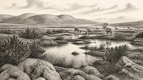
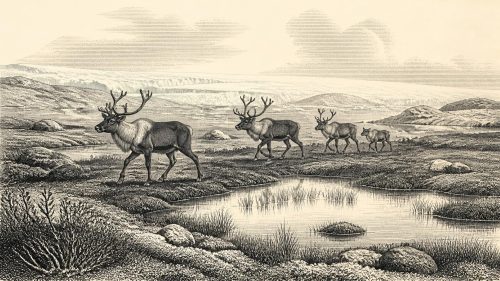
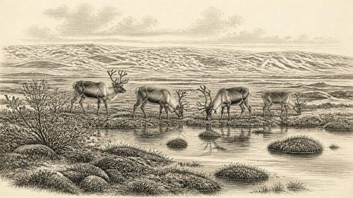
The broader faunal record indicates that cold-adapted and open-country mammals reached Ireland during portions of this long period. Reindeer and giant deer are among the animals represented, while some cave horizons also contain carnivores such as spotted hyaena. Their presence demonstrates ecological connections to the wider north-west European world at particular times. It does not establish that every species lived together at Derryvree, or that each occupied Ireland in 31,823 BCE itself. Cave assemblages may accumulate through carnivore activity, natural deaths, water movement and excavation disturbance; they are evidence of animals and processes, not ready-made snapshots of a single herd.
Nevertheless, animal remains and tundra vegetation together make a coherent ecological proposition. Where seasonal plant growth supported grazers and browsers, predators and scavengers could follow. The landscape was probably highly seasonal, with short productive summers and demanding winters. Mobility, rather than permanence, was likely fundamental to large mammals. River corridors, low ground and the then-expanded coastal plain may have mattered more than the later landmarks of counties, roads or towns.
No Known Community
There is no securely dated settlement, hearth, stone-tool assemblage, burial or built structure in Ireland that can responsibly be assigned to around 33,800 cal BP. Accordingly, there is no evidence for a resident community, social hierarchy, language, religion, trade network, territorial leadership or diplomacy at this date. It would be wrong to invent a Palaeolithic camp merely because contemporary Homo sapiens communities elsewhere in Europe made sophisticated tools, travelled widely and created art. Those wider developments provide context, not proof that they occurred in Ireland.
The possibility of very early human visits has attracted understandable interest. A reindeer femur from Castlepook was once interpreted as bearing a possible cut mark, but its meaning and chronological implications remain debated. Improved redating has strengthened the case that some Irish cave fauna is much older than formerly thought, while also underlining the limitations of antiquarian excavations and disturbed cave deposits. A plausible human modification on one bone would not, by itself, demonstrate a settled population. For this period, the prudent conclusion is that human presence in Ireland is unproven.
The best-supported evidence for human activity on the island is vastly later. Work at Alice and Gwendoline Cave in County Clare has identified a butchered brown-bear bone dated to the terminal Pleistocene, around 12,800–12,600 cal BP, though interpretations of that evidence have also been debated. Even if accepted, it belongs more than twenty millennia after the date considered here. The gap is historically important: it warns against projecting Ireland’s later hunter-gatherer settlement backwards into an earlier and ecologically different world.
What Cannot Be Written
For that reason, conventional headings such as political affairs, conflict, diplomacy, economy and learning have almost no direct content in this year. There were no known Irish polities, institutions, shrines, markets or written traditions. There is no evidence of organised warfare, exchange between communities, farming, animal husbandry, metalworking or formal religious practice. Silence here is not an omission in the record of kings; it is a characteristic of the period and of the evidence available.
There was, however, a physical history of enormous consequence. Frost, water, vegetation and migrating animals shaped a landscape that would later be transformed by ice-sheet expansion. Organic deposits at Derryvree survived only because sedimentary circumstances briefly preserved them. Glacial erosion then reworked much of Ireland, leaving the drumlins, rock basins, tills and altered drainage systems that would condition later soils, lakes, bogs and routes of movement. The distant future of Irish settlement was not present in 31,823 BCE, but some of its environmental foundations were being made.
An Evidence-Led Year
Thus the most accurate picture of Ireland around this point in time is a cold, open and regionally varied Pleistocene landscape, probably largely without established human communities and certainly without documented political or cultural institutions. Freshwater silts beneath a Fermanagh drumlin preserve mosses and other traces of tundra life; cave bones in southern Ireland reveal that changing animal communities reached the island during Marine Isotope Stage 3. Both bodies of evidence are powerful precisely because they are limited. They allow a history of climate and habitat, while requiring restraint about people. Modern calendar precision is unavailable, but calibrated ranges and careful interpretation still permit a meaningful view of Ireland long before history in the ordinary sense began.
Primary Sources
- Middle Midlandian Freshwater Series at Derryvree, Maguiresbridge, County Fermanagh, Northern Ireland
- A Reconsideration of the Radiocarbon Dating of the Marine Isotope Stage 3 Fauna from Southern Ireland
- The Irish Quaternary Fauna Project
- Growth and Retreat of the Last British–Irish Ice Sheet, 31,000 to 15,000 Years Ago: The BRITICE-CHRONO Reconstruction
- Extent and Timing of the Last Glacial Maximum (LGM) in Britain and Ireland: A Review
- Late Pleistocene Chronostratigraphy and Ice Sheet Limits, Southern Ireland
- Radiocarbon Constraints on the Age of the Maximum Advance of the British–Irish Ice Sheet in the Celtic Sea
- Last Glacial Maximum Cirque Glaciation in Ireland and Implications for Reconstructions of the Irish Ice Sheet
- New Data for the Last Glacial Maximum in Great Britain and Ireland
- Dimensions and Chronology of the Last Ice Sheet in Western Ireland
- Maximum Extent and Dynamic Behaviour of the Last British–Irish Ice Sheet West of Ireland
- Stratigraphic and Palaeo-Geomorphological Evidence for the Glacial-Deglacial History of the Last British-Irish Ice Sheet in the North-Western Irish Sea
- Middle Midlandian Interstadial Deposits at Greenagho, Near Belcoo, County Fermanagh, Northern Ireland
- Palaeoecology
- Quaternary Geology
- Advances in Irish Quaternary Studies
- Ireland: Submerged Prehistoric Sites and Landscapes
- The IntCal20 Northern Hemisphere Radiocarbon Age Calibration Curve (0–55 cal kBP)
- First Evidence of a Late Upper Palaeolithic Human Presence in Ireland
- New Insights on the Fauna of Ireland's Younger Dryas and Early Holocene from Alice & Gwendoline Cave