Derryvree’s Last Open Season30300 BCE
Around 30,300 BCE, a modern approximation rather than a precise recoverable date, Ireland was a cold, changing Ice Age landscape during Marine Isotope Stage 3. Organic sediments at Derryvree, County Fermanagh, deposited between glacial advances, preserve sedges, mosses, dwarf willow and aquatic plants, indicating treeless periglacial wetland. Cave remains at Castlepook, County Cork, document mammals including reindeer, mammoth, giant deer, bears, wolves and hyaenas, though they represent different episodes. A cut-marked reindeer bone may indicate an early human visit, not settlement. Increasing ice eventually transformed Ireland, while later deposits preserved only fragmentary environmental and faunal evidence from this broad interval.
Dateline
“30,300 BCE” is a useful modern label, not a date that can be recovered from the evidence with calendar-year precision. In the archaeological timescale it corresponds roughly to 32,250 calibrated years before present (cal BP, where “present” is AD 1950), within the later part of Marine Isotope Stage 3. No written record, settlement sequence or annual environmental archive allows historians to say what occurred in Ireland in that particular year. What can responsibly be described is a changing Ice Age landscape, reconstructed from deposits that accumulated across spans of centuries or millennia.
For Ireland, the most revealing evidence comes not from monuments or human graves, but from sediments, fossil plants, animal bones and the glacial layers that enclose them. Around this broad period, parts of the land now called Ireland could support cold-adapted vegetation and large mammals, while the regional ice sheet was dynamic and growing. The island’s later blanket of glacial deposits has erased or buried much of this earlier world. The result is a history with sharp limits: physical traces are real, but stories of named peoples, political communities or events are not.
A Date Within a Long Interval
The key chronological caution is the distinction between radiocarbon years and calendar years. An organic deposit at Derryvree, near Maguiresbridge in County Fermanagh, produced the measurement BIRM-166: 30,500 ± 1,200 radiocarbon years BP. Published calibrations have placed this broad evidence for an ice-free interval at approximately 36,900–31,700 cal BP. That range is far wider than a single year, and calibration curves have themselves been improved as new datasets become available. BIRM-166 is therefore not evidence for an event in 30,300 BCE. It is evidence that, for a substantial interval encompassing the approximate date, freshwater and wetland sediments formed at this northern locality between episodes of glaciation.
Derryvree is important precisely because its organic silts and muds were sandwiched between tills: unsorted debris deposited by ice. The sequence demonstrates that the site was not continuously entombed beneath one unchanging glacier throughout the last cold stage. At one point, water, plants and organic matter accumulated; later, ice again advanced and sealed that record. This is a local stratigraphic observation, not a licence to imagine all Ireland as mild or uniformly ice-free. Conditions varied greatly between uplands, lowlands, coasts and ice margins, while the available dates retain large uncertainties.
Wet Ground Beneath Future Drumlins
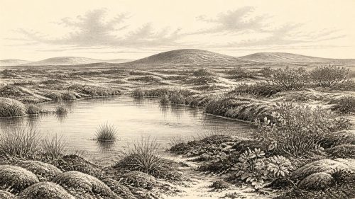
The Derryvree deposits preserve a treeless, cold-climate wetland rather than a forested Irish countryside. Plant macrofossils and related palaeoenvironmental evidence include sedges, mosses, dwarf willow, mountain avens, bogbean or buckbean (Menyanthes trifoliata) and water-milfoil. Such a combination points to open, periglacial ground with pools, wet hollows and shallow freshwater margins. It was a landscape capable of a short productive growing season, but exposed to severe winter cold and shaped by frost, meltwater and unstable ground.
This was not the familiar green island of later millennia. There is no basis for projecting modern woods, peat bogs, enclosed fields or a settled rural landscape backwards into this period. The deposits instead suggest a mosaic of herb-rich tundra, sedge wetland and sparse low shrubs. Local vegetation tells us about conditions at and around a depositional basin; it cannot provide a complete map of the whole country. Yet it gives a rare glimpse of living communities that existed before later ice movement remodelled much of the terrain.
The wider climatic setting was unstable. Ice sheets across Britain and Ireland did not simply grow in a smooth, uninterrupted advance. Research on the British–Irish Ice Sheet identifies repeated advance and retreat during Marine Isotope Stage 3, although the timing, thickness and extent of pre-Last Glacial Maximum ice remain less securely constrained than its later retreat. Reconstructions place a major phase of expansion across northern and central Ireland at about 30,000 cal BP, but this is partly an informed reconstruction from landforms and ice-flow evidence, not a direct annual record. At approximately 32,250 cal BP, Ireland stood within that longer transition towards much more extensive ice cover.
Animals on an Open Landscape
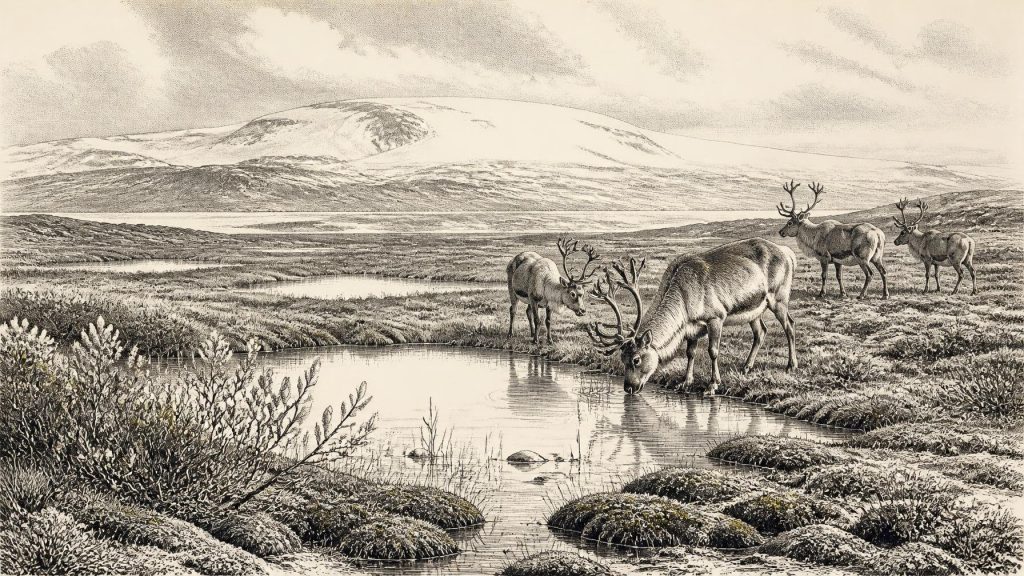
Caves in the south provide a complementary, though complicated, record. Castlepook Cave, also known as Mammoth Cave, near Doneraile in County Cork, has produced a remarkable assemblage of Pleistocene animal remains. Reindeer, woolly mammoth, giant deer, brown bear, wolf, fox, Arctic fox, lemmings and spotted hyaena attest that Ireland was, at different times in the Late Pleistocene, accessible to an assemblage associated with open and often cold environments. Revised radiocarbon work has shown that some Castlepook fauna is considerably older than earlier determinations indicated, placing important elements of the assemblage in Marine Isotope Stage 3.
Those bones should not be treated as a photograph of one year or one coherent animal community. Cave deposits may be accumulated by carnivores, natural deaths, water movement and later disturbance; early excavations also removed much of the original sedimentary context. A mammoth bone, a reindeer bone and a hyaena remain may each have entered a cave at different moments. Nevertheless, the combined evidence makes clear that the Irish landscape was not biologically empty in this broad period. Grazers and browsers could exploit open vegetation, while predators and scavengers followed prey or used caves as shelters and dens.
How these mammals reached Ireland is still not fully resolved. Lower global sea levels altered the outlines of the Irish Sea basin, and glacial conditions repeatedly changed routes and barriers. Fossil evidence demonstrates faunal presence, but not the precise paths, seasons or frequencies of movement. It is safer to say that the land was intermittently connected ecologically to wider north-west European faunal worlds than to assert a particular land bridge or migration route for 30,300 BCE.
The Human Question
Human history at this date is even more uncertain. Castlepook has yielded a reindeer femur bearing a deep linear mark interpreted by zooarchaeologist Ruth Carden as damage from a sharp stone tool during carcass processing. Public reporting has associated the specimen with an age of roughly 33,000 years. If that interpretation and chronological association are sustained, it would indicate a human visit to Ireland during the Upper Palaeolithic, vastly earlier than the long-recognised terminal-Pleistocene evidence from a cut-marked brown-bear patella at Alice and Gwendoline Cave in County Clare, dated to about 12,810–12,590 cal BP.
But the Castlepook find cannot yet bear the weight of a settled national origin story. It does not provide a securely associated hearth, dwelling, stone-tool assemblage, burial, occupation surface or village. Nor does it establish that people were present in 30,300 BCE specifically. The cave’s old collections are scientifically valuable but difficult: the depositional histories are mixed, and fresh excavation has so far recovered limited surviving Pleistocene material. The responsible conclusion is that a pre-Last Glacial Maximum human presence is possible and potentially significant, not that an enduring population or a named culture has been demonstrated.
No Politics, Yet a Human Landscape
Accordingly, there is no evidence from which to reconstruct political affairs, diplomacy, warfare, leaders, law or territorial boundaries in Ireland at this time. There are no inscriptions, language records, monuments or securely dated settlements. Nor can religion be described beyond the broadest comparison with Upper Palaeolithic communities elsewhere in Europe. People on neighbouring landmasses undoubtedly possessed social knowledge, technologies and cultural practices, but importing their art, ritual or identities into Ireland without direct evidence would be speculation.
The same restraint applies to economy and trade. If people did reach Ireland, a marked reindeer bone would be consistent with hunting or scavenging and the skilful use of stone edges to process animal tissue. It would not reveal a trading network, a regular hunting territory, a population size or a pattern of seasonal camps. Most of what can be said about everyday life instead belongs to the non-human environment: mobile herds, carnivore use of caves, cold wetland plants and people’s potential dependence on brief windows of habitable ground.
An Approaching Glacial Transformation
The major development appropriate to this point is environmental rather than political: the approach of more extensive glaciation. The Last Glacial Maximum came later, broadly between about 26,000 and 20,000 cal BP, when much of Ireland was covered by the British–Irish Ice Sheet. It would scour bedrock, deposit tills, reshape drainage and bury or destroy earlier surfaces. Derryvree’s organic horizon survived only because it was sealed beneath later glacial material. Castlepook’s cave passages, by contrast, protected fragments of a long and disrupted faunal archive.
Thus Ireland around 30,300 BCE is best understood as a threshold landscape. Its evidence records neither a nation nor a calendar year, but an open, cold and ecologically active country in transition. Freshwater silts at Derryvree show that life persisted in a northern wetland during an interval between ice advances. Cave bones in Cork show that Ice Age mammals ranged through parts of the land, and perhaps that small human parties occasionally did so too. Beyond those hard-won conclusions, silence is part of the history.
Primary Sources
- The Stratigraphic Position and Age of the Gortian
- Middle Midlandian Interstadial Deposits at Greenagho, Near Belcoo, County Fermanagh, Northern Ireland
- The Timing and Magnitude of the British–Irish Ice Sheet Between Marine Isotope Stages 5d and 2
- Growth and Retreat of the Last British–Irish Ice Sheet, 31,000 to 15,000 Years Ago: The BRITICE-CHRONO Reconstruction
- Radiocarbon Constraints on the History of the Western Irish Ice Sheet Prior to the Last Glacial Maximum
- Radiocarbon Constraints on the Age of the Maximum Advance of the British-Irish Ice Sheet in the Celtic Sea
- Late Pleistocene Chronostratigraphy and Ice Sheet Limits, Southern Ireland
- Trimlines, Blockfields and the Vertical Extent of the Last Ice Sheet in Southern Ireland
- Last Glacial Maximum Cirque Glaciation in Ireland and Implications for Reconstructions of the Irish Ice Sheet
- Stratigraphic and Palaeo-Geomorphological Evidence for the Glacial-Deglacial History of the Last British-Irish Ice Sheet in the North-Western Irish Sea
- A Reconsideration of the Radiocarbon Dating of the Marine Isotope Stage 3 Fauna from Southern Ireland
- The Irish Quaternary Fauna Project
- Pleistocene Vertebrates in the British Isles
- Proceedings of the Royal Irish Academy: Castlepook Cave Report
- Archaeology Research Excavation Grant 2022: Castlepook Cave, Co. Cork
- First Evidence of a Late Upper Palaeolithic Human Presence in Ireland
- New Insights on the Fauna of Ireland's Younger Dryas and Early Holocene from Alice & Gwendoline Cave
- The IntCal20 Northern Hemisphere Radiocarbon Age Calibration Curve (0–55 cal kBP)
- Bayesian Modelling the Retreat of the Irish Sea Ice Stream
- Advance and Retreat of the Marine-Terminating Irish Sea Ice Stream into the Celtic Sea During the Last Glacial: Timing and Maximum Extent
- Mammoth Cave, County Cork
- Archaeological Heritage of County Cork