
Derryvree’s Intertill Water-Milfoil30337 BCE
30,337 BCE is a modern label within MIS 3, not a year identifiable in Irish history. At Derryvree, County Fermanagh, organic sediments between tills, broadly dated to 36,900–31,700 calibrated years BP, record an ice-free freshwater wetland with cold, treeless vegetation. Castlepook Cave, County Cork, preserves mixed fauna accumulated over millennia, including reindeer, mammoth, giant deer and cold-adapted carnivores, demonstrating ecological links with north-west Europe. Ireland preceded the Last Glacial Maximum, when ice expanded widely. A possibly cut-marked reindeer femur suggests human presence but cannot prove settlement. Evidence supports a shifting, sparsely vegetated landscape, while human activity and routes remain uncertain.
Dateline
30,337 BCE is a modern calendar label, not a date at which an Irish event can be placed. It corresponds approximately to 32.3 thousand years before the radiocarbon convention of AD 1950, within the Late Pleistocene and Marine Isotope Stage 3 (MIS 3). No written calendar, annual record or archaeological sequence permits year-level history for Ireland at this depth of time. Even radiocarbon results measure samples rather than moments, carry statistical uncertainty and require calibration. The responsible approach is therefore to ask what evidence illuminates Ireland around this point, using calibrated ranges where they exist, and to separate what the deposits demonstrate from what remains interpretation.
The result is not a story of rulers, tribes or battles. Ireland had no known states, named communities, political institutions, diplomacy, settlements or monuments at this date. There is likewise no direct evidence for religion, language, art, farming, trade or a resident human population. Yet the island was part of a changing north-west European world of ice, exposed ground, freshwater basins and mobile animal populations. Its surviving record is unusually fragmentary because later ice movement eroded, buried and redistributed older surfaces. A handful of cave collections and buried sediments nevertheless preserve an important, if discontinuous, view of this lost landscape.
A Date Within a Wide Window
The most directly relevant Irish environmental archive is Derryvree, near Maguiresbridge in County Fermanagh. Road works exposed organic silts and fine sands lying between two tills: sediment laid down by water during an interval bracketed by deposits associated with ice. The key radiocarbon determination, BIRM-166, returned 30,500 radiocarbon years BP, with a substantial error range. In later calibrated terms, the organic horizon has been placed broadly at about 36.9–31.7 thousand calibrated years BP. The modern label 30,337 BCE, approximately 32.3 thousand calibrated years BP, falls within that broad range. It does not, however, identify a particular layer, season or event at Derryvree.
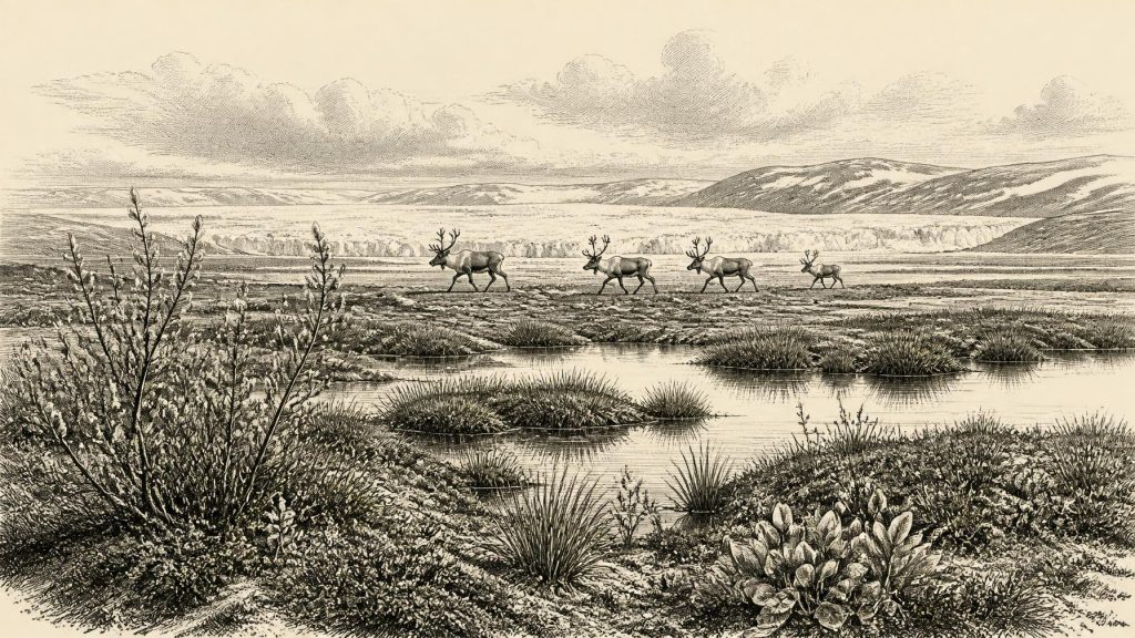
The significance of the site is local but real. Its plant and animal remains show that, while the freshwater sediments accumulated, this part of Fermanagh was not overridden by glacier ice. The assemblage included aquatic and wetland plants, mosses, sedges and cold-adapted taxa associated with open, treeless country. Water-milfoil indicates standing or slow-moving freshwater; bogbean, dwarf willow and other remains point to marshy margins and low vegetation rather than woodland. Insects and plant macrofossils reinforce the picture of a cold, strongly seasonal environment in which shallow pools, saturated ground and patches of tundra-like vegetation could coexist.
Derryvree should not be mistaken for a complete map of Ireland. A buried wetland tells us that its own basin was ice-free when its sediments formed; it cannot prove that every coast, mountain or lowland was open at precisely the same time. Nor does the age range resolve how long favourable conditions endured, or whether ice margins advanced and retreated repeatedly nearby. Still, the sequence decisively complicates the older image of an Ireland continuously smothered by ice throughout the later Ice Age. It records a freshwater refuge or interval of exposed terrain before the fullest expansion of the last ice sheet.
Approaching the Great Ice Expansion
The date belongs to an unsettled phase before the Last Glacial Maximum, not to the maximum itself. Evidence from landforms, offshore sediments, radiocarbon dates, luminescence dating and cosmogenic exposure ages shows that the British–Irish Ice Sheet later became much more extensive. Its maximum Irish phase is generally placed roughly between 27,000 and 23,000 calibrated years BP, though timings varied by sector and remain subject to revision. At its greatest known extent, ice covered all or almost all Irish low ground and extended across the surrounding continental shelf. Thus 30,337 BCE lies thousands of years before this later maximum, during a period when the growth, limits and behaviour of Irish ice remain less securely resolved.
Climate was not a single, steadily worsening winter. MIS 3 was marked across the North Atlantic by abrupt swings between relatively milder interstadials and colder stadials. Greenland ice-core chronologies provide the larger climatic framework, but they cannot be converted mechanically into a local Irish weather report. What can be said is that the Derryvree wetland formed during a cold period capable of supporting freshwater life and sparse vegetation, while regional ice was not static. Over the following millennia, increasingly severe conditions altered drainage, stripped soils, reshaped bedrock and ultimately buried or destroyed many older landscapes and any traces people might have left on them.
Coasts and routes must also be treated carefully. Global sea level was lower than today during the glacial period, exposing parts of the continental shelf. But ice loading depressed the land, sea levels changed through time, and the Irish Sea basin was itself affected by ice. It is therefore unsafe to draw a simple land bridge, assign a fixed shoreline, or infer a known route into Ireland for this exact date. The geography that mattered to animals or any human visitors was a moving combination of shore, estuary, shelf, ice margin and exposed ground, much of it now submerged or heavily reworked.
Castlepook’s Faunal Evidence
County Cork provides the other principal window. Castlepook Cave, near Doneraile, is Ireland’s richest known cave assemblage for Middle and Late Ice Age vertebrate fauna. Its older excavations, conducted from the late nineteenth century into the early twentieth century, recovered bones from complex cave deposits rather than from a single intact occupation floor. Modern reassessment and improved radiocarbon pretreatment have shown that some previously accepted dates were too young, while also demonstrating that the cave accumulated material across a long span, broadly from at least about 45,700 to 19,950 years ago. Its fossils cannot all be treated as contemporaneous.
Nevertheless, Castlepook establishes that an impressive range of animals reached Ireland during portions of MIS 3. The assemblage includes woolly mammoth, reindeer, giant deer, brown bear, wolf, fox, Arctic fox, lemmings and spotted hyaena. These remains do not recreate one harmonious herd on one day. Some may have been brought into the cave by carnivores, some moved through at different times, and the cave’s deposits have been disturbed and accumulated over long intervals. Taken together, however, they demonstrate that cold-open habitats and mammal movements connected Ireland to wider north-west European ecological systems.
For everyday animal life, such evidence is more secure than any human narrative. Reindeer were mobile grazers suited to open country; lemmings and Arctic fox signal cold conditions; mammoth and giant deer indicate that at least some expanses could sustain large herbivores. Spotted hyaena is particularly revealing because caves may have served as dens or scavenging places, helping explain why bones accumulated there. Predation, scavenging and seasonal movement were the central conflicts demonstrable in the record. It would be misleading to translate them into human warfare or organised hunting without the archaeological evidence to do so.
The Reindeer Femur Question
Castlepook also raises the most consequential possibility for Irish human history at this date. A reindeer femur in the National Museum of Ireland’s Natural History collections has been publicly reported as around 31,000 BC and as bearing a deep incision interpreted by zooarchaeologist Ruth Carden as a cut made with a sharp stone tool on fresh bone. If the mark is confirmed as human butchery and securely related to the animal’s death, it would indicate that people handled a reindeer in Ireland during the Upper Palaeolithic, far earlier than the long-established evidence for post-glacial settlement.
That possibility must remain exactly that: a significant but limited indication, not proof of a settled Ice Age Ireland. The femur comes from an old cave assemblage, not a sealed camp surface excavated to modern standards. No associated stone-tool assemblage, hearth, dwelling, burial, human bone, artwork or concentrated food waste of comparable age has yet been securely demonstrated. Nor can one modified bone establish whether people killed the animal, processed a carcass elsewhere, arrived in a small party, remained for days, crossed by a particular route or returned. The cave’s carnivore activity makes contextual caution especially necessary.
Elsewhere in Europe, people at broadly comparable dates made sophisticated stone and bone tools, travelled over large territories and participated in distinct Upper Palaeolithic cultural traditions. That wider comparison explains why a cut-marked Irish bone would matter. It cannot license an attribution of Aurignacian or Gravettian identity to Ireland, however. There is no diagnostic Irish lithic collection for 30,337 BCE, and no basis for naming an Irish people, reconstructing kinship, defining a trade network or assigning beliefs. Potential contact with Britain or continental Europe is a research question, not an established fact.
What Can Be Said Responsibly
Around this notional year, then, Ireland was neither the familiar wooded island of later prehistory nor an evidential blank. At Derryvree, a cold freshwater wetland supported plants and small creatures during an ice-free interval whose calibrated span includes the date in question. At Castlepook, a cave accumulated traces of a rich but time-depth-mixed Ice Age fauna, showing that reindeer, mammoth, carnivores and other animals reached the island during MIS 3. The climate was unstable, the ice-sheet story was still unfolding, and later glaciation would transform both terrain and preservation.
The human dimension is unresolved. The Castlepook reindeer femur may eventually prove that Upper Palaeolithic visitors butchered an animal in Ireland, but it cannot presently carry the weight of a settlement narrative. There were no known political affairs or diplomacy; no evidenced villages, economy, religion or formal learning. The most important development is geological and ecological: Ireland occupied a shifting threshold between habitable open ground and expanding ice. Continued excavation, direct dating, microscopic study of bone surfaces and re-examination of museum collections may refine that picture. They may never recover a history for one calendar year, but they can make the long prehistory of Ireland less silent.
Primary Sources
- A Middle Midlandian Freshwater Series at Derryvree, Maguiresbridge, County Fermanagh, Northern Ireland
- The timing and magnitude of the British–Irish Ice Sheet between Marine Isotope Stages 5d and 2: implications for glacio-isostatic adjustment, high relative sea levels and ‘giant erratic’ emplacement
- Timing and pace of ice-sheet withdrawal across the marine–terrestrial transition west of Ireland during the last glaciation
- Extent and deglacial chronology of the last British–Irish Ice Sheet: implications of exposure dating using cosmogenic isotopes
- Trimlines, blockfields and the vertical extent of the last ice sheet in southern Ireland
- Response of the Irish Ice Sheet to abrupt climate change during the last deglaciation
- Pleistocene glaciations in Ireland
- Extent and timing of the Last Glacial Maximum (LGM) in Britain and Ireland: a review
- Radiocarbon constraints on the age of the maximum advance of the British–Irish Ice Sheet in the Celtic Sea
- Late Pleistocene chronostratigraphy and ice sheet limits, southern Ireland
- Dimensions and chronology of the last ice sheet in Western Ireland
- A reconsideration of the radiocarbon dating of the Marine Isotope Stage 3 fauna from southern Ireland
- The Irish quaternary fauna project
- Castlepook Cave, County Cork: County Geological Site Report
- Archaeology Research Excavation Grant 2022: Final Report
- Heritage Artefacts of County Cork
- First evidence of a Late Upper Palaeolithic human presence in Ireland
- New insights on the fauna of Ireland's Younger Dryas and Early Holocene from Alice & Gwendoline Cave
- Quaternary Geomorphology
- Geology of Ireland
- IE GSI Quaternary Geomorphology (Glacial Landforms) 50k Ireland (ROI) ITM
- A stratigraphic framework for abrupt climatic changes during the Last Glacial period
