
BIRM-166’s Bogbean Shore30286 BCE
About 30,286 BCE, Ireland lay within a changing late Ice Age landscape rather than a documented historical world. At Derryvree, County Fermanagh, organic freshwater sediments between tills, dated broadly to 34,950–29,750 BCE, preserve evidence of locally ice-free tundra wetland, including bogbean, sedges, mosses and dwarf willow. Castlepook Cave, County Cork, indicates varied Marine Isotope Stage 3 fauna, including giant deer, hyaena, reindeer and mammoth, while a possibly cut-marked reindeer bone offers inconclusive evidence of human presence. Growing ice sheets soon transformed the island. No securely dated settlements, political institutions, economies or social practices can be confidently assigned to this period.
Dateline
The label 30,286 BCE is a modern point on a calendar projected far beyond the reach of Irish written history. No community in Ireland recorded a year, no settlement can be assigned to this date, and no archaeological deposit gives calendar-year precision at such depth of time. In radiocarbon terms the number is roughly 32,235 years before AD 1950, but that conversion is not itself an archaeological date. The responsible historical frame is a broad one: late Marine Isotope Stage 3, during the last Ice Age, when climate and ice margins could change markedly over centuries and millennia.
The most illuminating Irish evidence is not a chronicle but a buried wetland at Derryvree, near Maguiresbridge in County Fermanagh. Its radiocarbon determination, BIRM-166, is conventionally reported as 30,500 radiocarbon years before present, with a substantial uncertainty of +1,170 and −1,030 years. Modern calibration turns this into a wide calendar range rather than a single answer: broadly about 36,900–31,700 calibrated years BP, or approximately 34,950–29,750 BCE. Thus 30,286 BCE falls within the general chronological window relevant to the deposit, but cannot be made the date of one pool, plant, animal or human action. The organic sediment itself accumulated over time.
A Wetland Between Ice Advances
Derryvree was exposed in a road cutting through a drumlin in 1969. Beneath and above the organic layer lay separate sheets of till: unsorted material deposited by glacier ice. Between them were freshwater silts and fine sands, with organic matter. This sequence provides a clear relative order. Ice affected the locality before the wetland formed; a period then followed in which the area was locally ice-free enough for freshwater sediment and vegetation to accumulate; later glacier ice advanced again and sealed the deposit beneath till.
That is powerful evidence, but it is local evidence. It does not demonstrate that every part of Ireland was open ground at once, nor does it allow a map of a particular year. The northern British–Irish Ice Sheet was building rapidly during this wider period. Recent reconstructions begin charting its growth from about 31,000 years ago, while its maximum extent was reached at different times in different sectors, broadly from 30,000 to 22,000 years ago. By the fuller Last Glacial Maximum, conventionally placed around 27,000–23,000 calibrated years BP for Ireland’s maximum ice cover, ice had engulfed the island and much of its continental shelf. Around the date represented here, therefore, Ireland should be envisaged as a changing regional mosaic, not as either wholly ice-covered or uniformly habitable.
The Derryvree deposits are especially valuable because later ice preserved them. Glaciation also destroyed or disturbed innumerable older surfaces, campsites and animal remains. Absence of evidence elsewhere is consequently not proof of an empty island, but it sharply limits what can be claimed about it. The site is a rare environmental window, not a national census.
Treeless Fermanagh
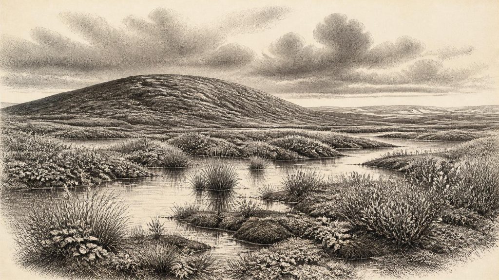
The plant and small-animal evidence from Derryvree indicates open tundra vegetation and a periglacial climate: ground and water affected by intense cold, seasonal freezing and thawing, but not necessarily buried beneath active glacier ice at that moment. Pollen was poorly preserved, yet the surviving record and plant macrofossils point to herb-rich, largely treeless terrain. Mosses, sedges and freshwater plants grew in and around standing or slowly moving water. Finds reported from the deposit include bogbean (Menyanthes trifoliata), water-milfoil, freshwater mosses, dwarf willow, mountain avens and other plants now familiar from cold or alpine environments.
This was not the forested Ireland often imagined from later prehistory. Trees would have been absent or extremely scarce around the Fermanagh basin. The scene was likely patchy: shallow pools and silty margins, wet mossy ground, low herbs and dwarf shrubs, with more exposed mineral soil on drier rises. Summer growth may have been brief but productive in sheltered wet places; winter brought hard constraints. The organic material does not support a picture of uninterrupted deep snow or universal barren ice. Rather, it records an austere but living freshwater landscape at a northern Atlantic climatic edge.
Climate interpretation must remain cautious. A fossil plant shows that suitable conditions existed close to where it was deposited; it cannot yield a precise annual temperature or rainfall total. Nor should the wetland be treated as a miniature version of the whole island. Uplands, western coasts, limestone caves and lowland basins would have responded differently to changes in snow accumulation, wind, drainage and advancing ice. Yet Derryvree firmly refutes any simple notion that pre-maximum-glaciation Ireland was lifeless beneath permanent ice.
Animals in the Southern Caves
County Cork’s Castlepook, or Mammoth, Cave near Doneraile supplies a complementary, though differently preserved, archive. Its old excavated collections and more recent reassessments show that southern Ireland supported a varied Pleistocene mammal fauna during Marine Isotope Stage 3. Re-dating of bones using improved pretreatment methods has demonstrated that several earlier cave dates were too young. The revised work places some Castlepook material thousands of radiocarbon years further back and indicates that animals including giant deer and spotted hyaena had disappeared locally before the Last Glacial Maximum, perhaps around 40,000 calibrated years ago.
Reindeer, brown bear, fox, hare, lemming, hyaena and woolly mammoth are among the kinds of Ice Age fauna represented in the wider Castlepook investigations and collections. Such animals should not be assembled into an imagined herd standing together on one day in 30,286 BCE. Cave deposits accumulate unevenly, and bones may be introduced by carnivores, water, natural deaths or people. Nevertheless, the assemblage establishes that suitable habitats and animal routes existed in Ireland before the later ice-sheet maximum. It also suggests an environment more ecologically varied than the Derryvree wetland alone can show: open feeding ground for herbivores, carnivore ranges, caves used as shelters or dens, and routes through a landscape not yet fully overwhelmed by ice.
A reindeer femur from Castlepook has been reported to bear an incision consistent with cutting fresh bone by a sharp stone tool. If confirmed as a human-made cut, it would be extraordinarily important evidence for a very early Upper Palaeolithic visit to Ireland. It does not, however, establish a settled population, a village, or a date for this particular calendar year. The bone derives from an old collection, and the cave’s chronology and site formation remain subjects of active reassessment. The proper conclusion is narrower: possible human interaction with an animal has been proposed for pre-Last Glacial Maximum Ireland; the evidence is intriguing, but insufficient to reconstruct a resident society.
No Polities, No Proven Settlements
For the headings normally used in a year-by-year history—politics, diplomacy, warfare, rulers and institutions—there is no evidence at all. There were no states, kingdoms, written agreements, borders or named peoples that can responsibly be assigned to Ireland at this time. Equally, there is no secure archaeological basis for describing houses, camps, kinship structures, ritual sites, artistic traditions, languages or burial customs in Ireland around 30,286 BCE.
Economy and trade must be treated with the same restraint. The Derryvree flora documents an ecosystem, not food collection by people. The Castlepook fauna documents animals and cave histories, not a hunting economy. If people did occasionally reach the island during this broad phase, they may have moved through a wider north-west European world in which mobile hunter-gatherers used stone, animal and plant resources. But that is a comparison drawn from surrounding regions, not a demonstrated Irish way of life. No Irish stone-tool assemblage, hearth, dwelling floor, worked-bone industry or exchange network securely belongs to this date.
Even movement to Ireland cannot be reduced to a simple land-bridge story. Lower global sea levels altered coastlines, but Ireland’s separation from Britain and the character of the Irish Sea changed through time, while ice, sea ice, weather and shifting channels would have shaped access. The lack of securely dated sites may partly reflect preservation and research history, particularly along now-submerged or glacially reworked landscapes. It cannot be used to prove either routine access or complete isolation.
The Historical Significance of a Mud Layer
The principal development relevant to Ireland around this notional year was environmental rather than political: the approach of a major glacial transformation. Derryvree records a cold, treeless wetland during an interval between ice advances. Castlepook records the broader presence of large mammals and predators in pre-maximum-glaciation Ireland. Together they show that the island’s Late Pleistocene past was dynamic—ice, water, vegetation and fauna repeatedly reshaped the opportunities for any animal, including humans, to live or travel here.
Later ice would obscure much of that world. It would remould ground into drumlins, redistribute sediments and remove many traces of earlier occupation. This is why BIRM-166 matters. A thin seam of organic silt beneath Fermanagh till preserves evidence that, within a long cold age, there was freshwater, vegetation and seasonal ecological life. Around 30,286 BCE, that is the most defensible Irish history: not an invented event, but a carefully bounded reconstruction of an Ice Age landscape on the brink of further change.
Primary Sources
- Middle Midlandian Freshwater Series at Derryvree, Maguiresbridge, County Fermanagh, Northern Ireland
- Middle Midlandian Freshwater Series at Derryvree, Maguiresbridge, County Fermanagh, Northern Ireland
- Palaeoecology: South Fermanagh, Northern Ireland
- Figure 6: The Subdivision of the Quaternary Period in Ireland
- Field Guides
- A Reconsideration of the Radiocarbon Dating of the Marine Isotope Stage 3 Fauna from Southern Ireland
- The Irish Quaternary Fauna Project
- New Insights on the Fauna of Ireland's Younger Dryas and Early Holocene from Alice & Gwendoline Cave
- The Colonization of Ireland: A Human Ecology Perspective
- Ireland: Submerged Prehistoric Sites and Landscapes
- Ireland: Submerged Prehistoric Sites and Landscapes
- Growth and Retreat of the Last British–Irish Ice Sheet, 31,000 to 15,000 Years Ago: the BRITICE-CHRONO Reconstruction
- Growth and Retreat of the Last British–Irish Ice Sheet, 31,000 to 15,000 Years Ago: the BRITICE-CHRONO Reconstruction
- Pattern and Timing of Retreat of the Last British-Irish Ice Sheet
- Timing, Pace and Controls on Ice Sheet Retreat: an Introduction to the BRITICE-CHRONO Transect Reconstructions of the British–Irish Ice Sheet
- Stratigraphic and Palaeo-Geomorphological Evidence for the Glacial-Deglacial History of the Last British-Irish Ice Sheet in the North-Western Irish Sea
- Radiocarbon Constraints on the Age of the Maximum Advance of the British–Irish Ice Sheet in the Celtic Sea
- Character of Advance and Retreat of the Southwest Sector of the British-Irish Ice Sheet During the Last Glaciation
- The IntCal20 Northern Hemisphere Radiocarbon Age Calibration Curve (0–55 cal kBP)
- Our Ancient Landscapes: Hunter-Gatherers in Ireland