
Derryvree’s Bogbean Marsh31725 BCE
31,725 BCE is a modern label, not a datable Irish year. Evidence from Derryvree, County Fermanagh, indicates a freshwater marsh between glacial advances during MIS 3, containing bogbean, mosses, sedges, herbs and cold-adapted insects. It suggests local treeless tundra-steppe conditions, not continuous ice cover, although dates span centuries or millennia. Ireland’s ice sheet fluctuated regionally; Kerry speleothems record intermittent milder phases. Cave remains show that cold-environment mammals reached Ireland at various times, but deposits are chronologically complex. No securely dated human occupation exists. Together, these records portray Pleistocene landscapes of wetlands, exposed ground, fauna and advancing ice, beyond annual precision.
Dateline
The label 31,725 BCE is a modern filing device, not a recoverable Irish year of events. No calendar, writing, named ruler, community, battle or settlement allows historians to describe what happened in Ireland in that particular year. In archaeological usage it falls roughly 33,700 calibrated years before present, where “present” conventionally means AD 1950. That conversion is only approximate. At this depth of time, radiocarbon results have laboratory errors, require calibration against changing atmospheric carbon, and normally resolve ranges of centuries or millennia rather than a single year.
The responsible subject is therefore Ireland during the later part of the Late Pleistocene, broadly Marine Isotope Stage 3 (MIS 3): a long, climatically unstable phase before the Last Glacial Maximum. The nearest useful Irish evidence is not an annal but a sequence of buried sediments at Derryvree near Maguiresbridge, County Fermanagh. It gives a rare, local glimpse of cold-country life in a landscape later altered and sealed by glacier ice. Cave bones in Cork, cave calcite in Kerry, and landforms and offshore sediments around the island extend the picture, but none provides a day-by-day history.
Between Two Ice Advances
At Derryvree, road-cutting through a drumlin in 1969 exposed organic silts and fine sands between two tills: dense, unsorted deposits left by moving ice. The lower till belongs to an earlier glacial episode; the upper till records a later advance. Between them lay the remains of a freshwater environment. Organic material from this middle unit returned a conventional radiocarbon age of 30,500 years BP, with a large uncertainty. Later calibration places its possible age broadly around 36,900–31,700 calibrated years BP. The modern label 31,725 BCE lies close to the younger edge of that wide span. It is reasonable to use Derryvree as evidence for the environmental world around this date-range, but not to claim that the marsh existed in precisely 31,725 BCE.
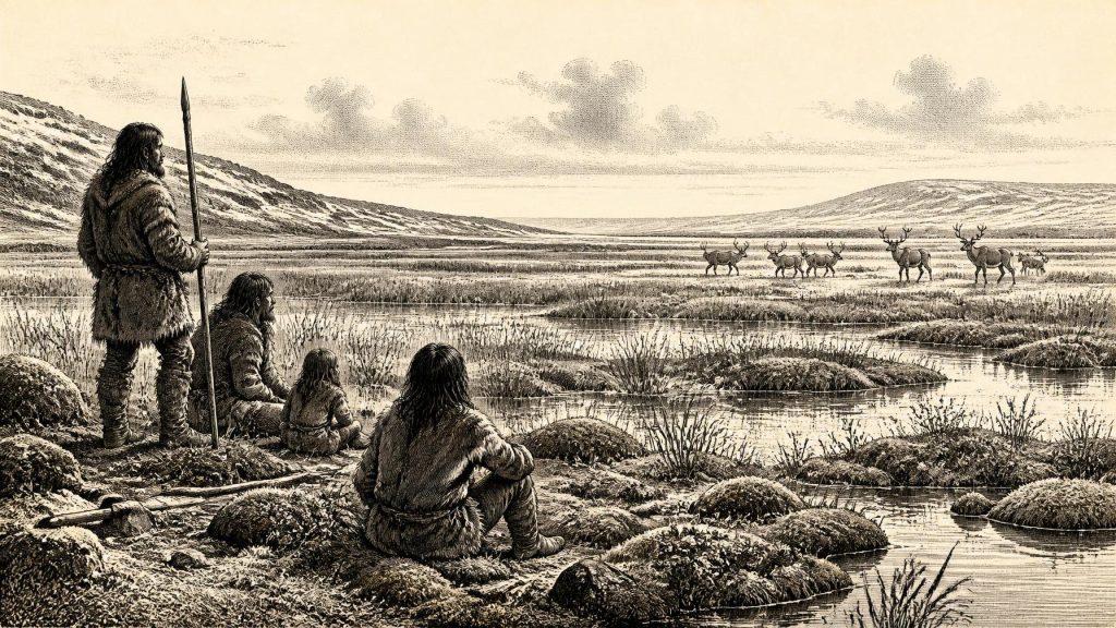
The deposits indicate that south Fermanagh was not continuously buried beneath ice throughout the relevant interval. Freshwater mosses and sedges, pollen of herbaceous plants, plant macrofossils and cold-adapted insects accumulated in a wet hollow. One notable find was a seed of bogbean, Menyanthes trifoliata, a plant of shallow, wet ground. Such evidence points to a marshy or muskeg-like freshwater setting surrounded by sparse, open vegetation. It does not recreate a complete landscape map: pollen can travel, preservation is selective, and the exposed section represents one place rather than all of Ireland. Nevertheless, it is unusually direct evidence that living plants, insects and standing or slow-moving freshwater existed in at least part of the country before the later ice advance.
The climate was periglacial: intensely cold and shaped by repeated freezing and thawing, but not necessarily glaciated at the spot where the organic layers formed. The broad inference is a treeless tundra or tundra-steppe environment, with mosses, sedges and herbs exploiting wet ground and a thin seasonal growing period. Bare mineral soil, frost-disturbed surfaces and exposed slopes probably alternated with wetter basins. This was not the Ireland of oak woods, blanket bogs and enclosed fields. Yet it was not simply a lifeless white expanse either. The Derryvree record matters because it preserves a functioning cold-climate ecosystem.
An Uneven Irish Ice Sheet
It would be misleading to imagine one simple frontier between an ice-covered north and an ice-free south. The British–Irish Ice Sheet changed repeatedly in size and flow during the last glacial period. Evidence from tills, marine sediments, exposure dating and landforms shows that its margins were mobile and that different sectors responded differently to climate and sea level. In western Ireland, radiocarbon evidence from marine deposits has been interpreted as showing substantial ice loading and fluctuations before the Last Glacial Maximum. Other reconstructions indicate that large parts of Ireland were ice-free until at least about 34,000 years ago, while also emphasising regional uncertainty.
For the period represented by 31,725 BCE, the safest description is one of change rather than a fixed national condition. Northern freshwater deposits such as Derryvree and Greenagho show that non-glacial conditions occurred in parts of Fermanagh during MIS 3. Conversely, earlier and later tills prove that glacier ice had reached those areas at other times. In the south-west, uranium-thorium dates from broken and reworked speleothems in Crag Cave, County Kerry, show episodic calcite growth through MIS 3. In shallow caves, dripstone can form only when liquid water infiltrates the ground and conditions are sufficiently mild for soil carbon dioxide and percolation. Its growth is therefore evidence for intervals of climatic amelioration, not for permanently benign weather.
These Irish records fit a wider North Atlantic pattern of abrupt millennial-scale shifts, often correlated with Greenland interstadials and stadials. Correlation is useful but should not erase uncertainty. A Greenland ice-core event, a Fermanagh marsh deposit and a Kerry stalagmite are dated by different methods and have different resolutions. They show that Ireland was affected by wider climatic oscillations; they do not permit the weather, season or shoreline of 31,725 BCE to be specified exactly.
Animals and Their Fragile Record
Animal bones from Irish caves offer another, separate line of evidence. Castlepook Cave, near Doneraile in north County Cork, is especially important because it has yielded pre- and post-Last Glacial Maximum faunal material. The wider MIS 3 cave record includes large mammals associated with cold, open environments, among them giant deer, reindeer, brown bear, wolf, Arctic fox, lemmings and, in some deposits, spotted hyaena and woolly mammoth. These animals establish that Ireland could be reached by a varied Pleistocene fauna during favourable phases of the last glacial period.
That statement needs two qualifications. First, a cave assemblage is not a census of animals living together on one day. Carnivores may carry bones into caves; water, collapse and excavation can mix deposits; and an individual bone may pre-date or post-date another by thousands of years. Secondly, improved ultrafiltration pretreatment and re-dating have shown that several older Irish radiocarbon determinations were too young. A major reassessment of Castlepook material moved some specimens substantially further back in time and suggests that giant deer and spotted hyaena may have disappeared locally before about 40,000 calibrated years BP. The cave evidence is consequently powerful, but it must be read specimen by specimen rather than as an unchanging Ice Age menagerie.
Reindeer are particularly evocative because their seasonal movements and use of open ground make them plausible inhabitants of this cold world. Their presence in the broader Irish Pleistocene record does not prove a herd at Derryvree in this exact calendar-labelled year. Nor do the bones demonstrate a stable land bridge or a single route of arrival. Lower global sea levels altered the configuration of coasts and shallow seas, but the changing ice sheet, local sea level and routes across the Irish Sea basin were complex. It is safer to say that animal movement between Ireland and the wider north-west European region was possible at intervals than to draw a definite corridor for 31,725 BCE.
The Human Question
No securely dated human habitation, hearth, stone-tool assemblage or burial establishes a resident human population in Ireland at about 33,700 calibrated years BP. This absence is central, not a gap to be filled with a story. Mainland north-west Europe had Upper Palaeolithic hunter-gatherers, and Britain preserves evidence of human visits in parts of the period, but neither fact demonstrates that people crossed into Ireland. The island’s changing geography and harsh climate may have made such movement difficult, while the scarcity and disturbance of surviving deposits make detection difficult as well.
A reported possible cut mark on a reindeer bone from Castlepook has sometimes been discussed as potential evidence that people processed an animal in Ireland during MIS 3. It is an intriguing claim, but it is not a securely associated archaeological occupation. One ambiguous modification on a cave bone cannot establish the date, scale, continuity, identity or route of human activity. The evidence permits the possibility of brief human incursions; it does not responsibly support a settled Irish Upper Palaeolithic society at this point.
Accordingly, there is no evidential basis for political affairs, diplomacy, warfare, law, language, religious institutions, formal learning, trade networks, villages or households in Ireland in 31,725 BCE. If humans did visit, they would have depended on mobile hunter-gatherer knowledge: reading animal movements, finding shelter and fuel, maintaining tools and surviving severe seasonality. But that is an inference from comparable Upper Palaeolithic societies elsewhere, not a description of documented Irish people. No Irish artefact or settlement allows those possibilities to be converted into fact.
A Landscape Without an Annal
The economic reality that can be securely described is ecological rather than human. Wetland plants captured sunlight during a short growing season; insects and small animals occupied the marsh and its margins; larger mammals ranged through some Irish landscapes over the wider MIS 3 interval. Predation, scavenging and migration were the forms of conflict we can observe most closely. The deposits themselves show environmental succession: waterborne silts, organic matter and fossils accumulated in a basin, then later ice overran or covered the landscape, preserving the evidence beneath till.
The most important development around this modernly numbered date was therefore neither a king’s accession nor a migration recorded in speech or writing. It was Ireland’s position near an environmental threshold. Derryvree’s bogbean, mosses, sedges and insects record an ice-age wetland during a cold, open phase. Castlepook’s difficult bone archive shows that substantial mammals reached Ireland at various times before the ice sheet’s maximum expansion. Crag Cave registers repeated climatic improvement and deterioration. Together they reveal a country of local refuges, exposed ground, freshwater hollows and advancing ice—real, dynamic and inhabited by plants and animals, yet still beyond the precision of annual human history.
Primary Sources
- An Inter-Till Freshwater Deposit at Hollymount, Maguiresbridge, County Fermanagh
- Palaeoecology
- Figure 6.— The Subdivision of the Quaternary Period in Ireland
- Middle Midlandian Interstadial Deposits at Greenagho, Near Belcoo, County Fermanagh, Northern Ireland
- A Reconsideration of the Radiocarbon Dating of the Marine Isotope Stage 3 Fauna from Southern Ireland
- The Irish Quaternary Fauna Project
- New Insights on the Fauna of Ireland's Younger Dryas and Early Holocene from Alice & Gwendoline Cave
- Episodic Speleothem Deposition Tracks the Terrestrial Impact of Millennial-Scale Last Glacial Climate Variability in SW Ireland
- Spatio-Temporal Dynamics of Speleothem Growth and Glaciation in the British Isles
- Radiocarbon Constraints on the History of the Western Irish Ice Sheet Prior to the Last Glacial Maximum
- Radiocarbon Constraints on the History of the Western Irish Ice Sheet Prior to the Last Glacial Maximum
- Growth and Retreat of the Last British–Irish Ice Sheet, 31,000 to 15,000 Years Ago: the BRITICE-CHRONO Reconstruction
- Timing, Pace and Controls on Ice Sheet Retreat: an Introduction to the BRITICE-CHRONO Transect Reconstructions of the British–Irish Ice Sheet
- Timing and Pace of Ice-Sheet Withdrawal Across the Marine–Terrestrial Transition West of Ireland During the Last Glaciation
- Dimensions and Chronology of the Last Ice Sheet in Western Ireland
- Trimlines, Blockfields and the Vertical Extent of the Last Ice Sheet in Southern Ireland
- Extent and Deglacial Chronology of the Last British–Irish Ice Sheet: Implications of Exposure Dating Using Cosmogenic Isotopes
- New Data for the Last Glacial Maximum in Great Britain and Ireland
- The Antiquity of Man in Ireland
- Phylogeographic, Ancient DNA, Fossil and Morphometric Analyses Reveal Ancient and Modern Introductions of a Large Mammal: the Complex Case of Red Deer in Ireland
- BSBI: Menyanthes Trifoliata
