BIRM-166’s Menyanthes Seed30319 BCE
Around 30,319 BCE, no precise Irish calendar history can be reconstructed, but Derryvree in County Fermanagh provides rare Late Pleistocene evidence. Organic silts, dated broadly to 36,900–31,700 calendar years BP, formed between glacial tills, proving local ice-free conditions rather than island-wide deglaciation. Bogbean seed, plants, pollen, mosses and insects indicate a seasonal freshwater wetland within open, treeless tundra-steppe. MIS 3 climate and ice cover were unstable and regionally varied, while changing seas affected animal movement. Cave bones show mammals across long periods, not local contemporaneity. No secure evidence supports human settlement in Ireland then; ecological traces, not society, define era.
Dateline
Modern calendar-year precision is not available for Ireland in 30,319 BCE. This number is a convenient point on a modern chronological scale, not a recoverable year in which an Irish event can be assigned to a season, a ruler or even a lifetime. The closest unusually informative evidence comes from Derryvree, near Maguiresbridge in County Fermanagh: an organic freshwater deposit given the laboratory number BIRM-166. Its conventional radiocarbon result, 30,500 ± 1,100 radiocarbon years BP, calibrates broadly to about 36,900–31,700 calendar years BP. That wide interval overlaps the general horizon represented by 30,319 BCE, but it cannot identify conditions in that exact year. What it can provide is a responsibly bounded view of Late Pleistocene Ireland during Marine Isotope Stage 3 (MIS 3), well before the later maximum of the British–Irish Ice Sheet.
A Wetland Beneath a Drumlin
Derryvree was revealed accidentally during roadworks in 1969, when a cutting passed through a north-east–south-west drumlin. Beneath the familiar rounded glacial landform lay two substantial sheets of till: stony sediment deposited by ice. Between them were fine sands and organic freshwater silts. The sequence is important because it records change rather than a single frozen landscape. Ice had advanced across the locality, then a depression held water and organic material accumulated, and later ice overrode or sealed the deposit beneath a new layer of till. The sediments therefore demonstrate an interval when this part of Fermanagh was locally ice-free; they do not prove that all Ireland was ice-free at once.
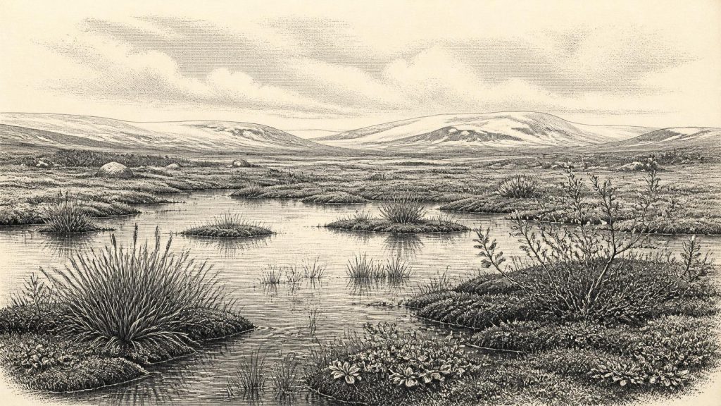
The organic layer preserves plant macrofossils, pollen, mosses and insects. Its most memorable specimen is a seed of bogbean, Menyanthes trifoliata, a three-leaved plant of shallow fresh water and saturated ground. Water-milfoil and sedge-rich vegetation, together with mosses and other wetland plants, show that pools or very slow-moving water existed. The evidence should not be stretched into a picture of a large lake, broad reed beds or a recognisably modern Irish bog. It does establish a small but real freshwater habitat: a wet hollow where plants could complete short seasonal growth cycles despite a severe climate.
Open Ground, Short Summers
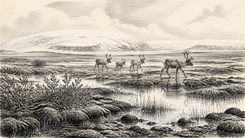
The wider Derryvree assemblage points to open tundra or tundra-steppe, not woodland. Herb pollen is dominant, while mosses, grasses, sedges, juniper and cold-tolerant herbs belong to a landscape with few or no local trees. Some pollen of pine or hazel can occur in such records, but wind can transport pollen far beyond the plants that produced it; isolated grains are not evidence of a local forest. In the older descriptive language of Irish Quaternary research, Derryvree was a “muskeg” environment: a mosaic of mossy, waterlogged ground, shallow pools and sparse vegetation. In modern terms, it was a periglacial wetland shaped by frost, thaw, snowmelt, waterlogging and wind exposure.
This was not a lifeless white wilderness. Mosses, sedges and flowering plants created cover and food for invertebrates; standing water supported specialised aquatic life; and brief summers could be biologically productive. Yet productivity was sharply seasonal. Long winters, frozen or intermittently frozen ground, and a short growing season limited the development of soils and trees. The insect assemblages from Derryvree reinforce this interpretation of cold, open country with wet, plant-rich pools. They provide environmental evidence, however, rather than a weather report. No deposit can say whether 30,319 BCE itself was a colder year, a snowy year, or a summer of unusually high water.
An Island in an Unstable Ice Age
The relevant geological setting is MIS 3, a long and climatically erratic portion of the last Ice Age. Greenland ice-core records show repeated abrupt shifts between colder stadials and relatively milder interstadials. Irish cave formations at Crag Cave in County Kerry grew only during some episodes when conditions allowed soil water and carbon dioxide to reach the cave, providing independent evidence that the island’s terrestrial climate could change markedly over millennial timescales. Derryvree’s freshwater interval belongs to this unstable world, not to an unchanging “Ice Age climate”.
At the scale of Ireland, ice cover was regionally variable and its growth was not synchronous. The BIRM-166 result, together with comparable evidence from Greenagho in Fermanagh, places ice-free conditions in north-central Ireland before the main later expansion of the last ice sheet. Wider reconstructions indicate that major ice-sheet growth and maximum extent developed later and differently in different sectors; the ice margin in the Irish Sea and on the western shelf did not behave as a single steadily advancing front. Thus it would be wrong either to picture the entire island as glacier-covered in 30,319 BCE or to imagine a wholly open land bridge landscape. The defensible conclusion is a patchwork of open terrain, expanding or surviving ice in some regions, altered coastlines and changing routes across the surrounding shelf.
Lower global sea levels exposed more of the continental shelf than exists today, but that fact does not by itself demonstrate a continuously dry crossing between Ireland and Britain. Sea depth, local ice margins, rivers, estuaries and the timing of particular cold phases mattered. The presence of mainland European animals in Ireland demonstrates ecological connection over long periods, not a mapped route available in a named calendar year. In a landscape continually rearranged by ice and sea, opportunities for animal movement could open and close over centuries or millennia.
Animals, Caves and Caution
For the animal world, Castlepook or Mammoth Cave near Doneraile, County Cork, is the other major Irish reference point. Collections from the cave include bones of woolly mammoth, reindeer, horse, giant deer, brown bear, wolf and spotted hyaena. The Irish Quaternary Fauna Project concluded that a diverse mammalian fauna reached Ireland at some point between at least about 45,000 and 20,000 years ago. Such animals are appropriate to an open, cold-stage landscape with substantial grazing resources and predators. They show that Ice Age Ireland was connected to wider north-west European faunal histories rather than biologically isolated.
But a cave bone assemblage is not a census of one valley on one day. Cave deposits can collect remains from carnivore activity, natural deaths, water movement, collapse and disturbance, while old excavations often removed deposits before modern recording standards existed. Direct dating has also shown that some older Irish radiocarbon determinations need reassessment. Individual bones from Castlepook may be far apart in age, and the full list of species should not be turned into one simultaneous herd. Around the target date, reindeer or other large mammals may plausibly have used suitable Irish terrain, but the evidence does not permit a claim that a particular species stood at Derryvree in 30,319 BCE.
No Demonstrable Irish Society
There is no secure evidence for a human settlement, hearth, stone-tool assemblage, burial, dwelling floor or occupation surface in Ireland at this depth in time. Therefore there are no known Irish leaders, political communities, alliances, wars, diplomatic relations, farms, markets, religious institutions or systems of learning to describe. These are not gaps that can properly be filled by borrowing the better-known Upper Palaeolithic societies of continental Europe or Britain. Human groups certainly lived elsewhere in north-west Europe, but proximity is not proof of a contemporary Irish population.
The earliest published archaeological evidence interpreted as human activity in Ireland is much later: cut marks on a brown-bear patella from Alice and Gwendoline Cave, County Clare, directly dated to the terminal Pleistocene, around 12,800–12,600 calibrated BP. Subsequent excavation and dating have strengthened the importance of that cave while also demonstrating the complexity and disturbance of its deposits. This later evidence makes clear why cave collections deserve continuing study; it cannot establish human presence more than twenty millennia earlier at Derryvree.
The Meaning of One Seed
For this remote point in Irish history, the bogbean seed is more revealing than any invented narrative of tribes or hunters. It attests to a freshwater margin in a cold, treeless landscape; the enclosing tills show that this living surface stood between episodes of glaciation; insects and plant remains reveal a functioning, if highly seasonal, wetland ecosystem. Cave bones elsewhere show that large mammals moved into Ireland during the wider Late Pleistocene. Together, these traces describe ecological history rather than political history.
Ireland around the broad calibrated interval relevant to 30,319 BCE was neither the wooded island of later prehistory nor necessarily a featureless field of ice. At Derryvree, water gathered in a low place beneath what would later become a drumlin, and bogbean set seed. That modest fossil has survived because later ice sealed the mud around it. It offers a rare, local and carefully limited witness to an Ireland of tundra pools, mossy margins, short summers and shifting ice—an ancient environment long before a securely evidenced human society on the island.
Primary Sources
- A Middle Midlandian Freshwater Series at Derryvree, Maguiresbridge, County Fermanagh, Northern Ireland
- Irish Pleistocene Biostratigraphy
- The Irish Quaternary Fauna Project
- Episodic Speleothem Deposition Tracks the Terrestrial Impact of Millennial-Scale Last Glacial Climate Variability in SW Ireland
- First Evidence of a Late Upper Palaeolithic Human Presence in Ireland
- New Insights on the Fauna of Ireland’s Younger Dryas and Early Holocene from Alice & Gwendoline Cave
- Growth and Retreat of the Last British–Irish Ice Sheet, 31,000 to 15,000 Years Ago: the BRITICE-CHRONO Reconstruction
- The Timing and Magnitude of the British–Irish Ice Sheet Between Marine Isotope Stages 5d and 2
- The Deglaciation of the Western Sector of the Irish Ice Sheet from the Inner Continental Shelf to its Terrestrial Margin
- Sedimentary and Foraminiferal Records of Late Quaternary Environmental Change West of Ireland and Implications for the Last British–Irish Ice Sheet
- Exploring Controls of the Early and Stepped Deglaciation on the Western Irish Shelf
- Timing and Pace of Ice-Sheet Withdrawal Across the Marine–Terrestrial Transition West of Ireland During the Last Glaciation
- Deglaciation Chronology of the Donegal Ice Centre, North-West Ireland
- Character of Advance and Retreat of the Southwest Sector of the British-Irish Ice Sheet During the Last Glaciation
- Radiocarbon Constraints on the Age of the Maximum Advance of the British–Irish Ice Sheet in the Celtic Sea
- Palaeoecology
- The Subdivision of the Quaternary Period in Ireland
- Publications
- Menyanthes trifoliata
- Prehistoric Details