

Derryvree’s Buckbean Basin30314 BCE
Around 30,314 BCE, Ireland was a regionally varied Late Pleistocene landscape within Marine Isotope Stage 3. At Derryvree, Fermanagh, freshwater sediments and organic remains lay between glacial tills, recording an ice-free interval later sealed by returning ice. Plants and invertebrates indicate cold, treeless wetlands with sedges, mosses, dwarf willow, juniper and aquatic species. Other deposits confirm climatic fluctuation, while Castlepook Cave preserves cold-stage fauna, including mammoth, reindeer and predators. A possible butchered reindeer bone suggests human visits, but permanent settlement remains unproven. No political, cultural or chronological narrative is recoverable. The evidence instead reveals shifting ecosystems, ice advance and change.
Dateline
“30,314 BCE” is a modern chronological label, not a recoverable Irish calendar year. No written record, named community, annual sequence of occupation or event can be assigned to that point with anything like historical precision. In archaeological practice it lies about 32,263 years before AD 1950, the conventional ‘present’ used in radiocarbon dating. At this depth of time, dates are expressed as ranges, with sizeable uncertainties, and must be calibrated because atmospheric carbon-14 has varied. The responsible subject is therefore Ireland around this point: a changing Late Pleistocene landscape within Marine Isotope Stage 3, before the fullest known expansion of the last British–Irish Ice Sheet.
A Date Within a Range
The closest important Irish environmental record is at Derryvree, near Maguiresbridge in County Fermanagh. Roadworks in 1969 cut through a drumlin and exposed an extraordinary sequence. A lower glacial till – the stony, unsorted debris left directly by ice – was overlain by freshwater silts, fine sand and organic material, which were themselves sealed beneath a second till. The order is direct physical evidence: ice had occupied the locality; then there was an interval in which water, sediment and living organisms accumulated; later ice returned and buried the wetland.
Organic material from the intervening freshwater deposit produced radiocarbon determination BIRM-166, conventionally reported as 30,500 radiocarbon years BP, with an uncertainty of +1,170 and −1,030 years. It is not a date for a single pond, season or generation. Modern calibration places the result broadly at about 36,900–31,700 calibrated years BP, or approximately 34,950–29,750 BCE. The notional year 30,314 BCE falls inside that broad span. It cannot responsibly be treated as the moment when the basin formed, a particular plant grew, or a glacier advanced.
This distinction matters because the landscape had no relationship to a numbered BCE year. Sediment may have accumulated over centuries or much longer; organic remains may represent material carried into the basin; and later geological processes may have removed other deposits. Yet Derryvree remains unusually valuable precisely because subsequent ice protected its freshwater horizon beneath a drumlin. It preserves a local window into a period from which much of Ireland’s surface evidence has been scoured away, mixed or hidden by later glaciation.
Fresh Water Between the Ice
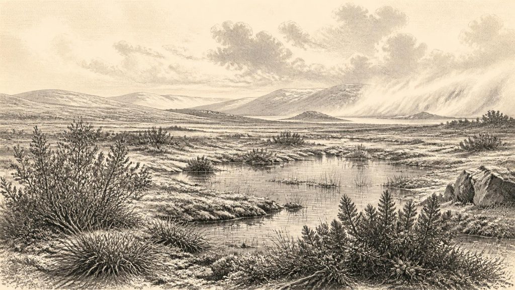
The Derryvree deposits indicate an open, cold and treeless environment rather than woodland. Plant and invertebrate evidence includes sedges, mosses, dwarf willow, juniper, herbaceous vegetation and aquatic or wet-ground species such as bogbean (Menyanthes trifoliata) and water-milfoil. These remains are evidence for what grew in, beside or near the freshwater setting; they do not create a complete vegetation map for Ireland. Nevertheless, taken together, they support an interpretation of shallow pools, sedgy margins and waterlogged ground set within tundra-like or muskeg vegetation.
Such country was not lifeless. Summer growth must have been sufficient for aquatic plants and wetland communities to develop, while insects and other small animals occupied damp ground. But the ecological year was probably severe. Frost action, snow cover, short growing seasons, seasonal thaw and unstable drainage would have affected every part of the landscape. The familiar green, wooded island of later prehistory did not yet exist. Derryvree instead evokes a cold basin where water persisted despite a climate increasingly favourable to ice-sheet growth.
Other Irish deposits help to place this evidence in context, although none should be forced into an exact synchronism with Derryvree. Organic beds at Greenagho near Belcoo, also in Fermanagh, and at sites such as Hollymount and Aghnadarragh in Northern Ireland show that the island’s glacial history was not one uninterrupted freeze. They record episodes of open ground, freshwater and, at some sites, milder conditions between glacial advances. Speleothem growth at Crag Cave in County Kerry similarly shows that liquid water circulated underground during parts of Marine Isotope Stage 3. These records demonstrate climatic fluctuation, not a simple island-wide sequence.
Before the Greatest Ice Expansion
Ireland around this time stood on the approach to, rather than at, the local Last Glacial Maximum. Reconstructions of the British–Irish Ice Sheet show major growth after roughly 31,000 years ago, with maximum extent reached several millennia later, broadly around 27,000 years ago in some sectors. The exact timing and reach of ice varied across Ireland and its continental shelf. It would be misleading to imagine either a wholly ice-covered island in 30,314 BCE or an entirely open one. Derryvree’s sequence itself proves that local ice-free intervals occurred between glacial episodes.
Lower global sea level altered the geography around Ireland because water was locked in expanding ice sheets. More of the continental shelf was exposed than today, and animals could move through a changing north-west European world whose coastlines, rivers, channels and ice margins differed greatly from modern maps. That does not prove a permanent, easy land bridge into every part of Ireland. Routes could be interrupted by water, glacier fronts, marshland and fast-changing terrain. The sound conclusion is ecological connection, not certainty about a single migration corridor.
Regional change also occurred at different speeds. A wetland in Fermanagh cannot stand for Cork, the western seaboard or upland Donegal. It is likely that elevation, distance from ice, local drainage and exposure to Atlantic weather created a patchwork of conditions. The later advance of ice would reshape or erase many earlier surfaces, while drumlins, tills and redeposited sediment would complicate the record. This is why the survival of one organic basin can be disproportionately important: it is not typical in the statistical sense, but it is rare testimony.
Castlepook’s Animal World
Far to the south, Castlepook Cave near Doneraile in north County Cork supplies a complementary record. Formerly known as Mammoth Cave, it has yielded more than two thousand bones and is Ireland’s richest known archive of vertebrate life before the Last Glacial Maximum. Re-dating work, including research by Ruth Carden and colleagues, has shown that some older radiocarbon determinations on southern Irish cave bones were too young. The revised evidence places important elements of the fauna securely within Marine Isotope Stage 3, though individual specimens belong to a long interval rather than one shared moment.
The cave’s assemblage includes woolly mammoth, reindeer, giant deer, brown bear, wolf, Arctic fox, spotted hyaena and lemmings. These animals are direct evidence that Ireland was accessible to a varied cold-stage fauna at different times before the later maximum glaciation. They support the interpretation of extensive open habitats capable of feeding large grazers and browsers, with predators and scavengers exploiting them. Mammoth, reindeer and giant deer should not, however, be pictured as a single herd beside the Derryvree pools in 30,314 BCE. Cave deposits accumulated over long periods and their bones need not be contemporary.
Castlepook also warns against overly tidy stories. Caves are not simply prehistoric museums arranged by their original occupants. Water can move bones; carnivores can drag in carcass parts; animals may die in cavities; and antiquarian excavations did not record deposits to modern standards. Spotted hyaena activity probably helped create parts of the assemblage. Therefore, animal bones establish the presence of species and broad ecological relationships more securely than they reveal population size, season of death, hunting events or a permanent human camp.
People: Possibility, Not Settlement
A reindeer femur from Castlepook, reported as around 33,000 years old, bears a deep mark interpreted as stone-tool butchery. If that interpretation is confirmed, it would be a major indication that Upper Palaeolithic people reached Ireland far earlier than the previously accepted terminal-Pleistocene evidence from a butchered bear bone at Alice and Gwendoline Cave, County Clare. It is relevant to the wider period represented by 30,314 BCE, but it does not date to that nominal year and cannot demonstrate continuous settlement.
No securely published lithic assemblage, hearth, house floor, burial, human skeleton, art panel or settlement surface establishes an Irish community at Derryvree’s date. Nor can one marked bone identify the number, language, ancestry or social organisation of visitors. The most that can presently be said is that short-lived hunter-gatherer movement into Ireland during Marine Isotope Stage 3 is plausible and may be indicated at Castlepook; permanent occupation remains unproven. Future excavation of intact cave deposits, microscopic study of bone-surface damage and direct dating are essential.
No Polities, No Chronicle
There is no evidence for political affairs, diplomacy, warfare, territorial rule, named peoples or institutions in Ireland at this date. There are likewise no grounds for reconstructing religion, formal ritual, learning or artistic traditions. Silence here is not evidence that people lacked culture; it is evidence that Ireland has not yielded securely dated material capable of describing it. A responsible year-by-year history must resist filling that silence with later Celtic identities, imagined tribal structures or generic scenes of Ice Age family life.
If people did enter the island, their economy would have depended on mobile foraging: knowledge of terrain, weather, animal movements, fuel, shelter and safe routes. That is an inference from the environment and from Upper Palaeolithic lifeways elsewhere in north-west Europe, not a directly excavated Irish camp economy. The clearest ‘economy’ visible in the evidence is ecological: plants drawing on a short season; herbivores using open ground; predators and scavengers following prey; and water sustaining wetland life between advancing phases of ice.
Settlement, in the durable sense, is not visible. Derryvree was a freshwater habitat, not a village site, while Castlepook was a cave repository whose contents were shaped by animals, water and excavation history. Around 30,314 BCE, Ireland is best understood as a fluctuating, regionally varied cold-stage landscape. Its history is written in tills, buried silts, seeds, mosses, insect remains and bones. Those fragments offer a compelling picture of environmental change and animal life, while setting firm limits on what can be claimed about people.
Primary Sources
- A Middle Midlandian Freshwater Series at Derryvree, Maguiresbridge, County Fermanagh, Northern Ireland
- Middle Midlandian Interstadial Deposits at Greenagho, Near Belcoo, County Fermanagh, Northern Ireland
- The Irish Quaternary Fauna Project
- A Reconsideration of the Radiocarbon Dating of the Marine Isotope Stage 3 Fauna from Southern Ireland
- Castlepook Cave: County Geological Site Report
- Pleistocene Glaciations in Ireland
- Extent and Timing of the Last Glacial Maximum in Britain and Ireland: A Review
- Growth and Retreat of the Last British–Irish Ice Sheet, 31,000 to 15,000 Years Ago: The BRITICE-CHRONO Reconstruction
- Timing and Pace of Ice-Sheet Withdrawal Across the Marine–Terrestrial Transition West of Ireland During the Last Glaciation
- Maximum Extent and Dynamic Behaviour of the Last British–Irish Ice Sheet West of Ireland
- The Timing and Magnitude of the British–Irish Ice Sheet Between Marine Isotope Stages 5d and 2
- Stratigraphic and Palaeo-Geomorphological Evidence for the Glacial-Deglacial History of the Last British-Irish Ice Sheet in the North-Western Irish Sea
- Deglaciation Chronology of the Donegal Ice Centre, North-West Ireland
- Trimlines, Blockfields and the Vertical Extent of the Last Ice Sheet in Southern Ireland
- The IntCal20 Northern Hemisphere Radiocarbon Age Calibration Curve (0–55 cal kBP)
- The Last Glacial Maximum
- The Subdivision of the Quaternary Period in Ireland
- Soils of County Waterford
- First Evidence of a Late Upper Palaeolithic Human Presence in Ireland
- New Insights on the Fauna of Ireland's Younger Dryas and Early Holocene from Alice & Gwendoline Cave







