
Castlepook’s Hyena-Worked Fauna31570 BCE
Although 31,570 BCE cannot be treated as a recoverable Irish year, evidence from Marine Isotope Stage 3 reveals intermittent ice-free environments. At Derryvree, County Fermanagh, freshwater silts between glacial tills preserve plants and insects indicating cold, open, waterlogged terrain. Castlepook Cave, County Cork, yielded mammoth, reindeer, giant deer, bear, hyaena and other fauna, accumulated over time largely through natural and carnivore processes. A possible cut-marked reindeer bone may suggest human butchery, but proves neither settlement nor culture. Changing sea levels and ice affected animal dispersal. Renewed glaciation later erased much evidence, leaving a dynamic, fragmentary prehistoric landscape across the island.
Dateline
31,570 BCE is a modern calendar label, not a year that can be recovered from the Irish record. Nobody in Ireland counted years in this fashion; there are no texts, named peoples, settlements, graves or securely dated occupation surfaces from which a particular season, generation or event can be identified. In the conventional archaeological scale that counts backwards from AD 1950, the label falls about 33,519 years before present (cal BP). It belongs to the later part of Marine Isotope Stage 3 (MIS 3), a long and climatically unstable interval of the last Ice Age. The responsible subject is therefore not an annual chronicle but the evidence for Ireland during a broad span around the mid-30,000s cal BP.
That evidence is sparse, local and often difficult to date. Later glaciers eroded, transported and buried much of the land surface on which animals moved and any people may have camped. Caves and sediments sealed beneath glacial deposits are consequently of exceptional value. They do not provide a complete national picture, still less a political history, but they show that parts of Ireland supported cold-adapted life before the greatest expansion of the last British–Irish Ice Sheet.
A Date Beyond Annual Precision
Radiocarbon ages are not calendar dates. They measure the remaining carbon-14 in organic material and require calibration against independently dated records of past atmospheric change. At more than 30,000 years ago, an individual determination can translate into a wide calendar range, and those ranges may alter as calibration methods improve. The important Irish deposit at Derryvree, near Maguiresbridge in County Fermanagh, produced a conventional radiocarbon age of roughly 30,500 BP with a substantial laboratory uncertainty. Published discussion has placed the relevant organic interval broadly around 36,900–31,700 cal BP, or approximately 34,950–29,750 BCE.
The nominal year considered here falls within that broad bracket, but cannot be assigned to a particular layer, pool, animal or human visit. It should not be imagined as a fixed snapshot of an island with a single climate. MIS 3 was characterised by repeated shifts between colder stadial conditions and comparatively milder interstadials. What could be true for a wet hollow in Fermanagh need not have been true at the same moment in north Cork, the western uplands or the basin of the Irish Sea.
Freshwater Beneath Derryvree
Derryvree offers the clearest local environmental archive for this period. Road works in 1969 cut through a drumlin, exposing fine sands and freshwater silts trapped between two distinct tills: unsorted deposits left by glacier ice. The sequence has a powerful relative chronology. An earlier ice advance deposited the lower till. Afterwards, ice-free conditions allowed freshwater sediment, plant remains and insects to accumulate. A later advance laid down the upper till and sealed the evidence beneath the drumlin.
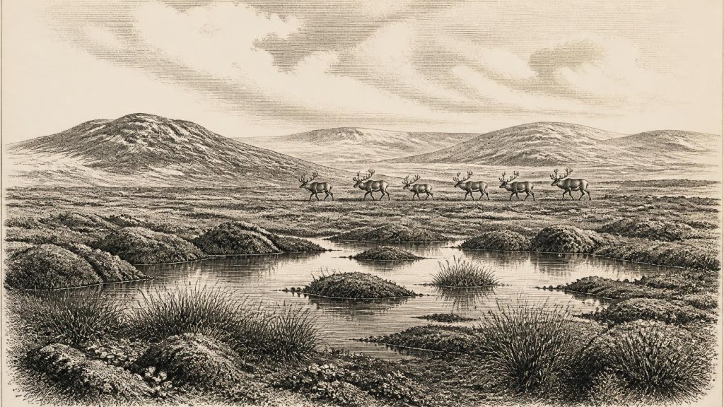
The fossil assemblage points to a cold, open and largely treeless landscape. Pollen was poorly preserved, but plant macrofossils, mosses and insects complement it. Grasses, sedges, herbs, juniper and low-growing vegetation occurred around wet ground and shallow pools. Researchers described the setting as muskeg: waterlogged, peaty terrain with mossy margins and plant-rich hollows. This was not the wooded Ireland of later prehistory. It was a highly seasonal periglacial landscape, with exposed ground, saturated depressions and unfrozen freshwater sufficient for plants, insects and organic sediments to persist.
Evidence and interpretation must be kept apart. The sedimentary succession demonstrates that this Fermanagh locality was ice-free between two glacial episodes; the biological remains demonstrate a cold freshwater environment. Calling the wider region “tundra” or “muskeg” is a useful environmental interpretation, not a claim that every part of Ireland looked identical. Sparse tree pollen cannot prove nearby woodland, because pollen can travel or be reworked. Conversely, the rich low-plant evidence makes a dense temperate forest at Derryvree highly improbable.
Animals in a Cold Corridor
North Cork’s Castlepook Cave, also known as Mammoth Cave near Doneraile, supplies a different kind of evidence. Its limestone galleries yielded one of Ireland’s richest Pleistocene vertebrate assemblages. The cave fauna includes woolly mammoth, reindeer, giant deer, brown bear and spotted hyaena; other remains from the site include wolf, Arctic fox and lemmings. Modern redating has shown that several older radiocarbon results from southern Irish caves were too young, demonstrating both the importance of improved collagen preparation and the danger of treating old measurements as final.
Castlepook was not a neatly stratified village site. Animal remains entered its chambers over a long period through a mixture of carnivore activity, natural death, water movement and excavation disturbance. Spotted hyaenas were important agents in that history: gnawing, dragging and accumulating bones. The cave’s famous nineteenth- and early twentieth-century excavations recovered a very large collection, but much contextual information was lost by the standards of modern archaeology. The surviving assemblage therefore establishes that varied large mammals reached Ireland during parts of MIS 3, but it cannot show that all species lived together, or that they occupied the cave in one short interval.
The fauna nevertheless changes the scale on which Ireland’s Ice-Age past can be understood. Reindeer and mammoth imply access to open, cold-country habitats and movement through a changing north-west European landscape. At lower sea levels, the geography of Ireland, Britain and the continental shelf differed radically from today. Yet low sea level alone does not prove a simple dry-land bridge at every moment. Ice margins, water channels, coasts and routes across exposed shelf terrain shifted repeatedly. Animal presence demonstrates successful dispersal; the exact paths and timing remain matters for palaeogeographical reconstruction.
The Human Question
A reindeer femur from Castlepook has been publicised as bearing a deep mark made while the bone was fresh, possibly by a stone tool during butchery. If that diagnosis is upheld, it may represent a very early human handling of animal carcass in Ireland, broadly close to this period. It is an important possibility, but it is not evidence for a known camp, a permanent population or a named Upper Palaeolithic culture. No securely associated stone-tool assemblage, hearth, dwelling floor, burial or artwork presently permits such claims.
Even a genuine butcher’s mark would record an episode rather than a society in full view. Small, mobile foraging parties could have followed game into a land that was intermittently accessible, leaving little more than temporary traces. The subsequent growth and movement of ice greatly reduced the chance that open-air camps would survive. It is equally possible that the mark will remain debated, since distinguishing human cuts from damage caused by carnivores, sediment, handling or excavation requires close taphonomic study. The animal bone itself is material evidence; the proposed human action is an interpretation that should be stated cautiously.
No Kingdoms, No Trade Network
There is no evidence from Ireland around this horizon for political institutions, rulers, warfare, diplomacy, farming, villages, formal religion, monuments, writing, schooling or organised trade. Those are not missing details waiting to be supplied with imagination: the available record cannot support them. Nor can Irish evidence identify kinship systems, languages, ritual practices, clothing or the everyday routines of any possible visitors. Continental Upper Palaeolithic groups made sophisticated stone tools and, in some regions, art and ornaments, but such wider European comparisons cannot be transferred automatically to Ireland.
The most defensible account of society is thus ecological rather than political. If people were present, they would have depended on mobility, knowledge of weather and terrain, fuel, shelter and the movements of animals. The economy would have been foraging, not agriculture; any exchange with other groups is unknown. Caves may have offered shelter on occasion, but Castlepook’s principal archaeological importance is as an animal repository, not as proof of human residence.
Approaching Greater Ice
The broader development was climatic change. The Last Glacial Maximum, when the British–Irish Ice Sheet became far more extensive, still lay ahead; current reconstructions place its principal expansion and maximum broadly between about 27,000 and 23,000 cal BP. The Derryvree sequence preserves a rare earlier interval in which water, vegetation and animals occupied part of the island before renewed glaciation. Crag Cave in County Kerry adds independent evidence that liquid water intermittently fed cave calcite during later MIS 3, consistent with oscillating rather than uniformly frozen conditions.
For Ireland around 31,570 BCE, then, the central development was neither a battle nor a dynasty but a precarious living landscape. Wet tundra-like ground in Fermanagh, cold-country mammals in Cork and the impending remaking of the island by ice together provide the clearest picture. The record is fragmentary, but it is enough to replace an empty, permanently ice-bound Ireland with a more dynamic one: a landscape in which life endured locally, routes opened and closed, and most traces were soon vulnerable to erasure.
Primary Sources
- A Middle Midlandian Freshwater Series at Derryvree, Maguiresbridge, County Fermanagh, Northern Ireland
- A reconsideration of the radiocarbon dating of the Marine Isotope Stage 3 fauna from southern Ireland
- The Irish Quaternary Fauna Project
- Irish Pleistocene Biostratigraphy
- Palaeoecology
- The Subdivision of the Quaternary Period in Ireland
- Castlepook Cave: Cork County Geological Site Report
- Geological Heritage Audit Report: County Cork
- Growth and Retreat of the Last British–Irish Ice Sheet, 31,000 to 15,000 Years Ago: the BRITICE-CHRONO Reconstruction
- BRITICE-CHRONO Maps and GIS Data of the Last British-Irish Ice Sheet 31 to 15 ka
- Pattern and Timing of Retreat of the Last British-Irish Ice Sheet
- New Data for the Last Glacial Maximum in Great Britain and Ireland
- The IntCal20 Northern Hemisphere Radiocarbon Age Calibration Curve (0–55 cal kBP)
- IntCal Publications
- Episodic Speleothem Deposition Tracks the Terrestrial Impact of Millennial-Scale Last Glacial Climate Variability in SW Ireland
- Occurrence of Mammalia Relicts at Site Castlepook Cave
- Archaeological Heritage of County Cork
- The Exploration of Castlepook Cave, Co. Cork. With 3 Plates.
- The Mesolithic in Ireland: When Was It?
- New Insights on the Fauna of Ireland's Younger Dryas and Early Holocene from Alice & Gwendoline Cave
