
Derryvree’s Interstadial Basin31604 BCE
31,604 BCE is a modern label for a broad, uncertain Marine Isotope Stage 3 interval, rather than a recoverable historical year. At Derryvree, County Fermanagh, freshwater silts between glacial tills, radiocarbon dated broadly to 36,900–31,700 calibrated years BP, preserve evidence of a treeless, cold periglacial mosaic of pools, sedges, mosses, herbs and insects. Castlepook Cave, County Cork, records varied Ice Age mammals, though disturbed deposits and revised dates limit conclusions. A possibly cut-marked reindeer bone may indicate brief human activity, not settlement. Together, these archives show locally habitable environments between ice advances before renewed glaciation erased much evidence of occupation.
Dateline
The label 31,604 BCE is a modern filing device, not a date that could be recognised by anyone living in prehistoric north-west Europe. Ireland has no written record, named individuals, monuments, settlements or calendar chronology from this depth of time. In radiocarbon terms, the nominal year lies roughly 33,600 calendar years before present, but even that conversion must be handled carefully. Radiocarbon measurements require calibration, produce probability ranges rather than precise anniversaries, and may be revised as methods improve. The responsible history of Ireland at this point is therefore not a story of a particular year. It is an account of a changing Late Pleistocene landscape, reconstructed from exceptionally rare sediments, fossils and cave deposits.
A Date Within a Broad Interval
This horizon belongs to Marine Isotope Stage 3, an unstable part of the last glacial cycle. It preceded the global Last Glacial Maximum, conventionally dated to about 26,500–19,000 calendar years before present, but it was already a world of severe cold, fluctuating climate and expanding ice. Ireland was not uniformly buried beneath an ice sheet throughout this longer period. Glaciers advanced and retreated at different times in different regions, while areas beyond or between active ice could support open, cold-climate vegetation and animals. The island’s later glacial cover also destroyed, displaced or deeply buried much earlier evidence. That is a principal reason why the Irish archive is so fragmentary.
The closest securely dated environmental record for the broad period around this nominal year comes from Derryvree, near Maguiresbridge in County Fermanagh. Roadworks in 1969 cut through a drumlin and exposed a sequence of deposits that had been sealed beneath later glacial material. Organic-rich freshwater silts and fine sands lay between two tills: a lower deposit made by an earlier glacier and an upper till left by a later ice advance. This order matters. It demonstrates that, for a significant interval between glacial episodes, water, plants and small animals occupied a basin in what is now south Fermanagh.
Material from the Derryvree freshwater beds produced a conventional radiocarbon age of 30,500 years BP, with a large uncertainty of +1,170 and −1,030 years. Published calibration places the deposit broadly around 36,900–31,700 calibrated years BP. The notional year 31,604 BCE falls within that wide span, not at a precisely identifiable point in it. The sequence cannot tell us what occurred on a particular day, season or decade. It can, however, show that northern Ireland contained a periglacial freshwater environment during part of the later Middle Midlandian, before renewed ice covered the landscape.
Wet Ground in an Open Country
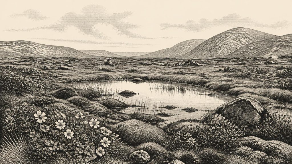
Derryvree is especially valuable because it preserves several kinds of environmental evidence together. Pollen was poorly preserved but was chiefly herbaceous. Plant macrofossils included mosses, sedges and aquatic or wet-ground plants, while insect remains added evidence for cold northern conditions. Mountain avens, a plant strongly associated with exposed cold environments, and bogbean, which grows in shallow freshwater and marshy ground, are among the best-known finds. The fossil assemblage does not depict a modern Irish bog or a closed woodland. It indicates a treeless landscape in which waterlogged hollows, open pools, mossy margins and sparse dry ground formed a local mosaic.
“Tundra” is a useful short description, provided it is not mistaken for a featureless plain. Derryvree’s freshwater plants show that local relief, drainage and snowmelt mattered. A shallow basin could retain water and organic matter while adjacent ground remained exposed to wind, frost and seasonal drying. Grasses, sedges, herbs, mosses and low shrubs would have offered uneven patches of forage and shelter. The evidence supports a harsh, continental-style climate with cold winters; it does not allow a measured annual temperature or rainfall figure for the nominal year. Nor should a site in Fermanagh be treated as a complete map of Ireland. Conditions in uplands, western coastal districts and the south may have differed sharply according to ice extent and proximity to the Atlantic.
Ice, Water and a Changing Geography
At this time Ireland’s geography was being reshaped by ice rather than by human boundaries. The Irish Ice Sheet was building towards its later maximum, but its growth was neither simple nor simultaneous around the island. Evidence from the wider British–Irish Ice Sheet shows that its margins advanced asynchronously, with some sectors reaching extensive positions earlier than others. In Ireland, subsequently overridden organic deposits such as those at Derryvree are important reminders that cold conditions did not always mean continuous glacier ice at every place.
Lower global sea levels changed the outlines of the continental shelves and narrowed or altered sea passages around Ireland and Britain. Yet it is unsafe to turn that general fact into a confident picture of a dependable land bridge or a particular migration corridor at 31,604 BCE. Ice margins, marine waters, river systems and exposed shelf terrain changed through time. The movement of animals into Ireland proves that routes existed during favourable phases, but the exact paths and duration of those routes are still matters of reconstruction. The landscape was connected to wider north-west European ecological systems, but its degree of accessibility varied.
Cave Fauna in the South
Another major Irish source lies far to the south, at Castlepook Cave near Doneraile in north County Cork. Excavations undertaken there in the early twentieth century recovered an impressive, though difficult, collection of Ice Age animal remains. Mammoth, reindeer, giant deer, brown bear, wolf, fox, hare, lemming and other species have been identified from the wider cave archive. The cave is particularly associated with spotted hyaena, whose gnawing and bone-accumulating behaviour helps explain why so many remains survived together.
These finds illuminate the broad ecological world of Late Pleistocene Ireland rather than providing a census for one calendar year. Caves are complicated archives. Carnivores can drag in prey; water can move bones and sediment; animals can die naturally in chambers; and antiquarian excavation often disturbed layers before modern recording standards existed. Recent re-dating has shown that some older radiocarbon determinations from Castlepook, Foley Cave and Shandon Cave were substantially too young. Improved pretreatment of bone collagen has pushed several specimens further back into Marine Isotope Stage 3 and demonstrated why every individual date must be evaluated critically.
The most defensible conclusion is that mammals reached and occupied parts of Ireland during favourable Late Pleistocene intervals, including cold open-country habitats broadly comparable to the settings suggested at Derryvree. It does not follow that all animals found in Castlepook lived together, that they were all present at the nominal date, or that Ireland supported the same species continuously. Giant deer and spotted hyaena, for example, may have disappeared locally before the later peak of the last glaciation. Fossils reveal presence at some point within dated ranges, not permanent residence or a stable community.
The Human Question
A reindeer femur from Castlepook has recently been highlighted as carrying a deep mark interpreted as the result of cutting or chopping fresh bone with a sharp stone implement. The animal has been reported as dating to roughly 33,000 years ago, making the find potentially relevant to the broad chronological horizon represented by 31,604 BCE. If the mark is confirmed as humanly made, it would be important evidence that people processed an animal in Ireland before the Last Glacial Maximum. It would push the island’s known human story much further back than the formerly accepted terminal-Pleistocene evidence.
But it cannot responsibly be inflated into a conventional narrative of settlement. No securely associated lithic-tool assemblage, hearth, dwelling floor, burial ground or enduring camp is known from this period in Ireland. Recent work at Castlepook has sought undisturbed Pleistocene deposits, yet its 2022 excavation recovered no cultural artefacts and also demonstrated the extent of later disturbance and contamination within parts of the cave. A single marked bone, even if ultimately accepted, may record a short visit, scavenging or butchery episode rather than a resident population. It cannot identify a language, kin group, political organisation or route of arrival.
What Cannot Be Written
There is consequently no evidence for political affairs, diplomacy, warfare, chiefs, territories or institutions in Ireland at this time. Nor can archaeology identify an Irish religion, ritual practice, art tradition, teaching system or trade network. A cave used by hyaenas and preserving animal bone is not, on that basis, a shrine; a reindeer possibly butchered by people is not proof of organised hunting bands or exchange. These absences are historically meaningful. They mark the limits of a record made primarily by geology and palaeontology rather than by human-built sites.
Everyday human life can only be discussed conditionally. If people did reach Ireland during this interval, they would have had to meet the practical demands shared by Upper Palaeolithic groups elsewhere in cold north-west Europe: finding food, maintaining fire, making and carrying tools, clothing themselves, and moving through a dangerous seasonal environment. Such comparisons provide context, not direct Irish evidence. They must not be mistaken for proof that a particular social custom, dwelling type or hunting strategy existed at Derryvree or Castlepook.
An Archive of Survival
The central development around this nominal date was environmental, not political: Ireland contained places where cold-climate life persisted between episodes of glaciation. At Derryvree, a freshwater basin accumulated sediment, mosses, plant remains and insects before later ice sealed them beneath a drumlin. At Castlepook, caves preserved a partial record of animals that moved through the southern landscape, though their histories are mixed and their dates require continual reassessment. Together they replace the old image of an invariably sterile, ice-covered Ireland with a more precise one: a region of severe but shifting conditions, with locally habitable open ground and wetlands, followed by renewed glacial transformation.
That is why 31,604 BCE matters in Irish history. It is not a year of named deeds. It is a point within a broad calibrated interval in which the island’s deepest recoverable past becomes briefly visible: sedges and mosses beside cold water in Fermanagh; large mammals in the wider Irish landscape; possible, still unproven-in-detail human intervention at a Cork cave; and an approaching phase of ice that would erase most traces of any open-air life. The history is necessarily cautious, but it is far from empty.
Primary Sources
- A Middle Midlandian Freshwater Series at Derryvree, Maguiresbridge, County Fermanagh, Northern Ireland
- Early Midlandian–Middle Midlandian, Pleistocene, Northern Ireland
- Palaeoecology
- A Reconsideration of the Radiocarbon Dating of the Marine Isotope Stage 3 Fauna from Southern Ireland
- The Irish Quaternary Fauna Project
- Trimlines, Blockfields and the Vertical Extent of the Last Ice Sheet in Southern Ireland
- Growth and Retreat of the Last British–Irish Ice Sheet, 31,000 to 15,000 Years Ago: the BRITICE-CHRONO Reconstruction
- Dimensions and Chronology of the Last Ice Sheet in Western Ireland
- Timing and Pace of Ice-Sheet Withdrawal Across the Marine–Terrestrial Transition West of Ireland During the Last Glaciation
- Response of the Irish Ice Sheet to Abrupt Climate Change During the Last Deglaciation
- The Last Glacial Maximum
- The IntCal20 Northern Hemisphere Radiocarbon Age Calibration Curve (0–55 cal kBP)
- A 60,000 Year Greenland Stratigraphic Ice Core Chronology
- Timing of Glaciation During the Last Glacial Cycle: Evaluating the Concept of a Global ‘Last Glacial Maximum’
- 2022:564 – Castlepook Cave, Castlepook South, Cork
- Archaeological Heritage of County Cork
- Heritage Artefacts of County Cork
- First Evidence of a Late Upper Palaeolithic Human Presence in Ireland
- New Insights on the Fauna of Ireland's Younger Dryas and Early Holocene from Alice & Gwendoline Cave
- Menyanthes trifoliata
- Dryas octopetala
- Mammoth Cave, County Cork
- Ice Sheets and Sea Level of the Last Glacial Maximum
- Late Pleistocene Chronostratigraphy and Ice Sheet Limits, Southern Ireland
